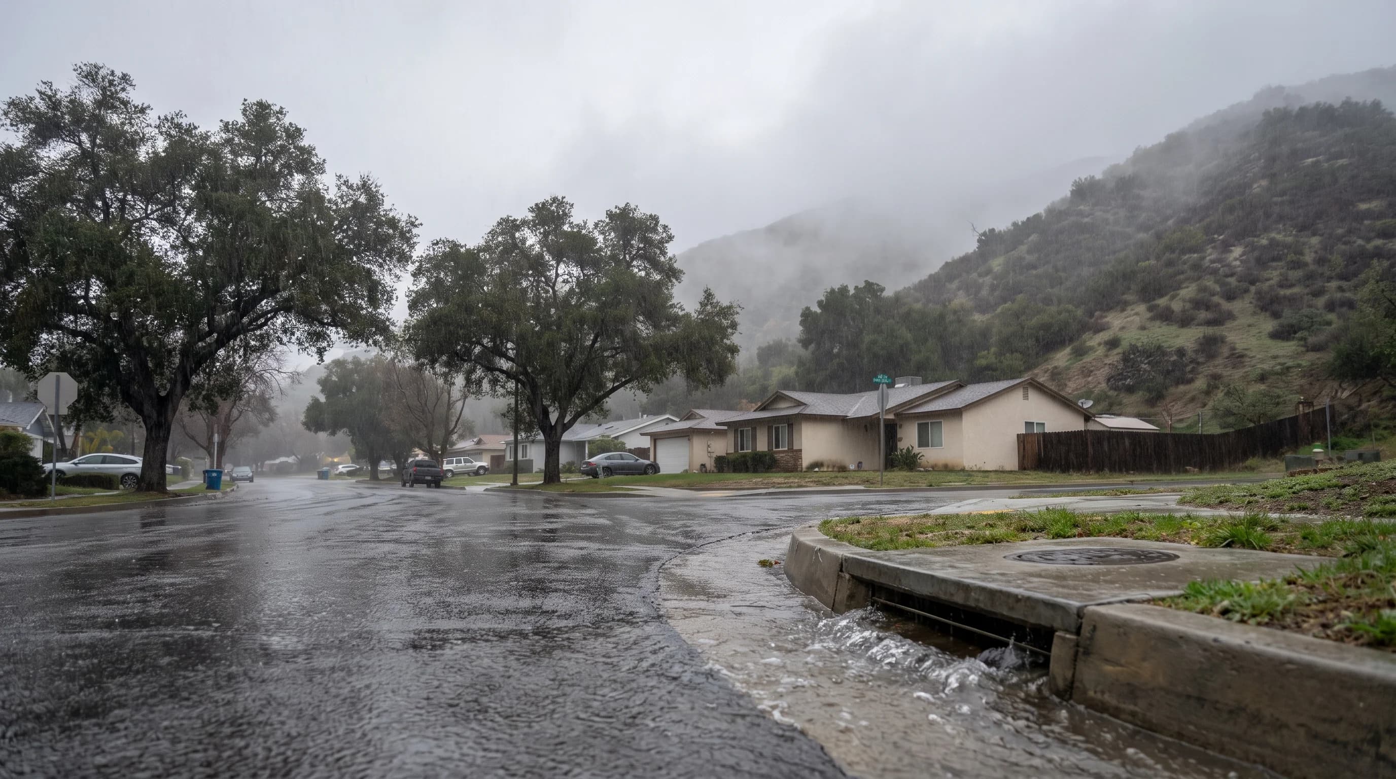
An atmospheric river is a long, narrow band of concentrated water vapor moving through the atmosphere, often carrying moisture from the subtropical Pacific to the West Coast. In Southern California, atmospheric rivers bring the winter's heaviest rain and mountain snow when a storm and the terrain force the vapor upward, cool it and wring it out over the coast and the San Gabriel and San Bernardino Mountains, including Wrightwood. The atmospheric river supplies the moisture; the storm and the mountains decide how much falls and where.
What Is an Atmospheric River?
An atmospheric river is a band of water vapor, often a few hundred miles wide and thousands of miles long, that carries an outsized share of the moisture moving through the atmosphere. A handful of atmospheric rivers active on a given day can carry more water than the mouth of the Amazon River, as vapor rather than liquid, according to NOAA. The vapor stays mostly invisible until it rises, cools and condenses into clouds and rain. A month-long series of atmospheric rivers caused California's worst recorded flood, the Great Flood of 1862.
An atmospheric river and a storm are two different things. The atmospheric river is the moisture band.
The storm is the low pressure system, with its fronts and wind, that steers the band and lifts the moisture into rain. An atmospheric river can bring little rain if nothing lifts it, and an ordinary storm can be fed by one. When a strong moisture band meets a storm that lifts it over mountains, Southern California gets its wettest multi-day storms and heaviest mountain snow.
How Does an Atmospheric River Form?
An atmospheric river forms when large-scale winds gather moist air, usually evaporated from the warm subtropical Pacific, into a fast-moving band that often runs just ahead of a storm's cold front. Meteorologists measure it with integrated vapor transport, or IVT, which combines how much moisture the air holds with how fast it moves. A high IVT means a large amount of water vapor is moving quickly toward a coastline.
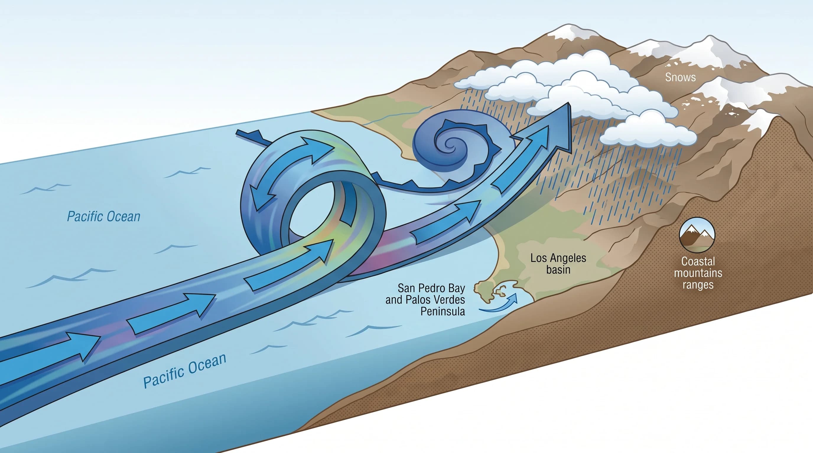
Direction and landfall point matter as much as moisture. An atmospheric river points in a direction, and where that line meets the coast decides which part of California gets soaked. A band aimed directly at the Southern California coast forces air up over the coastal mountains and the Transverse Ranges for as long as it holds its aim. A band angled farther north delivers most of its moisture to Central or Northern California.
Once the moist air reaches land and a front or terrain pushes it upward, it cools, and the vapor condenses into cloud droplets, then rain or snow. The jet stream and the surrounding storm decide how long the band holds its direction and landfall point, so forecasters watch the storm track as closely as the moisture.
Why Can Atmospheric Rivers Hit Southern California So Hard?
Atmospheric rivers hit Southern California hardest when a strong moisture band stalls or aims directly at the coastal slopes and Transverse Ranges, forcing moist air upward for many hours. This process, called orographic lift, is why the Santa Monica and San Gabriel Mountains are wetter than the basin floor in any storm. Rising air cools and releases more moisture, so one storm can bring modest rain downtown while burying Wrightwood or the peaks above Big Bear Lake in feet of snow.
Orographic lift also creates sharp rainfall differences over short distances. Coastal canyon communities like Malibu and Topanga sit in the path of onshore moisture and steep terrain, which concentrates runoff into narrow canyons. Foothill cities such as Pasadena, at the base of the San Gabriels, face water and debris draining off the mountain front before the rain feels extreme in town. In the February 2024 atmospheric river, UCLA's gauge at the foot of the Santa Monica Mountains caught 12.49 inches while San Diego got 2.43, as Southern California rainfall totals by city shows.
The downwind side of a mountain range sits in a rain shadow and can get much less rain than the windward slope a few miles away. One part of the region can flood while a nearby valley stays mostly dry. Storm direction, duration and how directly the band lines up with the mountains decide which slopes take the worst of it. For how storms play out across the basin in a wet winter, see what a wet Los Angeles winter actually looks like.
How Strong Is an Atmospheric River?
Atmospheric river strength is rated from AR 1 to AR 5, based on vapor transport intensity and duration, not rainfall totals. The Center for Western Weather and Water Extremes (CW3E) at UC San Diego developed the scale. It combines peak IVT with how many hours that intensity lasts at a location. A brief burst of strong transport rates lower than the same intensity lasting a day or more, because duration often matters as much as strength.
| AR category | Name | General impact balance |
|---|---|---|
| AR 1 | Weak | Primarily beneficial |
| AR 2 | Moderate | Mostly beneficial, with localized hazards possible |
| AR 3 | Strong | Balance of beneficial and hazardous impacts |
| AR 4 | Extreme | Mostly hazardous |
| AR 5 | Exceptional | Primarily hazardous |
IVT combines how much water vapor a column of air holds with how fast the wind pushes it toward the coast. Higher IVT lasting longer moves an event up the scale.
The AR scale rates the atmospheric river itself. Flood watches, flash flood warnings and debris flow warnings describe hazards on the ground. An AR 3 can still trigger a flash flood warning in one canyon if soil or rain rate pushes that spot past its threshold, so the AR rating is a starting point, not the full forecast.
What Hazards Can an Atmospheric River Cause in Southern California?
An atmospheric river can cause urban flooding, flash flooding, debris flows, landslides, high surf and strong wind in Southern California, often several at once. Urban flooding happens when rain fills storm drains and streets faster than they drain, even from moderate rain at a high rate. Flash flooding is faster and more local, usually from a burst of intense rain over a small watershed, creek or canyon, and it can develop within minutes.
Debris flows happen when intense rain on a recent wildfire burn scar sends loose soil, ash and rock downhill as a fast slurry. Burned hillsides lose the plants that hold soil and can develop a water-repellent layer that sheds rain. A landslide is a slower slope failure that needs no burn scar and often follows days of soaking rain. The storm can also bring high surf, coastal flooding and strong gusts along its fronts.
The snow level, the elevation above which precipitation falls as snow, adds another factor for mountain destinations. A cold atmospheric river with a low snow level piles heavy snow on the San Gabriel and San Bernardino Mountains with little flood risk up high. A warmer one with a high snow level turns that snow into rain on soaked slopes, adding runoff instead of building snowpack. A warm atmospheric river with moisture from near Hawaii is called a Pineapple Express.
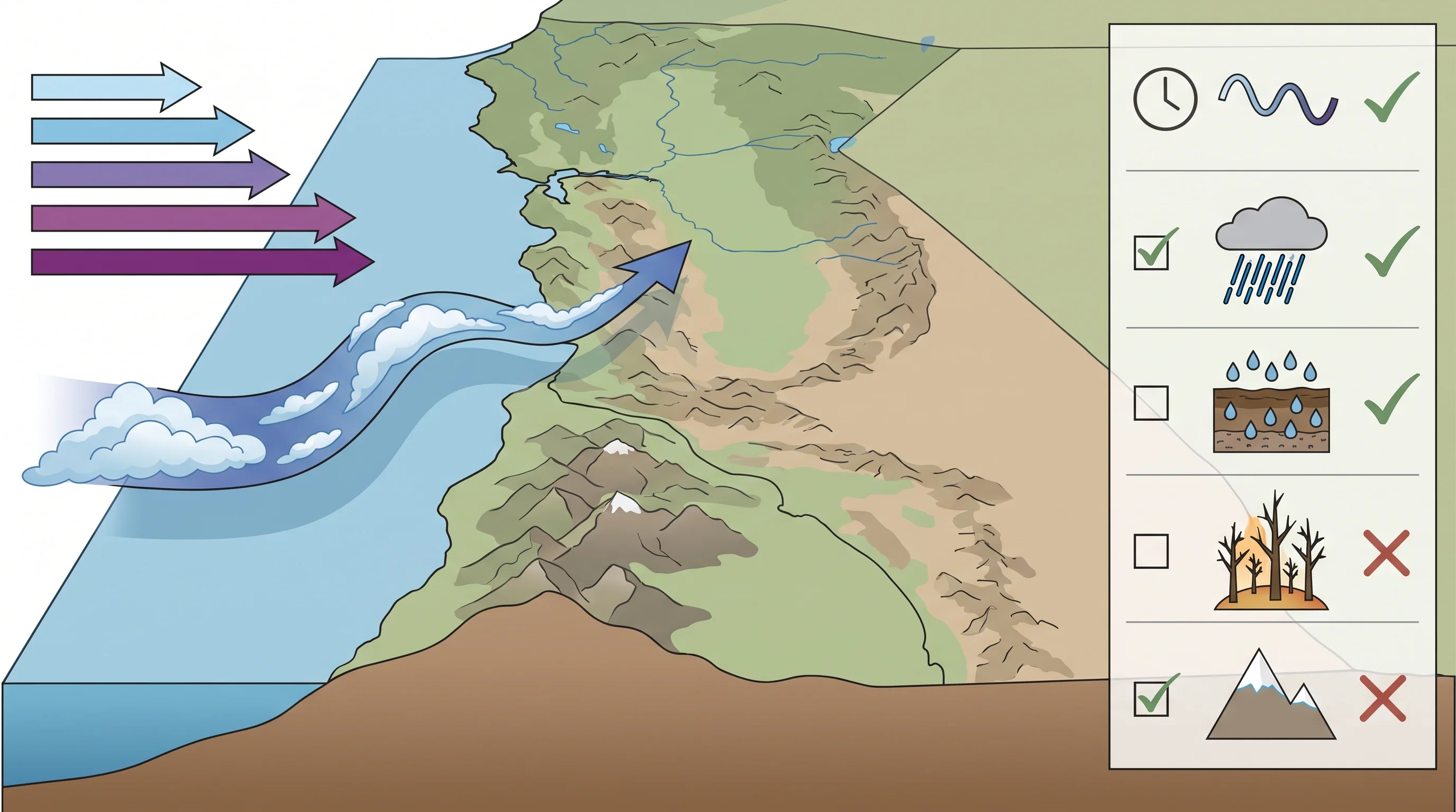
Two factors decide how damaging rain becomes: how soaked the ground already was before the storm, and how much rain falls in 15 to 60 minutes, not the multi-day total. The same storms that raise flood risk also refill reservoirs and build the mountain snowpack Southern California relies on later in the year. Forecasters therefore treat most atmospheric rivers as a balance of benefit and risk. For why the region's watersheds respond so fast to intense rain, see why Los Angeles floods so fast.
Is Every Atmospheric River Dangerous?
Not every atmospheric river is dangerous. Many that reach Southern California bring useful water with little damage. Most AR 1 and AR 2 storms are net beneficial, adding to reservoirs and snowpack with only minor, local effects. The most dangerous events combine several factors: strong vapor transport, long duration over one area, ground soaked by an earlier storm, high short-term rain rates, vulnerable terrain such as a burn scar or a snow level high enough to turn mountain snow into runoff.
A low-rated atmospheric river can still cause serious local problems. A canyon community below a fresh burn scar can get debris-flow warnings from an AR 2 that would be harmless elsewhere, because the burned ground cannot absorb even modest rain. The AR rating describes the atmospheric river. The watch, warning or advisory for a specific canyon, foothill or coast describes the local risk.
When Is Atmospheric River Season in Southern California?
Atmospheric river season in Southern California runs from late fall through early spring, when the Pacific storm track shifts far enough south to reach the region. Timing and frequency vary widely from year to year.
Some winters bring several major atmospheric rivers and others very few, depending on where the storm track sets up. El Niño and La Niña can shift how often storms favor Southern California, but neither guarantees a number of atmospheric rivers. For the storm-by-storm story of the most famous El Niño winter, see the 1997-98 El Niño in Los Angeles.
No local dataset ranks individual months reliably, so treat the whole cool season as atmospheric river season.
How Do You Track an Atmospheric River Headed for LA?
Track an atmospheric river headed for LA by combining several official sources. Start with the point forecast, flood watches and any flash flood or debris flow warnings from NWS Los Angeles/Oxnard or NWS San Diego, depending on location.
The NWS Weather Prediction Center publishes rainfall outlooks with expected totals for the coming days. The California-Nevada River Forecast Center provides river level and flood guidance for local watersheds. CW3E's atmospheric river tools show the current AR rating and forecast IVT.
Keep two distinctions in mind. First, forecast rain totals can change a lot as a storm's track and duration become clear, while an observed gauge total records what actually fell, like the season totals in Los Angeles rainfall totals. Second, a watch means conditions favor a hazard and it is time to prepare, and a warning means the hazard is happening or imminent and it is time to act.
With the official guidance in hand, check local rain rates, how long the heaviest rain will last, whether a recent burn scar sits above your route and whether mountain roads are affected. Before traveling to Malibu, Topanga, Pasadena, Wrightwood or Big Bear Lake during an atmospheric river, check each destination's WeatherLA page and the NWS products. Canyon and mountain communities can see very different rain, snow and road conditions from the same storm.
Atmospheric rivers bring Southern California both its water supply and its flood risk in the same band of moisture. The moisture band, the storm that lifts it and the terrain that decides where it falls are three separate pieces of the forecast. Before a storm, check the NWS forecast and flood products for your area, check whether your route crosses a recent burn scar or canyon and check destination conditions on WeatherLA's Los Angeles pages. If the storm is strengthening rapidly, see the guide to California bomb cyclones.