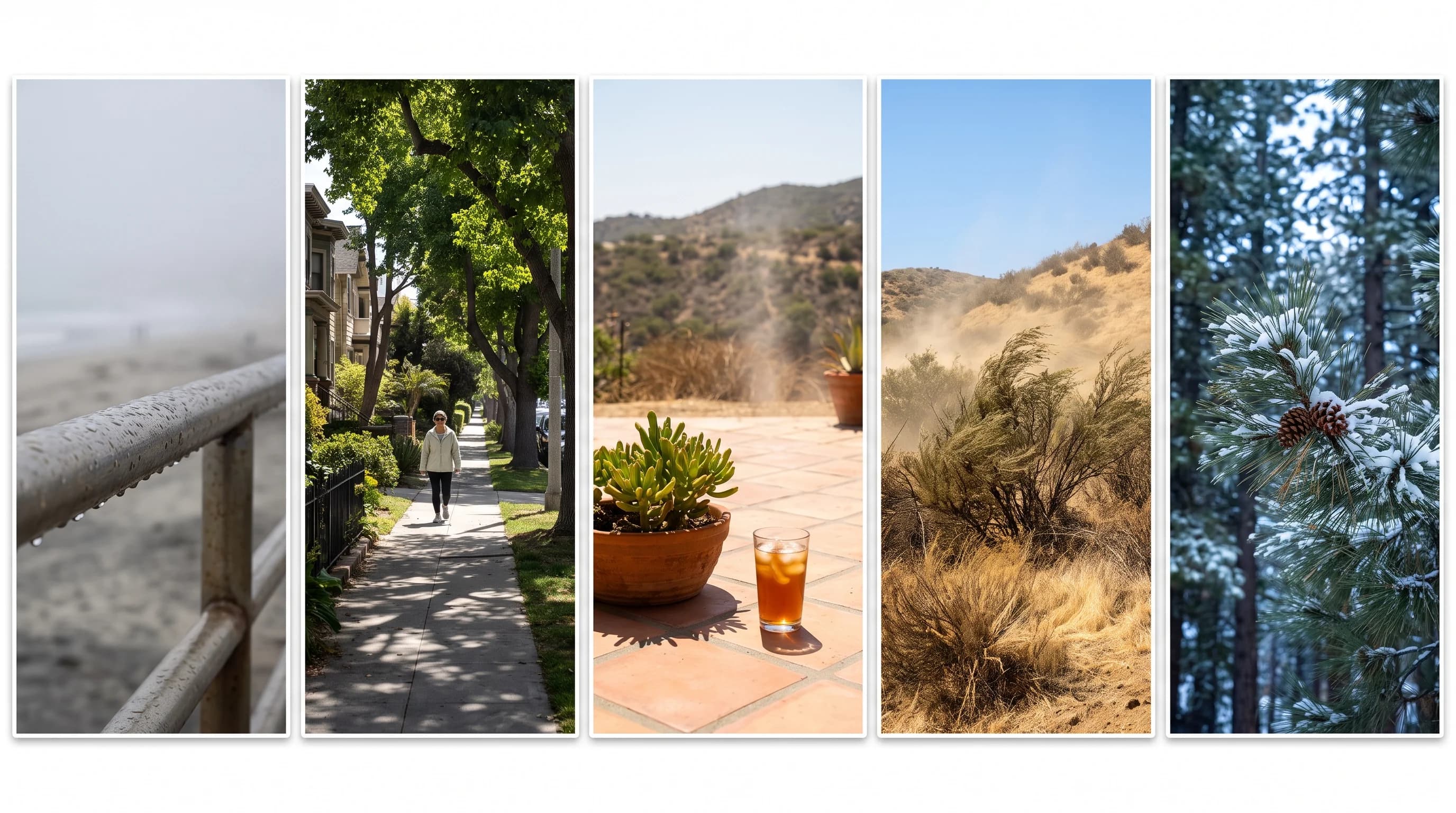
Los Angeles has so many microclimates because five forces, ocean distance, elevation, mountain terrain, city surfaces and wind exposure, all change sharply over short distances and change independently of one another. One county can have a foggy 62°F morning in Santa Monica, a sunny 78°F afternoon in Downtown Los Angeles, a dry 95°F day in Woodland Hills and snow above 6,000 feet in Wrightwood, all at the same hour. That is ordinary weather for a region where the Pacific, the Transverse Ranges and a vast city overlap within 60 miles.
What Is a Microclimate?
A microclimate is a local climate pattern that consistently differs from the surrounding regional climate, driven by a nearby factor such as water, elevation, terrain or land surface, not a passing storm. Consistency is the key. A microclimate is a repeating pattern, not one unusual day: a neighborhood that is reliably cooler at night, a hillside that reliably catches more wind or a coastal strip that reliably stays overcast longer than the city a few miles inland.
Los Angeles County packs an ocean edge, a low basin, several east-west mountain ranges, high desert and one of the country's largest urban areas into one compact region. Most cities have one or two of these features. Los Angeles has all of them within an hour's drive, which is why it needs the idea of microclimates instead of one citywide forecast.
A single Los Angeles temperature on the news or a national app is at best a rough average of many local patterns. At worst, it is one station's reading, usually from downtown or the airport, applied to a county that does not share that station's climate. Understanding the microclimates lets you look past that number and check conditions where you actually are.
| Destination | Zone | What sets its microclimate apart |
|---|---|---|
| Santa Monica | Coastal | Direct Pacific exposure keeps temperatures moderate and prone to marine layer fog |
| Downtown Los Angeles | Basin | Far enough from the coast to warm up faster, with dense pavement holding heat into the evening |
| Woodland Hills | Valley | San Fernando Valley location traps daytime heat and runs among the hottest afternoon readings in the county |
| Pasadena | Foothill | Sits against the San Gabriel Mountains, with cooler overnight lows from downslope air drainage |
| Wrightwood | Mountain | Above 6,000 feet in the San Gabriels, with a winter and snow season the basin never experiences |
| Palm Springs | Desert | Sits in the rain shadow east of the mountains, hot and dry most of the year with little marine influence |
How Does Distance From the Pacific Change Temperature?
Distance from the Pacific changes Los Angeles temperatures because the ocean acts as a huge heat buffer that loses its influence quickly over land. Ocean water off Southern California changes temperature slowly through the seasons. The afternoon sea breeze, pulled onshore by inland heating, arrives cool and often brings the marine layer, the shallow layer of moist ocean air behind much of the coastal fog.
The ocean's influence is strongest at the coast and weakens with each mile inland. Santa Monica and Malibu sit close enough to the water that the sea breeze and marine layer often keep afternoons mild and mornings gray. Downtown Los Angeles, about 15 miles inland, gets a weaker sea breeze, so it runs warmer and clears earlier. By Woodland Hills and the rest of the San Fernando Valley, distance and terrain have mostly used up the ocean's cooling, and afternoon heat takes over.
For the season when the marine layer is most persistent, see May Gray and June Gloom. This section describes the everyday coast-to-inland pattern.
How Do Mountains and Passes Divide LA Weather?
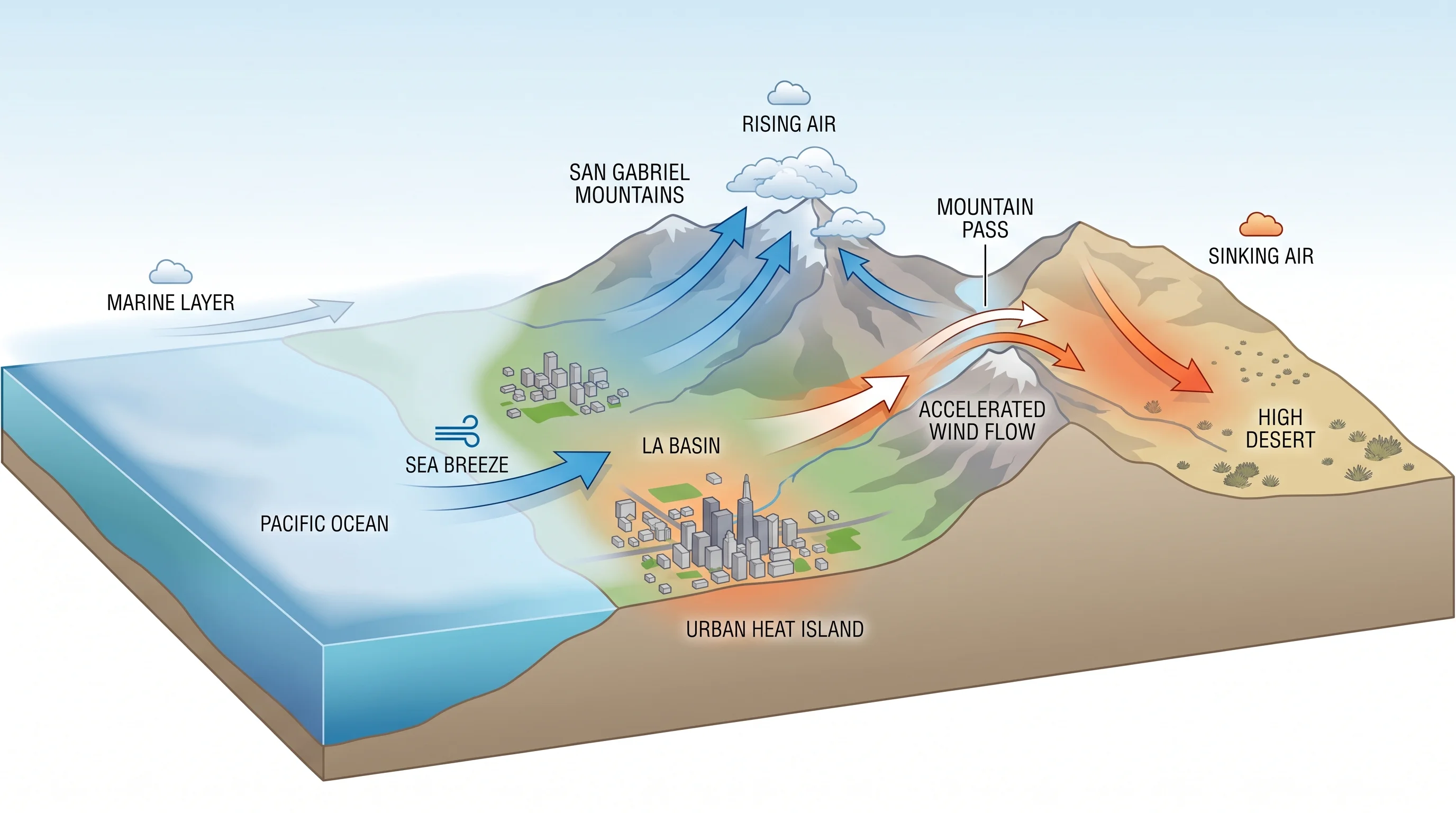
The Transverse Ranges divide Los Angeles weather. The Santa Monica, San Gabriel and San Bernardino Mountains run east to west, unlike most California ranges, so they cut across incoming ocean air and storms instead of letting them slide along the coast. That alignment is the biggest reason Los Angeles has so many terrain-driven zones in one county. Air pushed up the ocean-facing slopes rises, cools and drops rain or snow.
Air crossing the crest and sinking down the desert-facing side warms and dries as it compresses, leaving the Antelope Valley and high desert in a rain shadow even during wet Pacific storms. For how this lifting and sinking shapes fog and wind on each side, see how LA's mountains shape its weather.
Gaps in the mountains matter as much as the peaks. Cajon Pass, between the San Gabriel and San Bernardino Mountains, and the canyons north of the San Fernando Valley are where squeezed air escapes and speeds up, like water in a narrow pipe. The funneling is strongest during Santa Ana winds, when high pressure over the Great Basin pushes dry desert air through the passes toward the coast; see the Santa Ana winds explainer. Two towns a few miles apart, one in a pass and one sheltered, can have completely different wind on the same afternoon.
Why Do Neighborhoods Retain Heat Differently?
Neighborhoods hold heat differently because pavement, concrete and dense buildings absorb sunlight by day and release it slowly at night, a pattern called the urban heat island effect. Areas with more trees, open vegetation and fewer buildings cool faster after sunset, because soil and plants do not store and release heat like dark, hard surfaces.
The urban heat island is separate from the coast-to-inland pattern, though people often confuse the two. Distance from the ocean sets a neighborhood's baseline climate. How the neighborhood is paved, shaded and built decides how much hotter it runs than that baseline, especially at night. Dense, treeless blocks with little nighttime airflow hold heat longest, while open, tree-lined areas the same distance from the coast can run several degrees cooler after dark.
The two effects can work against each other. A heavily paved coastal neighborhood with little shade can stay warmer at night than an inland neighborhood with mature trees and watered landscaping, even though the coast has the ocean's cooling by day. Two places the same distance from the Pacific, even two blocks in one neighborhood, can have noticeably different overnight lows depending on how much ground is paved, roofed or planted.
For how scientists measure and map the effect, see the Los Angeles urban heat island explainer. Station numbers for the beach, the Westside, Downtown, the Valley and Pasadena are in Los Angeles weather by neighborhood.
Which Contrasts Matter for a Visitor?
The contrasts that matter most for visitors are coastal fog versus inland heat, elevation and wind exposure, because they change what to wear and when to go. A morning that starts gray and cool in Santa Monica can be clear and warming in Downtown Los Angeles by the time the marine layer's edge pulls back. A coastal morning and a downtown lunch often need different layers.
An afternoon in Woodland Hills during a summer heat spell can run 10 to 15 degrees warmer than the beach at the same hour, enough to change water and timing plans.
Elevation adds its own contrast. A drive from mild Pasadena toward Wrightwood or Big Bear Lake can go from shirt-sleeve weather to a cold, sometimes snowy mountain climate, especially outside summer.
The Valley holds the city's record low of 18°F (see LA's coldest temperatures), and Big Bear drops below freezing on about 176 nights a year (see Big Bear Lake weather by month). Wind is the least visible contrast. A calm morning in the basin says nothing about gusts at a canyon mouth or mountain saddle, so check wind forecasts for your route.
Pack for the zone, not the city. A layer you can take off works better than one outfit chosen from a downtown window, and a water bottle matters more on a valley afternoon than a coastal one, even on the same Los Angeles day.
Which Los Angeles Forecast Should You Use?
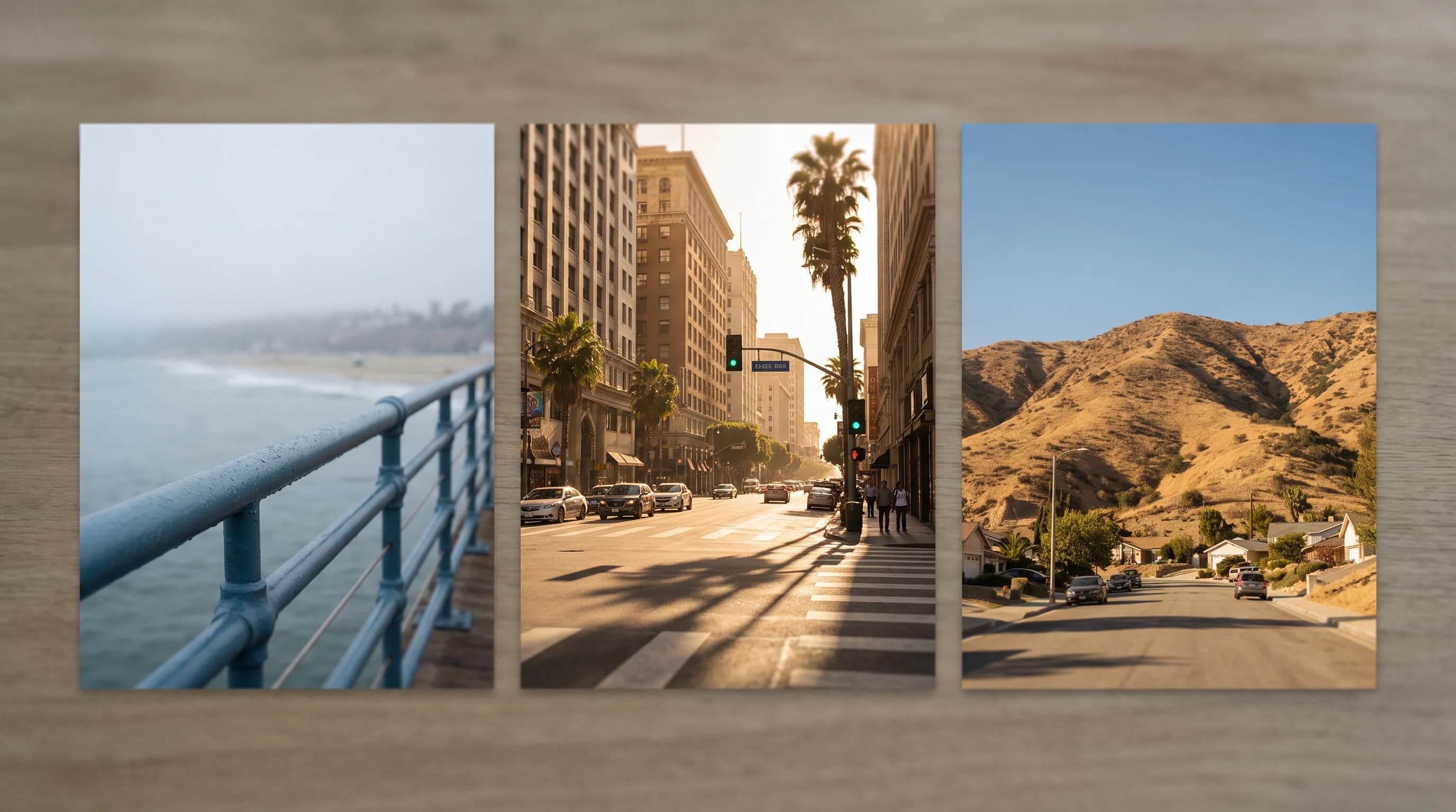
Choose a Los Angeles forecast for your exact destination, elevation and hour, not one citywide temperature, because a regional average hides the contrasts above. "Los Angeles: 74°F" could mean a foggy 63°F morning at the coast, a sunny 79°F downtown afternoon or a 90°F valley heat spell, and it matches none of them.
The NWS Los Angeles/Oxnard office and the NWS San Diego office issue point forecasts by zone instead of one countywide number, the National Weather Service's own answer to microclimates. The NOAA Climate Prediction Center and NOAA Climate.gov explain the seasonal pattern behind a given week. The California Department of Water Resources tracks mountain snowpack and reservoirs. None replaces checking your specific destination, whether a foggy beach town, a hot valley or a mountain pass.
Why Can the LA Coast, Basin, Valleys, and Mountains Have Very Different Temperatures on the Same Day?
The LA coast, basin, valleys and mountains can differ sharply on the same day because the five forces behind Los Angeles microclimates act independently. Ocean distance sets a coastal baseline that fades within a few miles. Mountains lift, block and channel air ridge by ridge.
City surfaces change heat block by block, most visibly after dark. Elevation cools the air about 3°F to 5°F per 1,000 feet in typical conditions, on top of coastal and urban effects. Wind exposure changes with ridge and canyon direction, not city limits.
Together, these five forces make Los Angeles a patchwork of climates under one metro name, not one climate with exceptions. The same coast-mountain-basin geography shapes the region's air quality, covered in how Los Angeles smog forms, and its storm hazards, covered in atmospheric rivers in Southern California and why LA hills give way after rain. For the seasonal pattern behind the whole region, see why LA's Mediterranean climate works the way it does.
Los Angeles has at least six weather stories running at once, in coastal, basin, valley, foothill, mountain and desert zones that can feel like different seasons on the same afternoon. Before a beach morning in Santa Monica, a valley errand in Woodland Hills or a mountain drive to Wrightwood, check WeatherLA's forecast for your destination, elevation and hour.