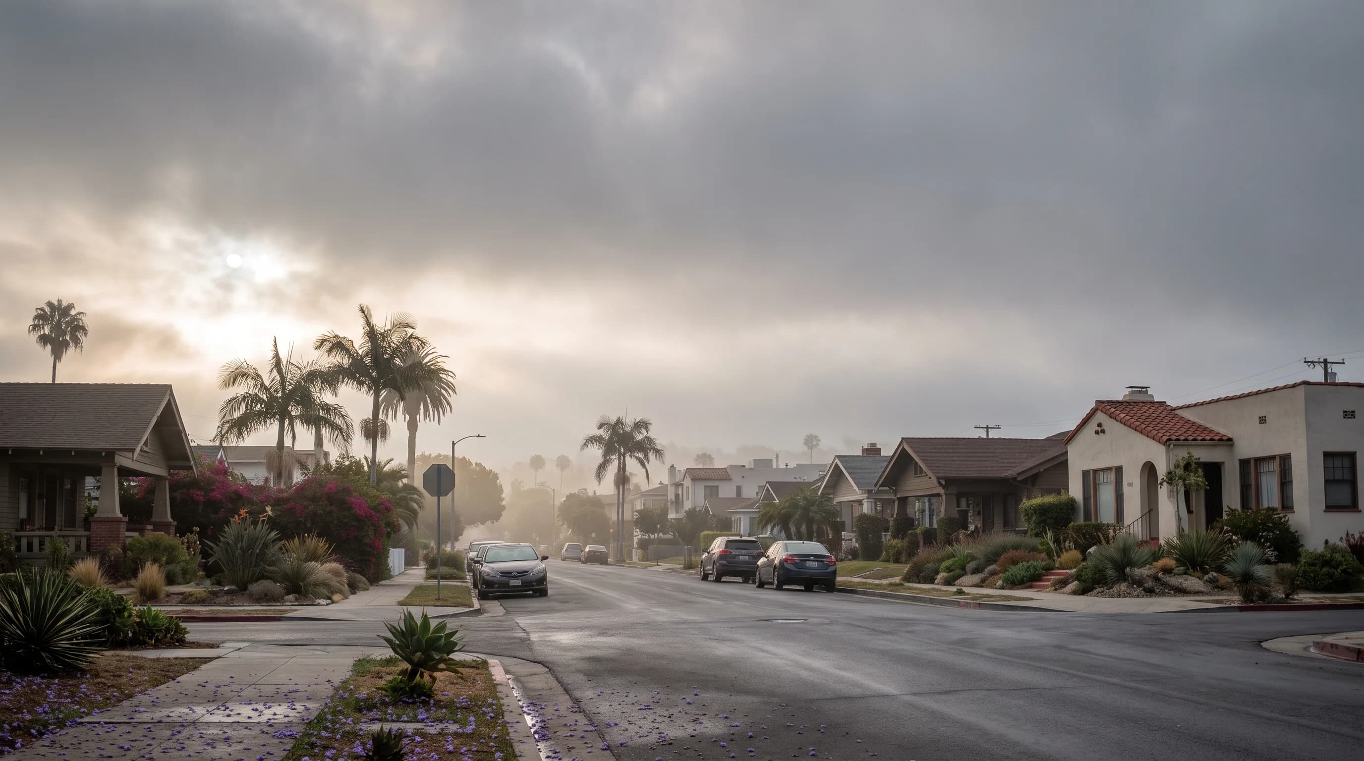
May Gray and June Gloom are the local names for the seasonal thickening of the marine layer along the Southern California coast. They are not separate weather systems or storms. Each spring, the Pacific off Los Angeles stays cold while the sun strengthens, and a stubborn deck of low clouds and fog builds overnight over the coast and parts of the basin. The gray usually starts as May Gray, becomes the more persistent June Gloom and can last into early July before sunnier summer weather takes over.
What Are May Gray and June Gloom?
May Gray and June Gloom are Southern California nicknames for the seasonal expansion of the marine layer, the shallow layer of cool, moist ocean air that often covers the coast in low clouds and fog. They describe a recurring pattern, not a storm, a cloud type or an official National Weather Service term. May Gray marks the onset in May, and June Gloom marks the more consistent, stubborn gray of June. For how those months fit into the year, see Los Angeles weather by month.
May Gray and June Gloom are strongest right at the coast, from Ventura County south through beach towns like Malibu and Santa Monica to San Diego County. Santa Monica's monthly odds of a gray morning are in Santa Monica weather by month. Inland, conditions change quickly: a chilly, overcast beach morning can be clear and warm a few miles inland. For how the marine layer and its inversion work, and why LA sees gray mornings in other months too, see the Los Angeles marine layer and its gray mornings.
| Location type | Typical morning cloud cover | Typical clearing |
|---|---|---|
| Immediate coast (Santa Monica, Malibu) | Persistent overcast, often into late morning | Late morning to midday, or not at all on the gloomiest days |
| Near-coastal basin (Downtown Los Angeles) | Overcast at dawn, thinning through the morning | Mid to late morning on most days |
| Inland and upslope (Pasadena) | Light haze or clear at dawn on many mornings | Often clear before the coast, or never socked in |
Why Does the Pattern Peak in Late Spring and Early Summer?
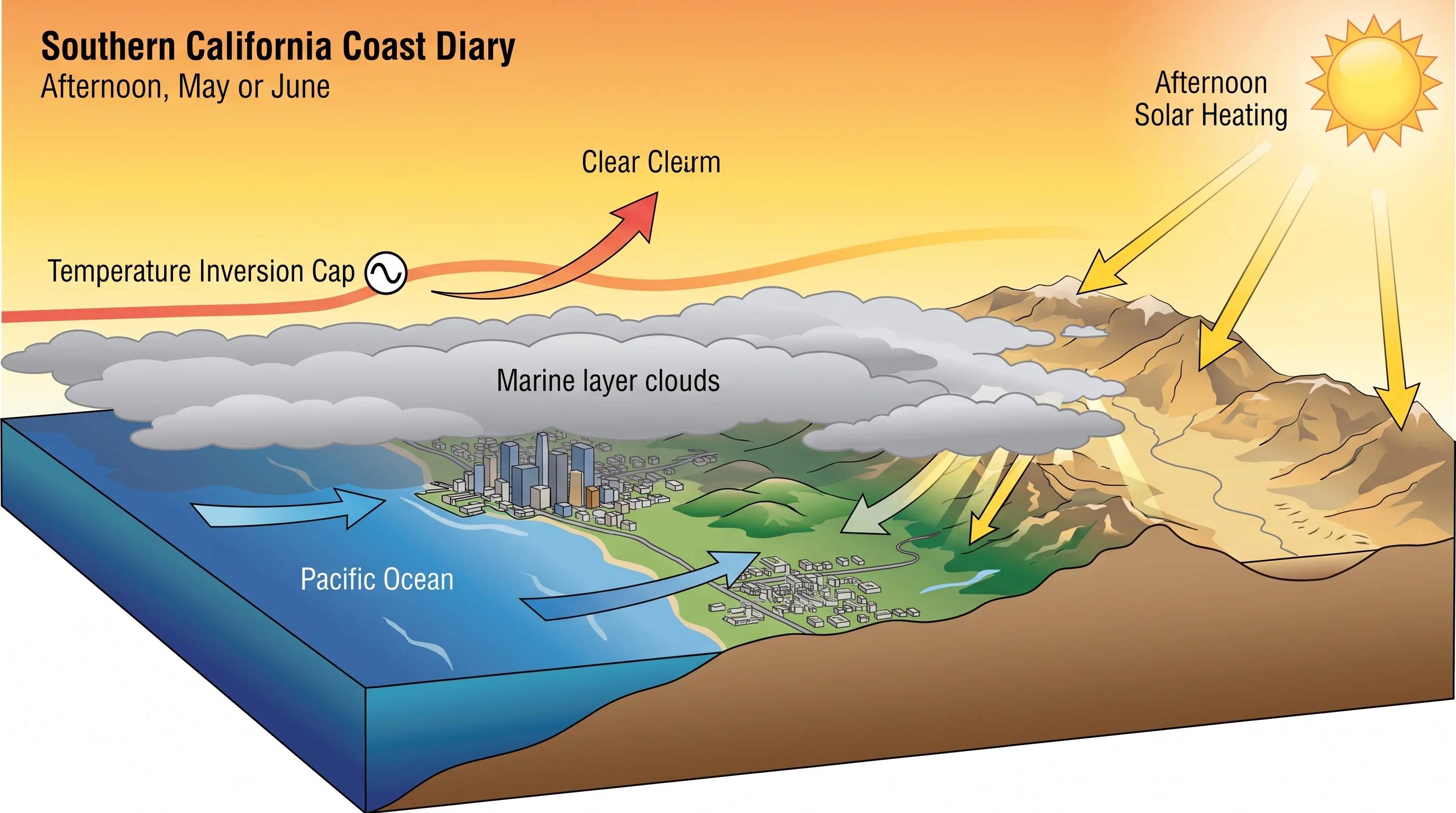
May Gray and June Gloom peak in late spring and early summer because several conditions line up. The Pacific off Southern California is still cold from spring upwelling while days lengthen and the sun climbs toward its summer peak. The cold water chills the air near the surface and strengthens the temperature inversion, a cap of warm air that traps cool, moist marine air below. Steady onshore wind keeps pushing that moist air over the coast, feeding the cloud deck night after night.
Inland heat eventually breaks the pattern, but in May and June it is not strong enough yet. The interior valleys and deserts have not fully warmed, so the daytime heating that would strengthen onshore wind and burn off the marine layer by midday is weak. Once inland areas heat up in July and August, stronger heating clears the coastal deck faster and pushes the gray back toward the shoreline.
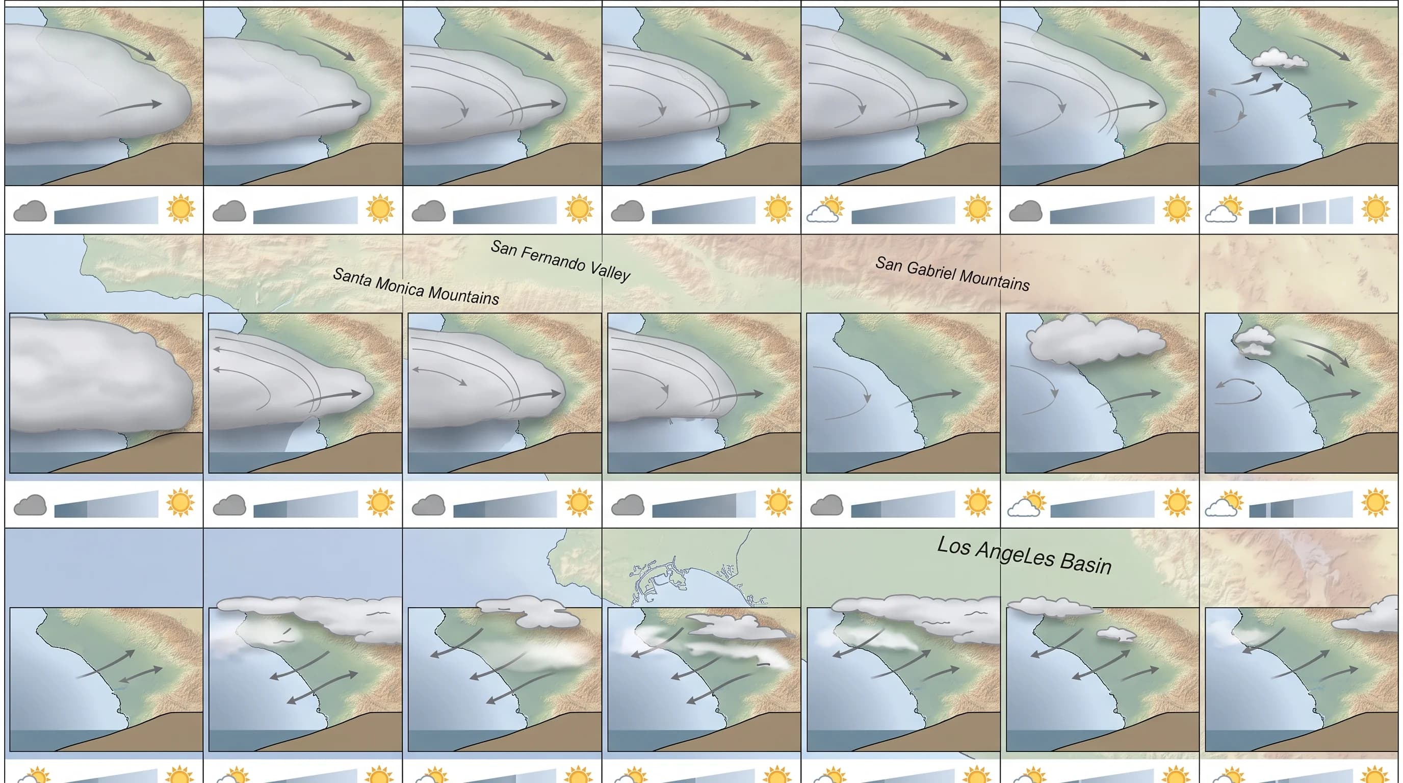
Southern California's Catalina Eddy, a counterclockwise coastal wind circulation that can deepen the marine layer for a day or two, adds extra cloud on top of the seasonal pattern. The eddy is a short-term addition, not the reason May and June are gray.
Why Can the Beach Stay Gray While Inland LA Is Sunny?
The beach stays gray while inland Los Angeles is sunny because the marine layer is shallow and hugs the coast, and its reach changes block by block. On a strong May Gray or June Gloom day, the cloud deck may be only a few thousand feet thick. It reaches just far enough inland to cover low coastal communities, while higher or more distant areas sit above or beyond it.
Distance from the ocean matters as much as elevation. Santa Monica and coastal Malibu sit directly in the onshore wind and often stay overcast into late morning.
In Downtown Los Angeles, the marine layer is already thinner after traveling inland. In Pasadena, against the San Gabriel Mountains, mornings can be clear or lightly hazy while the coast is still gray. That coast-to-valley pattern is why one regional forecast rarely matches any single Los Angeles neighborhood on a May or June morning.
When Do the Clouds Usually Clear?
During May Gray and June Gloom, the clouds usually clear later in the day than during a typical summer marine layer. Clearing depends on how deep the layer is, how strong the inversion is and how much sun is available to burn it off. With a thin layer and weak inversion, sun breaks through by mid to late morning. With a deep layer and strong inversion, the deck can last through midday or, on the gloomiest days, never clear before sunset.
No single clearing time applies to the whole season or the whole coast, because each day's ocean temperature, inversion strength and onshore wind differ. Some days the deck pulls back from the coast, then slides back in during the evening as temperatures drop and onshore wind strengthens. Gray overnight and at dawn, partial or full clearing by afternoon and gray again after sunset is the normal daily rhythm of the season.
How Do May Gray, June Gloom, Fog, and the Marine Layer Differ?
May Gray, June Gloom, fog and the marine layer are related but different, and confusing them is common among people new to Southern California. The marine layer is the air mass: a shallow, cool, moist layer of ocean air capped by a temperature inversion, present along the coast for much of the year.
Fog is a visibility condition: cloud low enough to touch the ground or ocean. Fog can form within the marine layer, but it is not the same as cloud cover. May Gray and June Gloom are labels for the weeks, roughly May into June and sometimes into July, when the marine layer is unusually persistent and widespread.
The Catalina Eddy is a wind circulation, not a season or an air mass, and it can deepen the marine layer for a day or two at any time of year. For how to tell fog, mist and haze apart, see our guide to reading LA's gray skies. For the onshore sea breeze that feeds the marine layer, see why LA's afternoon wind blows off the ocean.
Does a Gloomy Morning Predict a Cool Day?
A gloomy morning means a cooler start at the coast, because clouds block the early sun that would warm the air. Whether the whole day stays cool depends on when the marine layer clears. If it burns off by midday, coastal and inland temperatures can still climb a lot by afternoon, especially a few miles inland. If the deck holds, coastal temperatures stay well below sunnier inland neighborhoods a short drive away.
A gray sky at 7 a.m. does not predict 2 p.m. by itself, because clearing time changes by day and neighborhood. Check the day's forecast for your destination, including cloud cover and expected clearing.
May Gray and June Gloom are a predictable season on the Los Angeles coast, but how thick the deck is, how far inland it reaches and when it clears change every morning. Before a beach day or inland trip in late spring or early summer, check WeatherLA's current cloud cover and forecast for Santa Monica, Malibu or a sunnier inland stop like Pasadena.
For satellite views and background, see NOAA's Southern California marine-layer imagery and the National Weather Service's Southern California Weather Guide.