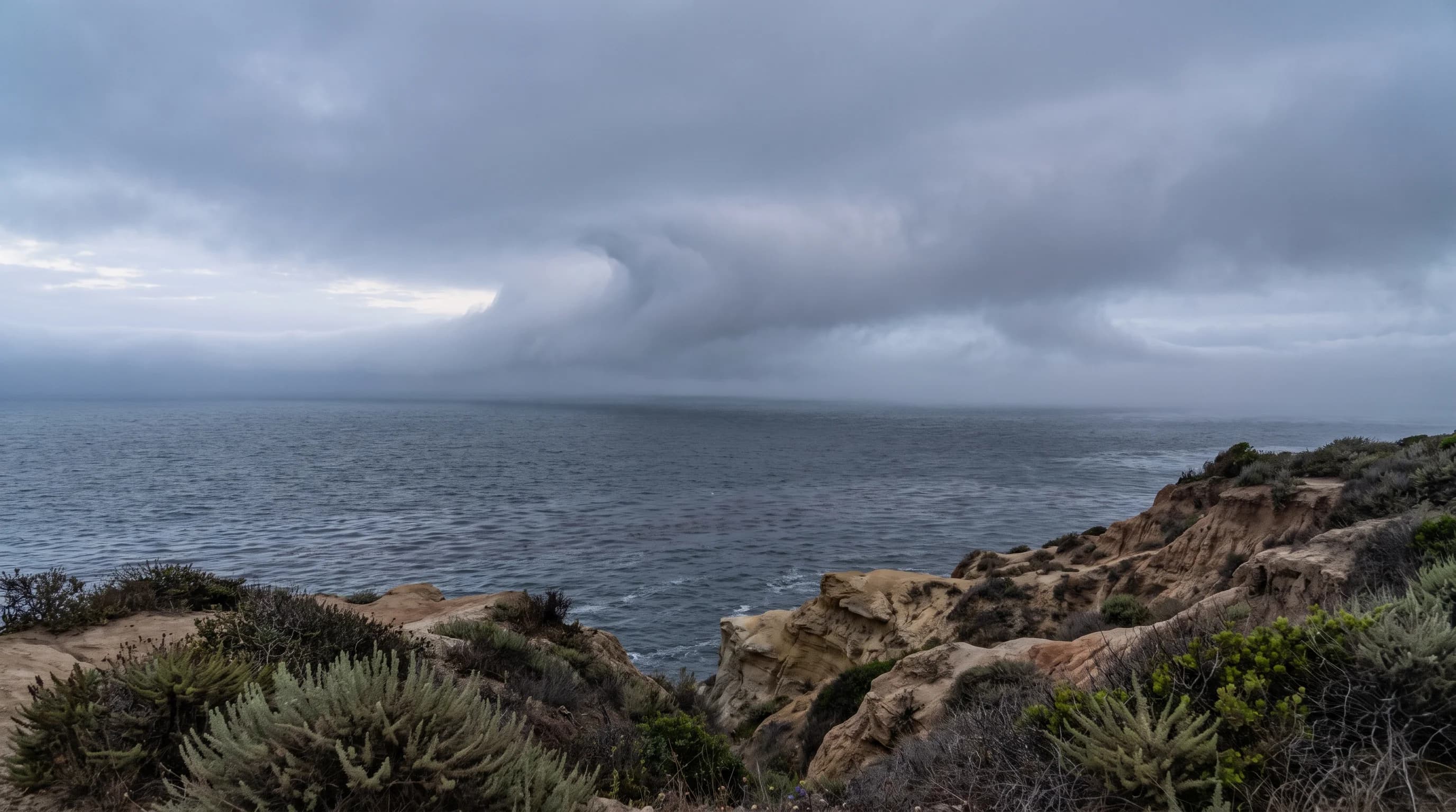
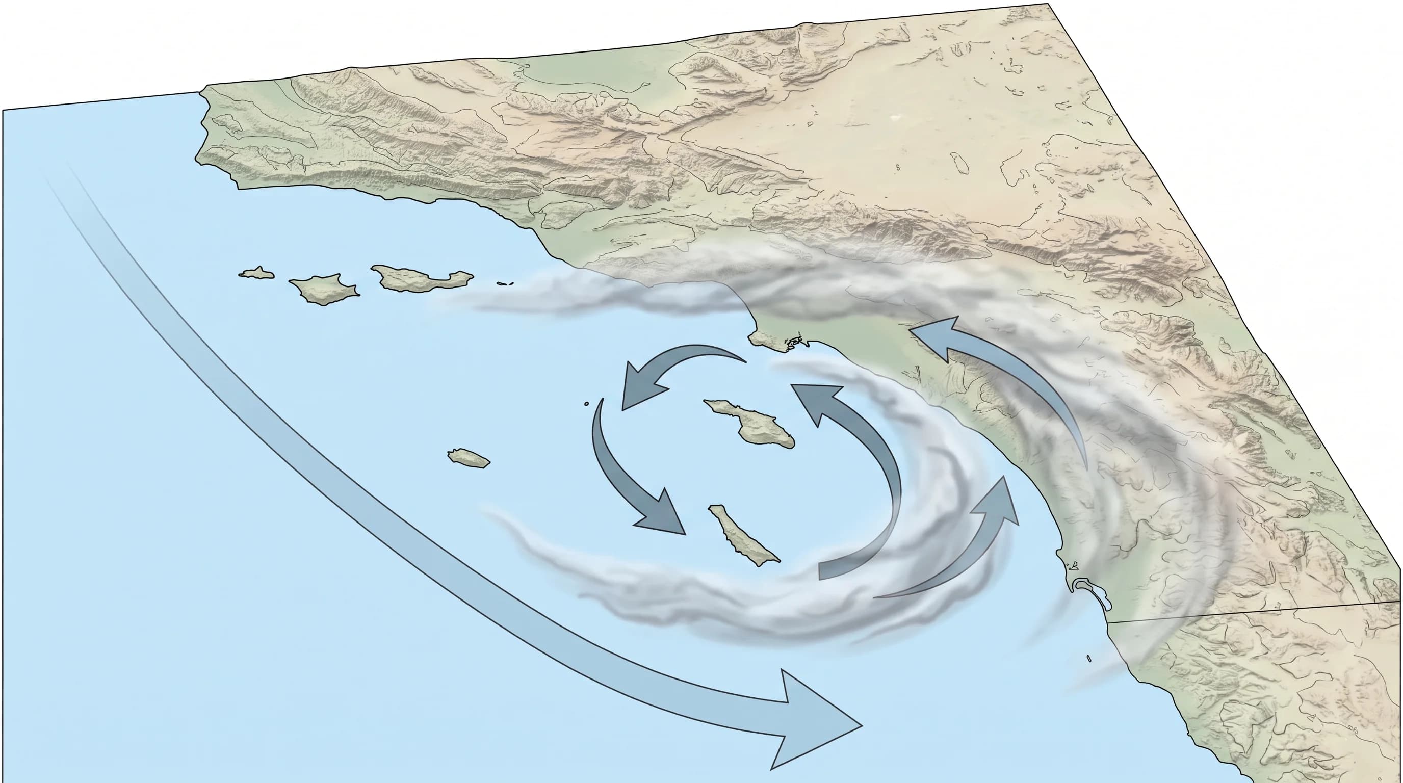
A Catalina Eddy is a small counterclockwise wind circulation in the Southern California Bight, the curved stretch of coast from Point Conception to San Diego. Santa Catalina Island sits in the bight about 22 miles offshore.
Most gray Los Angeles mornings come from the ordinary marine layer, the cool ocean air that builds overnight and clears by late morning. A Catalina Eddy turns the coastal wind southerly and pulls a deeper, wider cloud deck into the LA Basin. The gray can then last a day or two and keep ceilings low at coastal airports; see LAX weather delays.
What Is the Catalina Eddy?
The Catalina Eddy is a shallow counterclockwise circulation of surface wind inside the Southern California Bight. The bight runs from Point Conception south past Los Angeles to San Diego. The eddy is named for Santa Catalina Island, about 22 miles off the LA coast, because the circulation often centers around or just north of the island. Catalina's own weather is covered in Catalina Island weather by month.
Normally, wind in the bight blows from the northwest. During a Catalina Eddy, part of that flow rotates counterclockwise, which turns the wind along the LA coast southerly or south-southeasterly.
The eddy is a wind pattern, not a cloud, a storm or a season. The low clouds and cooler air during an eddy are effects of the wind shift. Most gray days come from the ordinary marine layer with no eddy, as our explainer on the Los Angeles marine layer describes.
How Does the Catalina Eddy Form?
A Catalina Eddy forms when the northwesterly wind moving down the California coast meets the terrain around Point Conception and the islands inside the bight. That interaction, along with pressure differences across the curved bight, spins off a smaller counterclockwise circulation.
Researchers describe the trigger as a combination of factors, because eddy strength, size and duration change from one event to the next. Some eddies only shift the wind at coastal stations. Others grow strong enough to change cloud cover across the region for a day or more.
The Catalina Eddy is a terrain effect on a larger wind pattern, not a storm arriving from offshore. The bight's shape, Point Conception's blocking effect and the positions of Catalina and the other Channel Islands all shape it. The eddy forms inside the marine air already along the coast, so it strengthens the existing marine layer instead of replacing it.
How Does an Eddy Change Clouds and Wind Around Los Angeles?
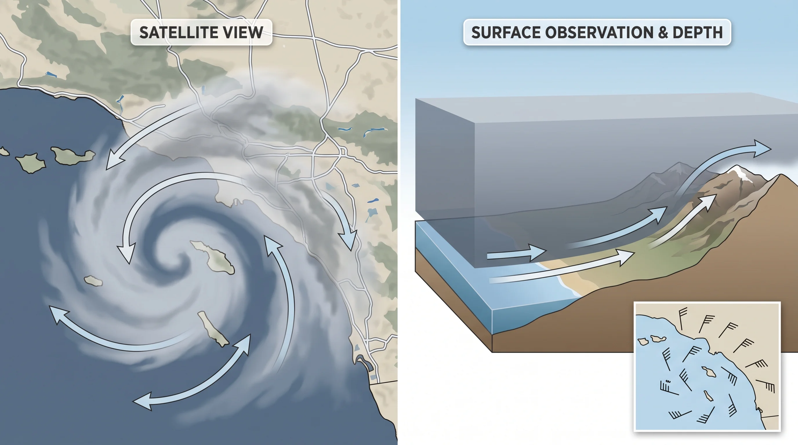
An active Catalina Eddy shifts the coastal wind from northwesterly to southerly or south-southeasterly for the length of the event. The wind shift changes how moist ocean air moves into the basin. Instead of the usual push from the northwest, the eddy draws ocean air in along a different path and holds it in place longer. The result is a deeper cloud deck that spreads farther inland than on an ordinary morning.
The clouds depend on how much moisture the marine air already holds and how strong the temperature inversion above it is. A strong eddy over a dry marine layer changes the wind more than the clouds. A strong eddy over a moist, deep marine layer, common in late spring, produces thicker overcast that clears later than usual.
On satellite images, an active eddy often appears as a comma-shaped swirl of low cloud curling counterclockwise near Catalina Island. Forecasters use that swirl to confirm the eddy.
| Feature | Typical marine layer morning | Active Catalina Eddy event |
|---|---|---|
| Coastal wind direction | Northwesterly, following the prevailing coastal flow | Shifts southerly to south-southeasterly |
| Cloud deck behavior | Builds overnight, generally clears from the coast by late morning | Can deepen, spread farther inland, and linger longer |
| Satellite signature | Diffuse stratus deck along the immediate coastline | Comma-shaped counterclockwise cloud swirl near Catalina Island |
| Typical duration | Clears within a single day, most days of the year | Can persist for a day or two before breaking down |
When Is a Catalina Eddy Most Likely?
Catalina Eddies are most common in the warm season, roughly May through September. They usually form overnight and show up most clearly in the next morning's wind and cloud observations. That season overlaps May Gray and June Gloom, covered in our article on LA's marine layer season. Most gray mornings in that season still come from cold coastal water and a strong inversion, with an eddy adding to some of them.
The National Weather Service Los Angeles/Oxnard forecast discussion is the most direct way to confirm whether an eddy is driving a given gray morning.
How Is a Catalina Eddy Different From June Gloom?
A Catalina Eddy is a specific wind circulation; June Gloom is a season. An eddy develops over a day or two and shows up as a wind shift and a satellite swirl.
June Gloom is the tendency for LA's marine layer to become persistent and widespread in late spring and early summer, driven by cold coastal water and a strong temperature inversion. An eddy during June Gloom makes the gray thicker and slower to clear. June Gloom can also last for weeks with no eddy, and an eddy occasionally forms outside May through September.
If the coast is overcast again in late May, the cause is almost always the seasonal marine layer described in the June Gloom article. If the wind turned southerly overnight and the gray reached farther inland and lasted longer than usual, a Catalina Eddy is the likely cause. Catalina Island gets the same late-spring low clouds as the mainland coast. Because the island sits closer to the eddy's center, Catalina's weather during an eddy can differ in timing and intensity from beaches near Santa Monica.
How Can You Recognize an Eddy in the Forecast?
Three signals together confirm an active Catalina Eddy. First, coastal stations that normally report northwesterly wind report southerly or south-southeasterly wind.
Second, satellite images show a comma-shaped swirl of low cloud near Catalina Island. Third, the NWS Los Angeles/Oxnard forecast discussion names an eddy or a countercurrent. The NWS San Diego office covers the southern edge of the bight and uses the same language when an eddy reaches that far south.
A weak eddy only nudges the wind. A strong eddy holds Downtown Los Angeles and the coast gray well past late morning, while Pasadena and other higher inland spots stay above or beyond the cloud layer. That is the same distance and elevation effect described in our explainer on Los Angeles microclimates. Before planning a coastal morning, check the forecast and current conditions for your specific destination.
The Catalina Eddy is a distinct counterclockwise wind circulation, not another name for the marine layer or June Gloom. Most overcast coastal days do not involve one. When the wind turns southerly and the gray lasts longer and reaches farther inland than usual, an eddy is often the reason. Check wind direction, cloud cover and the forecast discussion for your Los Angeles destination on WeatherLA to see whether the gray will clear by lunch.