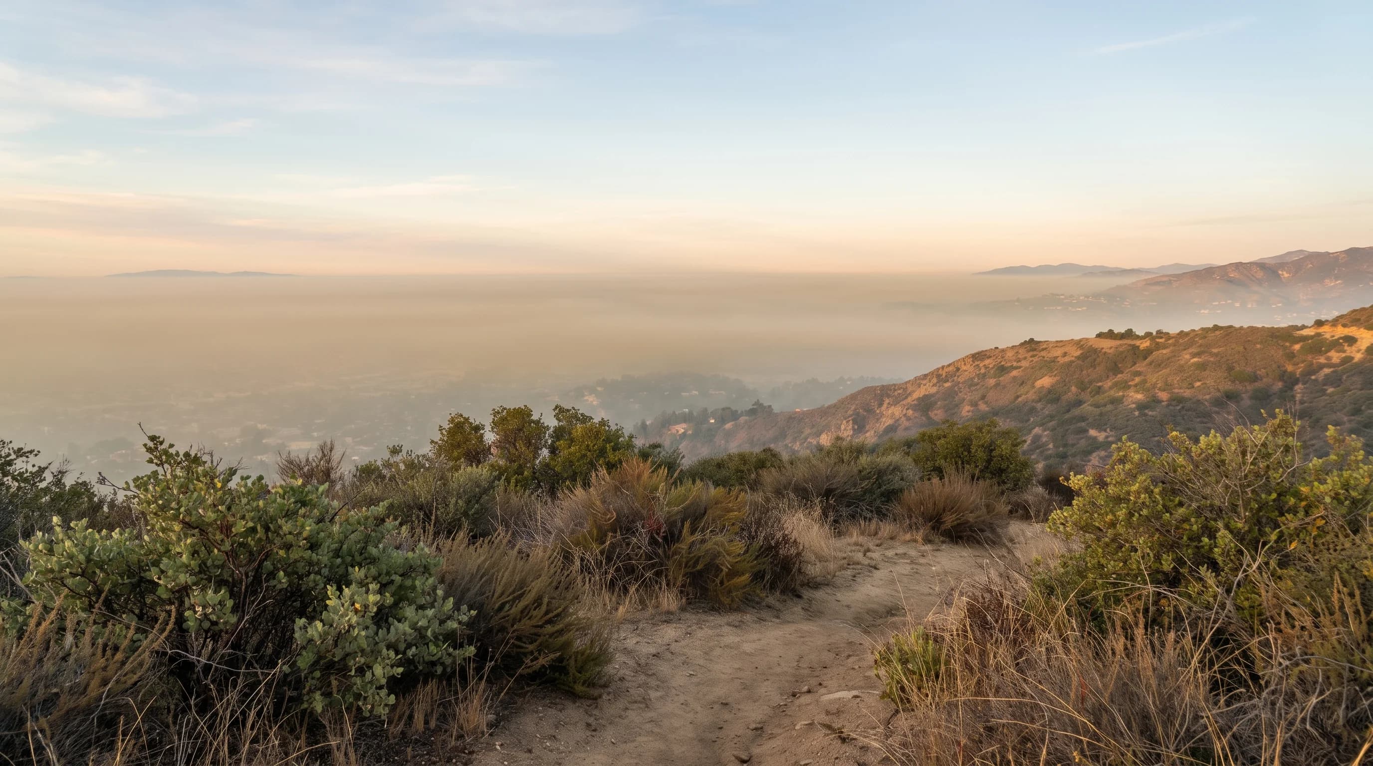
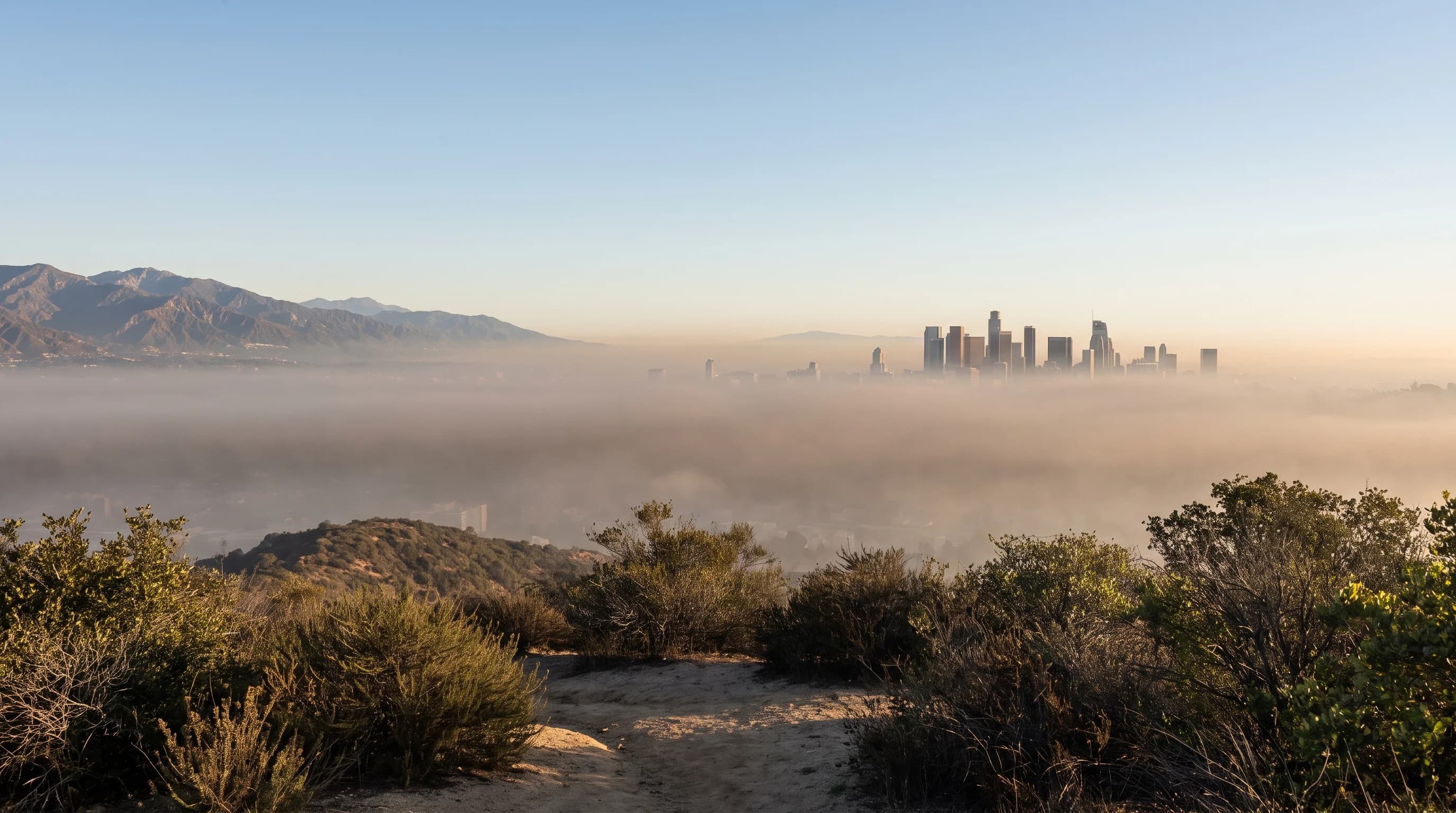
A temperature inversion is a layer of warmer air sitting above cooler air near the ground, the reverse of the normal pattern in which air cools with height. The warm layer blocks the vertical mixing that would carry surface air and pollution up and away. That is why the Los Angeles Basin's frequent inversions trap smog, wildfire smoke and morning haze near the ground.
What Is a Temperature Inversion?
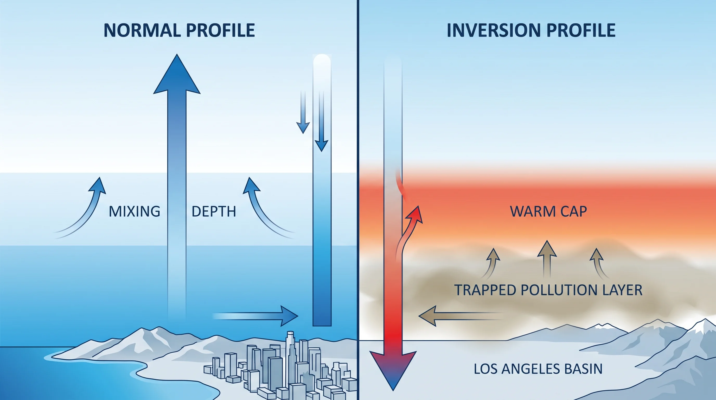
Normally, air temperature falls steadily with height, a pattern called the lapse rate. In a temperature inversion, temperature rises with height through a layer above the ground before falling again higher up. The warm layer works like a lid: it is less dense than the cool air below, so it does not sink and mix downward.
How Does an Inversion Trap Pollution?
A temperature inversion traps pollution by stopping the vertical mixing that normally disperses it; the inversion creates no pollution itself. In a well-mixed atmosphere, warm surface air rises and carries pollutants up and out, diluting them.
Under an inversion, that mixing stops, so vehicle exhaust, industrial emissions, wildfire smoke and wood smoke stay near the ground. Concentrations build under the cap until wind, daytime heating or a weather change breaks the inversion. On clear winter nights, the same layering pools cold air on valley floors, which is why the city's record lows come from the San Fernando Valley (LA's coldest temperatures).
| Condition | Temperature with height | Effect on surface pollution |
|---|---|---|
| Normal atmosphere | Cools steadily with height | Rises and mixes out, dispersing over a larger volume |
| Temperature inversion | Warms with height within the inverted layer | Trapped near the surface, concentrations build over time |
Why Are Inversions Common in Los Angeles?
Inversions are common in Los Angeles because two mechanisms work there. The Pacific high-pressure system produces sinking air offshore, which warms as it compresses and forms a subsidence inversion that regularly caps the marine layer over the coast and basin. On clear, calm nights, the ground loses heat quickly and chills the air just above it while air a little higher stays warmer. That creates a shallow surface inversion, common across the basin in fall and winter.
Terrain makes both worse. The San Gabriel, San Bernardino and Santa Monica Mountains surround the basin and give trapped air few ways out. The combination of subsidence inversions, clear-night surface inversions and mountains helps explain why Los Angeles neighborhoods can experience such different conditions, depending on how close they sit to the coast, the mountains or the open basin.
When and Where Are Impacts Strongest?
Inversions trap the most pollution during stagnant weather, when light wind and lasting high pressure hold an inversion in place for several days instead of letting it break and re-form daily. At the coast, the inversion caps the marine layer, adding to the low clouds and fog explained in the Los Angeles marine layer explainer.
Inland valleys form their own nighttime cold pools that trap local pollution and smog carried in earlier in the day. To tie a day's haze to an inversion, check monitor data or a National Weather Service weather balloon sounding. A hazy morning can also come from marine fog, wildfire smoke or humidity. To tell smog from smoke and fog by sight, see smog vs. smoke vs. fog.
Is an Inversion the Same as the Marine Layer?
A temperature inversion is not the marine layer. The marine layer is the cool, moist air near the surface along the coast and basin. The inversion is the warm cap above it that keeps the cool air from mixing upward. The marine layer supplies the cool, often foggy air, and the inversion keeps that air confined to a shallow layer.
For how the marine layer works and why LA has gray mornings outside peak season, see the Los Angeles marine layer explainer. For how inversions concentrate photochemical smog, see what is smog and how LA's photochemical haze forms.
What Breaks an Inversion?
A temperature inversion breaks when something disrupts the temperature layering. Strong daytime sun can warm the surface enough to erase the difference. Stronger wind can stir the layers together.
A front can replace the air mass entirely. A shift in the regional pressure pattern can end the sinking air behind a subsidence inversion. Terrain helps break inversions locally, because air forced over mountains or through passes mixes more than air over a flat basin.
An inversion that breaks during the day can re-form the next night, so one clear afternoon does not end a stagnant pattern. Official air quality monitoring shows the current state of an inversion and the pollution beneath it better than the look of the sky. South Coast AQMD's air-quality and health chapter explains how inversions trap emissions in the basin.
Before outdoor activity during a stagnant stretch, check the current South Coast AQMD subregion readings. Also check wind, the AQI pollutant reading and when the inversion should weaken for Downtown Los Angeles, Pasadena or Woodland Hills on WeatherLA, instead of judging the air by how it looks or smells.