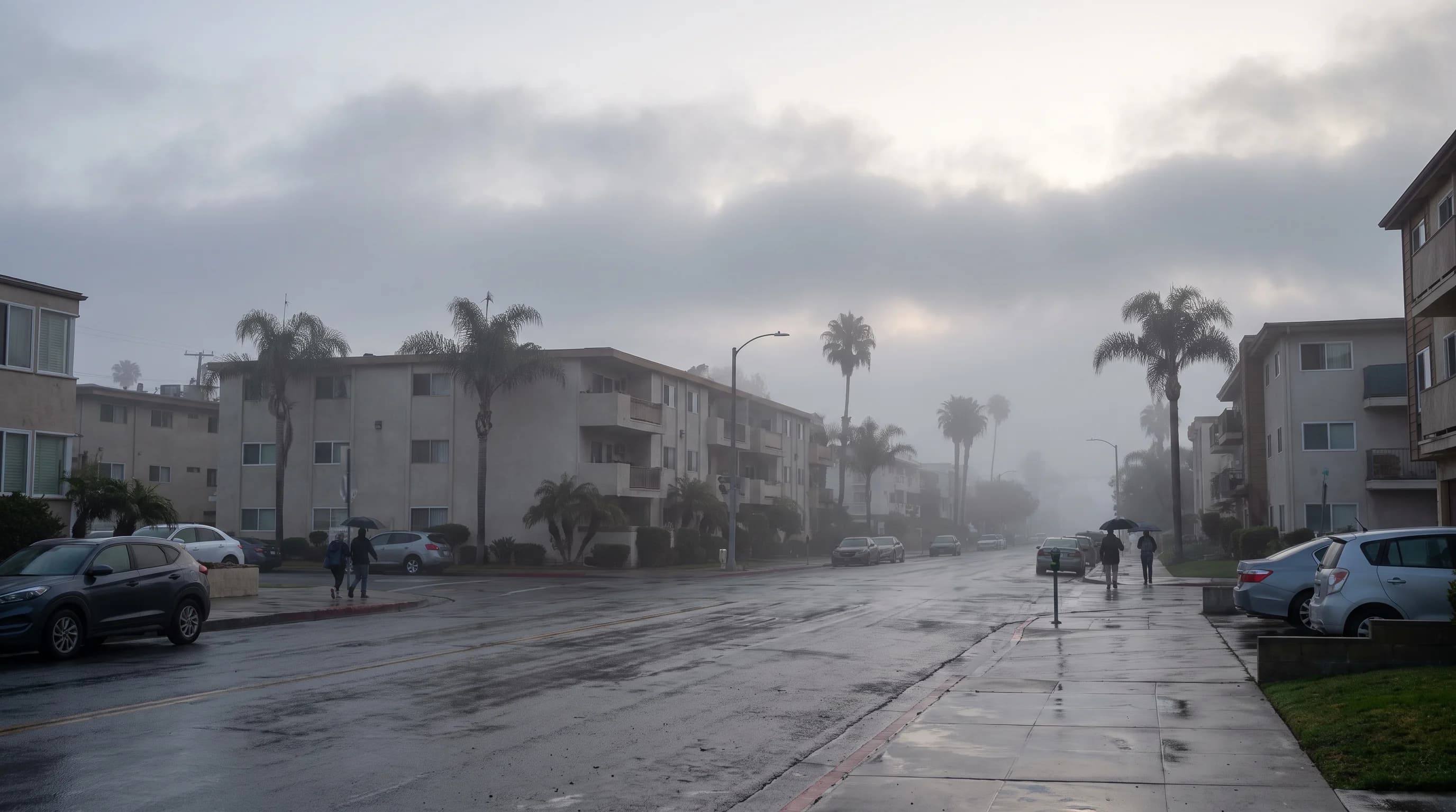
The Los Angeles marine layer is a shallow band of cool, moist ocean air trapped under a warm temperature inversion, and it makes coastal mornings gray while inland neighborhoods are sunny. The marine layer builds overnight over the cold Pacific, drifts onto the coast and into the basin on onshore wind and forms the low cloud deck locals call "the gray." The marine layer is not a storm, not fog on its own and not the same as May Gray or June Gloom, the nicknames for the season when it becomes unusually persistent. It can appear on any day of the year, thicken overnight and burn off unevenly as the sun heats the ground. It is also the main cause of weather delays at LAX, where low clouds peak around sunrise.
What Is the Los Angeles Marine Layer?
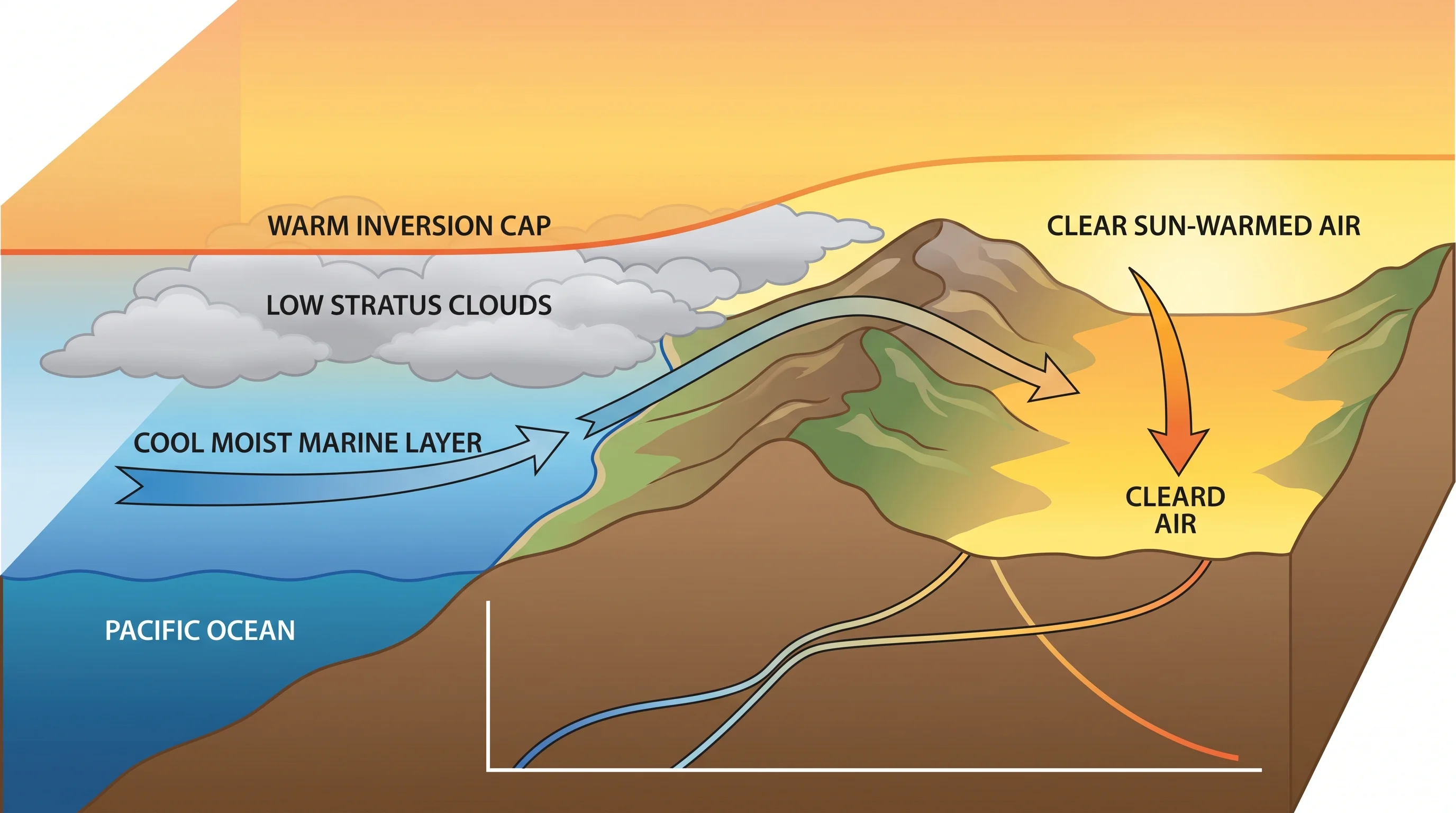
The marine layer is a shallow layer of cool, moist air, usually a few hundred to a couple thousand feet thick, that sits over the cold coastal Pacific and spreads onto nearby land. It forms because the ocean off Southern California stays cold all year, chilling the air just above it, while air higher up stays warmer. The warmer air on top, a temperature inversion, works like a lid that keeps the cool, moist air near the surface instead of letting it mix upward and dry out.
The marine layer, stratus and fog are three different things. The marine layer is the air mass itself, defined by its temperature and moisture, cloudy or not. Stratus is the low, flat gray cloud deck that forms when that air cools to saturation; it is what people usually mean when they say the marine layer rolled in. Fog is the same cloud touching the ground or ocean, cutting visibility on the street or on the water, where it can hide a whale's spout from whale watchers.
A day can have a marine layer with no clouds, if the air is not moist enough to saturate. It can also have thick stratus offshore that never reaches the beach as fog. The National Weather Service Los Angeles/Oxnard forecast office and the San Diego office treat the marine layer as a routine, near-daily feature of the Southern California coast. A marine layer bank sitting on the horizon hides the green flash at sunset, even on a sunny day.
| Term | What it actually describes | Can exist without the others? |
|---|---|---|
| Marine layer | The cool, moist air mass beneath the inversion, whether or not it is cloudy | Yes, can be clear if not saturated |
| Stratus cloud | Low, flat cloud that forms when marine layer air cools to saturation | No, requires a marine layer or similar moist air mass |
| Fog | Stratus cloud with a base low enough to touch the ground, reducing surface visibility | No, it is stratus cloud at ground level specifically |
How Does the Inversion Create a Low Cloud Deck?
The inversion creates the low cloud deck by trapping cool, moist marine air under warmer, drier air, so the moist layer cools to its dew point and condenses into stratus instead of rising and thinning. Over the ocean, air near the surface loses heat to the cold water and gains moisture from evaporation. Offshore, air sinking as part of the eastern Pacific high-pressure system warms as it descends and settles above the cool marine air, forming the inversion cap.
After sunset, onshore wind pushes the moist layer over cold water and cooling land. Once that air cools enough, it saturates and condenses into the low stratus deck that covers the coast and basin by early morning.
Mixing at the top of the cloud keeps the deck from growing much thicker on most nights. Turbulence where the cool marine air meets the warm cap slowly dries the top of the cloud while the surface keeps feeding it moisture. The inversion's strength, the size of the temperature jump between the cool layer and the warm cap, controls how well the system holds together. A strong inversion keeps the marine layer shallow and persistent.
A weak or broken inversion lets the cool air mix upward and disperse. That is why marine layer coverage can look completely different from week to week with similar ocean temperatures. For how the same inversion traps pollution, see our explainer on temperature inversions and trapped smog in Los Angeles.
Why Can the Coast Stay Gray While Valleys Are Sunny?
The coast stays gray while valleys are sunny because the marine layer is shallow and hugs the coast, and terrain and inland heat decide how far it reaches. Coastal hills and passes act as gates. Where a pass is low enough, marine air flows through and spreads gray sky into the basin. Where the terrain rises above the top of the marine layer, the clouds cannot climb over, and upslope communities stay clear while the coast below stays gray.
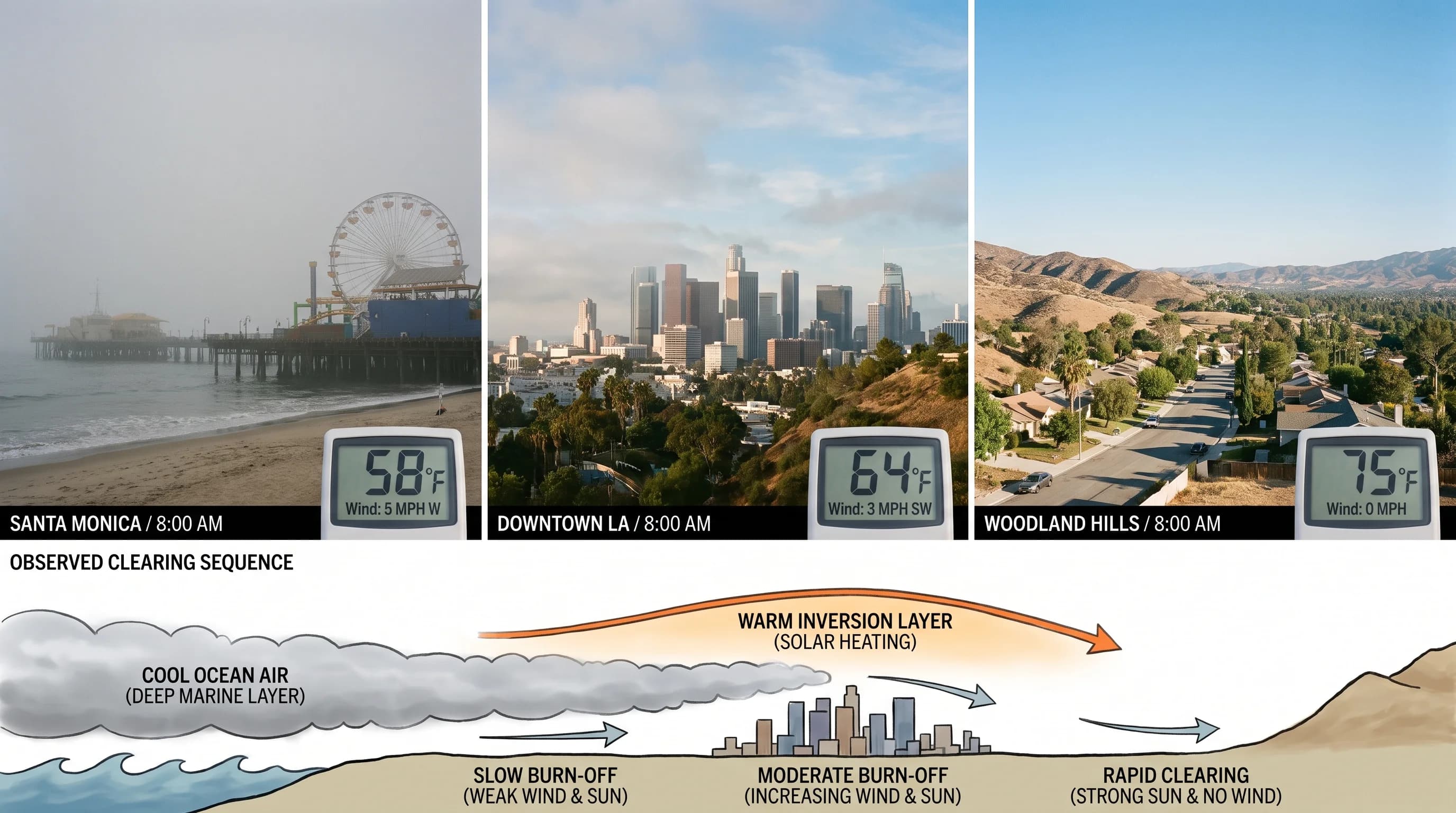
Santa Monica, on the coast, gets the most persistent marine layer and often stays overcast into late morning; about 59% of June mornings there start gray, per Santa Monica weather by month. Downtown Los Angeles is often overcast at dawn but clears noticeably earlier than the beach, because the layer thins as it travels inland. Woodland Hills, farther inland in the San Fernando Valley, often gets only a thin marine layer, so mornings stay clear or lightly hazy.
Santa Monica, Downtown Los Angeles and Woodland Hills show the coast-to-inland pattern behind nearly every marine layer morning. That same pattern helps explain why Los Angeles has so many distinct microclimates in one metro area.
When Is the Marine Layer Deepest?
The marine layer is deepest overnight and around dawn, after hours of cooling and onshore wind have built the cloud deck and pushed it inland. The marine layer is usually shallowest, or gone, by mid-to-late afternoon, once the sun has warmed the ground enough to erode the inversion from below. The cycle of thickening overnight, retreating by day and returning after sunset repeats on most days of the year along the Southern California coast.
The marine layer also has a season. Late spring and early summer bring the most persistent and widespread gray, known as May Gray and June Gloom, when cold ocean water and a strong inversion meet inland heat that has not yet built up for the year. Our guide to May Gray and June Gloom covers that season.
Storms reshape the marine layer temporarily, clearing it ahead of a front or deepening it behind one. No standard clearing time applies across the region or the year. Clearing time shifts with ocean temperature, inversion strength and how much onshore wind feeds the layer each night.
How Is the Marine Layer Different From Fog, May Gray, or a Catalina Eddy?
The marine layer is the air mass, fog is its cloud touching the ground, May Gray and June Gloom are its persistent season and a Catalina Eddy is a short-lived wind pattern that deepens it. The marine layer is present to some degree on most days. Fog is a visibility condition: stratus low enough to touch the ground or ocean. Fog, mist and haze are covered in our guide to reading LA's gray skies.
May Gray and June Gloom are seasonal nicknames, not separate weather events, for the weeks when the marine layer becomes unusually persistent and widespread. A Catalina Eddy is a counterclockwise coastal wind circulation that develops over a day or two and temporarily deepens and spreads the marine layer, in any season. The eddy adds to the everyday marine layer but is not why the coast is normally gray; see our explainer on the Catalina Eddy.
When Will the Marine Layer Clear?
The marine layer usually clears by mid-morning when it is thin, onshore wind is weak and inland heating is strong. A deep layer under a strong inversion, with onshore wind still feeding moist air, can last through midday or longer, especially right at the coast. Watch four signals together: how thick the cloud deck looks and how low its base sits, how strong the inversion is, whether onshore wind is still feeding the layer and how much inland heating is available to erode it.
For a specific morning, the most reliable source is the current forecast discussion from the NWS Los Angeles/Oxnard office or the NWS San Diego office, because forecasters use that day's inversion strength and onshore wind. The marine layer changes hour by hour. To plan a morning at Malibu, Pasadena or anywhere between the coast and the basin, check that destination's current cloud cover and forecast on WeatherLA.
The Los Angeles marine layer, cool and moist air trapped under a warm cap, explains why the beach can be gray at 8 a.m. while a neighborhood ten miles inland is already warm and clear. Before heading to the coast, check WeatherLA's current cloud cover, temperature and forecast for your destination.