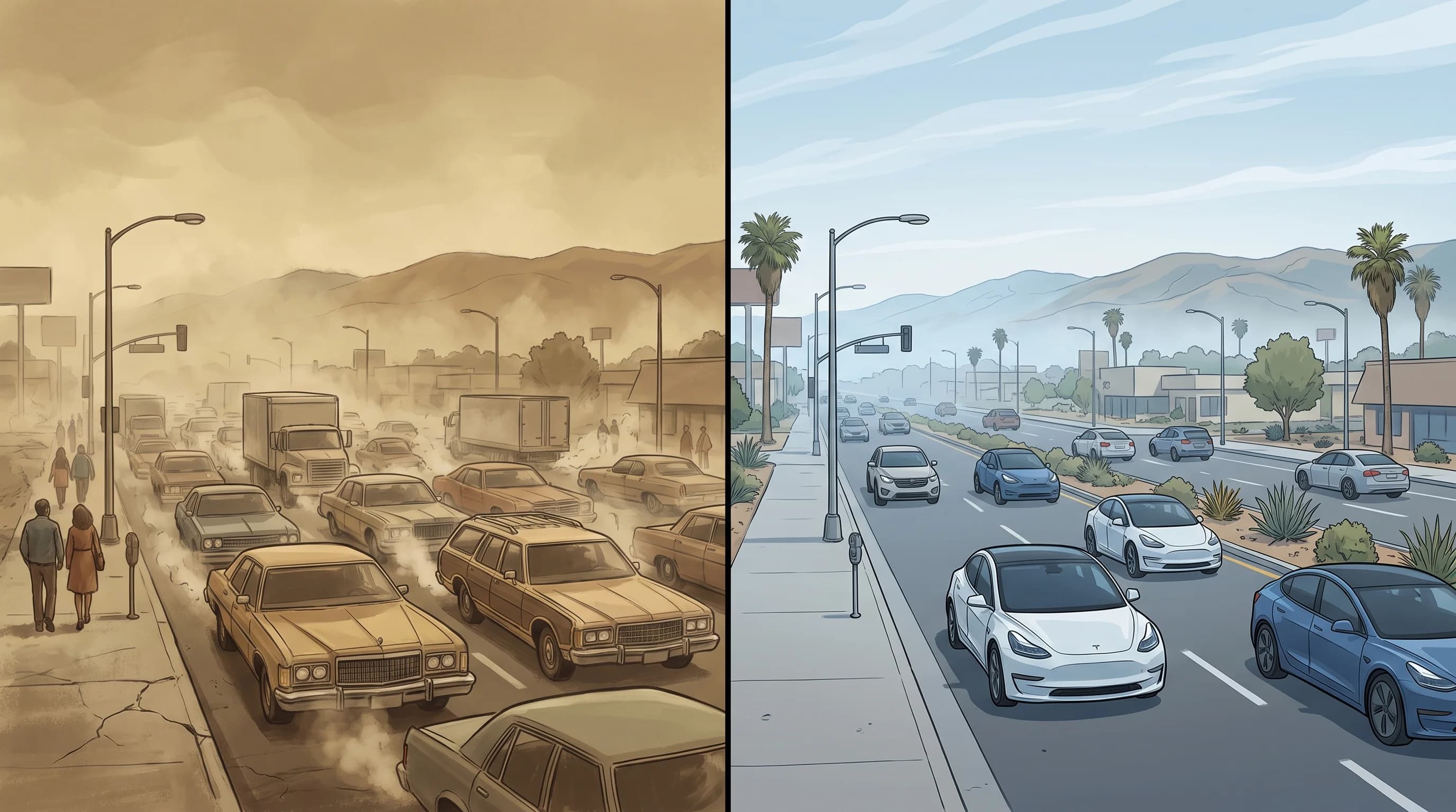
Los Angeles became America's smog capital because three factors overlapped: a basin walled in by mountains on three sides, the country's earliest and deepest dependence on cars and a climate that produces a temperature inversion on most days. Cars alone did not make Los Angeles smoggy, and neither did the terrain or the weather alone. The combination, discovered in the 1940s and 1950s, turned the Los Angeles Basin, from Downtown Los Angeles outward, into a pollution trap unlike almost anywhere else in the country.
Why Did Los Angeles Become Famous for Smog?
Los Angeles became famous for smog because it was the first American city to suffer severe, eye-stinging air pollution with no obvious industrial source. On July 26, 1943, a thick brown haze settled over downtown Los Angeles so suddenly that visibility dropped to a few blocks and residents' eyes and throats burned. It was wartime, and some people thought the city was under chemical attack.
Officials blamed a nearby butadiene plant making synthetic rubber for the war and shut it down. The haze came back anyway, so the real cause remained unknown.
Solving the mystery took years. Los Angeles in the 1940s was adding residents, industry and cars faster than almost any American city, but no single smokestack explained a haze that returned after the main suspect closed. The answer, worked out over the next decade, was that the city's own car exhaust reacted with sunlight to create a new kind of pollution that no one emitted directly.
For the chemistry of that reaction, and why it produces ground-level ozone instead of visible smoke, see what is smog and how does LA's photochemical haze form. This article covers the local ingredients that made Los Angeles the place where it became a citywide crisis. To tell smog from smoke and fog by sight, see smog vs. smoke vs. fog.
| Factor | What it contributes | Why it matters locally |
|---|---|---|
| Basin terrain | Mountains block pollution from dispersing inland or east | San Gabriel, San Bernardino, and Santa Ana Mountains wall in the South Coast Air Basin on three sides |
| Car dependence | Supplies the nitrogen oxides and VOCs that sunlight converts to ozone | LA built its transportation network around private automobiles decades before most US cities, concentrating tailpipe emissions across a huge geographic footprint |
| Temperature inversions | Caps the basin so trapped air cannot vent upward | Pacific high-pressure subsidence and clear, calm nights produce inversions on most days of the year, especially in summer |
| Strong sunlight | Drives the chemical reaction that forms ozone | Southern California's abundant sunshine is exactly the ingredient photochemical smog needs to cook precursor gases into pollution |
What Role Did Cars and the Basin Play Together?
Cars and the basin made smog together. Los Angeles adopted the car earlier and more completely than almost any other major American city and built around it.
New York and Chicago grew dense around streetcar and rail lines. Los Angeles spread across a wide basin as cars became affordable in the 1920s, and after World War II, freeways and suburbs grew together. The result put a huge, fast-growing number of vehicles on the road in a metro area ringed by mountains instead of open on most sides.
The basin kept that exhaust from blowing away. Emissions released anywhere from downtown Los Angeles to Woodland Hills stay inside a bowl of terrain with few exits. Winter wood smoke is handled separately through No-Burn Days.
Caltech chemist Arie Haagen-Smit's research in the early 1950s was the turning point. His experiments showed that ozone and the eye-stinging haze came from sunlight acting on gasoline vapor and car exhaust, not one factory's smoke. That finding shifted decades of regulation toward tailpipes instead of smokestacks, and it is why California built its own vehicle-focused regulatory system.
How Do the Mountains and Inversions Trap LA Pollution?
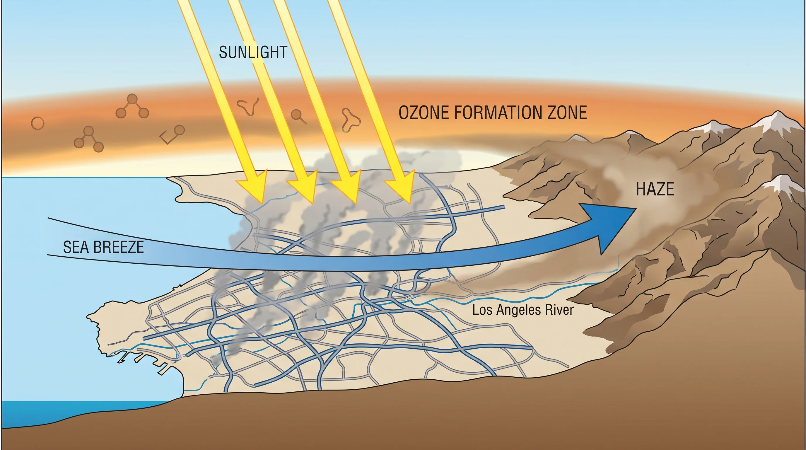
Mountains and inversions trap Los Angeles pollution together: mountains block it sideways and the inversion blocks it from rising. The San Gabriel Mountains to the north, the San Bernardino Mountains to the northeast and the Santa Ana Mountains to the southeast wall in the South Coast Air Basin on three sides, leaving the Pacific as the only open edge. Pollution that would spread out over flat land runs into high ground and circulates within the basin for days during stagnant weather.
The inversion adds a second lid. A temperature inversion is a layer of warm air above cooler surface air.
Warm air is less dense, so it does not sink and mix downward. Los Angeles has inversions on most days from air sinking within the Pacific high-pressure system, strengthened on clear, calm nights by cooling near the ground. For how that lid forms and why it persists, see why the LA Basin traps smog beneath a temperature inversion.
Mountains keep pollution from moving sideways out of the basin, and the inversion keeps it from rising. Emissions that would otherwise thin out instead concentrate in a shallow layer near the ground.
Why Can Inland Ozone Be Worse Than Coastal Ozone?
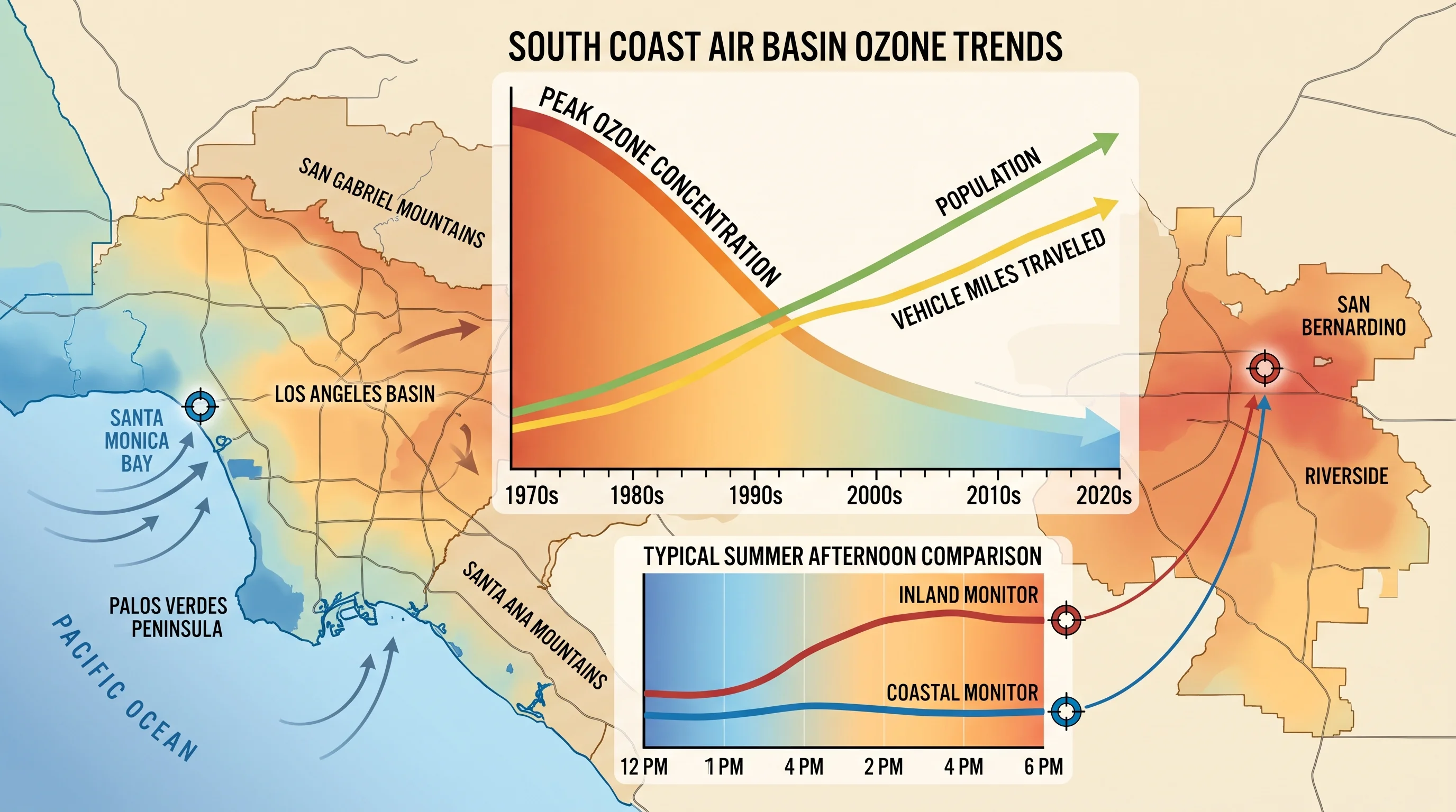
Inland ozone is often worse than coastal ozone because the daytime sea breeze carries emissions and partly formed ozone away from the coast toward the mountains before the chemistry finishes. The San Gabriel and San Fernando valleys frequently record worse ozone than beach neighborhoods on the same afternoon. Ozone takes hours to form, so air that leaves downtown or the ports in mid-morning often peaks only after drifting well inland. By the time it reaches Pasadena or Woodland Hills, it has spent more hours in sunlight, and the mountains keep it from moving on.
Living near the ocean does not guarantee clean air. Ports, freeways and dense traffic near the coast still add ozone-forming gases, and on days with a weak sea breeze the chemistry can finish closer to where it started. For how Southern California weather varies over short distances with the coast, elevation and terrain, see why Los Angeles has so many microclimates. The same geography makes pollution spread unevenly across the basin.
Has Los Angeles Air Quality Actually Improved?
Los Angeles air quality has improved substantially, though the problem is not solved. South Coast Air Quality Management District and California Air Resources Board monitoring shows peak ozone across the South Coast Air Basin has fallen sharply since the 1970s, even as population and driving both grew.
The improvement traces to the regulation that followed Haagen-Smit's discovery. California created the California Air Resources Board in 1967 to set its own vehicle emissions standards, an authority no other state holds in the same form. California then added catalytic converters, cleaner fuels and steadily stricter tailpipe standards.
The South Coast Air Basin still fails federal ozone standards on many summer afternoons and remains among the worst regions in the country for ozone. Inland communities and lower-income neighborhoods near freeways and industrial areas carry a larger share of the remaining pollution, which state and regional agencies now track as an environmental justice issue. The progress is real, but current monitoring still matters.
How Should Residents Track Today's Pollution?
Track today's pollution by checking the dominant AQI pollutant, the nearest official monitor and the ozone forecast before strenuous outdoor activity, not by looking at the sky. Ground-level ozone is colorless, so a clear afternoon can still be unhealthy, especially inland in summer. AirNow shows official monitor data in standard AQI categories, and South Coast AQMD runs the regional monitors and issues ozone forecasts and health advisories for the South Coast Air Basin.
The California Air Resources Board publishes long-term trends and regulatory background. The NWS Los Angeles/Oxnard office forecasts the wind, mixing height and inversion that decide whether the basin traps or clears its air on a given day. For the chemistry and inversions behind this history, see what is smog and how does it form and how temperature inversions trap LA smog.
Los Angeles is smoggy because its basin, its cars and its weather all push the same way at once; none of the three is unique to the city alone. The 1943 haze was a mystery because no one had connected all three. Today the cause is understood and the long-term trend is better, but the basin, the sunlight and much of the driving remain. Before a hike near Pasadena or a day outdoors in Woodland Hills, check current ozone and AQI on WeatherLA's Los Angeles forecast pages.