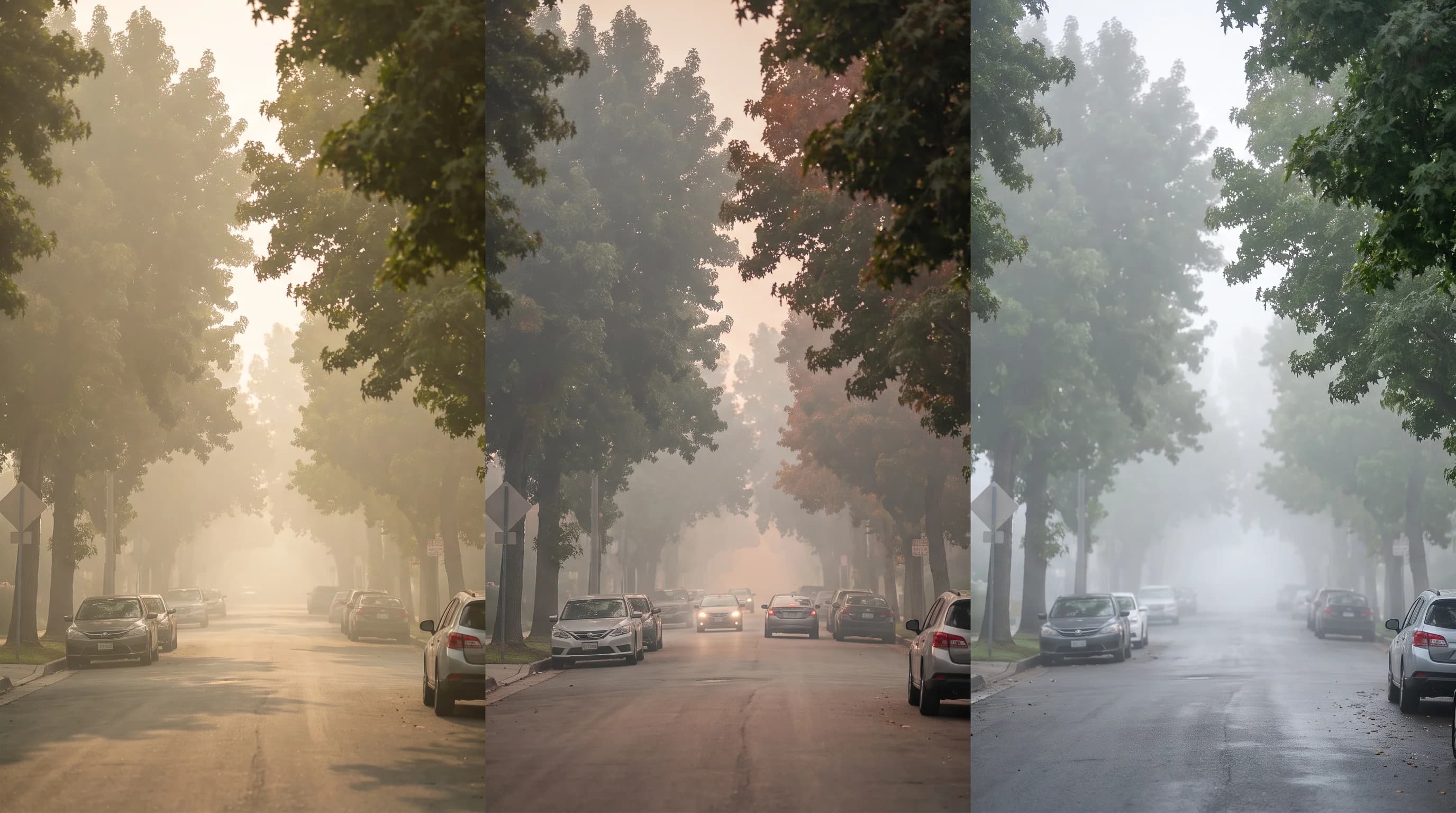
Smog, wildfire smoke and fog cannot be told apart by color alone, but a short checklist can. Ozone smog is invisible and builds through sunny afternoons.
Wildfire smoke has a tan or orange tint and can spike at any hour. Marine fog is water droplets that clear from the coast inland by late morning. For a reliable answer, combine the time of day, the season and any smell with humidity, visibility and the dominant pollutant on AirNow.
What Is the Difference Between Smog, Smoke, and Fog?
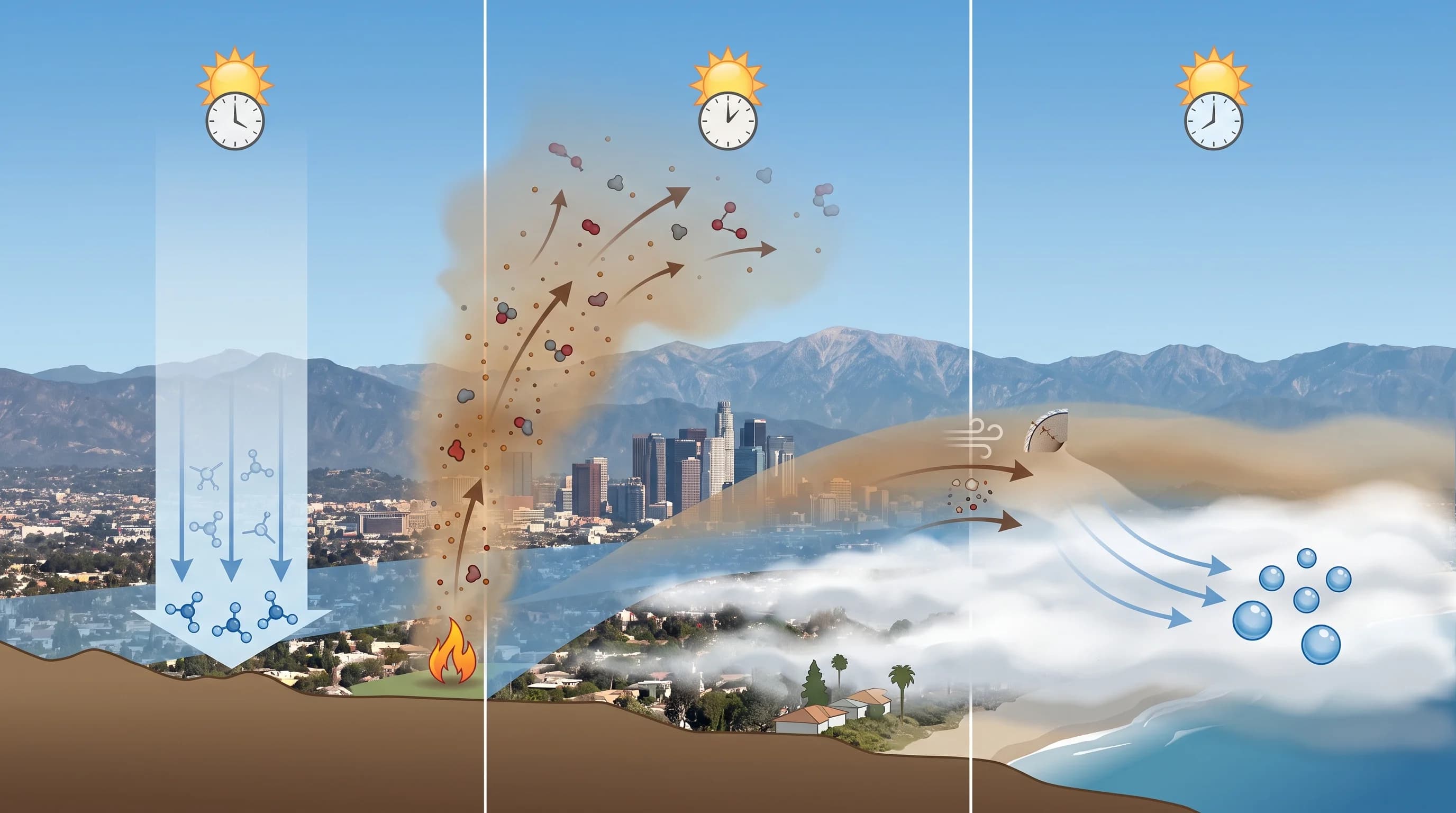
Smog, smoke and fog have different physical causes. Los Angeles smog is chemical: sunlight turns vehicle and industrial emissions, nitrogen oxides and volatile organic compounds, into ground-level ozone and secondary particles over several hours.
Wildfire smoke is a plume from burning vegetation or buildings, made of fine particles (PM2.5), carbon monoxide and other gases, carried in by wind. Fog is not a pollutant at all. Fog is water vapor that condensed into droplets when the air cooled to its dew point.
Smog, smoke and fog all reduce visibility and tint the sky, and they often mix, so one glance rarely settles which is present. For smog chemistry, see what is smog and how does LA's photochemical haze form. For water droplets, see fog vs. mist vs. haze.
| Signal | Smog (photochemical) | Wildfire smoke | Fog / marine layer |
|---|---|---|---|
| Typical color | Grayish brown haze; the ozone itself is colorless | Tan, gray, or orange, darker and more saturated close to a fire | Flat white or light gray |
| Smell | Usually none distinct, sometimes a faint acrid or tire-like edge near freeways | Campfire or burnt-wood odor, often the clearest single tell | Damp, salty, or no smell at all |
| Typical time of day | Builds through the morning, peaks in the afternoon | Any hour; depends on the fire and wind, not sunlight | Thickest overnight and at dawn, burns off by late morning |
| Typical season | Late spring through early fall, strongest on hot, stagnant days | Peak wildfire season, roughly summer through fall, but possible year-round | Most persistent in late spring and early summer (May Gray, June Gloom) |
| How it clears | Fades as the sun angle drops and photochemical production slows toward evening | Clears with a wind shift, rain, or the fire being contained; can linger for days | Burns off from the coast inland as morning sun heats and mixes the marine layer |
The table shows likely signs, not proof. Southern California's basin and mountains often stack smog, smoke and fog in separate layers of the same sky, so the reliable way to tell is to check the data, as explained below.
What Do Smog, Smoke, and Fog Do to Visibility and Air Quality?
Ozone, the main pollutant in LA smog, is an invisible gas, so a clear sky can still carry an unhealthy ozone reading, especially inland in the afternoon. Smog's visible haze comes from fine particles that form alongside the ozone.
Wildfire smoke is mostly PM2.5, particles that scatter light well and raise the Air Quality Index (AQI). A smoky-looking day and a bad AQI day usually arrive together. Fog behaves differently from both.
Fog is pure water, so it can cut visibility at a coastal airport to a quarter mile or less while the AQI stays clean. The National Weather Service measures moisture and visibility, and AQI monitors measure pollutants. A photo alone cannot identify smog, smoke or fog.
Why Can Smog, Smoke, and Fog All Look Like Haze?
Smog, smoke and fog all look like haze because particles or droplets in the air scatter sunlight in every direction instead of letting it pass straight through. The eye sees that scattering as haze, glare or a washed-out sky.
Humidity makes smog and smoke look worse, because water-absorbing particles swell as humidity rises and scatter more light. Looking toward the sun through any hazy layer makes it look grayer than looking away. The same afternoon can look much hazier driving west toward the coast than driving east.
The shape of the Los Angeles basin adds to the confusion. The San Gabriel, San Bernardino and Santa Ana Mountains surround the South Coast Air Basin, and a temperature inversion often caps it.
Smog, smoke and moisture can all get trapped in the same shallow layer near the ground. A marine layer can sit at the surface in Downtown Los Angeles while smog builds a few hundred feet above it. A wildfire smoke plume can pass thousands of feet overhead while the air at the ground stays fairly clear.
On many afternoons, a cross section of the basin would show two or three of these layers stacked at once. "Hazy sky" is too vague to say which one is present.
Which Observations Tell Smog, Smoke, and Fog Apart?
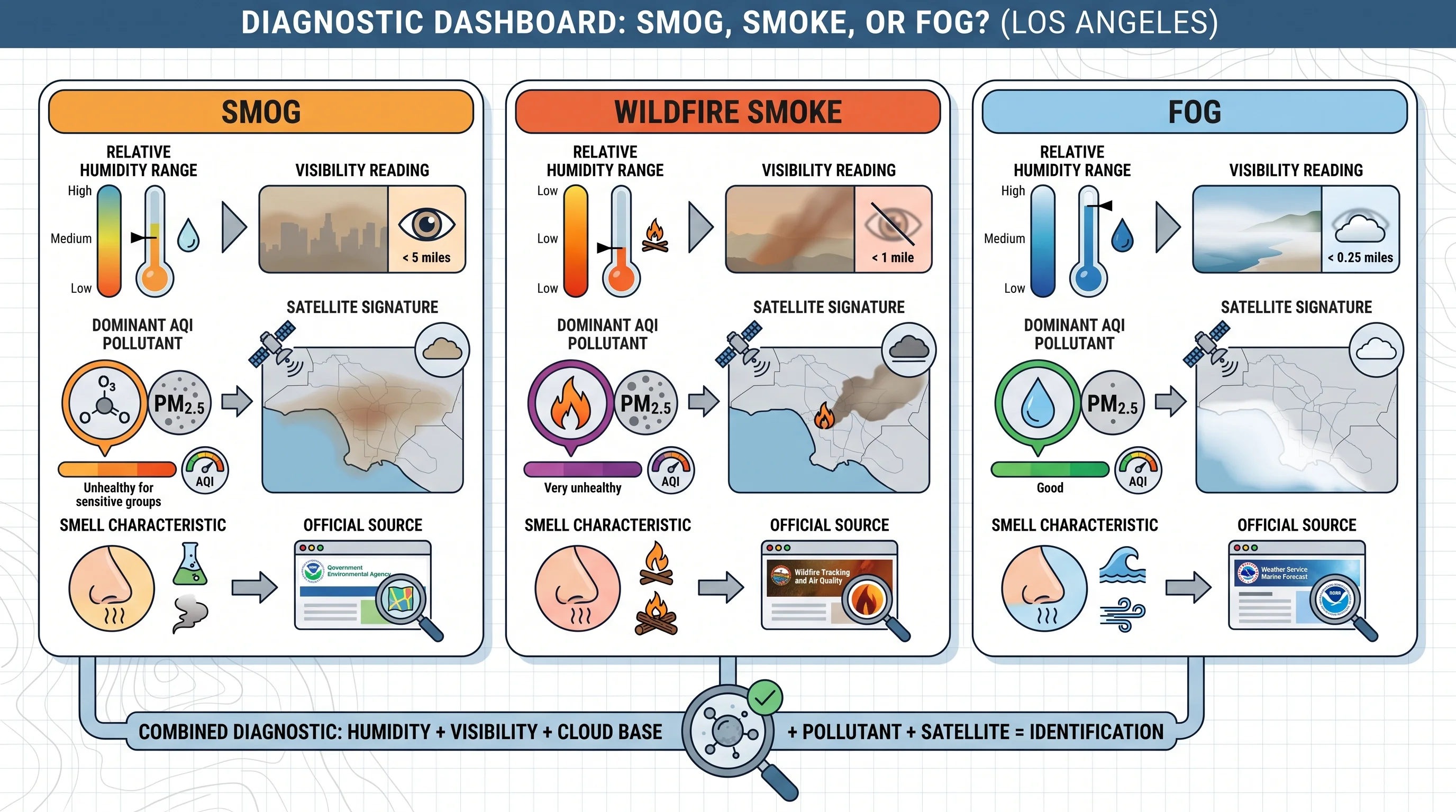
Humidity, visibility, cloud base, the dominant AQI pollutant and satellite smoke maps together tell smog, smoke and fog apart. Relative humidity and dew point spread come first.
Air near its dew point points to fog or mist. A wide spread with poor visibility points to smog or smoke. Visibility reports from airports or NWS stations separate dense fog, under 1 kilometer (about 0.62 miles), from lighter haze.
Cloud base helps next. A low, flat gray ceiling that a hiker can climb above within a few hundred feet is fog or marine stratus. A haze layer with no clear ceiling that persists at altitude is smoke or smog. The AQI's dominant pollutant gives the most direct answer: PM2.5 points to wildfire smoke, ozone points to smog and a clean AQI under a gray sky points to fog.
Satellite smoke and fire maps confirm an active plume and where it is heading, which a ground monitor cannot show. Low-cost consumer air sensors show rough trends but are not calibrated to AQI standards, so use them only alongside official monitors.
Can Smog, Smoke, and Fog Overlap?
Smog, smoke and fog overlap often in the Los Angeles basin. A morning marine layer can cover Downtown Los Angeles and the coastal plain while ozone-forming pollution collects beneath it, ready to react once the fog clears and full sun arrives. During a wildfire, smoke can travel above the marine layer on upper-level wind while an unrelated fog bank sits at the surface. A dim, hazy sky and a foggy coast can then have two separate causes on the same day.
Air quality can change through the day. A location can start with clean but foggy air, see ozone rise at midday as the fog clears and end the evening with smoke from a distant fire as the wind shifts. Check live readings instead of judging by the sky at one moment.
Where Can You Check What Is in LA Air Right Now?
To identify what is in LA's air, start with AirNow for the current AQI and its dominant pollutant: ozone points to smog, and PM2.5 points to smoke. South Coast AQMD publishes regional forecasts, smoke advisories and readings for each monitor, including Pasadena and Woodland Hills, which often differ from the coast. The NWS Los Angeles/Oxnard office and NWS San Diego office report visibility and cloud base, which settle the fog question. The California Air Resources Board keeps statewide air quality standards and historical data.
If the AQI shows high PM2.5 or ozone, follow official health guidance for sensitive groups, not the sky's appearance. For each cause in depth, see what is smog and how LA's photochemical haze forms, why wildfire smoke turns the LA sky orange and fog vs. mist vs. haze.
Color and haze alone cannot separate smog, smoke and fog, but smell, time of day, season and a quick AirNow check usually can. Before a hike, a beach day or opening the windows, check WeatherLA's current conditions and AirNow's dominant pollutant for your part of the basin. A gray sky over Pasadena in June is very likely marine fog. The same gray sky in September could be smoke from a fire far from the city.