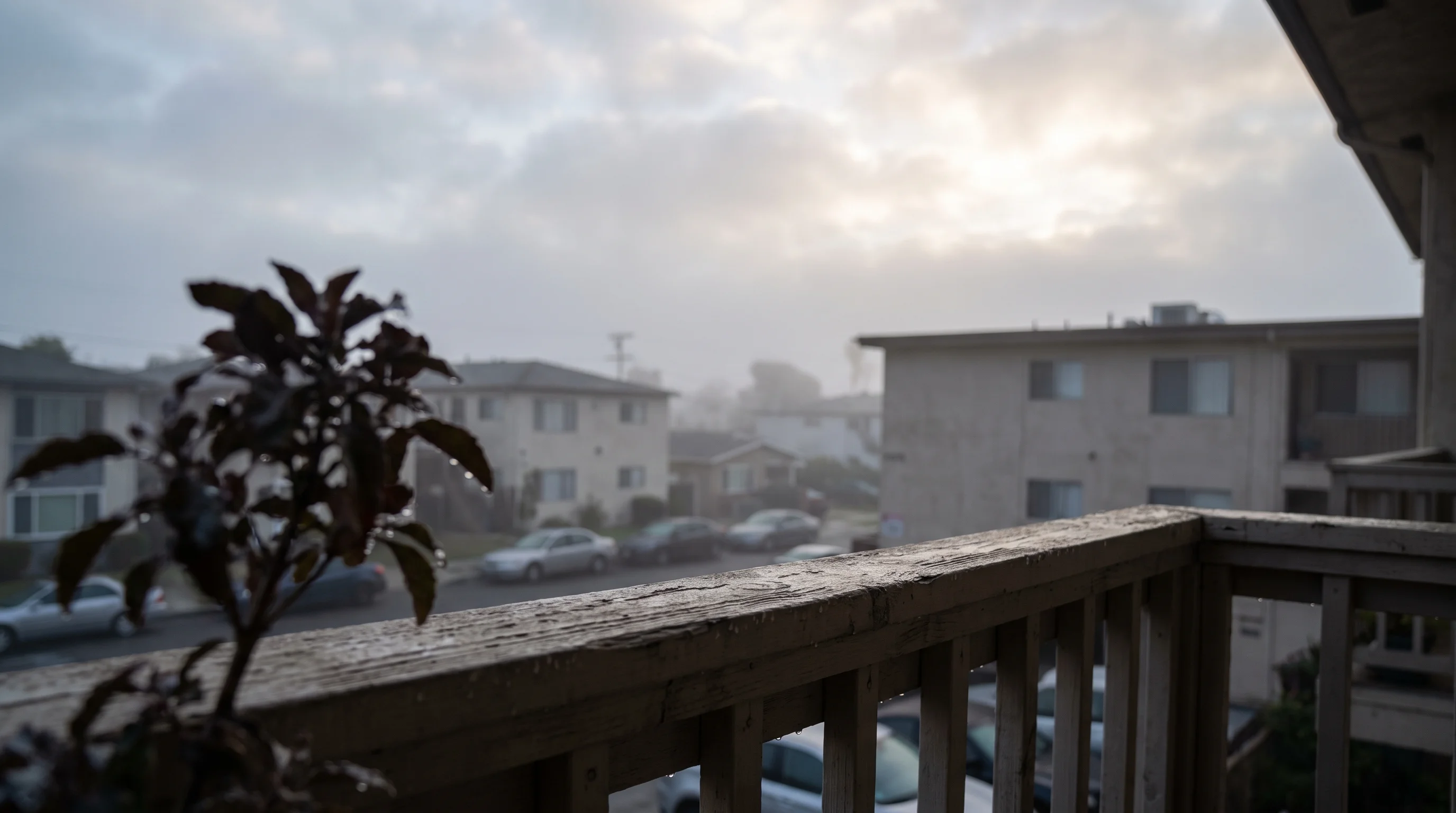
Relative humidity is a percentage that changes with temperature; dew point is a temperature that tracks the actual moisture in the air. Dew point is the better number for judging how humid the air will feel, because it does not swing every time the thermometer moves. Relative humidity has a different job: it shows how close the air is to fog, dew or saturation right now.
The difference matters more in Los Angeles than in most cities. A cool marine morning in Santa Monica can show 85% or 90% relative humidity without feeling muggy. An August monsoon surge can push the dew point high enough that a modest humidity percentage feels heavy. Knowing which number to trust changes how you read a Los Angeles forecast.
What Is Relative Humidity?
Relative humidity is the amount of moisture in the air as a percentage of the most the air could hold at its current temperature. Warm air holds far more water vapor than cold air. The same moisture therefore gives a much higher percentage in cool air than in warm air, which explains most of the confusion about high humidity on a chilly morning.
Relative humidity measures how full the air is, not how much water it holds. At 100% relative humidity, air holds all the water vapor it can at that temperature. Cool that air further and it releases water as fog, dew or drizzle, because its capacity shrinks. Warm it and its capacity grows, so the percentage falls even though no moisture left.
Relative humidity in the Los Angeles Basin usually peaks in early morning, when overnight cooling brings the air closest to saturation. It falls through the afternoon as the sun warms the air and raises its capacity. The National Weather Service glossary defines relative humidity the same way: the air's actual water vapor divided by the most it could hold at that temperature, as a percentage.
What Is Dew Point?
Dew point is the temperature air must cool to, at constant pressure, before it becomes saturated and water condenses. A higher dew point means more water vapor in the air, whatever the air temperature is. Unlike relative humidity, dew point does not change just because the temperature changes.
Meteorologists use dew point because it works like a moisture thermometer. A dew point in the 40s Fahrenheit means dry air, whether the temperature is 55°F or 95°F. A dew point in the upper 60s or 70s means moist air. The National Weather Service uses dew point to compare air masses and issue heat guidance, according to its humidity and dew point explainer.
Dew point does not guarantee that everyone feels the same at the same reading. Wind, sun, activity, shade and personal tolerance all change how a dew point feels. Dew point is a consistent way to compare moisture between two times or places, not a universal comfort scale.
What Is the Difference Between Humidity and Dew Point?
Relative humidity changes whenever temperature changes, even when the air's moisture stays the same, while dew point tracks the moisture and barely moves through the day. That is why the two numbers can tell opposite stories on the same morning.
| Question | Relative humidity | Dew point |
|---|---|---|
| What is it? | Percent of saturation at the current temperature | Temperature at which the air would become saturated |
| Does air temperature change the reading? | Yes, strongly | Much less directly |
| Best use | Fog, cloud, drying, and fire-weather context | Actual moisture and how muggy warm air may feel |
| Typical LA trap | High on cool marine mornings | Can remain modest even when morning RH is high |
| Important LA exception | Falls sharply as inland air heats | Rises during humid monsoon surges |
Here is an illustrative Los Angeles example. On a coastal morning, the air is 58°F with a dew point near 54°F, which gives relative humidity in the high 80s.
By early afternoon, the same air has warmed to 74°F with almost no change in moisture. The dew point is still about 54°F or 55°F, but relative humidity has dropped into the 40s, because warmer air can hold more water vapor. The moisture never left; the air's capacity grew. (This example follows the standard relationship between temperature, dew point and relative humidity. It is not a specific observed reading.)
Neither dew point nor relative humidity is a rain forecast. A high dew point means plenty of low-level moisture, one ingredient storms need. A high relative humidity means the air is near saturation, which favors fog or drizzle. Neither replaces the National Weather Service's probability of precipitation.
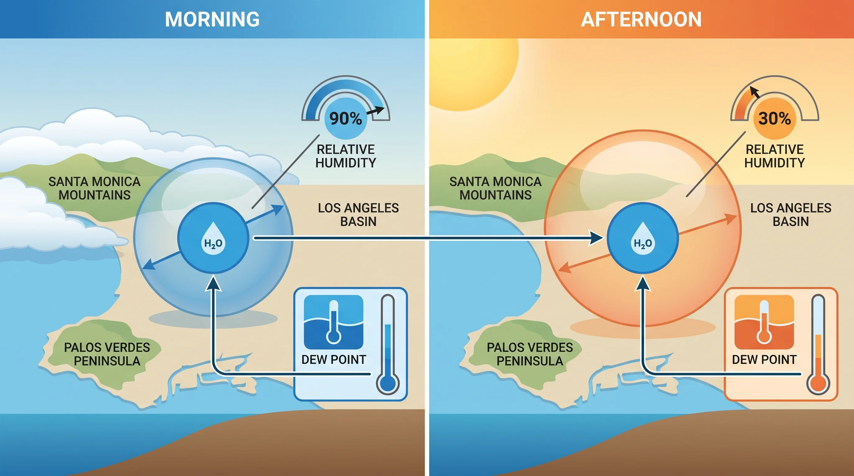
Why Can Los Angeles Have High Humidity and Still Feel Dry?
Los Angeles can have high morning humidity without feeling muggy because its marine air is cool, and cool air needs little moisture to approach saturation. 90% relative humidity at 58°F in Santa Monica or near LAX holds much less water vapor than 90% at 80°F. That is why coastal morning fog rarely feels oppressive, even with an extreme-looking percentage.
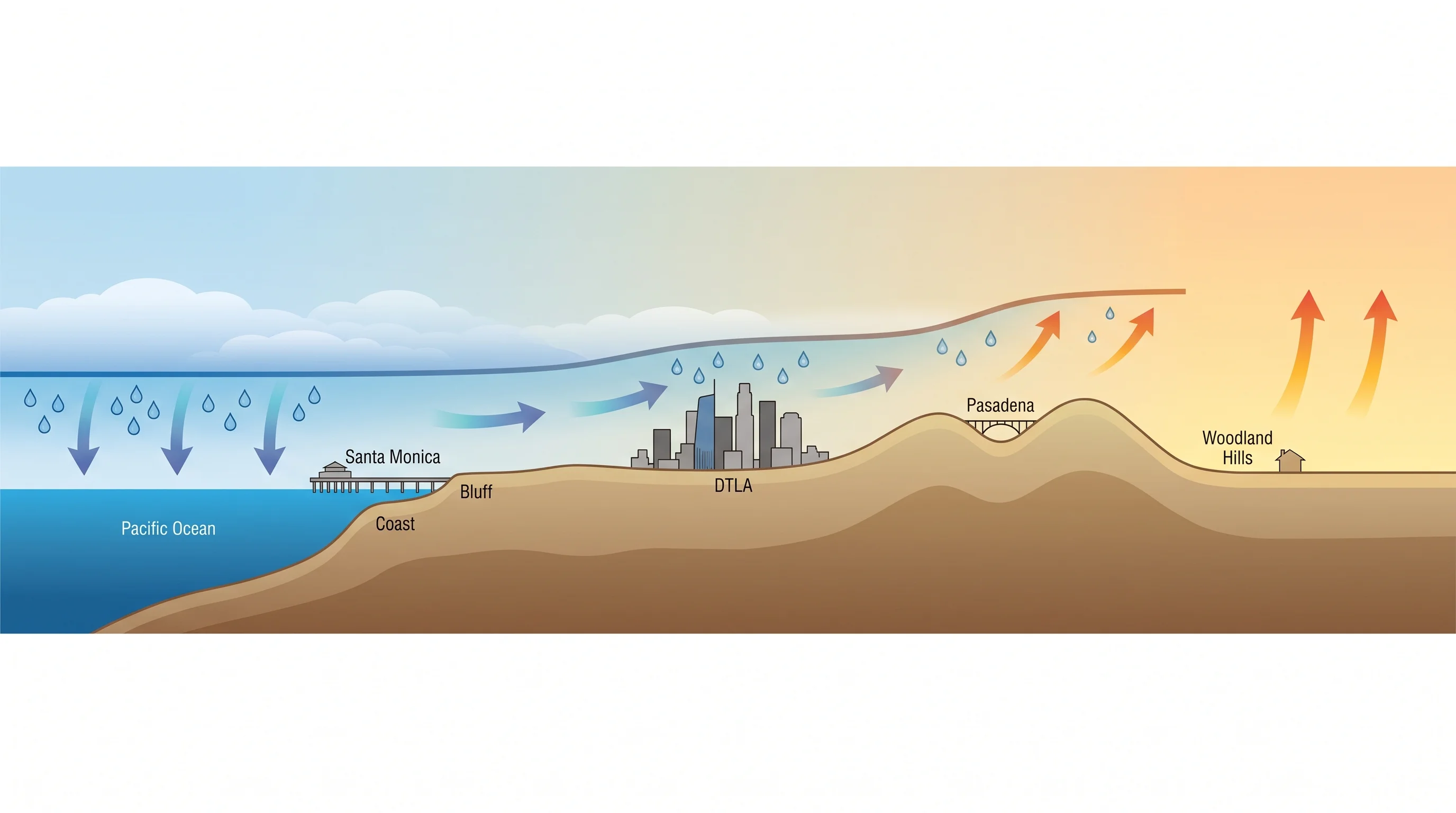
Inland, the pattern changes. Downtown Los Angeles sits far enough from the coast to start the day with less marine influence and heat up faster, so its relative humidity falls harder through the afternoon than a beach town's. Pasadena, at the base of the San Gabriel Mountains, often leaves the marine layer earlier in the morning and posts noticeably lower afternoon humidity than the coast.
Woodland Hills, in the San Fernando Valley, has the biggest swing. Valley mornings in summer often start with some leftover marine moisture and end hot and dry, because the valley is far from the ocean and heats quickly.
The coastal temperature inversion drives these differences. The inversion caps the marine layer, a shallow, cool, moist layer of ocean air trapped under warmer air above. Where the inversion is strong and lasts through the morning, humidity stays high longer. Where it thins, breaks up or never reaches a neighborhood, relative humidity falls faster once the sun is up.
When Does Dew Point Rise or Fall Across Southern California?
Dew point in Southern California rises when moist onshore or monsoon air moves in and falls sharply when dry offshore Santa Ana winds take over. Each pattern brings air from a different source. The dew point trend is one of the fastest ways to tell which pattern is in control.
A well-established marine layer raises coastal dew points to about 55°F to 62°F, cool and steadily damp. How far that moisture reaches inland depends on the marine layer's depth that day. A shallow marine layer may barely reach past Malibu and the shoreline, while a deep one pushes moist, gray air well into the basin before burning off in the afternoon.
A monsoon surge brings much muggier air. When moisture flows north from the Gulf of California and the Sonoran Desert in summer, dew points across the Los Angeles Basin and inland valleys can climb into the upper 60s or higher. That feels sticky even under clear or partly cloudy skies. It also raises the chance of afternoon and evening thunderstorms, especially over the mountains and deserts.
Santa Ana winds do the opposite. Dry air from the Great Basin sinks and compresses as it flows toward the coast, and dew points in exposed valleys and coastal areas can fall into the teens, single digits or below 0°F. Relative humidity barely recovers overnight. Very low dew point, poor overnight recovery and strong wind together create Southern California's most dangerous fire-weather days.
Which Number Should You Use in an LA Forecast?
In an LA forecast, use dew point to judge how much moisture is in the air, and use relative humidity to judge saturation, fog and drying. Read both with temperature, wind, cloud cover and time of day. Each answers a different practical question.
At the beach, dew point shows whether the air will feel damp in a cool onshore wind, and with cloud cover and wind direction, it helps predict whether the marine layer will linger. For an inland hike, watch the afternoon temperature and dew point together, because moderate moisture plus high heat raises heat-stress risk more than temperature alone shows. During a fire weather watch, use the National Weather Service's forecast minimum relative humidity and overnight recovery, along with wind speed and any red flag warning.
For why the coast clouds up, see the Los Angeles marine layer explainer. For how offshore wind turns dangerous, see the Santa Ana winds and heat index guides below.
Compare temperature, dew point, wind and humidity across Los Angeles destinations on WeatherLA before heading to the coast, foothills or valley, whether Santa Monica, Downtown Los Angeles, Pasadena or Woodland Hills. Use the heat-index guide when moisture combines with heat, and the Santa Ana winds guide when offshore wind drives humidity down.