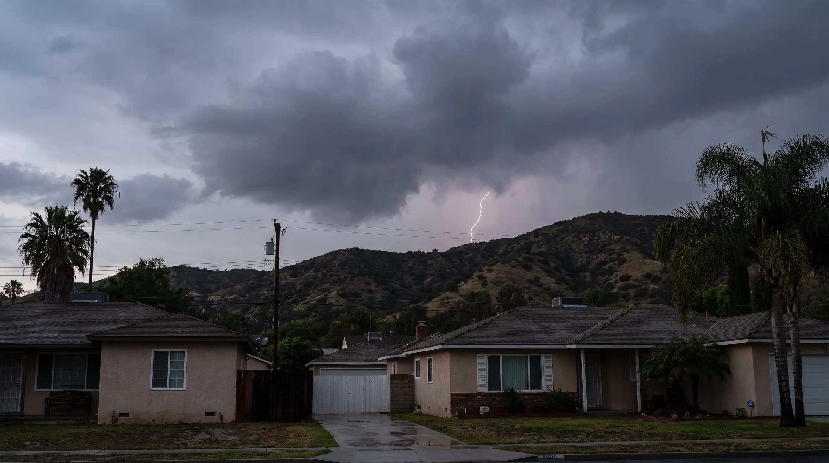
Thunderstorms are rare across the Los Angeles Basin. NWS Los Angeles/Oxnard, the National Weather Service office for the region, counts only a handful of thunder days at low-elevation stations in a typical year, far below the national average.
Cool Pacific air keeps the coast and basin stable most of the year. When lightning does occur, it usually comes with a winter storm, a summer monsoon surge over the mountains and deserts or occasionally a tropical remnant. The storms that do form still bring real lightning and fire risk.
How Often Does Los Angeles Get Thunderstorms?
Los Angeles gets only a few thunder days a year at low-elevation stations. A thunder day is any calendar day when thunder is heard or a thunderstorm is observed at a station, the standard measure the National Weather Service and NOAA use for storm frequency.
Florida or the central Plains can match LA's yearly total in one ordinary week. Lightning networks count something different: individual cloud-to-ground strikes, which rise with storm strength and length. Thunder-day counts and strike counts cannot be compared directly.
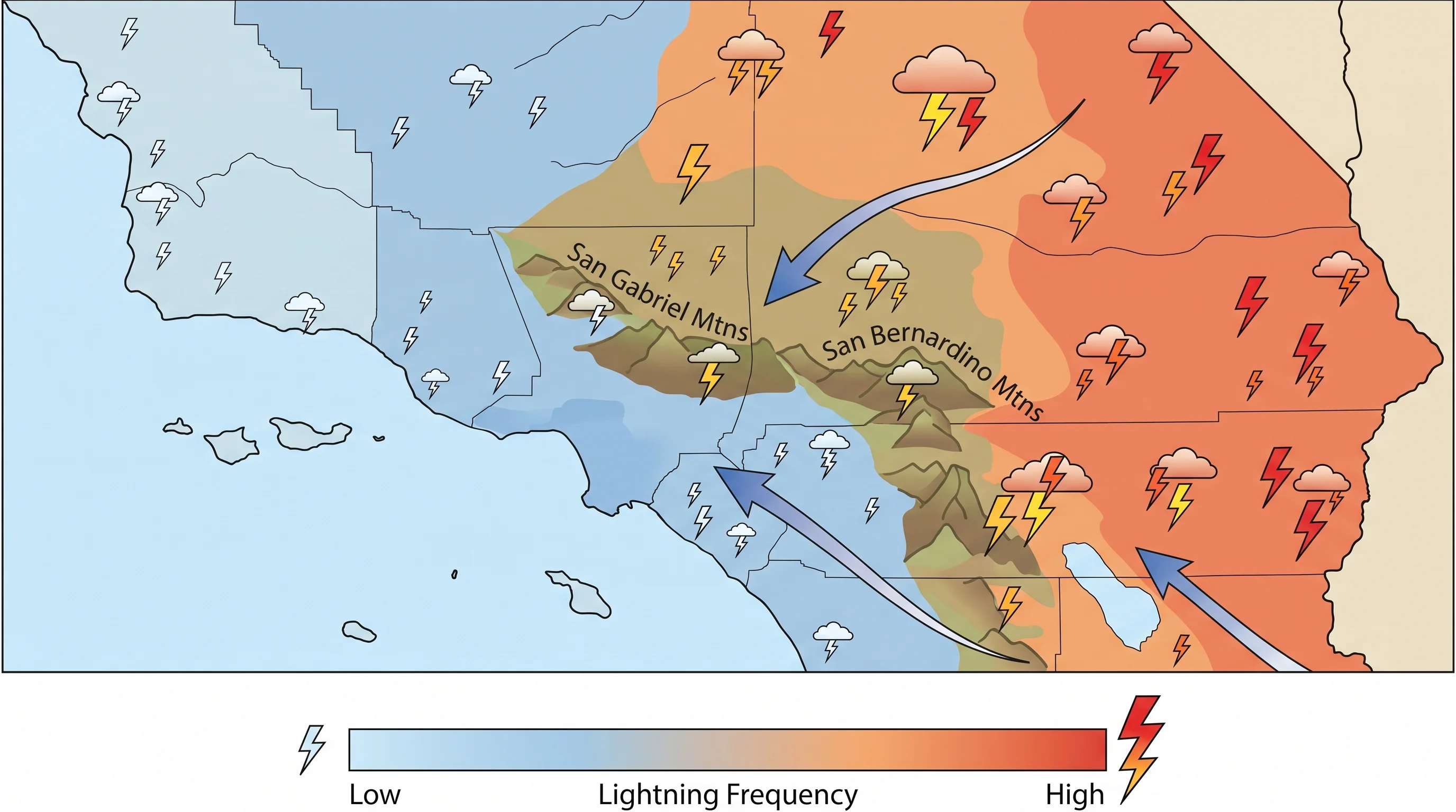
The basin and the surrounding mountains and deserts have different thunderstorm climates, so a regional average misleads. Coastal and basin stations near Downtown Los Angeles see the fewest thunder days in Southern California. The San Gabriel and San Bernardino Mountains and the deserts beyond them see noticeably more, mostly from summer monsoon moisture that rarely reaches the coast. Any specific yearly count should come from a named NWS or NOAA station record for a defined period.
| Zone | Typical thunder frequency | Usual trigger |
|---|---|---|
| Coast and basin (Downtown Los Angeles) | Lowest in the region; a handful of thunder days most years | Cold winter fronts and upper lows; rarely summer monsoon moisture |
| Foothills (Pasadena, Woodland Hills) | Occasional; more than the coast, less than the peaks | Winter storms and orographic lift from nearby terrain |
| San Gabriel and San Bernardino Mountains | Highest in the region during summer | Monsoon moisture plus daytime heating over high terrain |
| Deserts (lee side of the mountains) | Elevated in summer relative to the coast | Monsoon surges tracking north from Mexico and Arizona |
Why Are Coastal Storms Relatively Rare?
Coastal storms are rare because the cool Pacific Ocean keeps the marine layer stable and blocks the warm, rising air thunderstorms need. Why Los Angeles has so many microclimates explains the process. Summer, peak thunderstorm season in most of the country, is the driest and most stable season at the coast, because the marine layer is strongest and monsoon moisture rarely crosses the mountains.
For the three ingredients a thunderstorm needs, moisture, instability and lift, and why coastal LA usually has at most two, see how thunderstorms form and why LA sees so few.
The coast still gets occasional thunderstorms. Some winter storms arrive cold and unstable enough, especially behind a sharp Pacific front or under a cutoff upper-level low, to set off scattered thunderstorms at sea level. These can bring small hail or brief, weak funnels over the ocean. They are infrequent and usually short compared with summer mountain storms, but they are part of the record. The Pacific reduces coastal thunderstorms; it does not eliminate them.
Which Weather Patterns Bring Lightning?
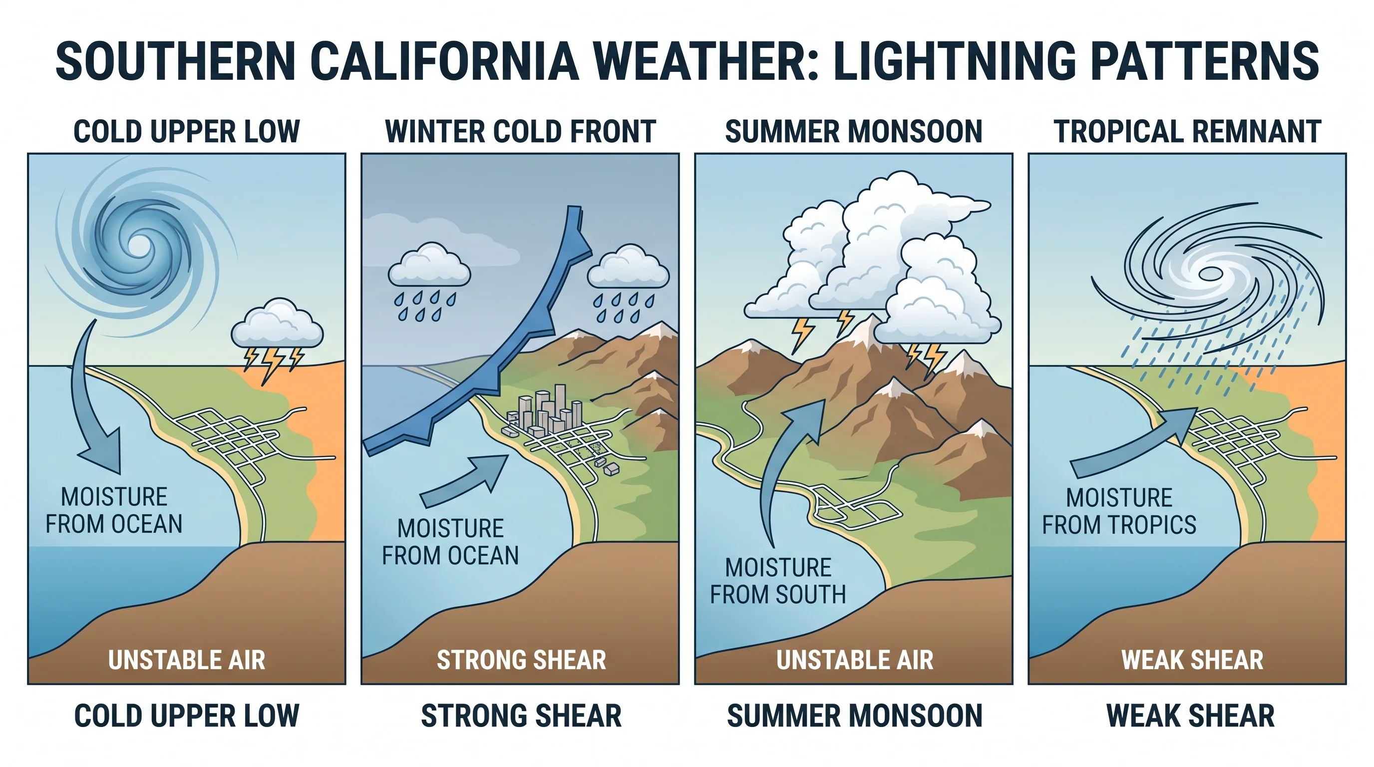
Four weather patterns bring nearly all lightning to Southern California, each with its own season, location and cause. Cold upper-level lows, also called cutoff lows, can stall over the region in almost any month and destabilize the air enough for scattered thunderstorms, sometimes reaching the coast and basin. Winter cold fronts behind Pacific storms can carry a narrow band of instability that triggers isolated thunderstorms as they pass, also occasionally reaching the coast and basin.
Summer monsoon surges cause most lightning over the mountains and deserts. Moisture flows north from Mexico and Arizona, and afternoon heating over the San Gabriel and San Bernardino high country lifts it into towering storms, as NOAA JetStream explains. Tropical remnants, the leftover moisture from eastern Pacific hurricanes or tropical storms, are the least frequent source. When they arrive, usually in late summer or early fall, they can bring some of the most widespread lightning and rain.
Where Is Lightning More Common in Southern California?
Lightning is most common in Southern California's San Gabriel and San Bernardino Mountains, where strong afternoon heating meets monsoon moisture from the east. The coast and basin rarely get both at once. The deserts beyond those ranges, including the Mojave, also get frequent summer lightning, because they sit closer to the monsoon moisture and heat up enough by afternoon to trigger storms without much terrain lift.
The coast and LA Basin get the least lightning, because marine air suppresses instability most of the year. Lightning frequency depends on elevation and access to monsoon moisture, not simply distance inland. Some low desert areas well inland still get little lightning when terrain blocks monsoon moisture. Check a named lightning climatology before ranking specific places.
Why Does Dry Lightning Raise Fire Concern?
Dry lightning raises fire concern because it strikes ground that gets little or no rain. Rain falling from the storm evaporates in hot, dry air below the cloud, a process called virga. The lightning still reaches the ground at full strength, so a storm that leaves no measurable rain at a weather station can still ignite dry vegetation. By late summer, months without rain have left Southern California's chaparral and mountain forests dry enough for one remote strike to start a fire.
Gusty, shifting outflow winds from the same storms can fan a new fire before firefighters know a strike hit. In remote mountains and deserts, some dry-lightning fires are found only when smoke appears. Dry fuel, evaporating rain and outflow wind together make even a rare, nearly rainless Southern California thunderstorm dangerous. For personal safety when lightning is possible, including for hikers in the San Gabriel and San Bernardino high country, see lightning safety in Southern California.
How Should Angelenos Track a Rare Storm?
To track a rare storm, start with the thunderstorm outlook and any discussions from NWS Los Angeles/Oxnard or NWS San Diego, depending on location. Once storms start developing, add live radar and a lightning map for real-time strikes. Southern Californians rarely build the storm-season habits of Gulf Coast or Plains residents, which makes checking these sources more important.
Lightning risk starts before any warning is issued. Developing storms can produce isolated strikes before they reach the strength that triggers a Severe Thunderstorm Warning or Tornado Warning. No warning does not mean no risk. NWS lightning safety guidance treats thunder itself, not a warning, as the signal to take shelter.
If you are heading into the mountains or deserts during monsoon season, or a winter storm is forecast to turn unstable, check the forecast for your exact destination. A storm over the San Gabriels can leave the coast completely dry at the same hour.
Los Angeles is not a thunderstorm city: cool Pacific air keeps the coast and basin stable most of the year, and winter fronts, monsoon surges and occasional tropical remnants supply the exceptions. The mountains and deserts get most of those storms, especially in summer, and a storm with little rain can still start a wildfire or endanger people outdoors. Before a San Gabriels hike, a monsoon-season desert trip or any outing with storms in the forecast, check live radar, lightning data and NWS warnings for your destination on WeatherLA.