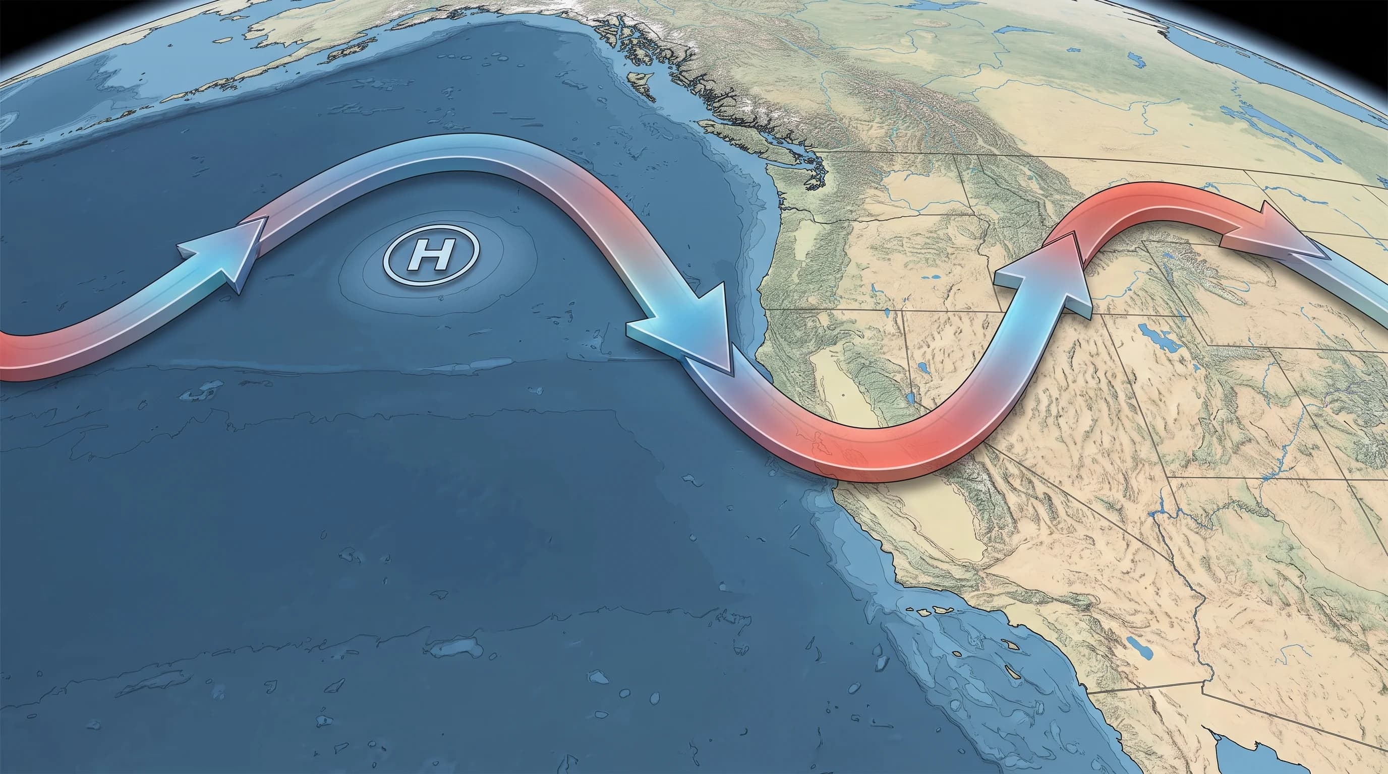
The jet stream is a narrow band of fast upper-level wind, usually 5 to 9 miles above the ground, that forms where cold polar air meets warm subtropical air. Its position each week decides whether Pacific storms head straight into California or turn north into Oregon and Washington or south into Mexico. When the jet dips south and aims a trough at the coast, Downtown Los Angeles and the rest of Southern California can get rain, wind and mountain snow within days. When it lifts north or a ridge blocks it offshore, the region can go weeks without rain.
What Is the Jet Stream?
The jet stream is a narrow, fast river of air in the upper atmosphere, usually between about 30,000 and 39,000 feet, with core winds that can exceed 100 to 200 mph. It exists because the atmosphere constantly works to even out the temperature difference between the cold poles and warm tropics. That contrast, packed into a narrow zone, creates the strong winds meteorologists track on upper-air maps.
The polar jet stream steers California's weather. It sits farther north in summer and moves south toward the West Coast in fall and winter as the pole-to-equator contrast sharpens.
A second, usually weaker band, the subtropical jet stream, sits closer to the tropics. It matters most in El Niño winters, when it can strengthen and reach toward California, as El Niño vs. La Niña: What's the Difference for a SoCal Winter? explains.
| Jet stream position | Upper-level pattern | Typical Southern California outcome |
|---|---|---|
| Dipped south, aimed at the coast | Trough over or near California | Storm after storm can track in; rain in the basin, heavy snow in the San Gabriel and San Bernardino Mountains |
| Lifted north, into the Pacific Northwest | Ridge of high pressure over or west of California | Storms get deflected into Oregon and Washington; Southern California stays dry and often mild |
| Split, with a subtropical branch active | Subtropical jet extends toward California, often during El Niño | Storm track can tap deeper tropical or subtropical moisture, raising atmospheric river potential |
| Buckled into a sharp offshore ridge | Blocking high parked off the coast | Storms are steered around the block; extended dry, often warm and Santa Ana-prone stretches |
Why Does the Jet Stream Form and Meander?
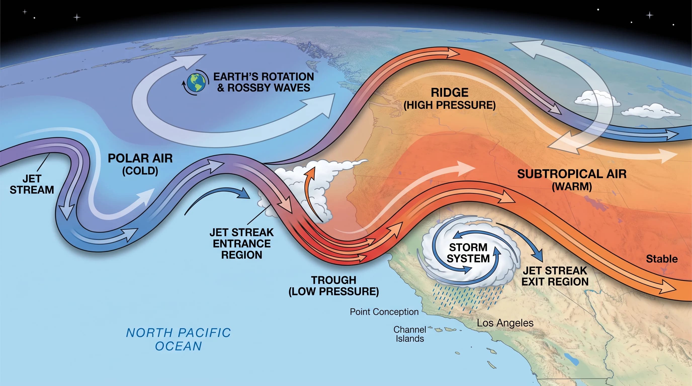
The jet stream forms along the sharpest temperature contrast in the atmosphere, the boundary between cold polar air and warmer air to the south. That contrast creates a strong pressure difference, which the atmosphere turns into wind. Earth's rotation bends the wind through the Coriolis effect into a wavy west-to-east current. Its large north-south bends are called Rossby waves: a northward bulge is a ridge, and a southward dip is a trough.
Rossby waves keep changing. They grow, move east and sometimes break down, so a pattern that holds a ridge over California for two weeks can collapse within days once the temperature contrast supporting it changes.
Wind speed also varies along the jet. Meteorologists watch jet streaks, the fastest cores within the jet, because their entrance and exit zones pull air upward or push it downward. That vertical motion helps decide whether a surface storm strengthens or weakens as it nears the coast. Forecasters therefore track where the jet is, how fast it blows and where its fastest core sits relative to California.
How Does the Jet Stream Steer Storms Toward California?
The jet stream steers storms the way a river current carries a boat: surface low pressure systems move along and beneath the upper-level flow, so storms follow where the jet points. When a trough dips south toward the West Coast, it brings cold air and an active storm track. Rising air on the trough's eastern side can also strengthen a surface low as it approaches California. Steering plus strengthening can turn a modest Pacific disturbance into a strong, wet storm by the time it reaches Pasadena or the Los Angeles Basin.
A storm's moisture is separate from its steering. An atmospheric river, a long, narrow plume of water vapor from the tropics or subtropics, still needs the jet stream to guide it ashore and keep it aimed at one stretch of coast. A strong jet stream can help a storm deepen into a bomb cyclone.
The jet stream steers; the atmospheric river supplies the moisture. For how atmospheric rivers form and why they can flood the region, see What Are Atmospheric Rivers? How They Drench Southern California.
Why Can the Jet Stream's Position Create Wet, Dry, Warm, or Cold Weather?
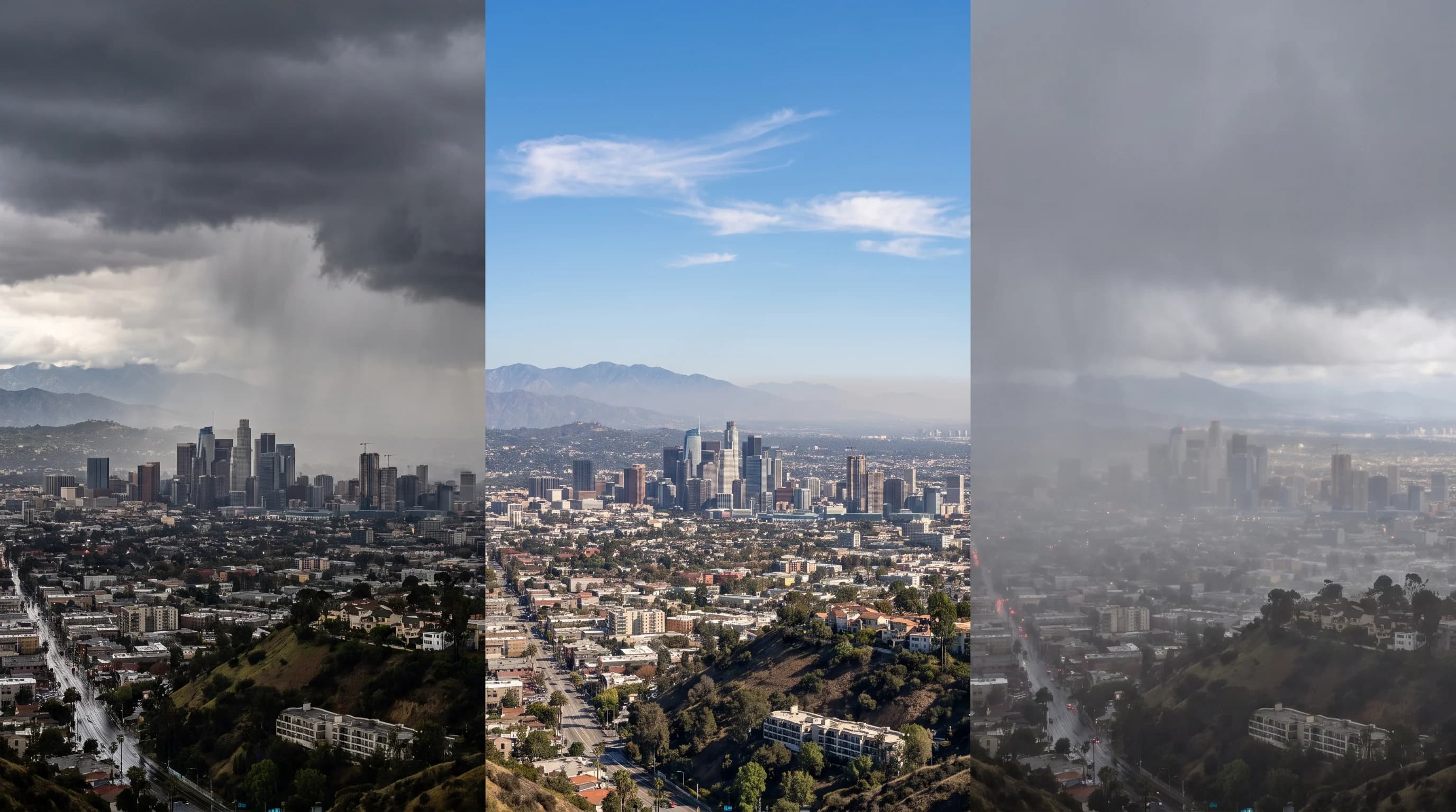
The jet stream's position decides whether California sits in the path of Pacific storms or in the dry, mild zone beside it. A trough over or just off California opens the door to repeated storms, because each new Pacific disturbance can follow the same dip toward the coast. When the trough holds, several storms can arrive within one to two weeks.
A ridge of high pressure over or west of California does the opposite. It forces the jet stream and its storms to arc up and over the ridge, usually into the Pacific Northwest or British Columbia, while Southern California stays dry under sinking air that warms and clears the sky.
A strong, lasting ridge off the California coast can bring long dry spells, and the same sinking, dry air can support offshore Santa Ana winds as the pattern breaks down. The jet stream's position also controls temperature. A trough dipping south brings colder air, lowering the snow level in the San Gabriel and San Bernardino Mountains. A ridge warms the air beneath it, which is why dry spells in Southern California are usually warm and sunny.
How Is the Jet Stream Related to El Niño and Atmospheric Rivers?
The jet stream, El Niño and atmospheric rivers are related but different parts of the storm pattern. El Niño and La Niña are tropical Pacific ocean temperature patterns that shift the odds of where the jet sits over a whole winter. During El Niño, warmer tropical water usually strengthens the subtropical jet toward California, tilting the odds toward a wet season. La Niña usually leaves that jet weaker over Southern California and sends storms toward the Pacific Northwest.
For a season-long outlook, see El Niño vs. La Niña: What's the Difference for a SoCal Winter?.
Atmospheric rivers last hours to a few days, and they describe the moisture, not the steering wind. The jet stream can favor storms in any week regardless of El Niño or La Niña, and an atmospheric river still needs a well-placed jet to reach the coast. El Niño and La Niña shift the season's odds, the jet stream steers week to week and the atmospheric river supplies the moisture for heavy rain or snow.
How Do You Read a Jet Stream Map?
A jet stream map shows upper-level wind, usually at the 300 or 250 millibar level, about 5 to 9 miles up. It shows the large-scale pattern, not the local forecast.
The map shows whether a trough or ridge will sit over California and roughly when, which explains the multi-day storm track. It says little about rain totals, wind gusts or snow levels at Woodland Hills or the coast near Malibu. A jet stream pattern five to seven days out can still shift as models update; within 48 hours it is generally more reliable.
For local rain timing, wind and snow levels, use the National Weather Service. The NWS Los Angeles/Oxnard office covers the Los Angeles Basin, Ventura County and nearby mountains. The NWS San Diego office covers Orange and San Diego counties and western Riverside and San Bernardino counties. Both turn the jet stream pattern into point forecasts, watches and warnings for specific places and times.
The jet stream is why the same Pacific Ocean can bring Southern California a week of storms one winter and a dry, sunny stretch the next: it decides whether the ocean's moisture reaches the coast. Use a jet stream map for the big picture of the coming days, then check the NWS point forecast for rain timing, wind and snow level. Confirm current conditions and comfort scores for your destination on WeatherLA's Los Angeles forecast pages.