winterphenomenatrip planningdestinations

Where Does It Snow in Southern California?

By WeatherLA|Published |Last updated |9 min read
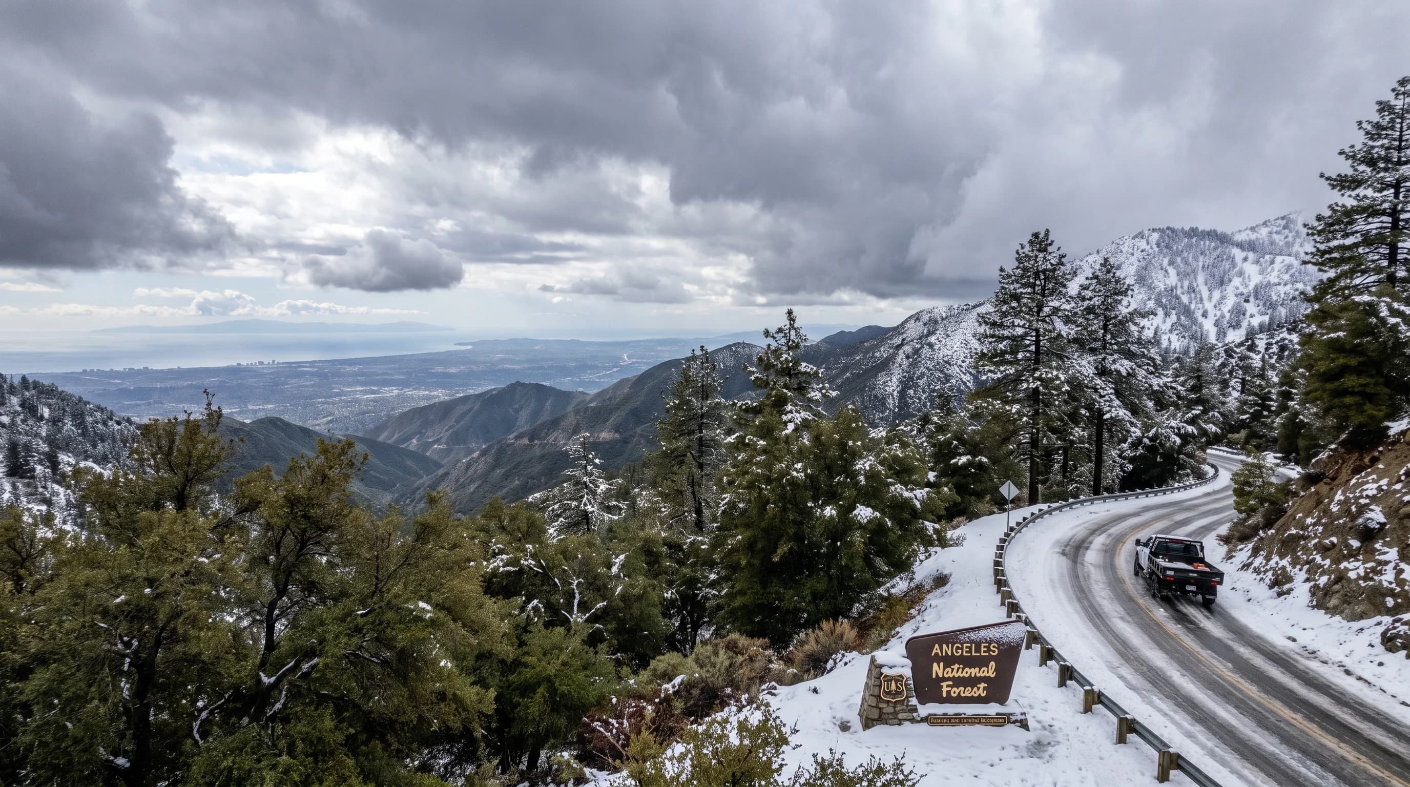
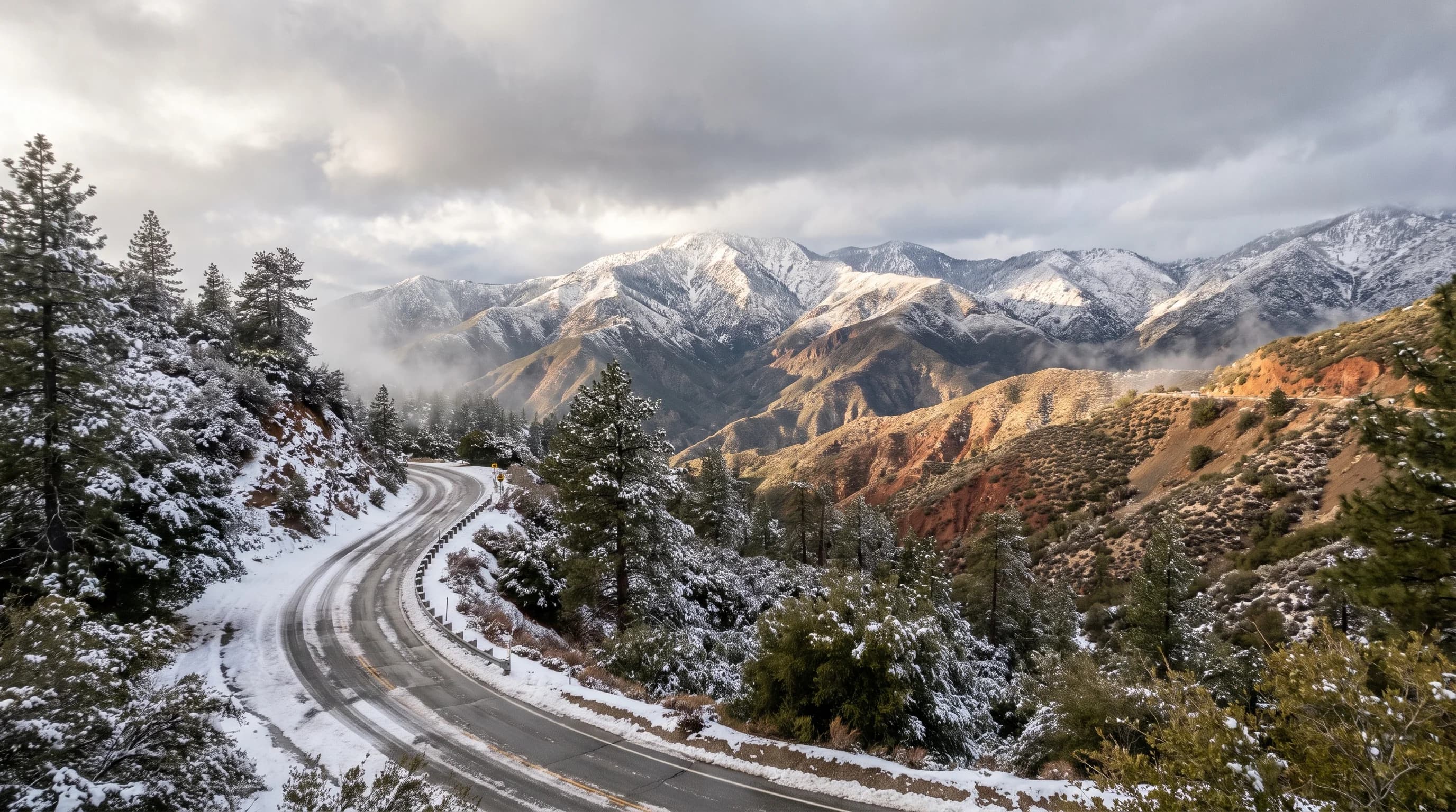
A realistic winter panorama of Big Bear, Wrightwood-area San Gabriels, and Mount San Jacinto, with snow concentrated by elevation rather than covering the lowlands

Key Takeaways

  • Reliable Southern California snow is concentrated in the San Bernardino, San Gabriel, and San Jacinto Mountains, generally above 5,000 to 6,000 feet, not at the coast or in the LA Basin.
  • Elevation, not distance from the ocean or from downtown Los Angeles, is the main variable: the San Gabriel Mountains get far more reliable snow than many inland valleys despite being closer to the coast.
  • The Palm Springs Aerial Tramway is the sharpest local example of the elevation effect, climbing from about 489 feet in the Coachella Valley to roughly 8,389 feet in about ten minutes, often crossing from rain into snow along the way.
  • The snow level, the elevation where precipitation switches from rain to snow, can shift by 2,000 to 4,000 feet within a single storm as fronts pass, so a single forecast number issued days ahead should not be treated as fixed.
  • Big Bear Lake (about 6,834 feet) and Wrightwood (about 6,614 feet) are the most reliable and accessible mountain snow destinations from Los Angeles, typically 1.5 to 2 hours by car.
  • Genuine lowland snow in the LA Basin and Inland Empire is rare; most of what looks like snow at low elevation is hail or graupel from cold-season thunderstorms, not accumulating snowfall.

Snow in Southern California is a matter of altitude, not latitude. On any given winter storm day, the coast and the basins get rain while the San Bernardino, San Gabriel, and San Jacinto Mountains, all within roughly two hours of downtown Los Angeles, can be under a foot of fresh snow. The dividing line usually sits somewhere between 4,500 and 6,500 feet, and it moves up or down with every storm, which is why the honest answer to "where does it snow" is always a moving elevation, not a fixed dot on a map.

Where does it snow reliably in Southern California?

Reliable snow in the region is a mountain phenomenon, concentrated in three ranges: the San Bernardino Mountains east of Los Angeles, the San Gabriel Mountains north of the city, and the San Jacinto Mountains above the Coachella Valley. Communities above roughly 5,000 to 6,000 feet in these ranges, including Big Bear Lake at about 6,834 feet, Wrightwood at about 6,614 feet, and Lake Arrowhead at about 5,220 feet, see measurable snow in nearly every winter based on NOAA 1991 to 2020 Climate Normals for the area. The coast, the Los Angeles Basin, the Inland Empire valley floor, and the desert floor around Palm Springs sit far below that band, which is why snow there is rare enough to make local news when it happens.

Higher desert ranges add a fourth zone worth naming: peaks above the Antelope Valley and the mountains ringing the Coachella Valley, including Mount San Jacinto itself at 10,834 feet, also collect reliable snowpack most winters even though the desert floor a few miles away almost never does. The pattern repeats across all four zones: elevation, not distance from the coast or from downtown LA, decides who gets snow.

Why does elevation matter more than distance from Los Angeles?

Elevation controls snow because it controls temperature, and Southern California proves the point by putting some of its shortest rain-to-snow transitions anywhere in the country right next to sea level. Downtown Los Angeles, at close to sea level, rarely drops cold enough for snow even in a strong winter storm, while the San Gabriel Mountains less than an hour north climb into the 5,000-to-10,000-foot range where the same storm runs well below freezing. Distance from the ocean matters less than how high the ground rises, which is why a coastal-adjacent range like the San Gabriels gets more reliable snow than many inland valleys that sit at lower elevation despite being farther from the moderating Pacific.

The Palm Springs area is the sharpest local example of this rule. The Coachella Valley floor near Downtown Palm Springs sits at about 489 feet, while the Palm Springs Aerial Tramway climbs to roughly 8,389 feet at its Mountain Station in about ten minutes, a vertical gain of nearly 7,900 feet over a few miles of cable. A single storm can rain on the tram's valley station while burying its mountain station in snow, all inside the same ten-minute ride. That case is covered in full detail in does it snow in Palm Springs, which is worth reading if the tram is part of your trip.

Pasadena shows the same rule at a smaller scale. The city sits at about 925 feet and rarely sees snow of its own, yet Mount Wilson, looming less than 5,000 feet higher and visible from downtown Pasadena streets, regularly turns white during the same storm that leaves the city wet and green. That contrast, and how often it plays out each winter, is covered in does it snow in Pasadena.

A Southern California elevation ladder placing coast, basin, foothill, mountain towns, and peaks against changing storm snow levels
The same storm can rain on the coast and basin while snowing heavily above roughly 5,000 to 6,500 feet in the San Bernardino, San Gabriel, and San Jacinto Mountains.

Which mountain destinations are most likely to have snow?

Among Southern California's mountain towns, the ones sitting highest and farthest from the moderating basin air tend to hold snow longest, though every destination's exact season still depends on the individual storm. The table below compares elevation, typical season, and drive time from downtown Los Angeles for the region's best-known snow destinations, based on NOAA climate normals and standard highway routes. None of these numbers promise snow on a given day; they describe what a typical winter season looks like at each elevation.

Southern California Snow Destinations: Elevation, Season, and Drive Time from LA
DestinationElevationTypical snow seasonApprox. drive from LA
Mount Baldy VillageAbout 4,236 feetIntermittent, elevation-dependent snow, late Nov. to MarchAbout 1 hour
WrightwoodAbout 6,614 feetRegular accumulation most seasons, Dec. through MarchAbout 1.5 hours
Lake ArrowheadAbout 5,220 feetRegular winter snow, more variable than higher townsAbout 1.5 to 2 hours
Big Bear LakeAbout 6,834 feetReliable accumulation nearly every season, Dec. through MarchAbout 2 hours
Idyllwild-Pine CoveAbout 5,761 feetRegular winter snow in the San Jacintos, Dec. through MarchAbout 2.5 hours
Mount San Jacinto Tram Mountain StationAbout 8,389 feetReliable snowpack most seasons, reached by tramway in minutesAbout 2.5 hours to Palm Springs, plus the tram ride

Two ski resorts anchor the San Bernardino side of this comparison: Snow Summit, at about 6,952 feet, and Snow Valley, at about 6,726 feet, both above Big Bear Lake itself and both running snowmaking to supplement natural snowfall in lean stretches. A resort snow report describes conditions at the resort, often boosted by machines, which is a different number from the natural accumulation measured in the town below. For a deeper look at how snow varies inside a single mountain community, including the gap between the valley floor and the surrounding ridgelines, see does it snow in Big Bear Lake.

Can snow reach Southern California lowlands?

Yes, but rarely, and much of what gets called lowland snow is actually hail or graupel rather than true accumulating snowfall. Hail forms as small pellets of layered ice inside strong thunderstorm updrafts, and graupel forms when supercooled cloud droplets freeze onto a falling ice crystal, producing soft white pellets that can briefly coat lawns and streets and look convincing on video. Both are common in cold-season thunderstorms across the Los Angeles Basin and Inland Empire and are far more frequent than genuine lowland snow.

The best-documented case of real snow reaching low elevation across a wide stretch of Southern California is the storm of January 1949, and any other specific claim about a given year's lowland snowfall should be checked against National Weather Service and NOAA station records rather than repeated secondhand. A full breakdown of that history for the city itself, including what typically gets mistaken for snow, is covered in does it snow in Los Angeles.

How does the snow level change during a storm?

The snow level, the elevation above which precipitation falls as snow rather than rain, rises and falls within a single storm and is rarely a fixed number for the whole event. Ahead of a storm's warm front, the snow level often sits high as milder air arrives first; behind a cold front, it can drop sharply, sometimes by 2,000 to 4,000 feet within several hours, as colder air moves in behind the frontal passage. Wet-bulb cooling adds another layer of uncertainty: heavy precipitation falling through dry air evaporates partly on the way down, cooling that air column and effectively pulling the snow level lower than the raw temperature profile alone would suggest.

This is why a single forecast snow level, quoted once at the start of a storm, is not something to plan a whole day around. A destination sitting right at the forecast line, such as Mount Baldy Village at about 4,236 feet, can flip between rain and snow more than once as a storm passes through.

Local terrain adds further variability on top of the storm-scale pattern. North-facing slopes that stay shaded hold snow longer than sunlit south-facing slopes at the same elevation, and a valley floor surrounded by higher ridgelines, like the town of Big Bear Lake itself, can end up with noticeably less snow than the resorts and peaks a few hundred feet above it, even during the same storm.

How should travelers check snow and roads?

Start with the point forecast and snow level from NWS Los Angeles/Oxnard for the San Gabriel and San Bernardino Mountains, or NWS San Diego for the San Jacintos and areas farther south, since the snow level can shift by a thousand feet or more between the morning of a trip and the forecast issued a few days earlier. Before driving into any of these ranges during or after a storm, check Caltrans QuickMap for chain control requirements and closures on routes like State Route 2, State Route 18, State Route 38, and State Route 330, which can be imposed or lifted with little advance notice during an active storm.

Pair the official forecast and road status with a resort snow report or a public webcam only as a supplement, not a replacement, since a webcam shows a single point in time and a resort report often reflects snowmaking as well as natural snowfall. Readers unfamiliar with winter driving should also review NWS winter weather safety guidance before heading up.
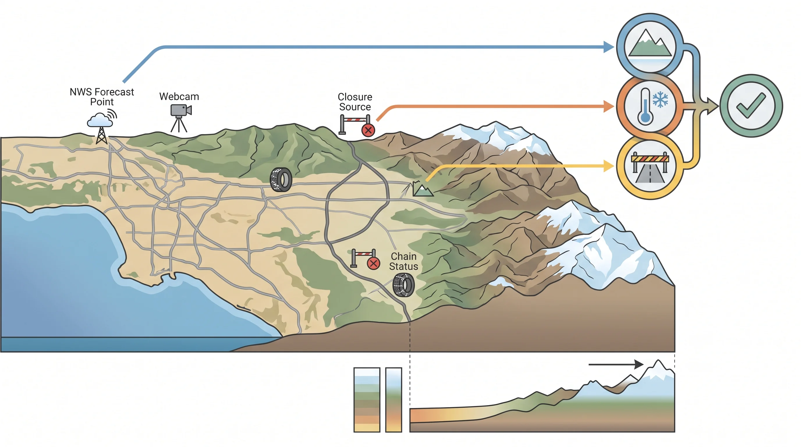
A destination planning map comparing elevation, typical snow reliability, approach highways, NWS forecast point, webcam, closure source, and chain status
Checking elevation, official snow level, and Caltrans road status together gives a more complete picture than any single source alone.

Southern California holds both ends of the winter spectrum inside a single afternoon's drive: a coastline and basin where snow is a historical footnote, and mountain ranges where it is a routine part of the season. The elevation ladder from sea level to over 10,000 feet, not the region's reputation for sun, is what decides which experience a traveler actually gets. Before heading up to Big Bear Lake, Wrightwood, or the San Jacinto high country, check the current snow level and destination-specific forecast on WeatherEscape, and confirm road and chain status before committing to the drive.

Frequently Asked Questions

Where does it snow reliably in Southern California?

Reliable snow falls in the San Bernardino, San Gabriel, and San Jacinto Mountains, generally at elevations above roughly 5,000 to 6,000 feet. Towns in this band, including Big Bear Lake, Wrightwood, and Lake Arrowhead, see measurable snow in nearly every winter based on NOAA 1991 to 2020 Climate Normals. The coast, the LA Basin, and the desert floor around Palm Springs sit far below that elevation and rarely see snow of their own.

What elevation gets snow in Southern California?

As a general threshold, elevations above about 5,000 to 6,000 feet see snow in most winter storms, though the exact snow level shifts with each individual system and can be lower or higher on a given day. Some storms drop the snow level well below 5,000 feet for a few hours, while others keep it above 7,000 feet the whole time, which is why checking the current NWS snow level forecast matters more than relying on a single fixed number.

Which Southern California mountain towns are best for snow?

Big Bear Lake, at about 6,834 feet, and Wrightwood, at about 6,614 feet, are the most reliable and most accessible from Los Angeles, typically 1.5 to 2 hours by car. Lake Arrowhead (about 5,220 feet) and Idyllwild-Pine Cove (about 5,761 feet) also see regular winter snow but sit slightly lower and can be more variable storm to storm. The Palm Springs Aerial Tramway offers the fastest elevation gain of any option, reaching about 8,389 feet in roughly ten minutes.

Can it snow in Los Angeles and the lowlands?

Genuine accumulating snow at low elevation is rare enough to be historically notable, with the January 1949 storm as the most widely documented case of snow reaching the LA Basin. Most of what people call lowland snow today is actually hail or graupel from cold-season thunderstorms, which can briefly whiten the ground and melt quickly. A full look at that history is covered in the Los Angeles-specific snow article.

How do you check snow levels and chain controls?

Check the point forecast and snow level from NWS Los Angeles/Oxnard or NWS San Diego depending on which range you are heading toward, since the snow level can shift by a thousand feet or more between forecast updates. Before driving up, check Caltrans QuickMap for chain control requirements and closures on routes like State Route 2, State Route 18, State Route 38, and State Route 330, and treat any resort snow report or webcam as a supplement to, not a replacement for, the official forecast and road status.

Which parts of Southern California get the most snow?

The highest terrain in each range tends to hold the most snow: the peaks and ridgelines above Big Bear Lake, including Snow Summit at about 6,952 feet and Snow Valley at about 6,726 feet, and the upper elevations of Mount San Jacinto above Palm Springs, which reaches 10,834 feet. Valley floors surrounded by higher terrain, like the town of Big Bear Lake itself, often end up with less snow than the ridgelines a few hundred feet above them during the same storm.

When was the last time it snowed in low-elevation Southern California?

This article does not state a specific recent date for lowland snow, since a reliable answer requires checking current National Weather Service and NOAA station records rather than relying on secondhand reports or viral video, which are frequently hail or graupel misidentified as snow. What is consistent year to year is that the mountain destinations covered here see snow in nearly every winter, regardless of whether the lowlands see any at all.

Is a ski resort snow report the same as the snow depth in town?

No. A resort snow report describes conditions on that resort's runs, which are often supplemented by snowmaking in addition to natural snowfall. The natural accumulation in a nearby town, like Big Bear Lake itself, can be noticeably less than what a resort a few hundred feet higher reports on the same day. Cross-checking an NWS observation, a resort report, and a timestamped webcam together gives a more complete picture than relying on any single source.

Related Destinations

Live Los Angeles Conditions

Compare temperature, wind, clouds, and comfort across the map.

See which microclimates are clear, cool, windy, smoky, or warming up right now.

Open the Weather Map
Destinations☀️Smog Forecast🌫️Smog Heat Map🔒Privacy Policy📄Terms of Service