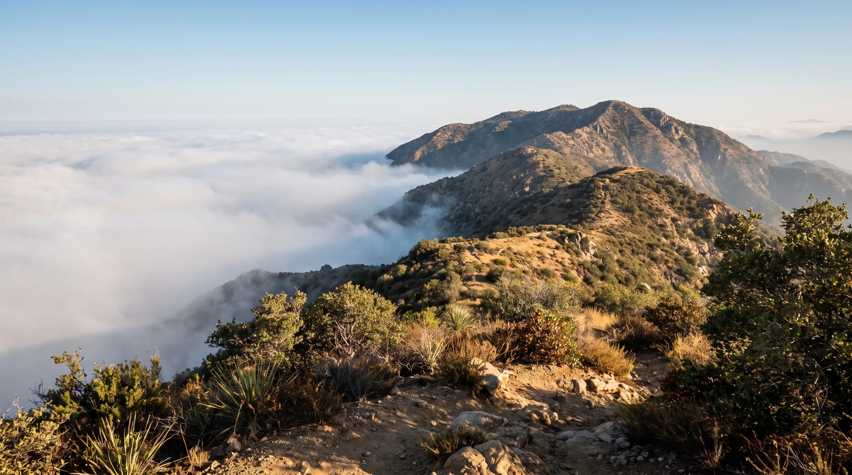
Los Angeles weather changes over short distances because the region sits below the Transverse Ranges, mountains that run east to west instead of north to south like most of California's ranges. That sideways alignment puts the Santa Monica, San Gabriel and San Bernardino Mountains directly across Pacific storm tracks and incoming ocean air. The mountains block some of that air, lift some into rain and snow and funnel the rest through passes and canyons as wind. The coast, basin, foothills and desert can each have different weather at the same hour.
Which Mountains Shape Los Angeles Weather?
Three mountain ranges shape Los Angeles weather: the Santa Monica Mountains along the coast, the San Gabriel Mountains northeast of the basin and the San Bernardino Mountains farther east. With smaller connecting ranges, they form the Transverse Ranges, named for their unusual east-west direction. That direction lets them meet storms and ocean air head-on instead of letting weather slide past along the coast, as it does through most of California.
The gaps between the ranges matter almost as much as the peaks. Cajon Pass carries Interstate 15 between the San Gabriel and San Bernardino Mountains, and canyon corridors north of the San Fernando Valley connect the basin to the high desert. Air squeezed by the mountains escapes through these passes, which is why they get the strongest wind.
| Zone | Example destination | What shapes its weather |
|---|---|---|
| Coast | Santa Monica | Direct ocean exposure keeps temperatures moderate year-round |
| Basin | Downtown Los Angeles | Far enough inland to warm more on sunny afternoons |
| Foothill | Pasadena | Sits against the San Gabriels, with cooler nights from downslope drainage |
| Mountain | Wrightwood | Above 6,000 feet, with a winter and snow season the basin never sees |
| Desert | Palm Springs | Sits in the rain shadow east of the mountains, dry and hot most of the year |
How Does Rising and Descending Air Change Temperature and Rain?
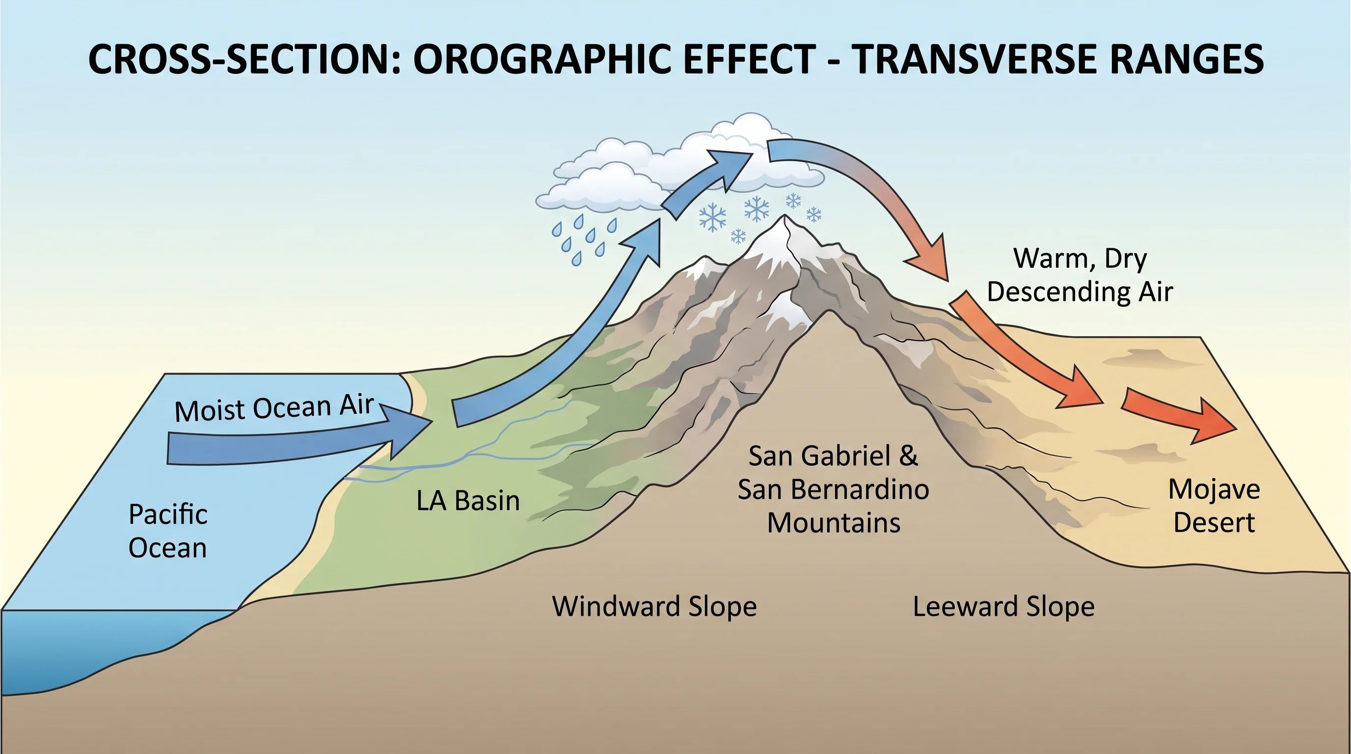
Rising air cools and sinking air warms, a relationship the National Weather Service and the Weather Prediction Center describe as the lapse rate. When moist Pacific air reaches the ocean-facing slopes of the San Gabriel and San Bernardino Mountains, it is forced upward. As it rises, it cools and its moisture condenses into clouds, rain and snow. This process is called orographic lift.
On the desert-facing side of the mountains, the process reverses. The air sinks and warms through compression, and because it already lost moisture on the way up, it reaches the Antelope Valley and western Mojave Desert warmer and drier than it started. Wet air on one side and warm, dry air on the other keep the desert in a rain shadow, even during a wet Pacific storm.
Why Do Coast, Basin, Foothill, and Mountain Forecasts Diverge?
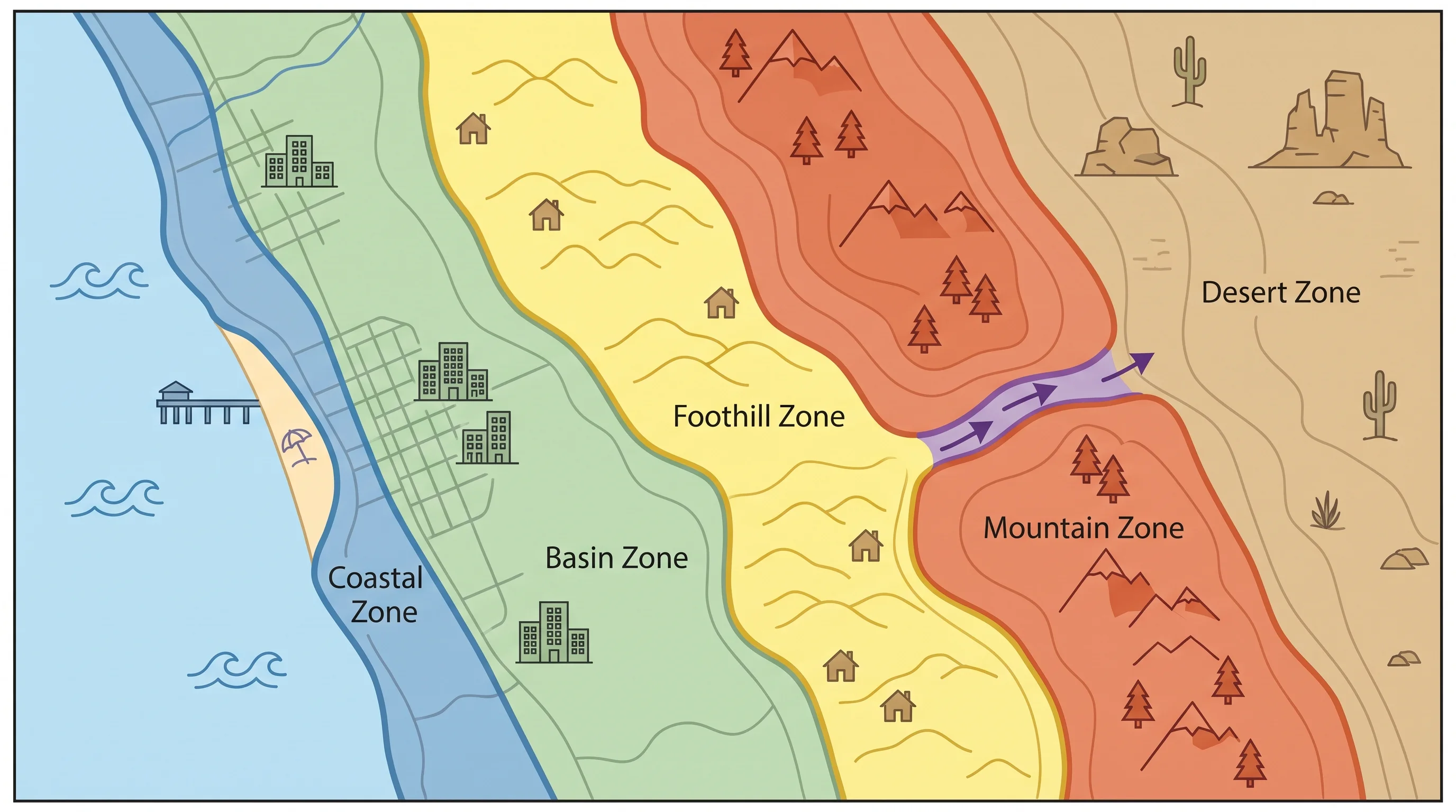
Coast, basin, foothill and mountain forecasts differ because ocean distance, elevation, slope direction and cold air draining downhill at night each change local conditions. All four act within Los Angeles County on an ordinary day. Santa Monica sits close to the Pacific, which keeps it moderate all year.
Downtown Los Angeles sits farther inland and warms more on sunny afternoons. Pasadena sits against the San Gabriel foothills, where cold air draining downhill overnight can make mornings cooler than the flatter basin. The foothills also get more rain, about 20 inches a year in Pasadena versus 14.25 Downtown, as the rainfall totals by city show. Wrightwood, above 6,000 feet, has a winter climate unlike any of them.
Zone-to-zone forecast differences exist without any storm. They come from how each area interacts with the ocean, the sun and the terrain, so one regional forecast can understate how different two Los Angeles neighborhoods feel on the same afternoon.
How Do Mountains Control Fog and Low Clouds?
Mountains decide how far the marine layer, the shallow layer of cool, moist ocean air behind LA's coastal fog, can spread inland. The marine layer is usually only a few thousand feet deep. Where hills and mountains rise higher than the layer, they stop it, keeping fog and low clouds near the coast and in low basin areas. Higher foothills and mountains sit in clear air above.
Passes and low gaps are the exception. Marine air flows through them and carries cool, cloudy weather farther inland than the surrounding terrain would allow. For the season when the marine layer is most persistent, see May Gray and June Gloom.
Why Are Passes and Canyons So Windy?
Passes and canyons are windy because the gaps that let air through also speed it up. When a pressure difference pushes air across the Transverse Ranges, most often during a Santa Ana wind event with high pressure over the Great Basin, the air squeezes through Cajon Pass and the canyons north of the San Fernando Valley and accelerates. Water speeds up the same way in a narrow section of pipe. The sinking air also warms and dries through compression, making the wind gusty and very dry.
Each canyon responds differently to the same wind event, depending on its direction and shape. For how Santa Ana winds form and why they raise fire risk, see the Santa Ana winds explainer.
Which Forecast Matches a Mountain Trip?
For a mountain trip, use the forecast for your exact destination and elevation, not the nearest big city. A drive from the basin toward Big Bear Lake or Wrightwood can go from rain to snow over a few thousand feet of climbing. Check wind, snow level and road conditions for the destination itself. The NWS Los Angeles/Oxnard office and the NWS San Diego office issue point forecasts by zone, and the Weather Prediction Center tracks the storms that bring terrain-driven rain and snow.
Check terrain hazards too. Heavy rain on steep, burned or soaked slopes can trigger mudslides, as why the hills give way after rain explains. The desert side of the mountains has its own wind and visibility hazards, covered in dust storms and desert weather in Southern California. For a wet winter's overall storm pattern, see what a wet Los Angeles winter looks like.
Los Angeles has a coast, a basin, foothills, a mountain crest and a desert within about 60 miles, and the Transverse Ranges keep those zones distinct. Before heading to the mountains or desert, check the point forecast, snow level and road conditions for your exact destination on WeatherLA. The guide to lenticular clouds over the San Gabriels shows one visible sign of air flowing over the mountains.