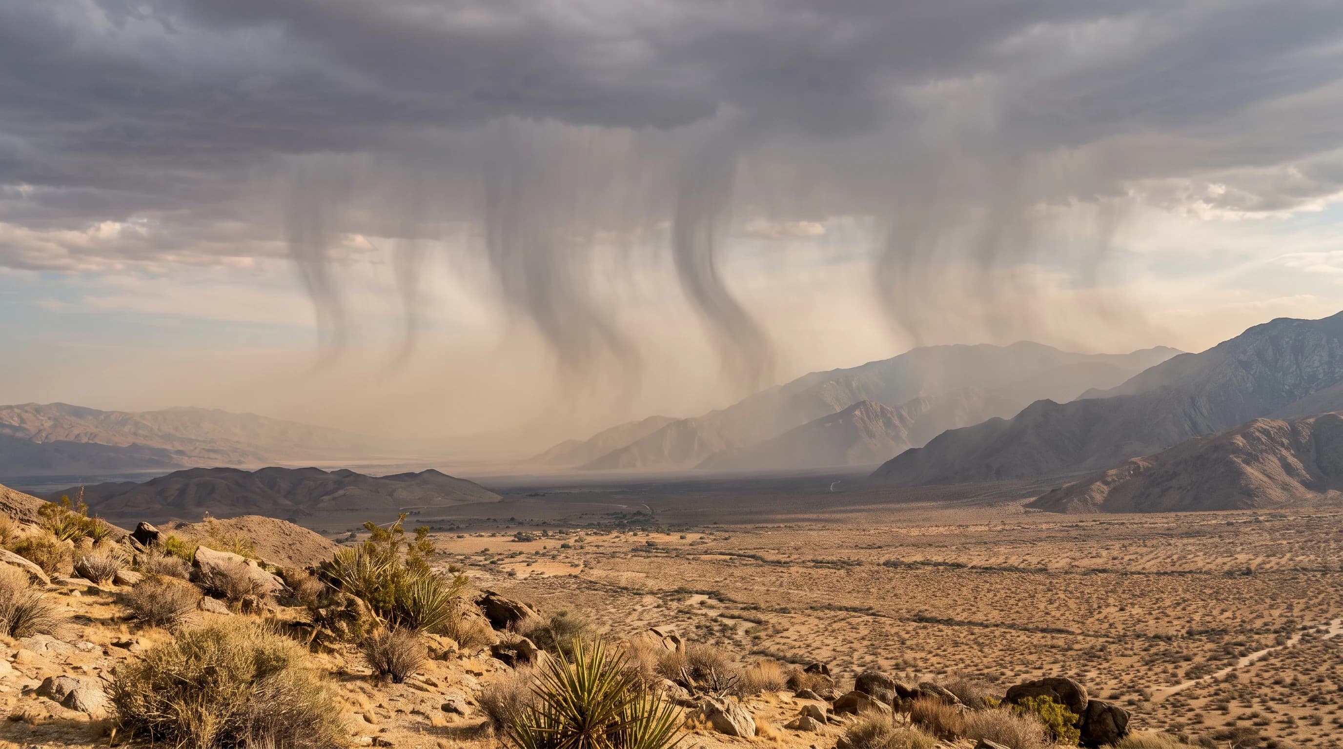
Virga is precipitation that falls from a cloud and evaporates before reaching the ground, seen as gray streaks hanging beneath a cloud that never touch the surface. Virga is one of the most common sights over the Palm Springs and Joshua Tree deserts, where air near the ground is often dry enough to evaporate falling rain long before it lands. Virga shows two very different air layers stacked on top of each other. It can also signal the downdrafts and dust that make desert weather change fast.
What Is Virga?
Virga is the meteorological term for rain, snow or ice that visibly falls from a cloud but evaporates before reaching the ground. The word comes from the Latin for "twig" or "rod," describing the wispy streaks trailing below the cloud. The World Meteorological Organization's International Cloud Atlas lists virga as a cloud feature. Virga forms wherever a moist cloud layer sits above a deep layer of dry air, a setup common over Southern California's Mojave and Colorado deserts.
Virga is not limited to deserts; it appears over oceans, mountains and plains wherever the air below the clouds is dry enough. Southern California's deserts show it reliably because their surface air is dry most of the year, while monsoon surges and passing winter storms bring occasional higher clouds with enough moisture to produce precipitation aloft.
Why Does Rain Evaporate Below a Cloud?
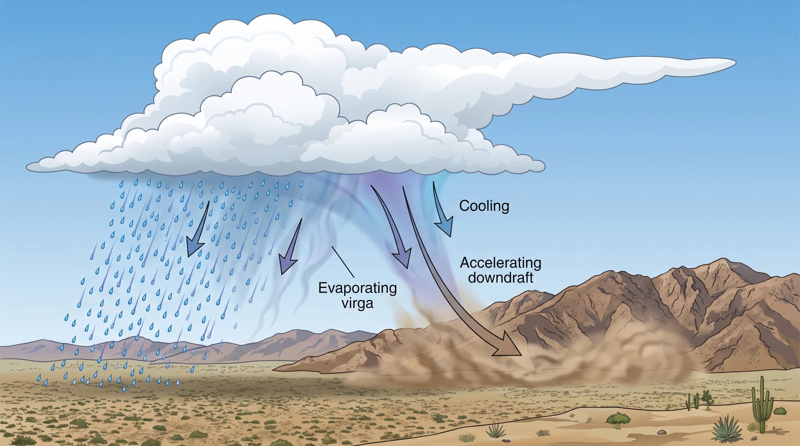
Rain evaporates below a cloud when it falls into air far from saturation, where low relative humidity makes drops lose water faster than gravity pulls them down. Each small drop has a large surface for its size, so dry air below a cloud can evaporate it completely within a few thousand feet.
In the deserts east of Los Angeles, surface relative humidity is often well below 30% on afternoons, especially in late spring and early summer. A cloud layer several thousand feet up can be much moister. Dry air near the ground under moister air aloft is why precipitation forms visibly but rarely lands.
Drop size matters too. Larger drops from a strong thunderstorm updraft have a better chance of reaching the ground than the fine drizzle from a thin cloud. As a drop evaporates, it slows and shrinks faster, so the smallest drops vanish quickly near the driest air. Evaporation also cools the air: turning water to vapor takes energy from the surrounding air, chilling the column the virga falls through.
| Season | Typical afternoon surface relative humidity | Common precipitation outcome |
|---|---|---|
| Winter (Pacific storm passages) | 30-50% | Rain often reaches the ground; virga near storm edges |
| Spring (transitional, driest surface air) | 10-20% | Virga common under any passing cloud with moisture aloft |
| Summer (monsoon surges, July-September) | 20-40%, spiking higher during a surge | Virga near developing cells; downpours reach ground under mature storms |
| Fall (dry offshore flow common) | 10-25% | Virga likely whenever isolated high cloud produces any precipitation |
Where and When Is Virga Common Locally?
Virga is most common over Southern California's desert basins, including the Coachella Valley near Palm Springs, the high desert around Joshua Tree and the Antelope Valley near Lancaster. These areas combine dry surface air with occasional moisture aloft from Pacific storms in winter and monsoon surges in summer. Virga also appears over the Los Angeles Basin and the San Fernando Valley near Woodland Hills when a weak winter storm arrives over a dry layer. It is a familiar sight toward the San Gabriel and San Bernardino Mountains during marginal storms.
The coast and basin see virga only in certain storm setups. The deserts see it often enough that residents recognize it on sight.
Virga is most common in two seasons. The first is the cool season, roughly November through March, when Pacific storms bring clouds with more moisture aloft than the desert air below, especially at a storm's leading or trailing edge where rain is lighter. The second is the North American monsoon, July through September, when desert thunderstorms often show virga as they develop, before they mature enough for rain to reach the ground. For that summer pattern, see what is the North American monsoon.
Can Virga Create Strong Wind?
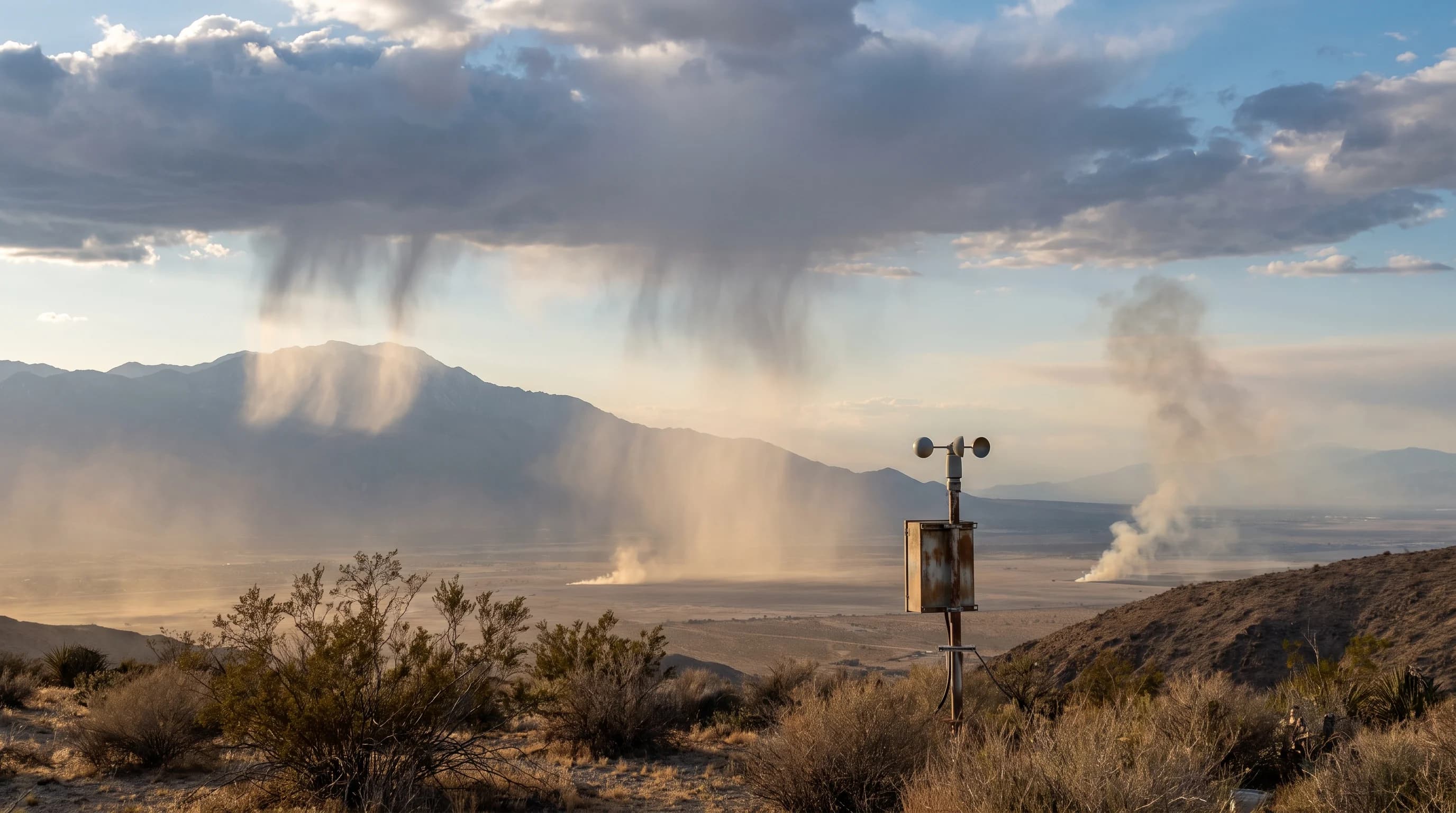
Virga can create strong, gusty wind at the surface even though no rain reaches the ground. Evaporating precipitation cools the air around it, making it denser so it sinks and speeds up, a process called a dry microburst or dry downburst. When the sinking air hits the ground, it spreads out in all directions as sudden gusts that can exceed 50 mph in strong cases and raise heavy dust in the deserts. Local National Weather Service offices watch for these outflow winds during summer thunderstorm season.
Virga does not always bring a downburst. Most virga marks a dry layer under a weak cloud and brings at most a light, brief gust. Dangerous downbursts usually come from deeper, stronger thunderstorms with heavy precipitation aloft evaporating into very dry air below, which the National Weather Service Los Angeles/Oxnard and San Diego offices watch for during monsoon surges. In open desert, treat a sudden wall of dust under a distant cloud as a sign the gust has already reached the ground.
How Can You Tell Virga From Distant Rain?
Shape tells virga from distant rain. Virga hangs below the cloud in soft, wispy streaks that fade partway down.
Rain reaching the ground looks like an even gray curtain that meets the horizon or terrain. Distance and haze make this hard to judge by eye, so comparing radar with surface reports is more reliable. Radar detects precipitation aloft whether or not it reaches the ground, so a radar echo with no rain reported at nearby stations points to virga.
National Weather Service radar pages let you compare radar echoes with nearby station reports. Smoke and dust can also look like virga from a distance.
Smoke drifts sideways with the wind and does not hang from a cloud base. A dust curtain is usually paler, hugs the ground and often follows a gust front. If the gray column clearly hangs from a cloud and thins toward the ground, it is virga.
What Does Virga Mean for a Forecast?
Virga in a forecast means there is moisture aloft that can form precipitation, but it does not mean measurable rain is likely at the ground. Read virga as a sign of moist or unstable air above dry surface air, a setup to watch. During monsoon season, virga under a growing cumulus cloud can be an early sign that a storm is organizing and may bring rain, lightning or a gust as it matures.
Treat virga as one input along with radar, surface humidity and any National Weather Service outlook. One virga shaft on the horizon rarely changes plans. Many virga columns growing darker across a desert basin, especially in mid-to-late summer afternoons, are a reason to check for a thunderstorm or flash flood watch before continuing a hike or a drive through a wash.
How Should You Respond to Virga in the Forecast?
When virga appears, check radar, surface humidity and wind gust reports, and review any National Weather Service thunderstorm or flash flood products before deciding it is harmless or that rain is coming. The NWS Los Angeles/Oxnard office covers the Antelope Valley and western high desert.
The NWS San Diego office covers the Coachella Valley around Palm Springs, and the NWS Phoenix office covers most of Joshua Tree National Park. These offices issue forecasts, radar and warnings that update far faster than a look at the sky. The Weather Prediction Center tracks the larger moisture patterns behind virga.
A downburst under virga can come with a storm that sends water down a desert wash even when no rain falls where you stand. The NWS flood safety guidance explains what to do near desert washes and low roads during storms.
Virga is worth recognizing in Southern California. It shows the air overhead holds more moisture than the dry ground suggests, and over Palm Springs, Joshua Tree and the Antelope Valley that gap can matter. Before heading into open desert under a sky streaked with virga, check radar and any watches or warnings from your National Weather Service office. Treat a sudden dust wall or gust as wind that has already arrived.
For the larger pattern, see how the Southern California monsoon works and how thunderstorms form around Los Angeles.