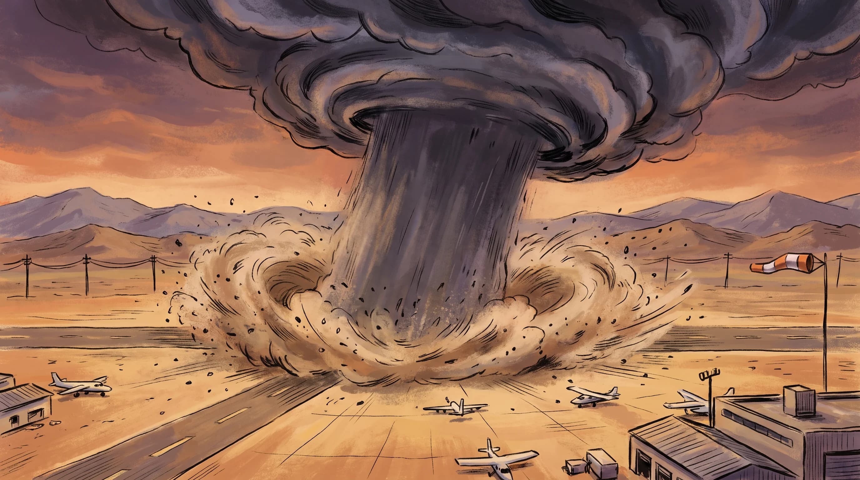
A microburst is a small, intense thunderstorm downdraft that hits the ground and spreads out in a violent burst of straight-line wind, sometimes over 100 mph, across an area just a mile or two wide. A microburst is not a tornado: it has no rotation, only a sudden column of sinking air that blasts outward in every direction. In Southern California, microbursts occur most often with summer thunderstorms over the deserts and mountains, and occasionally with strong cool-season storms over the LA Basin. They endanger aircraft, drivers and anyone outdoors near a collapsing rain shaft.
What Is a Microburst?
A microburst is a concentrated downdraft from a thunderstorm or shower that reaches the ground and spreads out sideways as a short, powerful burst of straight-line wind. Meteorologist Ted Fujita, creator of the tornado damage scale, coined the term in the 1970s. He investigated unexplained aircraft accidents near thunderstorms and found that sudden, local downdrafts were forcing planes into the ground during approach and takeoff. By definition, a microburst's outflow covers less than 2.5 miles; a larger downdraft of the same kind is a macroburst.
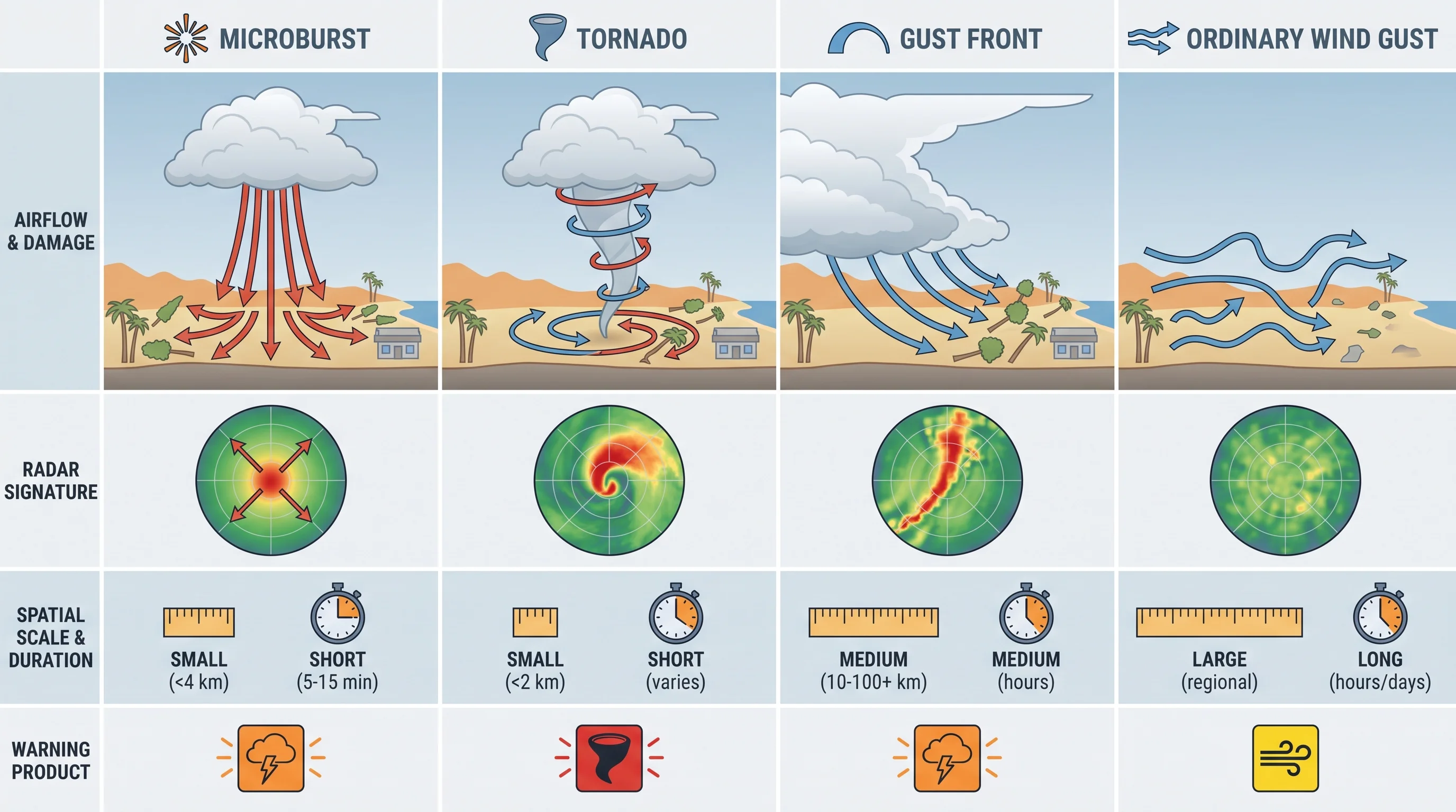
A microburst differs from ordinary thunderstorm outflow, the broad gust front ahead of a storm that brings a brief cool breeze. Outflow winds usually reach 20 to 40 mph over a wide area. A microburst is narrower, more sudden and much stronger, with winds that can match a weak tornado, though from straight-line wind instead of rotation. Only a National Weather Service damage survey can confirm that a gust or damage pattern came from a microburst.
| Feature | Wet microburst | Dry microburst |
|---|---|---|
| Visible precipitation | Heavy rain reaches the ground with the wind | Little or no rain reaches the ground; often just virga and dust |
| Driving mechanism | Weight of falling rain drags air downward | Evaporative cooling of rain in dry sub-cloud air makes the air denser and it sinks |
| Typical Southern California setting | Monsoon thunderstorms over the mountains and basin with deep moisture | Desert and high-desert convection over the Mojave and Antelope Valley |
| Visual warning sign | A collapsing, curtain-like rain shaft | A dust ring or blowing dust erupting under a cloud with little rain visible |
How Does a Thunderstorm Create One?
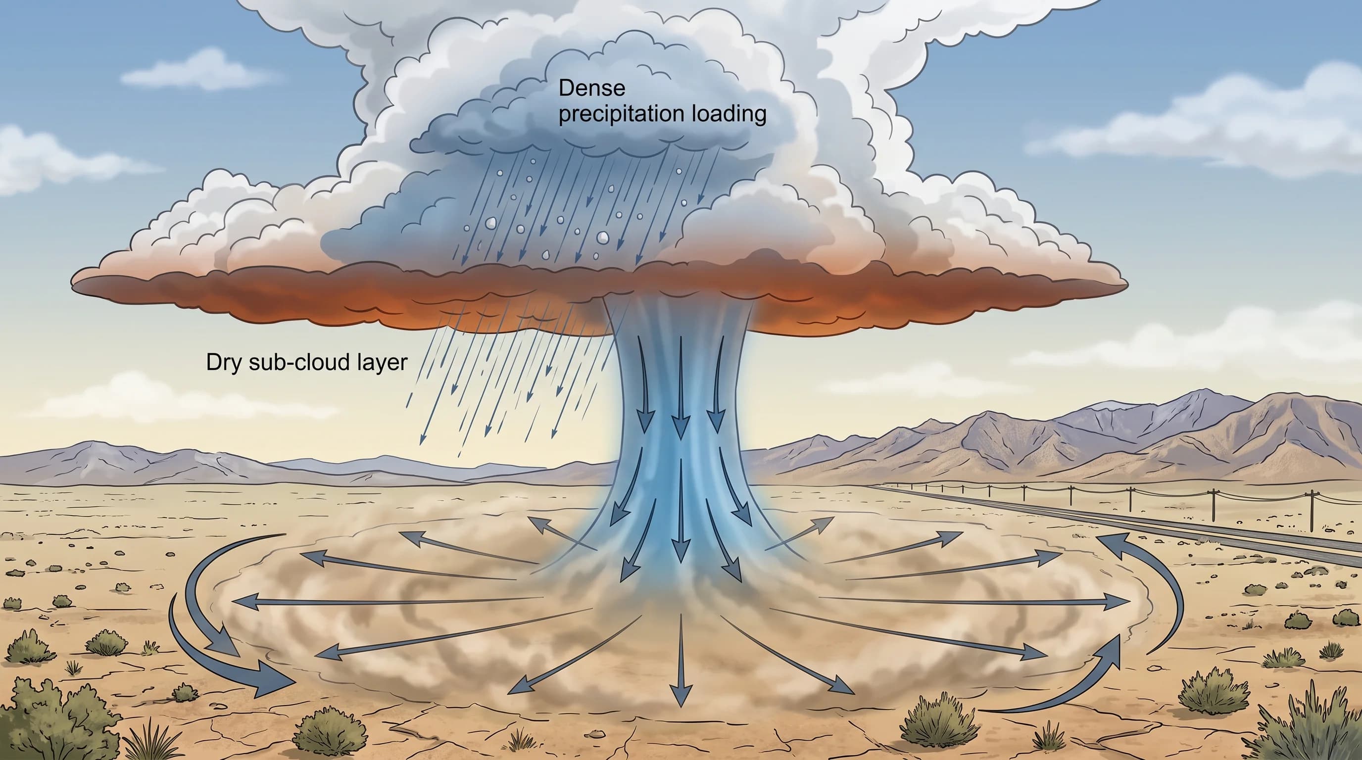
A thunderstorm creates a microburst when air inside or below the storm becomes heavier than the air around it, drops fast and spreads out when it hits the ground. In a wet microburst, heavy rain and hail drag a pocket of air down with them, and the downdraft reaches the ground with visible rain.
A dry microburst, the type most common in Southern California's deserts, forms when rain falls from the cloud into a deep layer of dry air and evaporates before reaching the ground. Evaporation cools the surrounding air quickly. The cooled air becomes denser than its surroundings and sinks, speeding up as it falls through thousands of feet of dry air.
When the sinking air hits the ground, it spreads outward in a radial burst. The damage often forms a starburst pattern, with tree limbs and debris pushed out from a central point instead of swirled together as a tornado leaves them. Dry microbursts often bring little or no rain, so the warning sign is usually virga, streaks of rain under the cloud that evaporate before landing. A sudden wall of dust and wind follows moments later while the sky overhead stays fairly clear.
The NOAA JetStream online weather school explains this evaporative cooling in more technical detail. For why rain evaporates before reaching the ground, see what is virga.
Where and When Do Microbursts Occur Locally?
Southern California microbursts occur most often with summer monsoon thunderstorms, usually July through September, when moisture from the Gulf of California builds storms over the mountains and deserts. NWS Los Angeles/Oxnard and NWS San Diego forecast for much of that terrain. The Antelope Valley, the Mojave Desert and the high desert east of the San Gabriel and San Bernardino Mountains have the driest storm bases and are the classic setting for dry microbursts, because the air below the clouds is deep and dry enough to evaporate falling rain.
Mountain and foothill areas with more monsoon moisture, including parts of the San Gabriels above Pasadena, get the wet type, where the downdraft arrives with rain still falling.
Microbursts occasionally occur in the cool season, when a strong Pacific storm brings enough instability for thunderstorms over the LA Basin, including near Downtown Los Angeles and San Fernando Valley communities like Woodland Hills. These events are less common than summer desert microbursts and usually come with broader severe thunderstorm conditions. Only a National Weather Service field survey can confirm that wind damage came from a microburst rather than ordinary outflow, other straight-line wind or a tornado. Treat reports of past events as unconfirmed unless they cite an NWS survey or storm report.
Why Are Microbursts Dangerous to Aircraft?
Microbursts are dangerous to aircraft because they reverse the wind a plane feels within seconds, during the most vulnerable phase of flight. A plane entering the outflow first meets a strong headwind, which briefly adds lift and can push it above its flight path. Seconds later, passing through the downdraft core, the plane meets a tailwind, and lift drops sharply, often just after the pilot reduced power to correct for the headwind.
During takeoff or landing, a plane is close to the ground with little room to recover. The fast headwind-to-tailwind reversal, plus the downdraft pushing the plane toward the runway, has caused fatal accidents.
Ted Fujita's research led to the wind shear detection systems now standard at major airports, including Doppler weather radar and Low-Level Wind Shear Alert Systems that warn pilots and controllers of sudden wind shifts near runways. Los Angeles International Airport and other major Southern California airports follow FAA and NWS wind shear procedures, and those agencies are the source for each airport's specific procedures. For sudden wind changes with height, including those caused by microbursts, see what is wind shear.
How Is a Microburst Different From a Tornado?
A microburst differs from a tornado in how the air moves. A tornado is a rotating column of air, with wind spiraling inward and upward around a center.
A microburst has no rotation. It is sinking air that spreads outward from a central point after hitting the ground, like water from a hose spreading across a floor. Survey teams see the difference in the damage: tornado debris follows curving, converging paths, often worst along a narrow track. Microburst damage shows trees and debris pushed outward in straight, diverging lines, sometimes called a starburst pattern.
Telling the two apart from one photo or a witness account is hard, because their wind speeds overlap. The National Weather Service sends survey teams to study how trees and buildings fell before classifying an event. For a comparison of tornadoes, waterspouts, microbursts and dust devils, see can tornadoes hit Southern California.
What Warning Signs and Products Matter?
The clearest visual warning of a microburst is a collapsing rain shaft: a curtain of rain that seems to speed toward the ground and fan outward as it lands. Under the dry storm bases of the Mojave and Antelope Valley, watch instead for virga under a cloud followed by a sudden wall of blowing dust spreading from one point, often with little rain. On radar, meteorologists look for a fast outward bulge below a storm cell, though radar can lag behind a small, brief microburst.
The key official product is a Severe Thunderstorm Warning from NWS Los Angeles/Oxnard or NWS San Diego, because microburst-strength gusts are one of that warning's criteria. If you are outdoors, at an event or hiking in open desert or mountains and see a rain shaft collapsing or a dust wall approaching, get to sturdy shelter immediately. Stay away from trees and freestanding structures that could fall, and avoid open ridges until the storm passes.
On desert highways during monsoon season, a microburst crossing the road can bring a sudden wall of dust or rain and a severe crosswind gust. Any storm strong enough to produce a microburst also produces lightning, so follow NWS lightning safety guidance too; the same shelter protects against both. For gusts and wind warnings beyond thunderstorms, see wind hazards in Los Angeles. For why Southern California gets few thunderstorms, see how do thunderstorms form and why LA sees so few.
Microbursts are brief, usually peaking for a few minutes and fading within 5 to 15 minutes of hitting the ground. A few minutes is enough to snap trees, damage roofs and endanger a plane or driver.
Southern California's desert thunderstorm season and occasional strong cool-season storms both produce microbursts. Before heading into open desert, mountain trails or a summer outdoor event during monsoon season, check radar, lightning and any Severe Thunderstorm Warning on WeatherLA's Los Angeles forecast pages. Treat a collapsing rain shaft or a sudden wall of dust as the signal to take shelter.