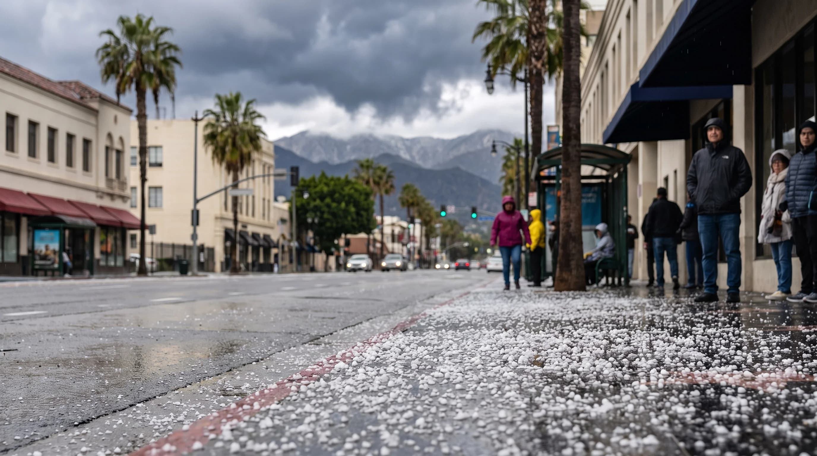
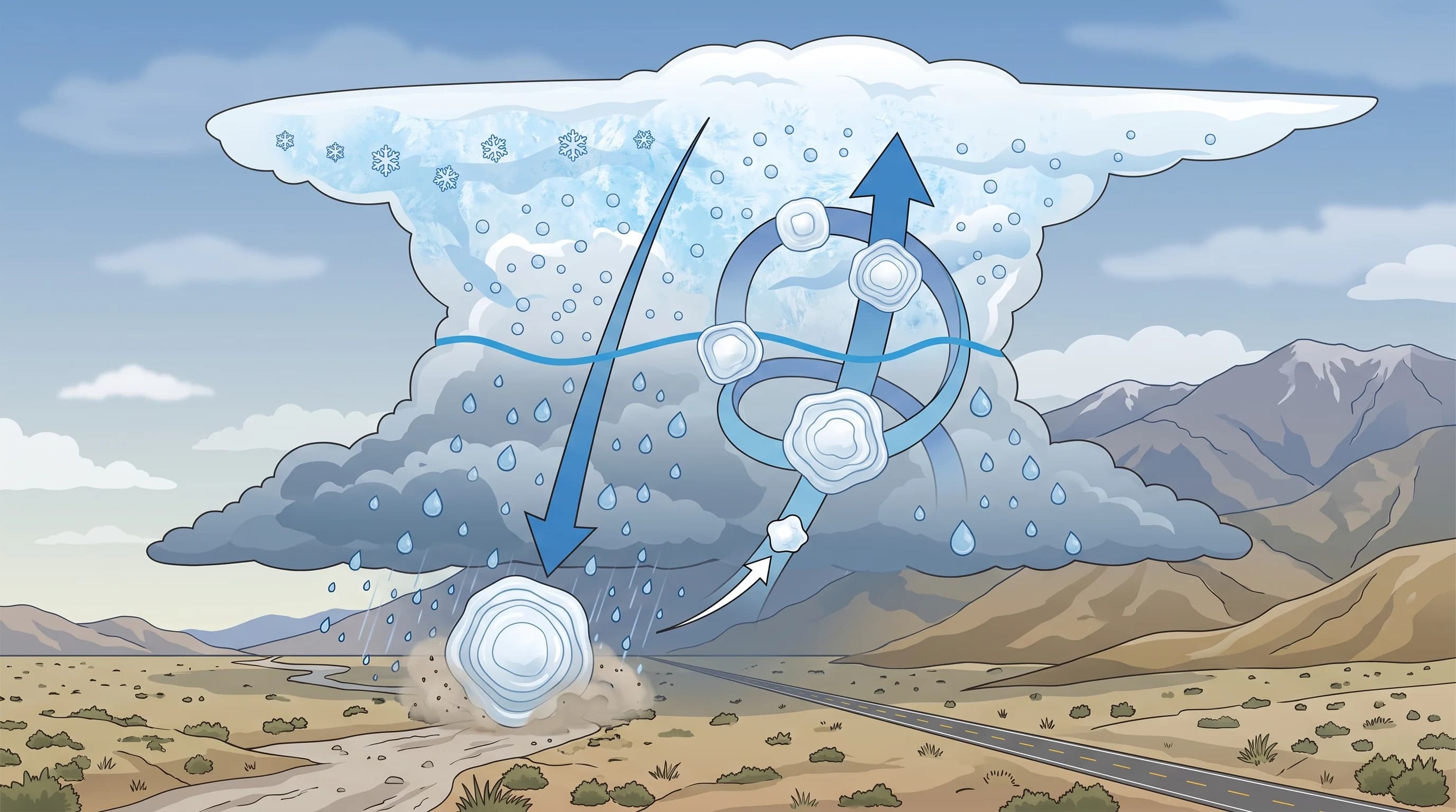
Hail is ice that grows inside a thunderstorm, not ice that forms while falling. A strong updraft carries a small ice pellet into a layer of supercooled cloud water, where it gains coats of ice on repeated trips up and down until it is too heavy for the storm to hold.
Southern California sees hail most summers, usually pea- to marble-size stones from mountain and desert thunderstorms. The Los Angeles Basin gets an isolated hail-producing storm only occasionally. Large, damaging hail is rare here because the region usually lacks the deep instability that builds the biggest storms.
What Is Hail?
Hail is a ball or lump of ice that forms entirely inside a thunderstorm cloud, built in layers as the storm carries it through supercooled water before it falls. Forming inside the storm, not on the way down, separates hail from other frozen precipitation.
Sleet and freezing rain form when snow or rain passes through a shallow cold layer near the ground and refreezes or freezes on contact. Graupel forms when a falling snow crystal picks up a light coating of frozen droplets. Only hail needs a thunderstorm updraft strong enough to hold and recycle an ice particle through the coldest, wettest part of the cloud.
Because hail needs an active thunderstorm, it comes from convective storms, not layered winter storms. For a full comparison of hail, graupel and sleet, including hardness, bounce and typical Southern California settings, see WeatherLA's sleet vs. hail vs. graupel guide. This article covers how hailstones grow, what sets their size and when and where Southern California sees hail.
| Diameter | NWS common comparison | Typical impact |
|---|---|---|
| 0.25 in | Pea | Minor; the most common Southern California hail size |
| 0.5 in | Marble / mothball | Minor to nuisance; can whiten the ground briefly |
| 0.75 in | Penny | Minor to moderate; below the current severe threshold |
| 1.0 in | Quarter | NWS severe thunderstorm threshold; can dent soft metal and damage plants |
| 1.75 in | Golf ball | Vehicle body damage likely; rare in Southern California |
| 2.75 in | Baseball | Significant damage to roofs and vehicles; not typical of the LA Basin |
How Does a Hailstone Grow?
A hailstone grows by cycling through a thunderstorm's supercooled layer, adding a coat of ice each pass until the updraft can no longer hold it. It starts as an ice seed, often a frozen raindrop or small graupel pellet, caught in the storm's updraft, the column of fast-rising air that powers a thunderstorm. The updraft lifts the seed well above the freezing level, where water droplets stay liquid even though the air is below 32°F. This supercooled water stays liquid until it touches something solid, like the ice seed.
When the seed hits supercooled droplets, they freeze onto it almost instantly, a process called accretion. Slow freezing lets water spread before hardening and makes a clear layer; nearly instant freezing traps air bubbles and makes a white layer.
A stone that passes through both zones several times builds alternating clear and white layers, so a hailstone cut in half often shows rings like a tree trunk or an onion. Each trip adds mass. The stone falls when it gets too heavy for the updraft or drifts out of the strongest part of it.
Updraft strength controls hailstone size more than anything else. A weak or brief updraft drops the seed after one or two cycles, producing small hail. A strong, lasting updraft, like those in supercell thunderstorms, holds a stone through many cycles and produces the large hail of the central United States. Southern California's thunderstorms are usually shorter and weaker than Great Plains supercells, so local hail stays small.
When Does Southern California Get Hail?
Southern California gets hail in two seasons from two storm types. The first is the summer monsoon, roughly July through September, when moisture from Mexico fuels afternoon and evening thunderstorms over the mountains and deserts.
Monsoon storms are brief but can be intense, and small hail is common when one develops a strong updraft. The second is the cool season, generally November through April, when unstable Pacific storms, especially cold upper-level lows, set off scattered thunderstorms within broader rain. Cool-season hail is small and brief but can reach closer to sea level, because the whole atmosphere is colder.
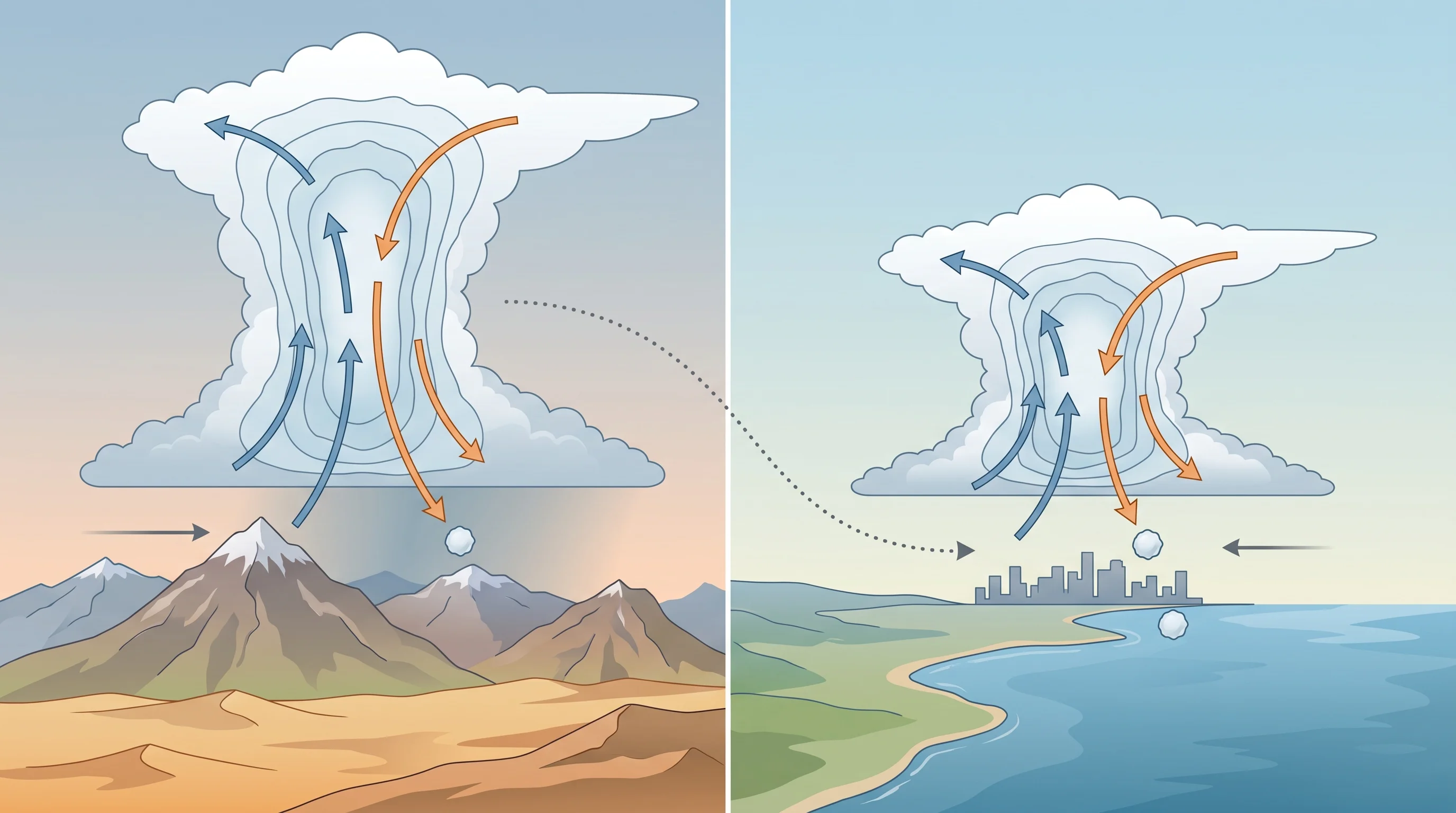
Elevation and terrain matter as much as the season. Mountains and high desert get more thunderstorms because rising terrain helps trigger them.
Big Bear Lake in the San Bernardino Mountains and Wrightwood in the San Gabriel Mountains see thunderstorms, and some hail, more often than the coastal basin. The Los Angeles Basin, including Downtown Los Angeles, is not immune. A strong storm can drift off the foothills and drop hail on lower areas, including near Pasadena, though basin hail is brief and limited to one storm's narrow path.
The atmospheric rivers that bring most of Southern California's winter rain rarely bring hail, because they are steadier, less convective storms. For how those large storms differ from the local thunderstorms that produce hail, see what are atmospheric rivers in Southern California.
Why Is Large Hail Uncommon Around Los Angeles?
Large hail is uncommon around Los Angeles because the region usually lacks the deep instability and strong, lasting updrafts that build big stones. Instability is the difference in temperature and moisture between the surface and the upper atmosphere; the bigger it is, the more explosively a storm grows. The central and southern Great Plains often combine intense surface heat, deep low-level moisture and strong upper winds, the ingredients for supercells. Southern California's ocean-moderated basin and drier upper atmosphere rarely combine them.
Large hail still happens occasionally. The region has documented severe storms with hail well beyond marble size, mainly over the Antelope Valley, the Inland Empire and the deserts, where surface heating is stronger and monsoon moisture deeper than at the coast. Any storm producing hail 1 inch or larger, the National Weather Service severe threshold, can prompt a Severe Thunderstorm Warning. Most Southern California hail stays pea- to marble-size, as the table above shows, briefly whitening lawns, sidewalks and cars before melting.
How Is Hail Different From Graupel or Sleet?
Hail differs from graupel and sleet in where and how it forms, not just size. Hail forms only inside a thunderstorm updraft through repeated cycles in supercooled cloud, and a stone of any size is hard enough to dent soft surfaces. Graupel forms in one gentle pass, when a falling snow crystal gathers a light frozen coating; it is soft, white and crumbly and needs no thunderstorm. Sleet starts as snow that melts aloft and refreezes into a hard, clear pellet in a cold layer near the ground, with no thunderstorm involved.
The fastest clue in the field is context. Small ice pellets falling with thunder, lightning or a dark, towering storm nearby are almost certainly hail. Small, soft, crumbly white pellets from an ordinary shower with no thunder, especially in the San Gabriel or San Bernardino Mountains in cold weather, are almost certainly graupel. WeatherLA's sleet vs. hail vs. graupel comparison has the full identification table.
What Should People Do During a Hailstorm?
During a hailstorm, get under solid shelter and stay away from windows until the storm passes. Hail always comes with an active thunderstorm, so treat it as a lightning risk as well as an impact risk, and move indoors or into a hard-topped vehicle immediately. In a car, pull into a garage or parking structure if one is close and safe to reach. A car parked in the open is exposed to whatever hail the storm produces.
Drivers caught in hail should slow down, because hail on pavement reduces traction like loose gravel. Do not stop under highway overpasses, which blocks travel lanes. After the storm, piled-up hail can keep roads slick until it melts, especially in shaded canyons and at higher elevations near Big Bear Lake and Wrightwood.
Storms and road conditions change quickly, so check the latest Severe Thunderstorm Warnings and point forecast from the NWS Los Angeles/Oxnard office or the NWS San Diego office, depending on your location. For lightning safety during the same storms that bring hail, see WeatherLA's lightning safety guide.
Hail is a thunderstorm product built in layers inside the storm. Southern California sees it most summers in small, mostly harmless sizes over the mountains and deserts, with an occasional storm reaching the basin. Hail forms differently from graupel and sleet. Before heading to the mountains or desert in unsettled summer or winter weather, check radar, the freezing level and any Severe Thunderstorm Warning on WeatherLA's Los Angeles forecast pages.