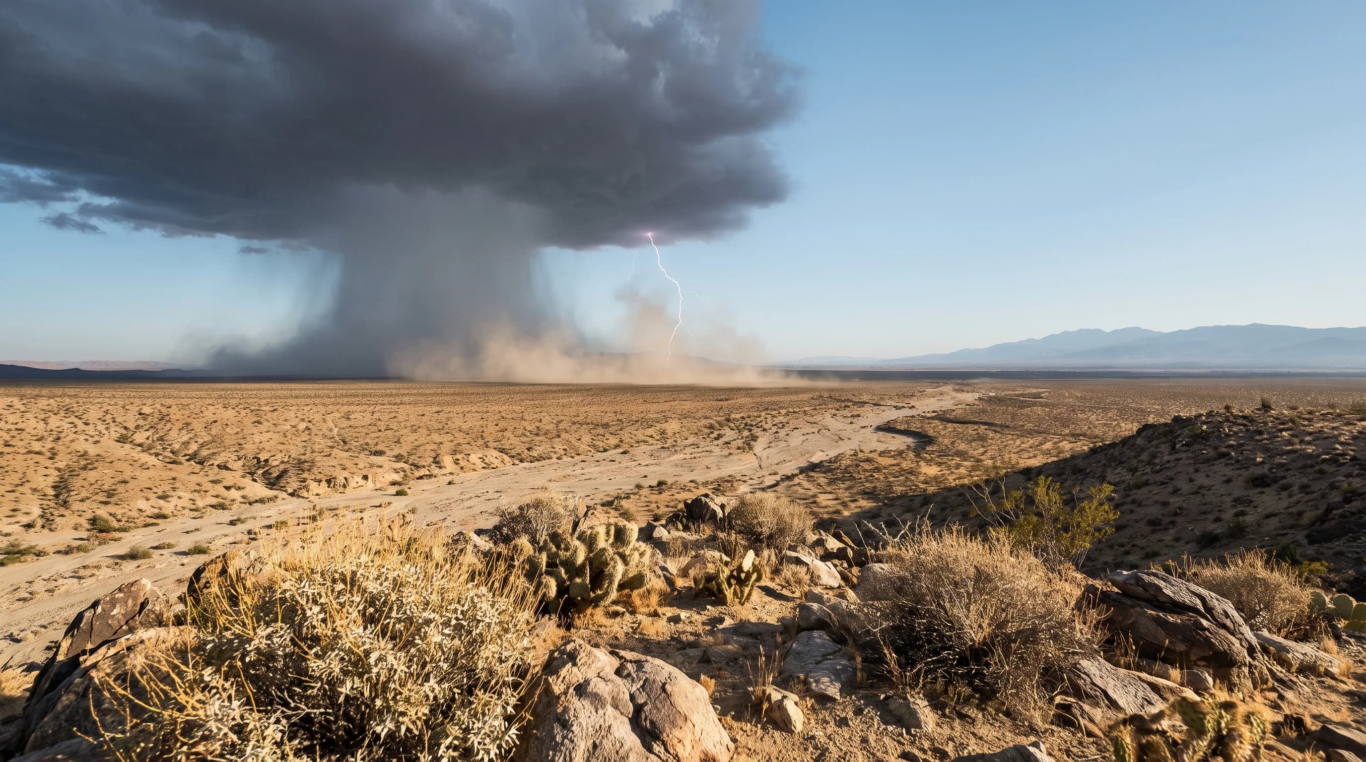
The North American monsoon is a seasonal shift in wind that draws subtropical moisture from the Gulf of California and the eastern Pacific into the Southwest each summer, sometimes fueling thunderstorms over the Southern California deserts. The monsoon is not a single storm or a tropical downpour over the whole region.
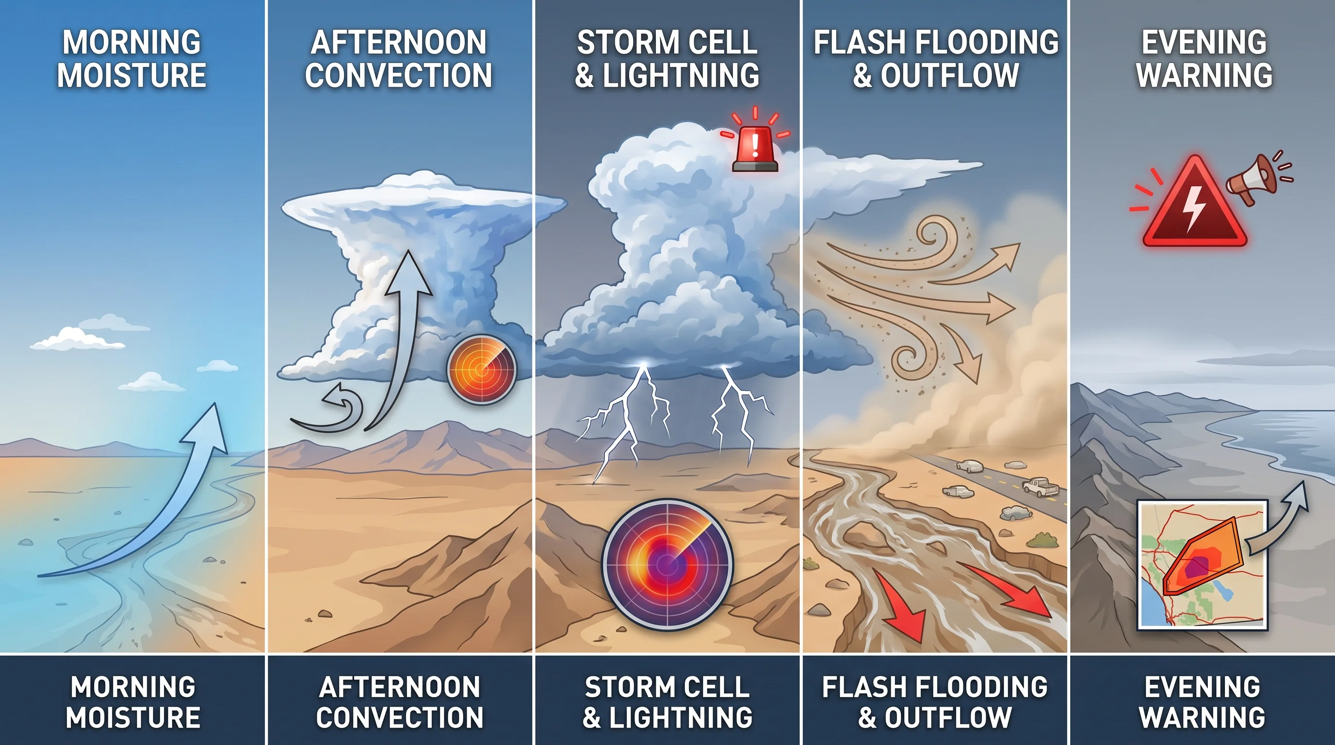
Most days stay dry even in monsoon season. When a moisture surge arrives, a clear morning near Palm Springs or Joshua Tree can turn into an afternoon of towering clouds, lightning and flash flooding. That is why July and September get more rain than June in Palm Springs weather by month.
What Is the North American Monsoon?
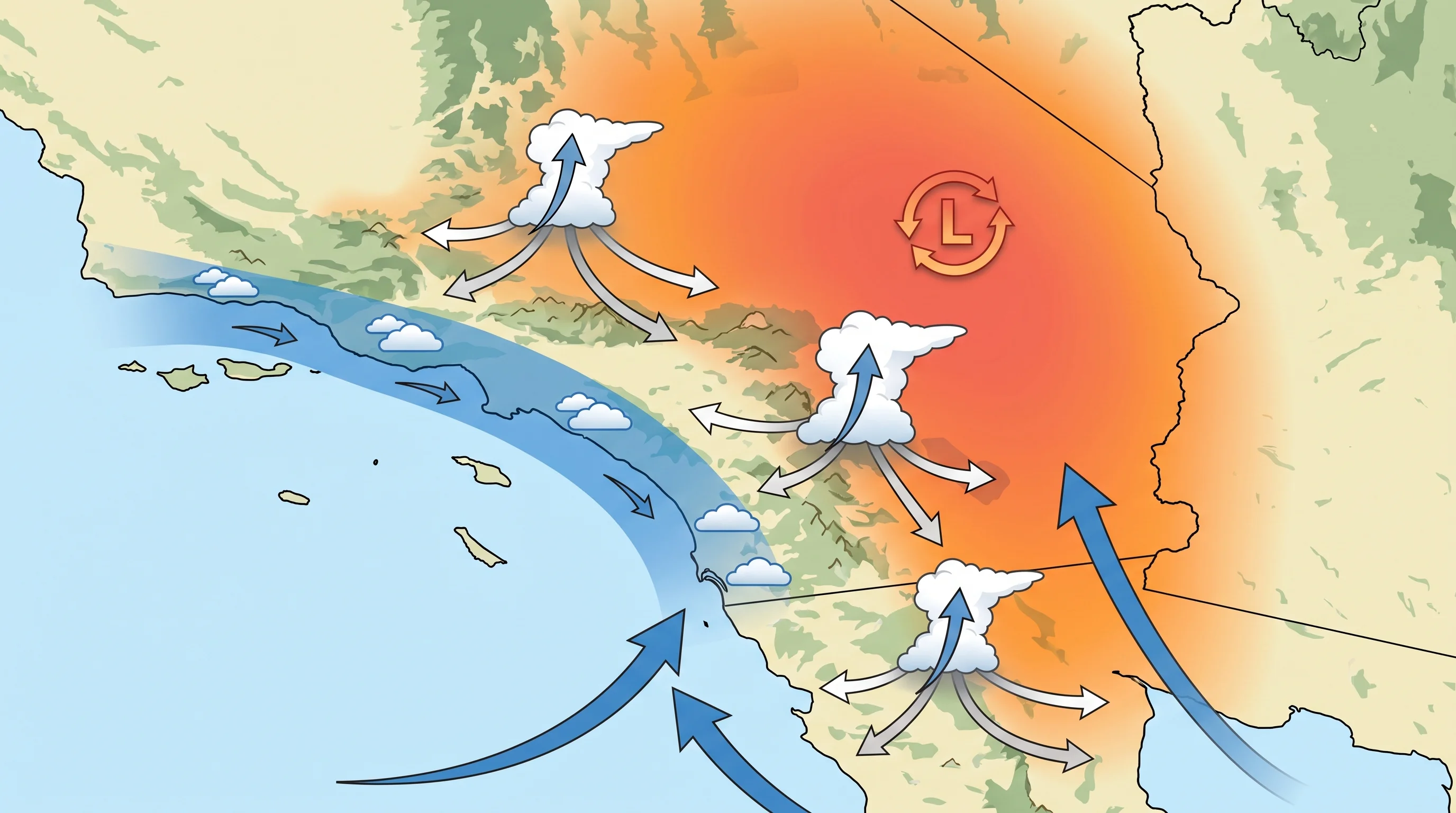
The North American monsoon is a seasonal reversal of the prevailing winds over northwestern Mexico and the U.S. Southwest that replaces late spring's dry, sinking air with moister, more unstable summer air. As desert ground heats under the summer sun, low pressure builds over the Southwest and northern Mexico. That heat low draws in moisture from the surrounding water, replacing the dry, sinking air of the rest of the year.
"Monsoon" means the seasonal reversal of wind and moisture source, not a single storm. The National Weather Service uses the word the same way across Arizona, Nevada and northern Mexico: a season-long pattern with separate moisture surges, not daily rain. Southern California sits at the northwestern edge of the monsoon, so it gets lighter, more scattered thunderstorms than Tucson and Phoenix, where monsoon storms are routine.
| Feature | Summer monsoon thunderstorms | Winter Pacific storms |
|---|---|---|
| Moisture source | Gulf of California, eastern Pacific, sometimes Gulf of Mexico | North and central Pacific Ocean, sometimes a tropical plume |
| Typical season | Roughly July through September | Roughly November through March |
| Storm structure | Isolated, cell-based thunderstorms, often one canyon or valley at a time | Broad frontal systems that can soak an entire region at once |
| Duration at one location | Typically 30 minutes to a few hours per cell | Often 12 to 48 hours of periodic rain |
| Dominant local hazards | Flash flooding in washes, lightning, dust outflow | Widespread rainfall flooding, mountain snow, coastal surf and wind |
| Where it hits hardest | Inland deserts: Coachella Valley, Mojave, San Bernardino Mountains | Coast, basin, and mountains fairly evenly, depending on storm track |
Where Does Southern California Monsoon Moisture Come From?
Most monsoon moisture reaching Southern California comes from the Gulf of California, the narrow sea between Baja California and mainland Mexico, where warm water evaporates huge amounts of water vapor in summer. The eastern tropical Pacific is a second, sometimes larger source, especially when a fading tropical storm or hurricane off Mexico sends a deep plume of moisture north. Gulf of Mexico moisture occasionally circles around the high pressure system over the Four Corners, but that path matters more for Arizona and New Mexico.
Which source dominates depends on the monsoon high, the ridge of high pressure that usually sits over the Southwest in summer. When the ridge shifts west or north, southerly and southeasterly winds on its western side carry Gulf of California moisture into the Colorado Desert and Coachella Valley. When it sits farther east, Southern California often stays dry for days or weeks. That is why monsoon moisture arrives in surges, not steadily all summer.
When Is Monsoon Season in Southern California?
Monsoon season in the Southwest runs roughly July through September, and Southern California's desert thunderstorms cluster in July and August. Some years bring an early surge in late June, and others stay dry into August if the monsoon ridge sits in the wrong place. Arizona uses a fixed June 15 to September 30 period for official monsoon statistics. The National Weather Service offices covering Southern California's deserts, including San Diego for the Coachella Valley and Los Angeles/Oxnard for the Antelope Valley, watch the same general window.
Within the season, moisture surges, sometimes called monsoon bursts, last a few days to a couple of weeks before dry, sinking air returns. A humid, stormy week can be followed by ten days of clear desert sky. Treat monsoon season as a period of higher odds for afternoon storms, not daily rain, and check the current forecast for dew point and instability on any given day.
Why Do Palm Springs and Joshua Tree See More Storms Than LA?
Palm Springs and Joshua Tree get far more monsoon thunderstorms than coastal Los Angeles because they sit closer to the moisture source, heat up more during the day and have mountains nearby that push air upward. The Coachella Valley and the high desert around Joshua Tree also lie beyond the cool marine layer that covers the Los Angeles Basin most summer mornings. Desert air can become unstable and build thunderstorms by early afternoon, which coastal air rarely does.
Terrain lift matters as much as heat and moisture. The San Jacinto, San Bernardino and Santa Rosa Mountains around the Coachella Valley force moist air upward, which often turns humid air into thunderstorms. Coastal Los Angeles, including Downtown Los Angeles and Pasadena, misses out twice. The marine layer limits the surface heating that destabilizes desert air, and monsoon moisture arrives from the southeast, so the deserts and mountains wring much of it out before it reaches the basin.
Inland valleys like Woodland Hills occasionally catch the edge of a strong monsoon surge. Usually that means high clouds or a stray thunderstorm, not the deserts' daily afternoon storm cycle.
How Is Monsoon Moisture Different From an Atmospheric River?
Monsoon moisture and an atmospheric river come in different seasons, move differently and cause different hazards. An atmospheric river is a long, narrow plume of water vapor carried across the Pacific by the jet stream. It usually arrives in the cool season and brings widespread rain or mountain snow for a day or two. The North American monsoon pulls moisture north from the Gulf of California and eastern Pacific near the ground and feeds scattered, individual summer thunderstorms instead of a broad, steady rain.
The practical difference is scale and predictability. Forecasters usually see an atmospheric river days ahead, and it affects a wide area at once, like the storms in Pineapple Express storms, steered by the winds described in how the jet stream steers California's storms. A monsoon thunderstorm can form and strengthen within hours over one canyon and miss a town a few miles away. Monsoon rain is therefore hard to forecast for a specific address.
Both can lower barometric pressure as a storm approaches, as what is barometric pressure explains. A monsoon thunderstorm usually causes a sharper, more local swing than a frontal storm crossing the basin.
What Should Desert Visitors Monitor During Monsoon Season?
Desert visitors in monsoon season should check dew point, radar and active alerts before leaving, not just the sky at the trailhead. A clear, dry morning can still produce a dangerous afternoon storm once dew points rise and heat destabilizes the air. No clouds at 9 a.m. does not mean safe all day.
Four hazards matter most. Flash flooding is often the most dangerous, because a storm over a distant canyon can send fast water down a wash that looks dry where you stand; see why Palm Springs washes fill so fast. Lightning is a close second and can strike well ahead of the rain. Lightning safety guidance for Southern California says to leave exposed ridges and open desert as soon as you hear thunder.
Outflow winds from a collapsing thunderstorm can raise blowing dust with little warning, as dust storms and desert weather in Southern California explains. Before any desert trip in July, August or September, check the National Weather Service forecast discussion, radar and any Flash Flood Warning or Severe Thunderstorm Warning for your whole route, not just your destination. For how monsoon storms flood desert washes, see flash flooding in Joshua Tree.
The monsoon is a real part of Southern California's summer climate, not a borrowed Arizona term. It explains why a Joshua Tree hike that starts under clear blue sky can end with thunder over the Little San Bernardino Mountains by mid-afternoon, while the coast stays calm. Before a summer desert trip, check dew point, radar and alerts on WeatherLA's forecast pages for Palm Springs and Joshua Tree. A clear morning is a starting point, not a forecast.