floodingsafetysevere weathercity guide

Why Palm Springs Washes Flood So Fast

By WeatherLA|Published |Last updated |8 min read
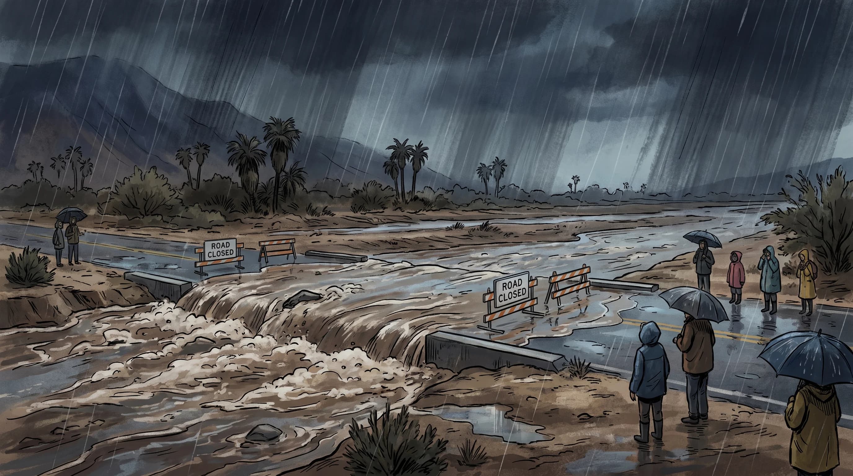
Dark rain shafts over the San Jacinto Mountains feeding a broad muddy wash across the Palm Springs alluvial fan, with a wash crossing closed well ahead of the rising water

Key Takeaways

  • Palm Springs averages under 6 inches of rain a year, but flash flooding depends on rainfall rate and steep upstream terrain, not the annual total, so a dry climate can still produce a dangerous flood.
  • Canyons draining the San Jacinto Mountains lose thousands of feet of elevation in just a few miles, so runoff reaches the Coachella Valley floor as a fast pulse of water across alluvial fans and washes.
  • Summer monsoon flash floods come from isolated, hard-to-forecast thunderstorm cells that can dump heavy rain on a canyon while the valley floor stays dry, unlike broader winter storms that soak the whole region.
  • Wash crossings such as those on Palm Springs and Coachella Valley roads are dangerous because floodwater can arrive from a storm you cannot see, hide changing depth under muddy water, and erode pavement beneath the surface.
  • Flood debris in the Coachella Valley is typically rock, sand, and scoured vegetation from desert washes rather than the wildfire ash and mud common in coastal Southern California debris flows.
  • Before crossing the valley during a desert storm, check the NWS San Diego office for Palm Springs-area warnings, upstream radar over the San Jacintos, and local wash-crossing or road closures rather than relying on the sky overhead.

Palm Springs can flood fast because intense, short-duration rain on the steep San Jacinto Mountains sheds almost immediately onto the alluvial fan the city sits on, filling normally dry washes with fast-moving water in a matter of minutes. It has little to do with how much rain the desert gets over a year and everything to do with how quickly a storm cell drops water on bare, steep terrain just above town. That is why Palm Springs and the surrounding Coachella Valley can go from dust-dry to a closed wash crossing within an hour, even in one of the driest climates in Southern California.

Why can Palm Springs flood when annual rainfall is low?

Flash flood risk tracks rainfall intensity and upstream terrain, not the yearly total. Palm Springs averages under 6 inches of precipitation a year, one of the lowest annual totals tracked by the National Weather Service San Diego office, which forecasts for the Coachella Valley. That low annual figure describes an average spread across dozens of mostly dry weeks, not the behavior of any single storm. A single summer thunderstorm cell or a winter atmospheric river can drop a meaningful fraction of that entire yearly total in an hour or two directly over the San Jacinto Mountains, and the desert floor below has almost no capacity to absorb that water once it starts moving.

The terrain compounds the problem. Bare granite slopes and thin desert soils in the San Jacinto and Santa Rosa Mountains generate runoff much faster than a forested or well-vegetated watershed would, because there is little plant cover or organic soil to slow the water down or soak it in. A storm that would be unremarkable in a wetter, greener landscape can produce a genuine flash flood once it falls on this kind of exposed, steep desert relief.

Two Ways a Coachella Valley Storm Can Flood Palm Springs
Storm typeTypical seasonFootprintMain flood hazard
Monsoon thunderstorm cellRoughly July through SeptemberIsolated, one canyon or wash at a timeSudden wash rises with little or no local rainfall as a warning sign
Winter atmospheric river or troughRoughly November through MarchBroad, covers the whole Coachella ValleyLonger, more widespread runoff across multiple washes at once

How does San Jacinto runoff reach the valley floor?

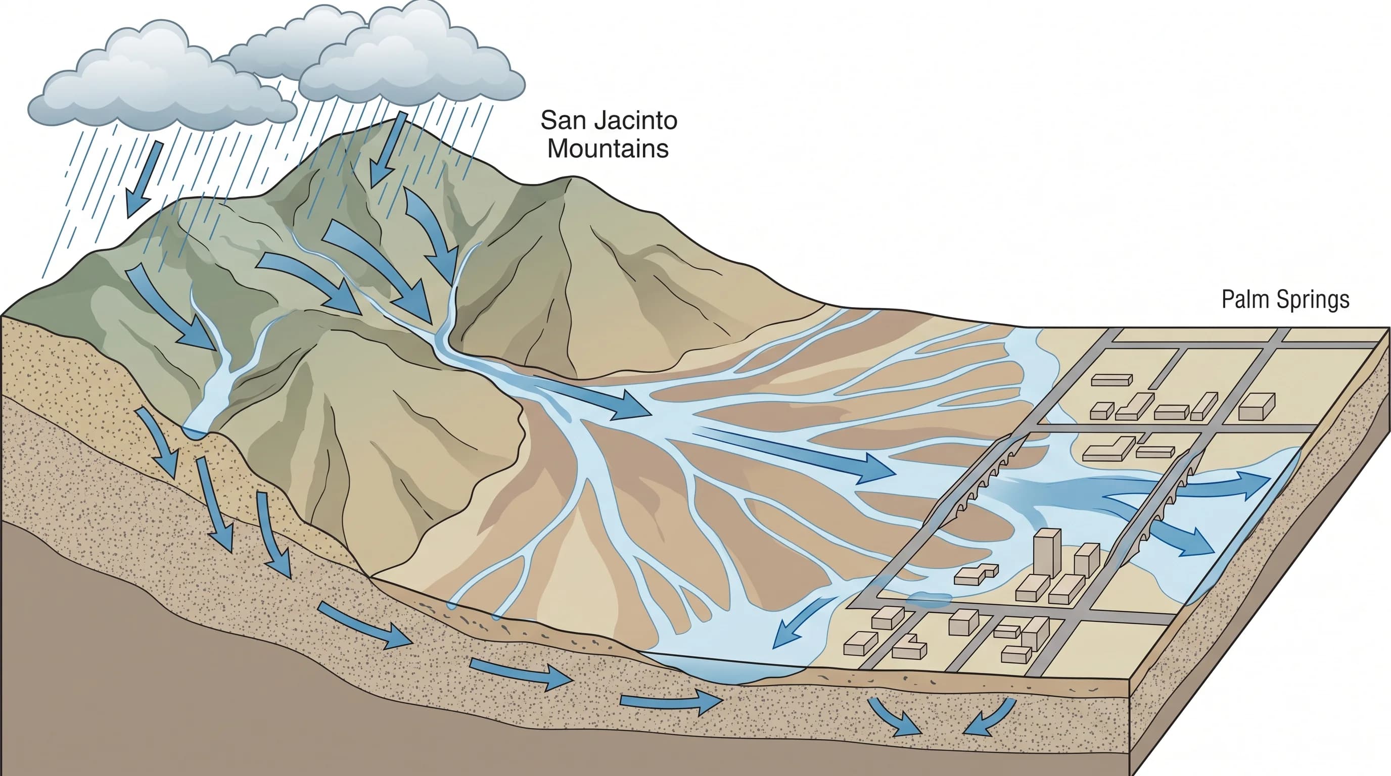
Water falling in canyons on the eastern face of the San Jacinto Mountains drops thousands of feet in only a few miles before it ever reaches the valley floor. That steep gradient is the core reason runoff arrives in town so quickly. As the water leaves the canyon mouths, it spreads out across the alluvial fans, the gently sloped aprons of sediment that Palm Springs and neighboring Cathedral City and Rancho Mirage are largely built on. These fans were shaped by exactly this kind of runoff over thousands of years, which is part of why development on them still crosses active desert washes rather than avoiding them entirely.

Once runoff leaves the canyon mouth and spreads across the fan, it concentrates again into defined washes, engineered flood control channels, and low points in streets and underpasses as it crosses the developed valley floor. Because the vertical drop from mountain crest to valley floor is so large relative to the horizontal distance, the lag between a heavy downpour high in the San Jacintos and rising water at a Palm Springs wash crossing can be well under an hour, sometimes closer to the response time described for the broader Los Angeles Basin in flash flooding in Los Angeles, even though the two areas sit on opposite sides of the mountains and flood for somewhat different reasons.

A mountain-to-desert fan cross-section showing canyon runoff from the San Jacinto Mountains spreading into washes that intersect streets, bridges, and developed valley areas of Palm Springs
Runoff dropping off the San Jacinto Mountains loses thousands of feet of elevation in a few miles before spreading across the alluvial fan and concentrating into washes that cross Palm Springs streets.

What is different about a monsoon flash flood?

Monsoon flash floods come from isolated, often intense thunderstorm cells rather than the broad, steady systems that soak the whole region in winter. The North American Monsoon brings a seasonal shift in moisture and wind pattern to the Southern California deserts roughly from July through September, favoring the kind of afternoon and evening thunderstorm cells the National Weather Service San Diego office tracks each summer over the Coachella Valley and surrounding mountains. A deeper look at how this seasonal pattern forms and why it targets the SoCal deserts is covered in what is the monsoon.

These monsoon cells are notoriously local. One canyon can receive a heavy, flooding downpour while a wash just a few miles away, or the Palm Springs valley floor itself, stays completely dry. That makes monsoon flooding harder to forecast with precision than winter storms, and it means a wash can rise with little or no warning from the sky directly overhead if the rain fell upstream instead. Monsoon storms also frequently bring lightning and blowing dust ahead of the rain, two additional hazards that a broader winter atmospheric river or trough usually does not pair with flooding in the same way.

Winter systems, by contrast, tend to be less locally intense but cover far more of the valley at once, which can mean multiple washes rising on the same afternoon rather than a single isolated crossing.

Why are wash crossings a recurring travel hazard?

Wash crossings are dangerous because the water reaching them may have fallen from a storm cell miles upstream in the mountains, so a crossing can flood with no rain falling at that exact spot. A driver watching clear sky overhead in Palm Desert or Thousand Palms has no direct way to know that a canyon feeding their route is already running.

Muddy, fast-moving water also hides its own depth. What looks like a few inches of sheet flow across a road can conceal a deeper channel, a scoured section of pavement, or debris sitting just beneath the surface, and the color and speed of the water make it effectively impossible to judge from a vehicle. Because many desert wash crossings are the only route across a drainage for some distance, a driver who commits to crossing has often given up their nearest alternate path, which is part of why local agencies close these crossings proactively rather than waiting for water to be visibly deep.

Can debris arrive with the flood water?

Yes, and it typically looks different from the ash-heavy debris flows more familiar in coastal Southern California. Desert flash floods in the Coachella Valley commonly carry rock, gravel, sand, and scoured brush pulled directly from the wash channel itself, since the granitic San Jacinto and Santa Rosa Mountains shed a steady supply of loose sediment that fast water can move in large quantities. This sediment load can bury a road surface, damage a vehicle's undercarriage, and reshape the exact path a wash takes from one storm to the next, which is one reason a wash crossing that was fine last month should not be assumed safe today.

A wildfire burn scar upstream can add ash and mud to that mix and make runoff even more dangerous, similar to the debris-flow risk described by the USGS Landslide Hazards Program, but the baseline desert wash hazard around Palm Springs does not require a recent fire to be dangerous. Rock and sand alone, moving with enough water behind them, are enough to close a road and damage property.

What should a desert driver check before crossing town?

Start with an active warning rather than the sky outside your window. The National Weather Service San Diego office issues Flash Flood Warnings for the Coachella Valley, including Palm Springs, and its products describe the affected washes and expected timing more precisely than a general forecast icon can. Pair that with current radar centered on the San Jacinto and San Bernardino Mountains, since that is where the rain that will reach a Palm Springs wash is actually falling, not necessarily over the city itself.

Next, check for local wash and road closures from the City of Palm Springs and Riverside County before you drive, along with Caltrans QuickMap for state highway status if your route includes a state route through the valley. The NWS flood safety guidance is unambiguous on the core rule: never drive into a flooded wash or roadway, since depth and current are both impossible to judge accurately from inside a vehicle. A crossing that was open when you left home can close within the hour during an active monsoon cell or winter storm, so the right habit is to check your exact route again immediately before you leave, not to rely on conditions from earlier in the day.

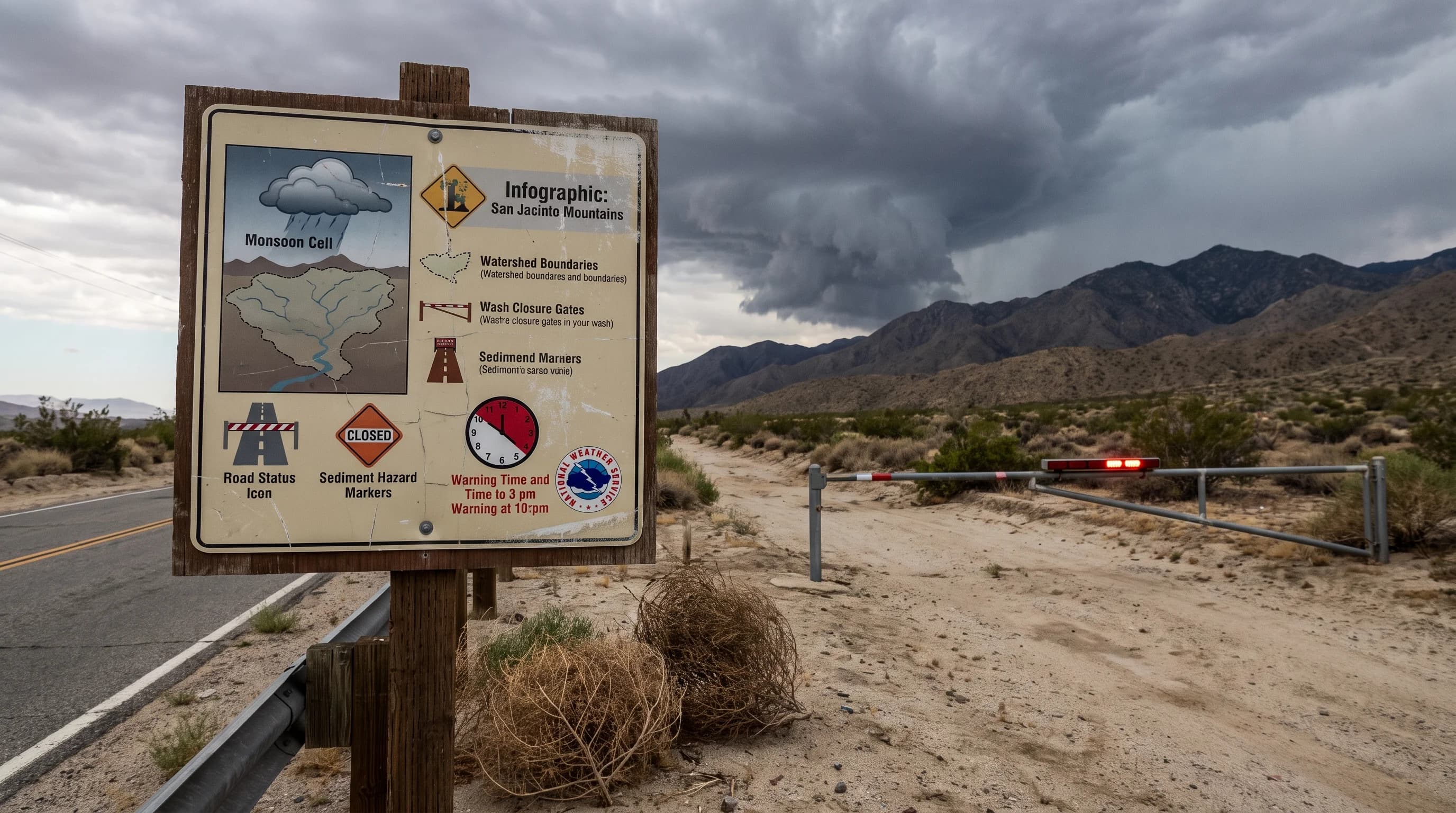
A Palm Springs travel panel combining monsoon cell position over the San Jacinto Mountains, upstream watershed boundaries, wash closure gates, road status icons, sediment hazard markers, and NWS warning timing
Before crossing the Coachella Valley during a desert storm, check the upstream watershed and an active NWS warning rather than just the sky over Palm Springs itself.

Palm Springs will keep looking dry most days of the year, and that is the trap. The desert does not need a wet climate to flood fast; it needs one intense storm cell over the right canyon, and the San Jacinto Mountains supply the steep terrain to turn that rain into a wash-filling pulse of water within an hour. Before you plan a drive across the Coachella Valley during monsoon season or a winter storm, check WeatherEscape's Palm Springs forecast alongside the current NWS warning status, and treat any active flash flood warning as a reason to wait, not a detail to work around.

Frequently Asked Questions

Why can Palm Springs flood when annual rainfall is low?

Flash flooding depends on how fast rain falls and how quickly steep terrain sheds it, not on how much rain a place gets over a year. Palm Springs averages under 6 inches of annual precipitation, among the driest climates the National Weather Service tracks in Southern California, but a single monsoon cell or winter atmospheric river can drop an intense burst of rain on the San Jacinto Mountains above the city. That water runs off bare, steep slopes with little soil to absorb it, so a dry annual average and a fast local flood are not contradictory.

How does San Jacinto runoff reach the valley floor?

Rain falling in canyons on the eastern face of the San Jacinto Mountains drops thousands of feet in only a few miles before spreading out onto the alluvial fans that Palm Springs and the western Coachella Valley are built on. That runoff concentrates into washes, engineered channels, and low-lying streets as it crosses the developed valley floor, often reaching populated areas within an hour or two of heavy rain in the mountains above.

What is different about a monsoon flash flood?

The North American Monsoon brings isolated, often intense thunderstorm cells to the Southern California deserts roughly from July through September, and these cells can dump heavy, short-duration rain on one canyon while leaving the rest of the valley dry, according to the National Weather Service. That makes monsoon flooding harder to forecast precisely than the broader, more predictable winter storms that can soak the entire Coachella Valley at once, and it means a wash can rise even when the sky above Palm Springs itself looks clear.

Why are wash crossings a recurring travel hazard?

Wash crossings are dangerous because the water arriving at a crossing may have fallen from a storm miles upstream in the San Jacinto or San Bernardino Mountains, so the road can flood with no rain falling locally. Muddy, fast-moving water also hides its true depth and can conceal pavement damage or scour beneath the surface, and once a driver is committed to a low crossing there is often no alternate route around it.

Can debris arrive with the flood water?

Yes. Desert flash floods commonly carry rock, sand, gravel, and uprooted vegetation scoured from canyon washes, and this sediment load can bury roads, damage vehicles, and change the shape of a wash channel from one storm to the next. This differs from the ash-heavy post-fire debris flows more common in the coastal Los Angeles Basin, since Coachella Valley debris is primarily granitic rock and sand from the San Jacinto and Santa Rosa Mountains rather than burned watershed material, though a local burn scar can still add ash and mud to the mix.

What should a desert driver check before crossing town?

Check for an active Flash Flood Warning from the National Weather Service San Diego office, which covers Palm Springs and the Coachella Valley, along with current radar over the San Jacinto and San Bernardino Mountains rather than just the sky above your location. Also check the City of Palm Springs and Riverside County for wash closures and Caltrans for state highway status before driving, since a route that was open an hour earlier can close quickly during an active storm.

Why do desert washes around Palm Springs and the Coachella Valley flood so rapidly?

Desert washes flood rapidly because they are dry channels shaped by infrequent but powerful flows, sitting downstream of steep, largely bare mountain watersheds that generate runoff far faster than the desert floor can absorb it. With little vegetation or soil structure to slow the water and a significant elevation drop concentrated over a short distance, a wash that has been dry for months can carry a dangerous flow within minutes of intense rain upstream.

Is Palm Springs flash flooding the same as a Los Angeles flash flood?

The basic mechanism, intense rain overwhelming drainage or running off steep terrain faster than people can react, is the same, but the local pattern differs. Palm Springs sits in a low-desert basin fed primarily by San Jacinto and Santa Rosa Mountain watersheds and sees a distinct summer monsoon season, while coastal Los Angeles floods more often from broad winter storms and post-fire debris flows off the San Gabriel and Santa Monica Mountains. For the citywide Los Angeles mechanism, see flash flooding in Los Angeles.

Related Destinations

Live Los Angeles Conditions

Compare temperature, wind, clouds, and comfort across the map.

See which microclimates are clear, cool, windy, smoky, or warming up right now.

Open the Weather Map
Destinations☀️Smog Forecast🌫️Smog Heat Map🔒Privacy Policy📄Terms of Service