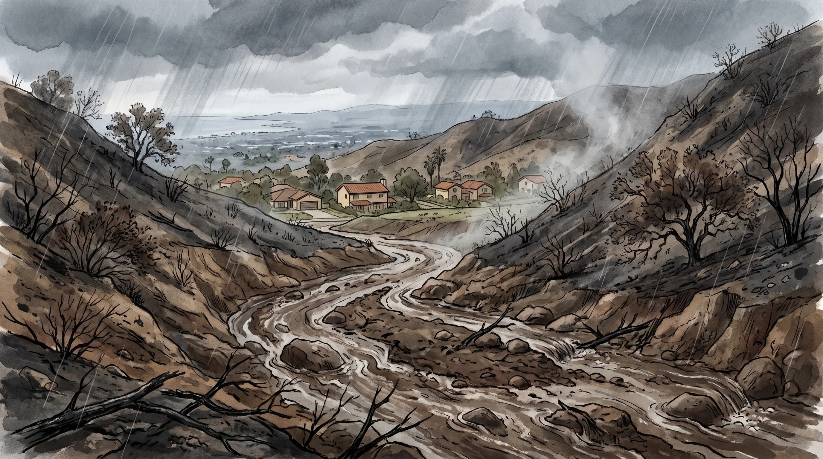
A post-fire debris flow is a fast, dense slurry of water, ash, soil, rock and vegetation that surges off a burned Southern California hillside within minutes of an intense burst of rain. Debris flows often move faster than a person can run.
A short, hard downpour on a steep, recently burned slope above Altadena or Topanga is enough to trigger one, because fire removes the plants and soil structure that hold water and sediment in place. The National Weather Service and the U.S. Geological Survey rank debris flows among the most dangerous hazards after a Southern California wildfire.
What Is a Post-Fire Debris Flow?
A post-fire debris flow is a fast-moving mixture in which ash, loose soil, gravel, boulders and uprooted plants make up a large share of the volume, carried by water down a burned watershed. That high solid content separates a debris flow from a flood. A debris flow moves like wet concrete, thick enough to carry boulders and tree trunks and strong enough to destroy homes, cars and roads.
Debris flows move fast. Once a burned channel fails, the slurry speeds up to many miles per hour within minutes and reaches homes and roads at the canyon mouth before residents can react. That is why the USGS Landslide Hazards Program and local emergency managers tell residents to evacuate before the rain arrives, not during it. For how the fire itself can behave, see what is a fire whirl.
| Feature | Debris flow | Mudslide | Flash flood |
|---|---|---|---|
| Material | High concentration of rock, soil, ash, and vegetation | Water-saturated soil and mud | Dominated by water, with less solid material |
| Typical trigger | Short burst of intense rain on a steep, often recently burned slope | Prolonged rain saturating soil on a vulnerable slope, fire not required | Rainfall rate exceeding what a channel, storm drain, or surface can carry |
| Speed | Very fast, can reach many miles per hour within minutes | Often slower and more gradual, though it can accelerate | Fast, but generally water rising rather than solid surge |
| Path | Concentrated in a defined channel or canyon | Can move across an open slope, not always channelized | Follows channels, streets, storm drains, and low ground |
| Role of fire | Central; burn severity directly controls susceptibility | Not required, though a burn scar can contribute | Not required, can happen with or without a burn scar |
Wildfire-caused debris flows are the focus here. For slope failure on rain-soaked hillsides with no recent fire, see mudslides in Los Angeles: why the hills give way after rain. For street and channel flooding away from burn scars, see flash flooding in Los Angeles: why it floods so fast. For flooding below burned slopes in Ventura County, see flash flooding in Ventura.
Why Does a Burned Slope Fail So Quickly?
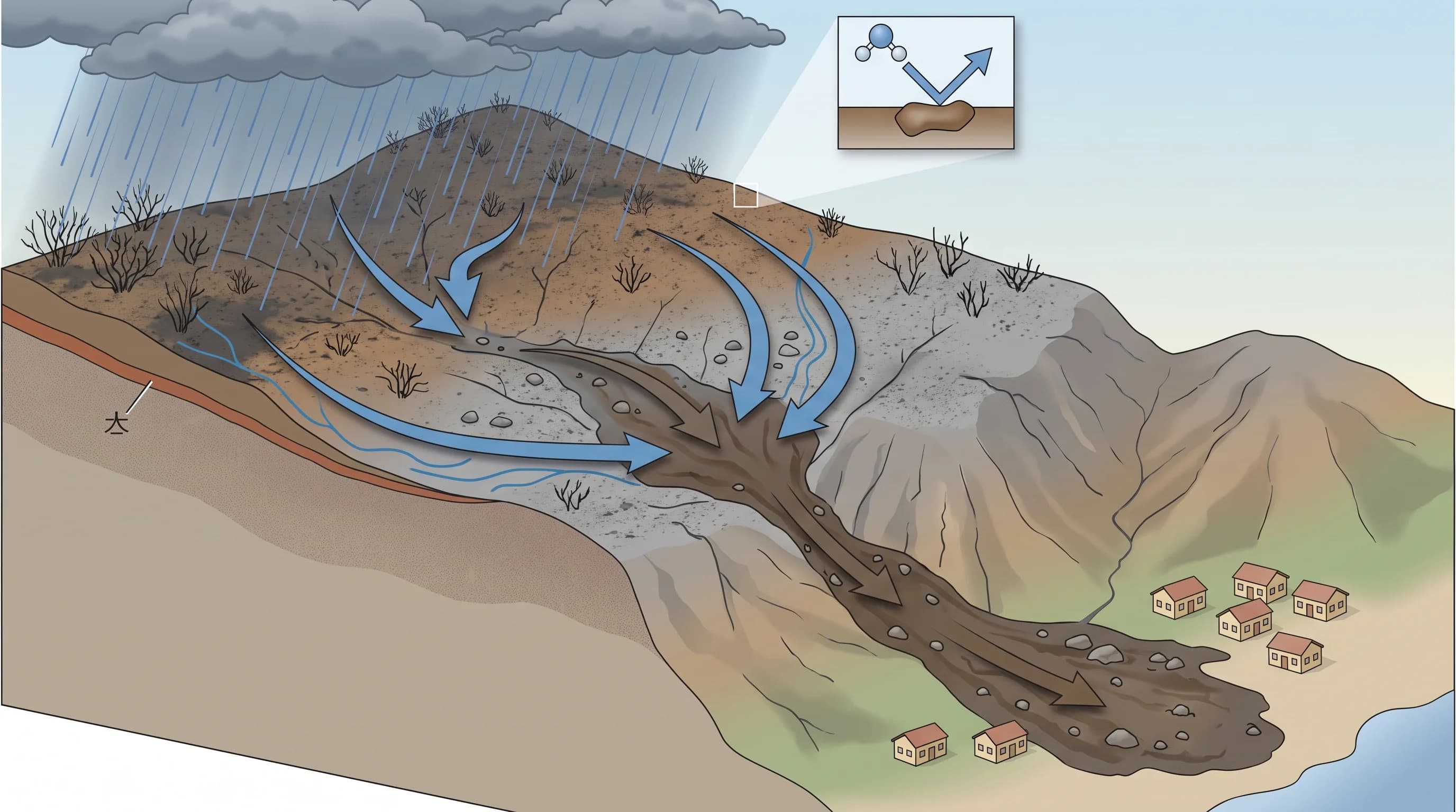
A burned slope fails quickly because wildfire removes the plants and absorbent topsoil that normally slow rainfall down. Live plants catch part of the rain before it reaches the ground, and roots bind the soil to the slope. After a fire, rain hits bare soil directly and starts moving downhill right away.
Fire also changes the soil. Intense heat vaporizes organic material in the leaf litter, and the vapor condenses on soil particles a few centimeters down, coating them in a waxy film. The result is a water-repellent, or hydrophobic, soil layer that sheds water instead of absorbing it. Rain runs off a burned slope much faster than an unburned one and collects quickly in steep channels, picking up ash and loose sediment.
Three factors decide how likely a burned slope is to produce a debris flow: burn severity, watershed shape and rainfall intensity. Burn severity controls how much vegetation and soil structure was lost.
Steep, funnel-shaped drainages concentrate runoff faster than broad, gentle terrain. Rainfall intensity is the trigger: a steep, badly burned watershed stays quiet if the rain never falls hard enough. That is why forecasters watch short-term rainfall rates, not storm totals.
How Much Rain Can Trigger a Debris Flow?
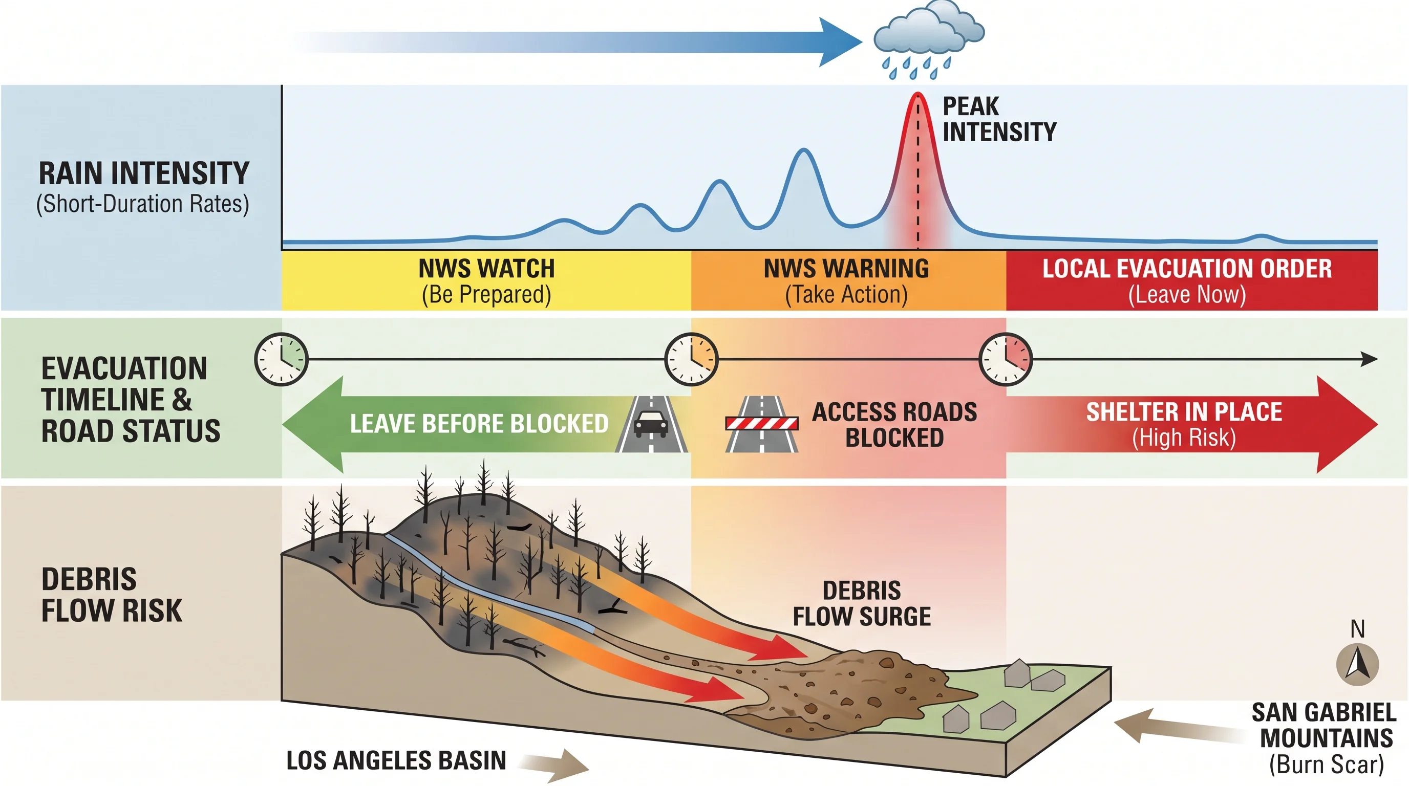
No single statewide rainfall amount triggers a debris flow, because the trigger is rainfall intensity over a short window, usually 15 minutes to an hour. A steady inch of rain over a full day is far less dangerous on a fresh burn scar than an inch in 15 minutes. Ordinary flood forecasting leans more on total storm rainfall.
The USGS Landslide Hazards Program publishes debris-flow likelihood and rainfall-intensity assessments for individual fire areas, based on burn severity, slope and soil type. A step-by-step guide to its viewer is in Los Angeles flood risk maps. The NWS Los Angeles/Oxnard office and the NWS San Diego office combine those assessments with radar and forecast rainfall rates, including guidance from the Weather Prediction Center. When rain rates approach a burn area's threshold, they issue Flash Flood Warnings that name debris flow for that burn area.
A reliable rainfall threshold for a fire scar names the fire, the time interval and the issuing agency. A number without those details, or one taken from a different fire, does not apply to your location.
Which Southern California Places Face the Greatest Risk?
The greatest debris-flow risk is on steep, recently burned watersheds whose canyons drain toward roads, neighborhoods or infrastructure. Risk is highest in the first one to two rainy seasons after a fire, before plants and roots recover. The risk fades as ground cover returns, but it does not end when the fire is contained. Foothill communities below the San Gabriel and Santa Monica Mountains, including Altadena, La Cañada Flintridge and canyon communities such as Topanga, face the most direct threat because steep burned canyons drain straight into them.
Debris-flow risk follows specific fire scars, not a fixed list of towns. To assess an area, check the current USGS debris-flow hazard assessment for the most recent nearby fire and the county evacuation zone maps. A steep neighborhood with no recent fire has low debris-flow risk. A neighborhood below a fire from the last season or two carries elevated risk regardless of its reputation.
Santa Clarita and Woodland Hills both sit near canyon outlets and foothills that have burned in past decades. Both show why the current fire-specific hazard map matters more than general geography. For foothill canyon flooding, see flash flooding in Pasadena.
How Is a Debris Flow Different from a Mudslide or Flash Flood?
A debris flow, a mudslide and a flash flood often occur in the same storm, but they differ in material, trigger and speed. A debris flow carries a high concentration of rock, soil, ash and plants through a defined channel. It is triggered by short bursts of intense rain on steep terrain, most dangerously on a recent burn scar. A mudslide is a broader public term for water-soaked soil and mud sliding down a vulnerable slope.
A mudslide does not require fire, can move across an open hillside instead of a channel and is often slower than a debris flow. Rain-soaked slope failure without wildfire is covered in mudslides in Los Angeles: why the hills give way after rain.
A flash flood is mostly water, not solid material, and needs no slope failure or burn scar. A flash flood happens when rain falls faster than a channel, storm drain or paved surface can carry it away, including on flat city streets. Flash flooding in Los Angeles: why it floods so fast explains that process.
One intense storm cell over a burned canyon can cause a debris flow at the canyon mouth and a flash flood in a storm drain a few blocks away at the same time. For that reason, National Weather Service warnings now name debris flow specifically for a burn scar instead of relying on a general flood warning.
What Should Residents Do Before Heavy Rain?
Before heavy rain, residents below or near a recent burn scar should sign up for county emergency alerts and learn their evacuation zone. Debris flows reach a canyon mouth within minutes of the triggering rain. That is faster than officials can issue and deliver evacuation orders once the rain has started.
Southern California's deadliest post-fire debris flow struck Montecito in Santa Barbara County in January 2018, after the Thomas Fire. A short, intense burst of rain on a steep, freshly burned watershed produced a fast, destructive flow with little warning time. California agencies still use Montecito as the reference case for debris-flow urgency. For the event record, use USGS and NWS official summaries.
Watch for a National Weather Service Flash Flood Warning or Watch that names debris flow for a specific burn scar, and treat it as more urgent than a general flood warning. If a warning covers your area, leave before the rain intensifies and before access roads close. Leaving is especially important at night, when a flow is hard to see or hear coming.
Waiting to see a slope fail before evacuating has been fatal in past Southern California debris flows, because the flow arrives within minutes of the rain. The NWS wildfire safety guidance and CAL FIRE publish debris-flow preparedness resources. Both explain how to tell whether your home sits below a recent burn scar and how to read county evacuation notices.
Before a storm reaches a burn area, check four things: the debris-flow warning status, the short-term rainfall-intensity forecast, your evacuation zone and whether your exit route crosses a canyon or drainage that could close. WeatherLA's Los Angeles forecast pages track incoming rain for a specific location, but the official Watch, Warning and evacuation order for your zone decide whether to leave. For why hazards differ between neighborhoods a few miles apart, see why Los Angeles has so many microclimates.