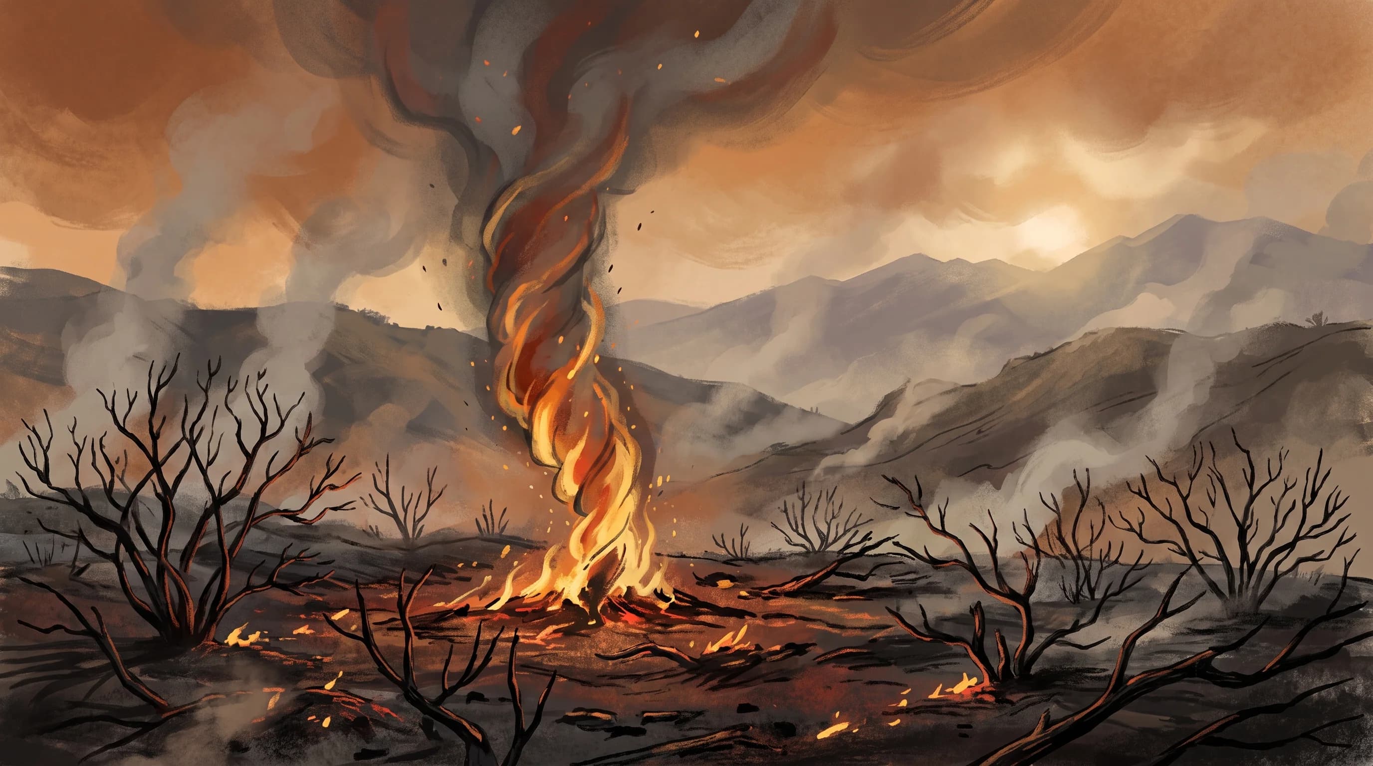
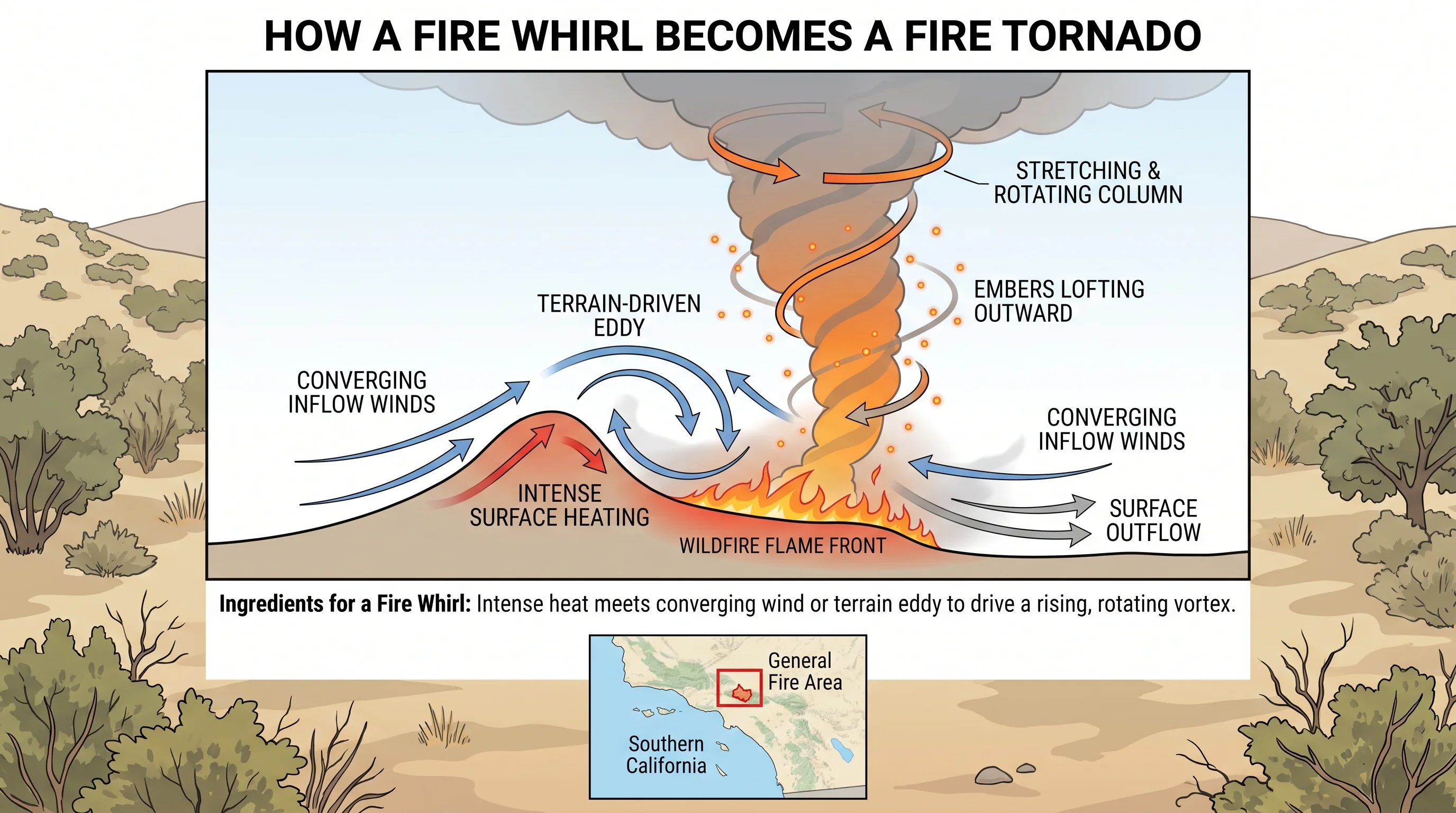
A fire whirl is a spinning column of flame, hot gas, ash and smoke that forms when a wildfire's intense heat meets converging or turbulent surface winds. The heat forces air to rise quickly at the fire's edge.
Where that rising column meets rotating or colliding air, often steered by canyon walls or shifting wind, the spin tightens and stretches upward. Dust devils spin up the same way, fueled by hot pavement instead of flame. Most Southern California fire whirls are small and brief, but a few grow large and destructive enough to count as fire tornadoes.
What Is a Fire Whirl?
A fire whirl is a spinning vortex of flame and hot gases that forms in or beside an active wildfire, pulling burning debris, embers and ash into a visible, often funnel-shaped column. A fire whirl behaves like a small tornado made of fire: air spirals inward and upward, spinning faster as the column stretches, the way a figure skater speeds up by pulling in their arms. Most fire whirls stand a few feet to a few dozen feet tall and last seconds to a few minutes before their spinning inflow runs out.
A fire whirl needs intense, concentrated heat. A wildfire burning through heavy brush or dead timber makes the air above it far lighter than the surrounding air, so it rises fast in a narrow column. That rising column is the engine, and rotation from wind, terrain or the fire itself is the other ingredient.
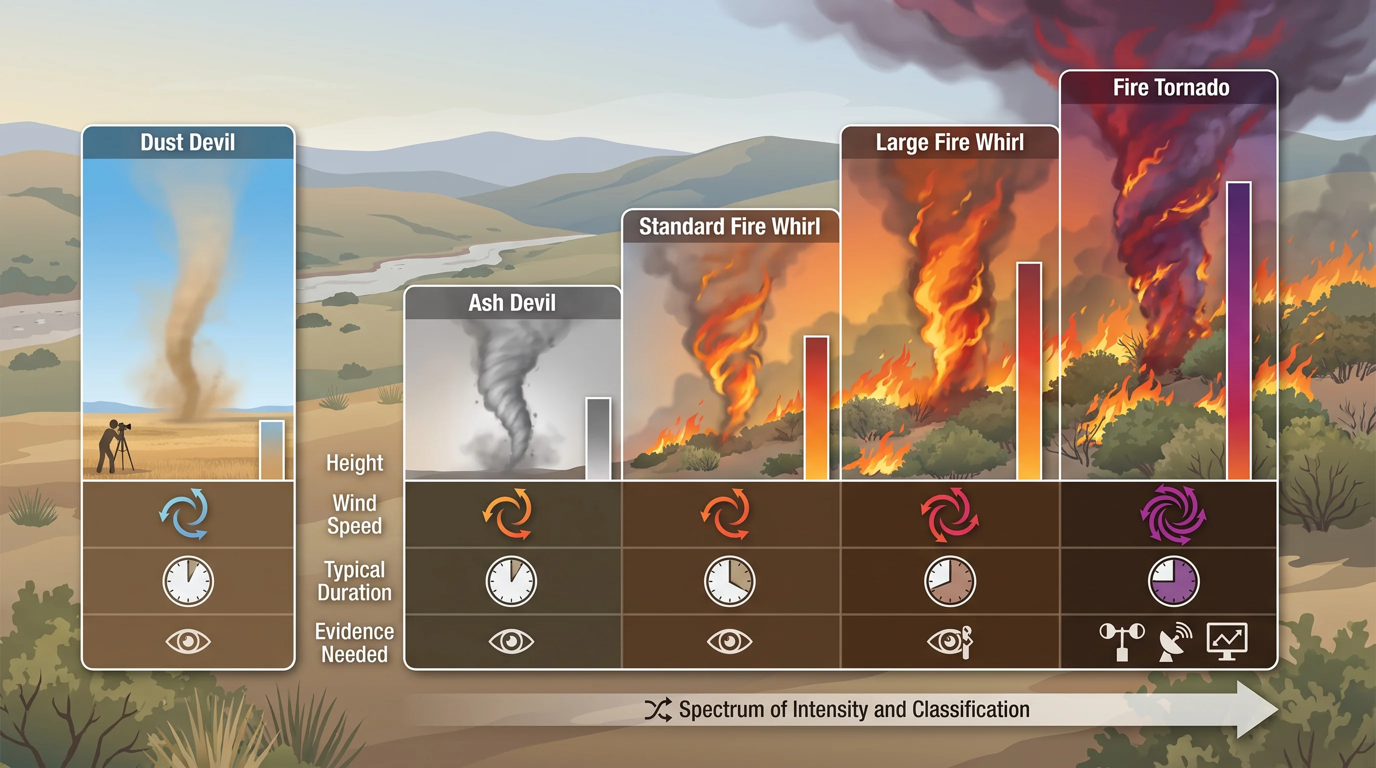
| Category | Typical size | Typical wind speed | Persistence and evidence needed |
|---|---|---|---|
| Ash devil | A few feet tall | Weak, comparable to a dust devil | Seconds; visible from lofted ash over smoldering ground, no flame involvement required |
| Standard fire whirl | Roughly 3 to 100 feet tall | Variable, often well under hurricane force | Seconds to a few minutes; common on active fire lines, documented in fire behavior reports and firefighter observation |
| Large or persistent fire whirl | Up to several hundred feet tall | Can exceed 60 mph | Minutes; capable of throwing embers well beyond the main fire front, tracked by incident command |
| Fire tornado (rare) | Can extend thousands of feet into the smoke column | Tornado-strength, documented over 140 mph in one case | Tens of minutes; requires official meteorological analysis and radar or damage survey to classify |
How Do Heat and Wind Create Rotation?
Heat and wind create rotation when converging surface winds meet a fire's rising column, and no single mechanism explains every fire whirl. Sometimes winds from different directions collide around a fire's edge and start turning, the same way a waterspout spins up over a lake. Sometimes spin already present near the ground, often from wind channeled through a canyon, gets pulled into the fire's updraft and stretched upward, tightening and speeding up.
Terrain matters most in Southern California's canyons and foothills. A lee eddy, the swirl of air on the downwind side of a ridge or hill, can supply the first rotation that the fire's heat then stretches and strengthens.
When two fire fronts, or a main fire and a spot fire ahead of it, burn close together, their competing inflows can collide and spin, a pattern fire behavior analysts watch for. No single ingredient guarantees a fire whirl. Concentrated heat plus a source of rotation from wind shear, terrain or interacting fires turns a plume into a visible vortex.
When Can Southern California Fires Produce Fire Whirls?
Southern California fires produce fire whirls when a fire burns hot enough to drive a strong rising column and the wind or terrain adds rotation. That combination is most common in steep canyons and foothills during the hottest, driest fire weather. Fires in the brush-covered canyons around the Los Angeles Basin, including terrain near Woodland Hills and the foothills around Pasadena, burn in exactly the kind of complex terrain where lee eddies and canyon winds supply rotation.
Afternoon heat makes fire whirls more likely, because peak temperatures strengthen the rise of a fire's plume and surface winds are usually strongest in the afternoon in Southern California's canyons and passes. Wind-driven fires, including those pushed by offshore Santa Ana winds, can produce erratic gusts and fire whirls at any hour once they burn hot enough. For the wind pattern behind many of the region's worst fires, see Santa Ana winds and Los Angeles fire weather.
Why Are Fire Whirls Especially Dangerous?
Fire whirls are dangerous because they move fast, change direction with little warning and throw burning embers well beyond the fire's main front. A whirl's spinning updraft can lift burning branches, pine cones and other debris and carry them hundreds of feet, starting spot fires ahead of the lines crews are trying to hold.
The stronger a fire whirl grows, the more it acts like a separate weather hazard. Large whirls can produce winds strong enough to snap limbs, overturn light vehicles and strip roofs, damage more typical of a weak tornado than a wildfire. A whirl's path and strength can change within seconds, so it cannot be safely watched up close. Incident commanders treat any reported fire whirl as a signal to reassess crew safety and public closures immediately.
Is a Fire Whirl the Same as a Fire Tornado?
A fire whirl is not the same as a fire tornado. Every fire tornado is a fire whirl, but only a rare few fire whirls become fire tornadoes. Researchers use the term fire tornado for a vortex with tornado-strength winds that lasts a long time, often tens of minutes, and connects the ground to a large smoke-and-fire cloud above. Confirming one usually takes meteorological analysis afterward, not just an eyewitness account.
The clearest documented fire tornado formed during the Carr Fire near Redding in Northern California on July 26, 2018. A peer-reviewed study found surface winds above 140 mph, comparable to an EF-3 tornado, and the National Weather Service confirmed damage consistent with that strength along its path. The Carr Fire vortex shows how extreme a fire vortex can become, though it happened far north of Los Angeles.
Nearly all fire whirls, including almost all reported on Southern California fires, stay far weaker and fade within seconds to a couple of minutes. Fire behavior specialists and the regional NWS offices, NWS Los Angeles/Oxnard and NWS San Diego, use the fire tornado label only when evidence supports it.
What Should Residents Do If a Fire Whirl Is Reported?
If a fire whirl is reported, treat it as a sign of dangerous, erratic fire behavior and rely on official incident and evacuation information. Do not try to see, photograph or film it. A fire whirl's path and strength can change within seconds, and getting close puts you in the same ember and sudden-wind zone firefighters avoid.
Respond as you would to any fast-changing wildfire. Follow evacuation orders and warnings for the incident, stay out of closed areas and check official sources instead of social media video. The CAL FIRE incident page for the fire and NWS wildfire safety guidance are the authoritative sources for evacuation status, red flag warnings and extreme fire behavior alerts.
For how fire weather alerts work, including how a fire weather watch differs from a red flag warning, see red flag warning vs. fire weather watch in Southern California. A towering, cauliflower-shaped cloud above a fire is a separate sign of extreme fire behavior, covered in what pyrocumulus clouds are and how wildfires make their own weather. A large foothill fire can spread smoke and ash to neighborhoods far from the flames, including Downtown Los Angeles. After containment, burned hillsides can send mud and debris downhill in winter rain, as debris flows, the deadly mud that follows a SoCal wildfire explains.
A fire whirl is a real, physics-driven hazard, not something to chase for a photo. Most fire whirls on Southern California wildfires are small and brief, but the same heat, terrain and wind can occasionally produce a much larger vortex. Check current wind, red flag and evacuation information on WeatherLA's Los Angeles pages, and follow CAL FIRE and NWS updates for any fire near you.