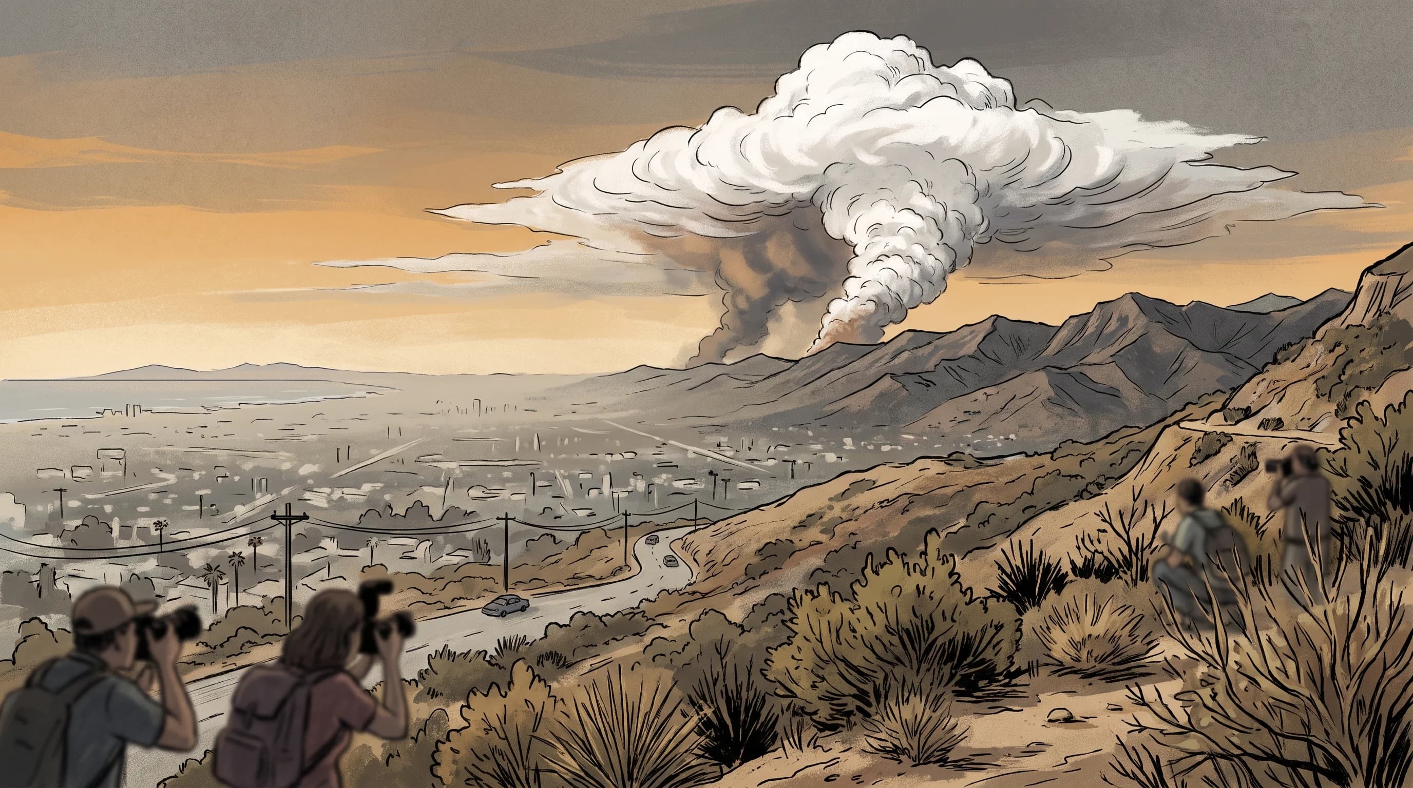
A pyrocumulus cloud forms when a wildfire burns hot enough to lift its smoke plume high into the atmosphere, where the rising air cools until water vapor condenses into a real cloud on top of the smoke. A pyrocumulus is not thick smoke or an ordinary cumulus passing overhead; the fire built it. When the cloud keeps growing, forms ice at its top and produces lightning or rain, fire agencies and the National Weather Service call it a pyrocumulonimbus, a fire-generated thunderstorm. A pyrocumulonimbus is one of the clearest visible signs of extreme fire behavior, and Southern California residents can see one from miles away.
What Is a Pyrocumulus Cloud?
A pyrocumulus cloud is a heaped, cumulus-shaped cloud that forms directly above an intense heat source, usually a wildfire. It forms when the fire's rising column of hot air carries water vapor high enough to cool and condense into cloud droplets. From a distance, a pyrocumulus looks like a dense white or light gray cauliflower-shaped tower rising above darker gray and brown smoke, often billowing upward like a strong afternoon thunderstorm cloud.
A pyrocumulus is condensed water, while a smoke plume is smoke and hot gas spreading with the wind. A pyrocumulus forms the same way as any cumulus cloud, powered by fire instead of sun-warmed ground. The same fire heat can also spin up fire whirls near the ground. For why heavy smoke turns the sky orange, see orange skies over Los Angeles.
The name combines "pyro," for fire, and "cumulus," for the heaped cloud shape. The National Oceanic and Atmospheric Administration and the National Weather Service wildfire safety program use the term for fire-generated clouds above a fire's smoke column. Both separate it from a pyrocumulonimbus, the larger, thunderstorm-producing version described below.
| Feature | Ordinary smoke plume | Pyrocumulus | Pyrocumulonimbus |
|---|---|---|---|
| What it is made of | Smoke and hot combustion gas only | Smoke plus a true condensed water cloud on top | Water cloud with ice, deep vertical development |
| Typical appearance | Gray or brown haze, thins with distance | White cauliflower-shaped tower above dark smoke | Anvil-topped tower, may look like a severe storm |
| Ice or precipitation | None | Rarely, cloud is usually too shallow | Possible virga, light rain, and lightning |
| Lightning risk | None | None to minimal | Can produce cloud-to-ground lightning |
| Fire behavior signal | Fire is producing smoke, intensity varies | Fire is generating strong, sustained convection | Extreme fire behavior, erratic wind and embers possible |
How Does a Wildfire Build Its Own Cloud?
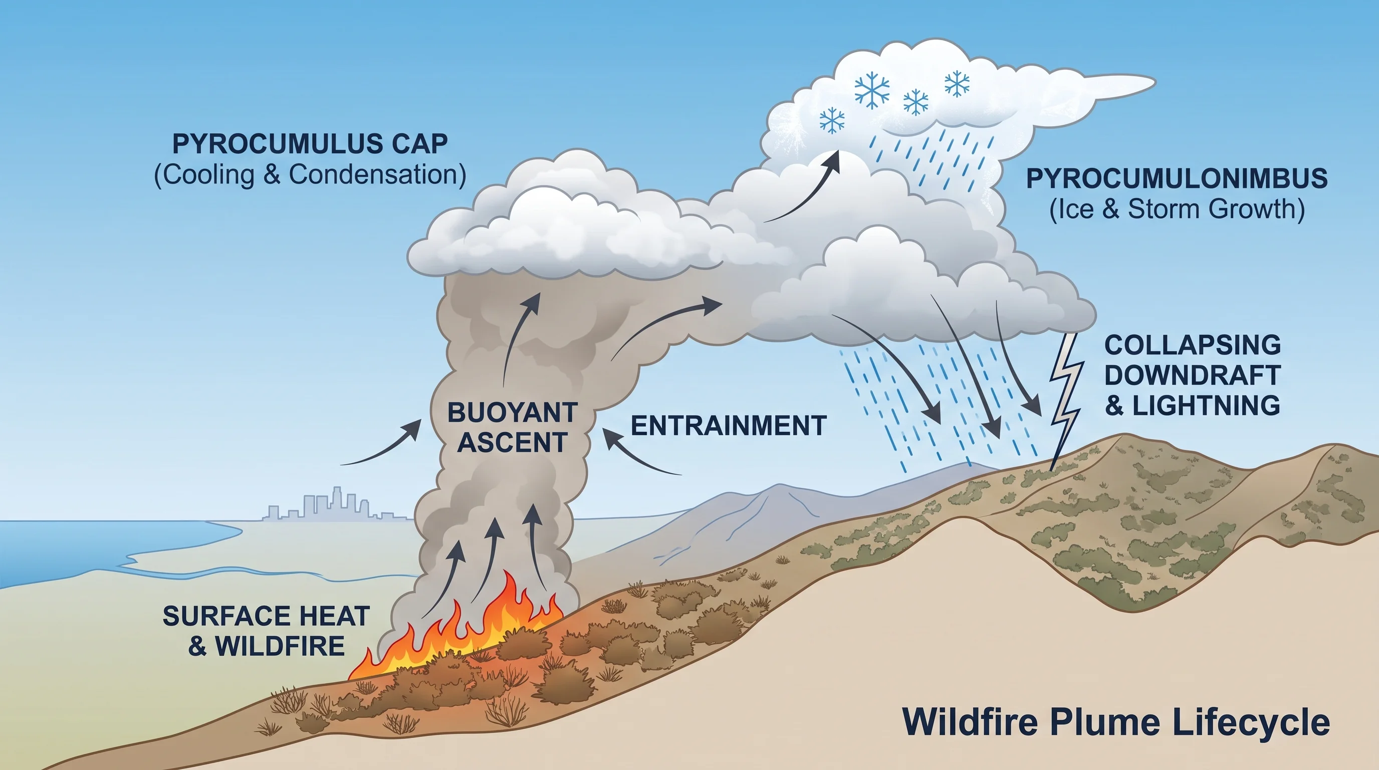
A wildfire builds its own cloud through the same rising-air process behind any cumulus cloud, with the fire supplying the heat instead of the sun. Burning vegetation makes the air above the flames much lighter than the air around it, so it rises fast in a narrow column. As it climbs, the column mixes with cooler surrounding air, which slows and dilutes it while the fire keeps adding heat from below.
The cloud's moisture comes from several sources: water released by burning live plants and damp soil, humidity in the surrounding air pulled into the column and, on humid days, moisture the fire's heat lifts higher than it would otherwise go. The rising column cools at a steady rate with height, like any rising air. At a certain height, the water vapor it carries condenses into visible droplets.
At that height, the smoke plume becomes a cloud, marked by a dense white cap on top of the gray or brown column. A tall, organized column can rise thousands of feet above the fire, and the cloud it builds can be visible tens of miles away.
When Does a Pyrocumulus Cloud Become a Pyrocumulonimbus?
A pyrocumulus becomes a pyrocumulonimbus when it grows tall and cold enough for its top to turn to ice and it can produce lightning, precipitation or both. That is the same threshold that separates a fair-weather cumulus from a thunderstorm, driven here by fire instead of sunlight. Once a fire cloud reaches that stage, the National Weather Service Los Angeles/Oxnard office and NWS San Diego treat it as a fire-generated thunderstorm. It can produce lightning, gusty and erratic outflow winds and sometimes rain that shows on radar.
A mature pyrocumulonimbus behaves like any thunderstorm, including cloud-to-ground lightning that can start new fires far from the original one. Whether a pyrocumulus stays shallow or grows into a pyrocumulonimbus depends on how much heat and moisture the fire keeps supplying, how unstable the surrounding air is and how far the column can grow before wind shear or a drop in fire intensity breaks it up.
Why Can a Fire-Generated Cloud Make a Wildfire More Dangerous?
A large fire-generated cloud makes a wildfire more dangerous by strengthening the wind feeding the fire and, later, by sending down violent, unpredictable wind when it weakens or collapses. While the column rises, it draws surface air toward the fire from all sides to replace the air carried upward. That inflow can strengthen winds at the fire's edge and feed it more oxygen, so the fire burns hotter.
The collapse is often more dangerous. If the cloud loses its lift or upper-level wind tears it apart, the air inside it can crash back down as a strong, erratic downdraft. The downdraft spreads out as gusty, shifting wind that pushes the fire in new directions with little warning. It can also carry burning embers far ahead of the fire front, starting spot fires beyond containment lines. A mature pyrocumulonimbus adds lightning, which can ignite fires where firefighters are not watching.
Not every pyrocumulus grows, collapses or produces lightning. Fire behavior analysts still treat fast, sustained cloud growth over a fire as a warning sign to watch closely.
How Is a Pyrocumulus Cloud Different From an Ordinary Smoke Plume?
A pyrocumulus differs from a smoke plume in its heat source and makeup. A smoke plume is smoke and hot gas rising and spreading with the wind. A smoke plume never condenses into a water cloud, thins with distance and has no real vertical structure. An ordinary cumulus cloud forms without fire, from sun-warmed ground heating the air until it rises and condenses.
A pyrocumulus falls between the two. It needs the fire's heat to start, but the cap on top is a real water cloud, denser and more three-dimensional than the smoke below.
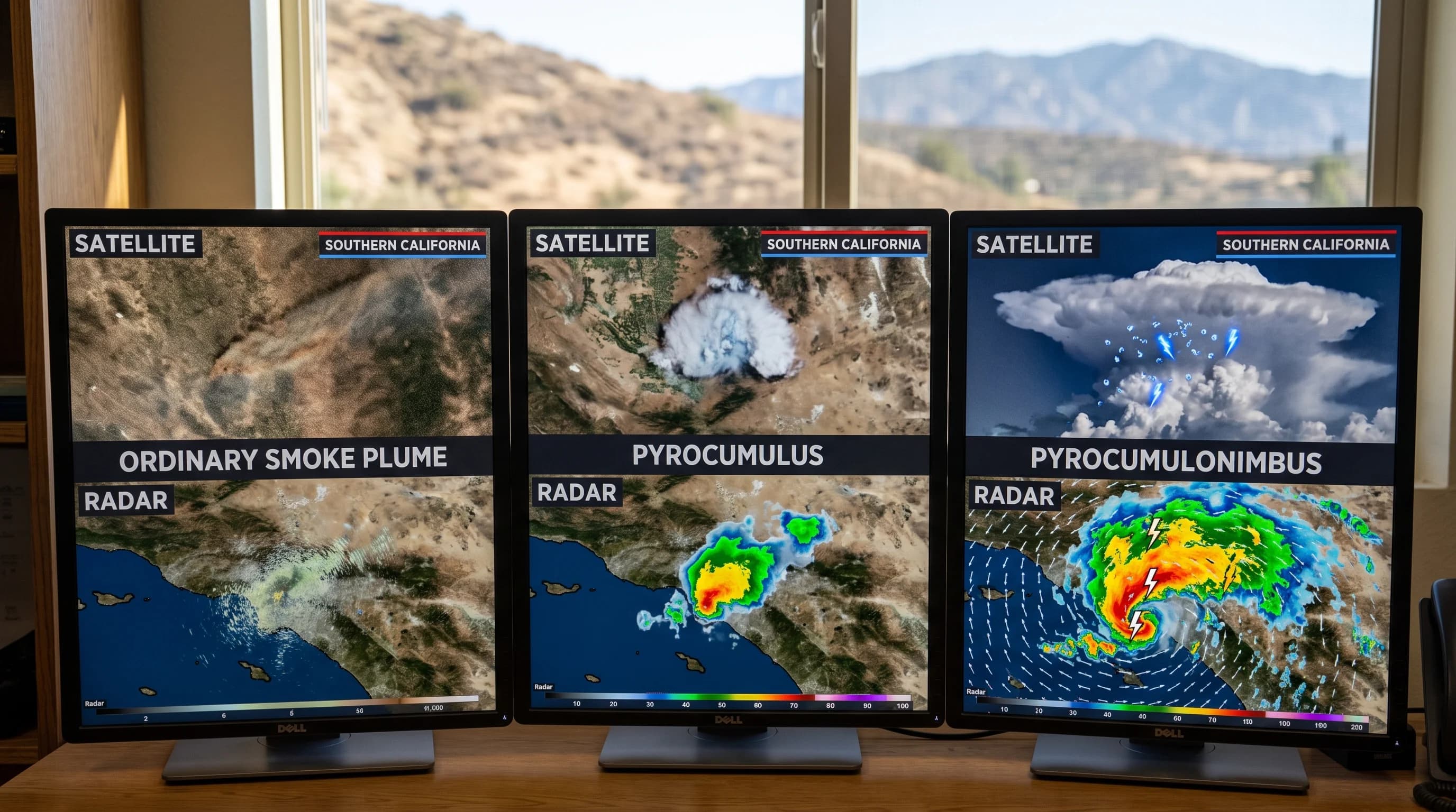
Satellite and radar show the difference. A smoke plume appears as a spreading haze. A well-developed pyrocumulus or pyrocumulonimbus shows a much colder, sharper cloud top and, once it has iced over, ice signatures like an ordinary thunderstorm.
Smoke and fire clouds can often be told apart by eye from a distance. A column that stays gray or brown and drifts is smoke. A column that builds a bright white, billowing, fast-rising cap is behaving like a cloud.
What Should You Take Away From a Fast-Growing Smoke Column?
A fast-growing smoke column, especially one with a bright white cauliflower cap, means the fire is burning with extreme intensity and creating its own strong updraft. A growing fire cloud is not an evacuation order by itself, and most pyrocumulus clouds never become lightning-producing pyrocumulonimbus. It is a cue to check official sources instead of guessing how the fire is behaving.
During a fire near Woodland Hills, Pasadena or elsewhere in the foothills and mountains around Downtown Los Angeles, respond to a growing fire cloud by checking official sources. Check CAL FIRE incident updates, the local NWS office's fire weather products and any evacuation orders or warnings for the area. Those sources use actual fire behavior data, not one distant view of the smoke.
Two related hazards connect to fire clouds. The erratic, gusty winds from a collapsing fire cloud resemble the Santa Ana wind fire weather behind most of Southern California's worst fires. Any fire on steep terrain raises the risk of post-fire debris flows once winter rain reaches the burn scar. For what fire weather alerts mean before a fire starts, see red flag warning vs. fire weather watch.
A pyrocumulus tower over the hills is one of Southern California's most dramatic weather sights: a fire building its own cloud. Treat it as a warning, not a spectacle. When a smoke column starts climbing and billowing like a thunderstorm, check the official incident update, wind forecast, lightning activity and evacuation status. Check current conditions near fire-prone destinations on WeatherLA's Los Angeles forecast pages.