In a Los Angeles wind forecast, the peak gust matters more than the sustained wind, because terrain decides how hard the gusts hit. A "20 mph wind" can mean little on a beach in Pacific Palisades and a great deal on a ridge above Pasadena. The National Weather Service issues a Wind Advisory for sustained winds of 30 to 39 mph, or gusts of 45 to 57 mph, lasting an hour or longer. It issues a High Wind Warning for sustained winds of 40 mph or more, or any gust of 58 mph or more.
To read an LA wind forecast, know which number you are looking at, and know that canyons, passes and foothill communities often get gusts 20 to 40 mph stronger than the open basin a few miles away.
What Makes Wind Hazardous in Los Angeles?
Wind becomes hazardous in Los Angeles when it meets the region's weak points: dry vegetation, overhead power lines, steep canyon roads and a coast exposed to wind-driven waves. Wildfire spread is the most serious impact. Strong, dry offshore wind can push a fire through brush faster than firefighters can contain it, which is why NWS Los Angeles/Oxnard and NWS San Diego pair wind forecasts with fire weather products during Santa Ana season. Gusts above about 45 to 50 mph start snapping tree limbs and downing power lines, the leading cause of wind-related outages in the county.
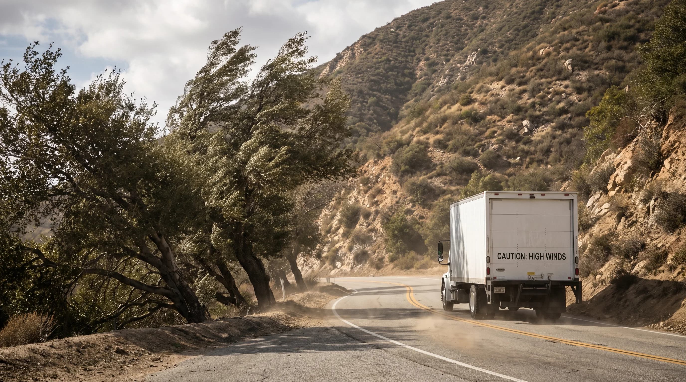
Tall vehicles such as box trucks, RVs and trailers are vulnerable to sudden crosswinds on open freeways and through mountain passes, and Caltrans sometimes restricts them on routes like the Cajon Pass during major wind events. On the coast, strong onshore or offshore wind can build dangerous surf and rip currents, even when the wind feels manageable on land. Hikers on exposed ridges or canyon overlooks face gusts strong enough to throw them off balance, even when the same wind is only a nuisance in the parking lot.
What Is the Difference Between Sustained Wind and Gusts?
Sustained wind is the average wind speed over an observing period, usually two minutes for a standard NWS observation, and a gust is a brief spike above that average lasting a few seconds. "Sustained 20 mph, gusts to 45 mph" describes two numbers with different meanings.
The 20 mph is what steady conditions feel like. The 45 mph gust is what a sudden burst could do to a tree limb, a patio umbrella or a tall vehicle. Warning criteria cover both, so official products always list sustained wind and gusts separately.
The sustained-versus-gust difference explains why an app and a forecast discussion can seem to disagree. Some apps show only a modeled sustained wind for one point and time. An NWS forecast describes gust potential across an area, including terrain the model may not capture. When gusts matter, such as on a fire weather day or before a coastal outing, check the gust figure, not just the headline wind speed.
Why Do Passes and Canyons Get Stronger Wind?
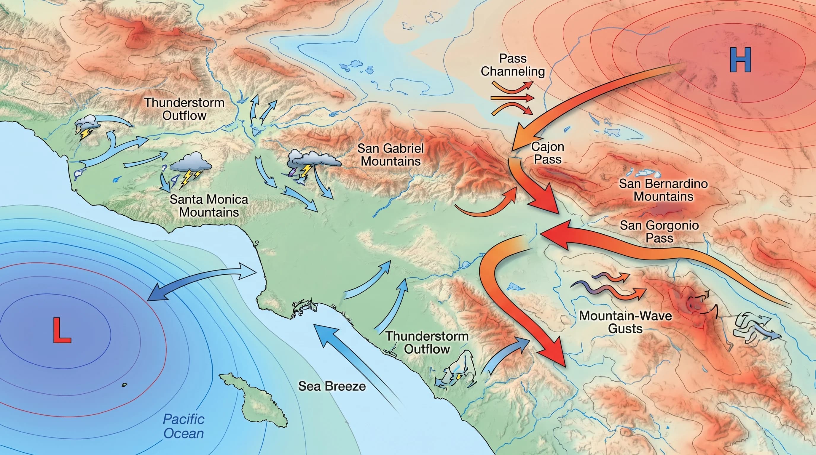
Passes and canyons get stronger wind because they squeeze the same air into a smaller space, the way a river speeds up through a narrow channel. When a pressure difference pushes air from the desert toward the coast, or a storm pushes air across the mountains, that air must funnel through gaps like Cajon Pass, Soledad Canyon and the passes above the San Fernando Valley. The squeezed air speeds up, often producing gusts far stronger than the pressure difference would cause on open ground.
Downhill acceleration adds a second effect. Air forced over a ridge and pulled down the far side by gravity and pressure can reach damaging speeds by the time it reaches foothill neighborhoods. That is the basic physics of Santa Ana winds and of the sundowner winds on slopes facing Santa Barbara.
Mountain waves, air rippling downwind of a ridge, can also cause isolated, hard-to-forecast gusts miles from the terrain. One regional wind forecast can therefore understate the risk at a specific pass, canyon mouth or foothill neighborhood, which is why NWS forecasts often name specific passes and canyons.
Which Local Wind Patterns Matter?
Several distinct wind patterns affect Los Angeles, and identifying which one a forecast describes is the fastest way to understand it. Santa Ana winds are offshore, downhill winds driven by high pressure over the Great Basin pushing dry desert air through mountain passes toward the coast. They are strongest in fall and winter and most closely tied to extreme fire weather, as the Santa Ana winds and fire weather guide explains. Sundowner winds are a related downhill wind on south-facing slopes near Santa Barbara and the Santa Ynez Mountains, usually peaking in the evening.
The sea breeze is the opposite: a daily onshore wind driven by the temperature difference between warm land and cool ocean, building through the afternoon and easing by evening, as the LA sea breeze guide explains. Frontal wind comes with winter storms, usually with rain, and can bring gusts across the whole basin instead of in specific terrain. Thunderstorm outflow is brief but locally intense: a collapsing storm sends a sudden gust front racing outward, as the microbursts guide explains.
Gap winds are any winds sped up through a terrain gap such as Cajon Pass. Gap winds occur under several of these patterns and cause many of the region's highest recorded gusts. Each pattern has its own season, time of day and duration, so identify the pattern instead of treating every windy LA day the same.
| Pattern | Typical direction | Typical gust range | Common NWS product |
|---|---|---|---|
| Santa Ana wind | Offshore (NE to E) | 30 to 70+ mph in passes and foothills | Red Flag Warning, High Wind Warning |
| Sundowner wind | Offshore, downslope (N to NE) | 30 to 60+ mph on south-facing slopes | Red Flag Warning, Wind Advisory |
| Sea breeze | Onshore (W to SW) | Generally 10 to 25 mph | Usually none; routine daily pattern |
| Frontal / storm wind | Variable, often SW to W | 30 to 60 mph basin-wide | Wind Advisory, High Wind Warning |
| Thunderstorm outflow / microburst | Variable, sudden | 40 to 70+ mph, brief | Severe Thunderstorm Warning |
| Gap wind (e.g., Cajon Pass) | Channeled through terrain | 40 to 80+ mph in the gap itself | High Wind Warning |
How Do Wind Advisory and High Wind Warning Differ?
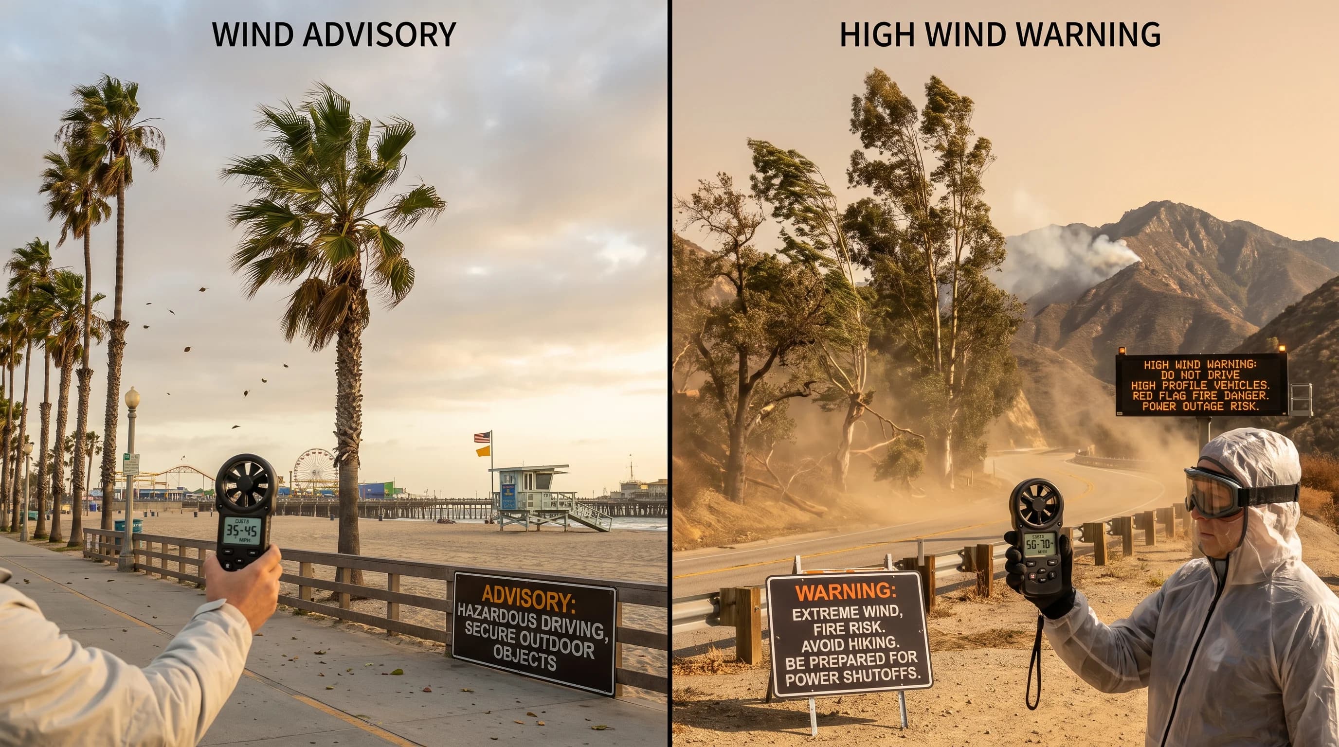
A Wind Advisory and a High Wind Warning differ in speed and expected damage, with the warning reserved for the more dangerous level. The National Weather Service issues a Wind Advisory when sustained winds of 30 to 39 mph, or gusts of 45 to 57 mph, are expected for an hour or longer. Those winds can cause isolated tree and property damage and make driving tall vehicles difficult. A High Wind Warning covers sustained winds of 40 mph or more for an hour or longer, or any gust of 58 mph or more, according to the NWS glossary definition.
At High Wind Warning levels, widespread power outages, downed trees and structural damage become likely. A Red Flag Warning is a separate product that can be added to either wind alert. It is issued when strong wind, typically sustained 15 mph or more under national criteria, combines with low humidity, commonly 25% or lower, and dry vegetation to create extreme fire-spread risk, according to the NWS glossary.
NWS Los Angeles/Oxnard and NWS San Diego set their own fire weather thresholds for each zone within the national framework, and those vary by elevation. Confirm the exact trigger for a given canyon or ridge on the issuing office's current products. A Wind Advisory can come with no fire concern, for example in a wet winter storm, so check separately whether a Red Flag Warning is also active.
How Should You Prepare for an LA Wind Event?
How to prepare for an LA wind event depends on what you are doing and where. Drivers of tall vehicles, including trucks, RVs and trailers, should check for wind restrictions before crossing exposed corridors like Cajon Pass or the passes between the San Fernando Valley and the coast. Sudden crosswind gusts commonly cause rollovers there during wind events.
Hikers should choose a sheltered route during a Wind Advisory or High Wind Warning, because gusts that are a nuisance at the trailhead can knock people off balance on an open ridge. Outdoor event organizers should watch the gust forecast, not just sustained wind, because tents, canopies and signs fail at gusts well below what feels dangerous to a person. Wind matters even at covered venues: at the January 2023 college football title game, gusts near 28 mph blew rain through the open sides of SoFi Stadium.
Homeowners in windy, fire-prone foothill and canyon areas, including near Pasadena, Altadena and Woodland Hills, should secure loose outdoor items and trim dead or overhanging limbs before wind season, not during a warning. When a Red Flag Warning is active with a wind alert, avoid spark-producing equipment such as power tools, grinders and dragging tow chains, as NWS and local fire agencies advise. For how wind and temperature vary over short distances, see why LA has so many microclimates. For how wind can clear or worsen air quality, see why LA is so smoggy.
Check the gust number and the active alert type together, not the sustained wind alone, before driving an exposed route, hiking an open ridge or leaving patio furniture out. On a breezy Southern California day, check the sustained wind, peak gust, direction and any Wind Advisory, High Wind Warning or Red Flag Warning for your destination on WeatherLA's Los Angeles forecast pages. A countywide headline rarely describes a specific canyon, pass or coastline.