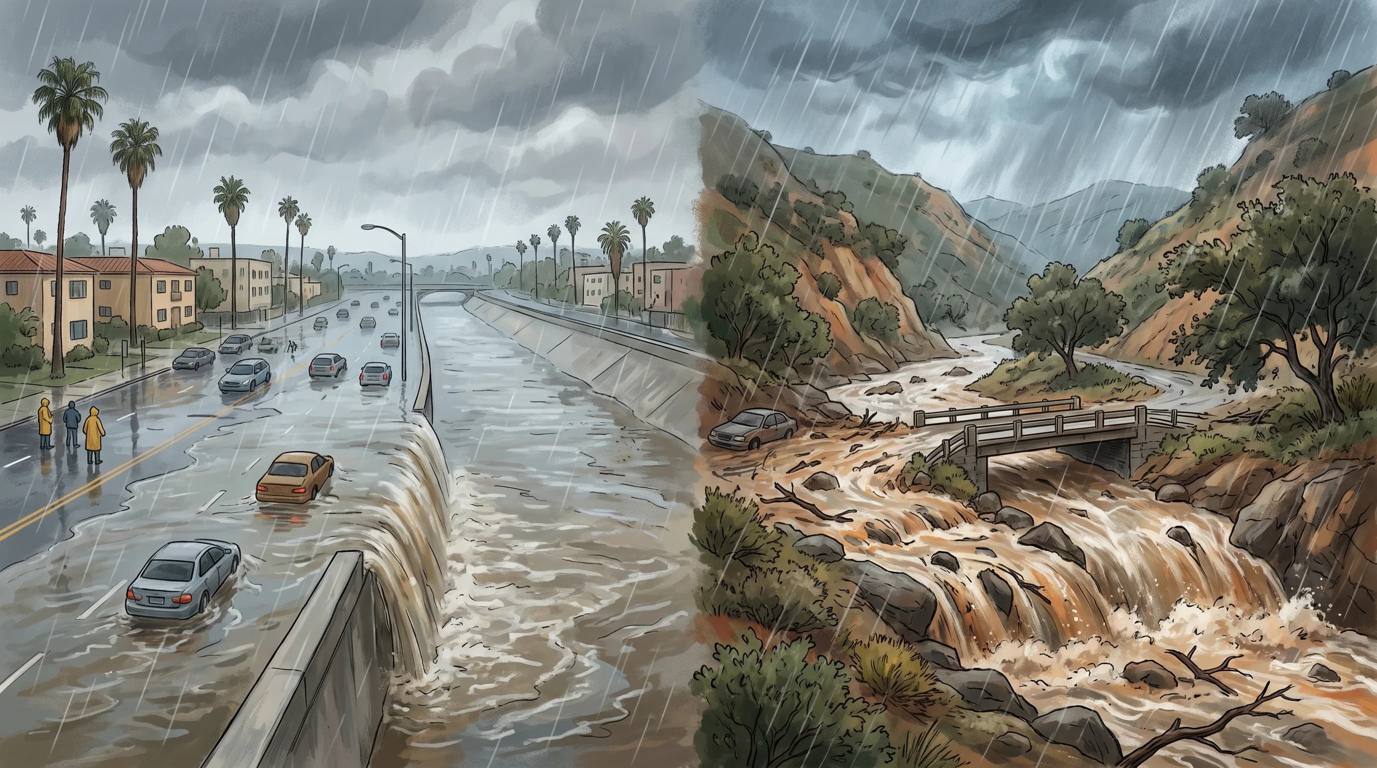
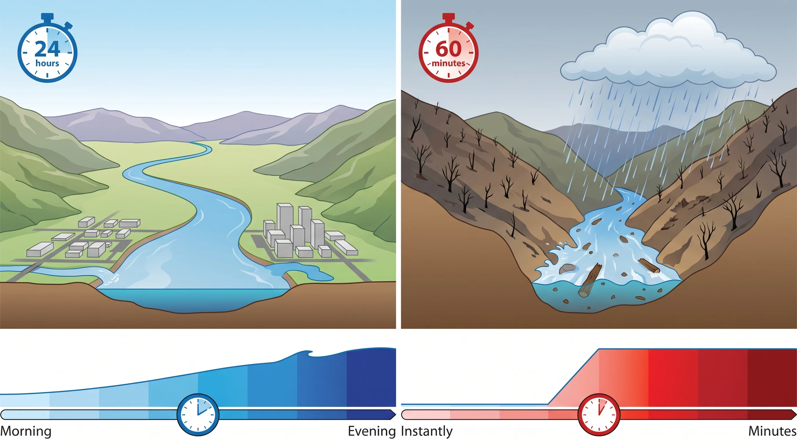
The difference between a flood and a flash flood is speed. A flood is water covering normally dry land, whether it takes hours or days, as with a slowly rising river.
A flash flood begins rapidly, usually within six hours of intense rain or a sudden release of water. In the steep, paved watersheds around Downtown Los Angeles, a flash flood can turn a dry wash into a dangerous surge in well under an hour. The National Weather Service issues different alerts for each, and the alert type tells you how much time you have.
What Is the Difference Between a Flood and a Flash Flood?
A flood and a flash flood differ in speed and process, not water depth. A flood is any water covering normally dry land, and it can build over days along a swollen river, over a tide cycle at the coast or over an afternoon as storm drains back up. A flash flood is defined by fast onset, generally within six hours of the triggering rain or release, and often much sooner.
A river flood along the Los Angeles River gives emergency managers hours to warn residents and gives residents time to move belongings and leave calmly. A flash flood down a canyon below a recent burn scar can arrive with only minutes of warning. The National Weather Service treats flash floods as a separate, more urgent product, not a slower version of the same hazard. Desert washes flood fastest of all; see flash flooding in Joshua Tree.
One storm can cause both. A Pacific frontal system crossing the Los Angeles Basin can raise a river gradually over a full day while causing a flash flood in a steep canyon elsewhere, because each location's terrain and drainage respond on a different timeline. Knowing which process is happening near you matters more than the rainfall total. For why Los Angeles terrain floods so fast, see why does Los Angeles flood so fast.
| NWS product | Typical onset window | What triggers it | What it asks you to do |
|---|---|---|---|
| Flood Advisory | Hours, often already underway | Minor flooding of roads, underpasses, or low spots that causes inconvenience but limited danger | Avoid the specific flooded spot; delays are likely |
| Flood Watch | Hours to roughly a day out | Conditions favor river, urban, or coastal flooding, but timing or location is not yet certain | Review your plans and watch for updates |
| Flood Warning | Occurring or imminent, often hours-long | A river, creek, or low-lying area is flooding or about to flood, confirmed by gauges or observation | Move away from the affected area; avoid the floodplain |
| Flash Flood Watch | Hours out, ahead of the rain | Heavy rain is forecast over terrain, including burn scars, capable of producing flash flooding | Plan an alternate route; avoid canyon and wash travel |
| Flash Flood Warning | Minutes to under an hour | Flash flooding is occurring or imminent, based on radar-indicated rain rate, gauges, or reports | Move to higher ground immediately; do not wait to see water |
How Quickly Can a Flash Flood Develop?
A flash flood can develop in minutes, because rainfall rate and watershed response matter more than the rain total at your location. A narrow canyon draining a few square miles of steep terrain can go from a trickle to a dangerous surge from a storm that never reaches the valley floor. The rain fell upstream, and the water arrived before the storm did. A sunny sky overhead does not mean a nearby wash or channel is safe.
The Weather Prediction Center and the NWS Los Angeles/Oxnard office track rainfall rate in inches per hour, not just storm totals. A short, intense burst produces far more runoff, far faster, than the same amount spread over an afternoon.
Burn scars shorten the timeline further. Wildfire strips vegetation and can seal the topsoil into a water-repellent crust, so rain sheets downhill carrying ash, rock and debris.
The USGS Landslide Hazards Program has documented that debris flows below recent burn scars start with far less rain than unburned slopes need, often within minutes of the downpour. A canyon that normally takes an hour to flood can flood in a fraction of that time in the first one to two years after a fire. That is why NWS burn-scar warnings use lower rainfall thresholds.
Where Does Each Kind of Flooding Occur Around Los Angeles?
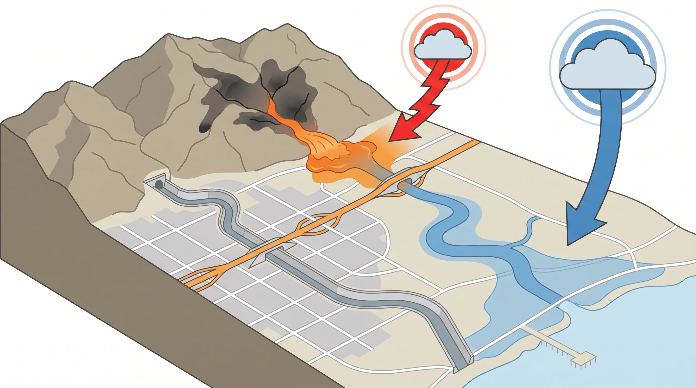
Each type of flooding occurs on a different kind of Los Angeles terrain. River and creek flooding develops along the Los Angeles River and its tributaries, where a Flood Warning reflects a gauge rising over hours. Urban street flooding occurs at low intersections and freeway underpasses across the basin, including around Downtown Los Angeles and Woodland Hills. There, storm drains built for ordinary rain cannot keep up with an intense burst, and water pools where the street dips.
Flash flooding concentrates on narrow canyon roads below the San Gabriel and Santa Monica Mountains, in concrete flood channels that surge from rain upstream and out of sight, and most of all in neighborhoods below recent wildfire burn scars. Coastal flooding, driven by high surf, king tides or storm surge instead of rain, is a separate category along the shoreline.
A neighborhood outside a mapped floodplain can still flood. Storm drains can be overwhelmed anywhere pavement sheds water faster than the pipes carry it, far from any river or floodplain map, as in parts of Pasadena during an intense summer monsoon storm. Floodplain maps show river and coastal flood risk, not every place a flash flood or ponded street can occur.
How Do Pavement, Concrete Channels, and Burn Scars Change Runoff?
Pavement, concrete channels and burn scars all speed up runoff, each in a different way. Pavement and rooftops absorb no water, so rain on a street or parking lot reaches a storm drain within minutes instead of hours. Concrete flood channels, including long stretches of the Los Angeles River system, move runoff away from neighborhoods quickly. That protects streets, but a channel can go from a trickle to fast, turbulent flow with little visible warning, because the smooth banks show nothing of the water coming from upstream.
Burn scars remove the plants that slow runoff and can leave soil unable to absorb water, adding ash, rock and debris. That is why post-fire flash floods are often debris flows instead of clear water. The USGS Landslide Hazards Program tracks debris-flow risk for specific burn scars. To look up flood and debris-flow risk for an address, see Los Angeles flood risk maps.
What Do Flood Advisory, Watch, and Flash Flood Warning Mean?
Flood Advisory, Flood Watch and Flash Flood Warning are separate National Weather Service products for different hazards and confidence levels, not steps on one ladder. A Flood Advisory covers minor flooding, such as ponded streets or a slowly rising creek, that causes inconvenience rather than danger to life. A Flood Watch means conditions favor river, urban or coastal flooding over the next several hours to about a day. A Flood Warning means flooding is happening or imminent at a specific river, creek or low area, usually confirmed by a stream gauge or observation.
A Flash Flood Watch means weather and terrain, including any active burn scars, could produce a flash flood if the forecast rain arrives, giving hours to plan another route. A Flash Flood Warning is the most urgent product: flash flooding is happening or about to happen, based on radar rainfall estimates, stream gauges or spotter and police reports. A Flash Flood Warning means move to higher ground immediately. For how watches and warnings work across every NWS Los Angeles/Oxnard hazard, from heat to high surf, see weather watch vs. warning: what LA's alerts mean.
What Should You Do When Water Covers a Road or Trail?
Never drive or walk into water covering a road or trail, however familiar the route. The NWS Turn Around Don't Drown guidance exists because depth, current, pavement condition and hidden debris are nearly impossible to judge, especially at night or in heavy rain. Six inches of fast-moving water can stall a passenger car, and about two feet can float most vehicles, including SUVs and trucks. A shallow-looking sheet of water can hide washed-out pavement, a missing manhole cover or a submerged curb.
Before heading out during or after a storm, check NWS Los Angeles/Oxnard alerts, or the NWS San Diego office for areas farther south, for any Flood Watch, Flood Warning or Flash Flood Warning on your route. County and city road closures add the detail an NWS alert lacks: a warning covers an area, while a closure names the exact street or trail. If you hear a sudden roar or rushing sound from a canyon or channel upstream, move to higher ground immediately.
A flood gives you time to prepare, and a flash flood gives you minutes to react; the alert name on your phone tells you which you face. Before driving near a canyon road, flood channel or recent burn scar during a storm, check the current Flood Watch, Flood Warning or Flash Flood Warning status for your route on WeatherLA's Los Angeles forecast pages, and confirm closures before you leave.