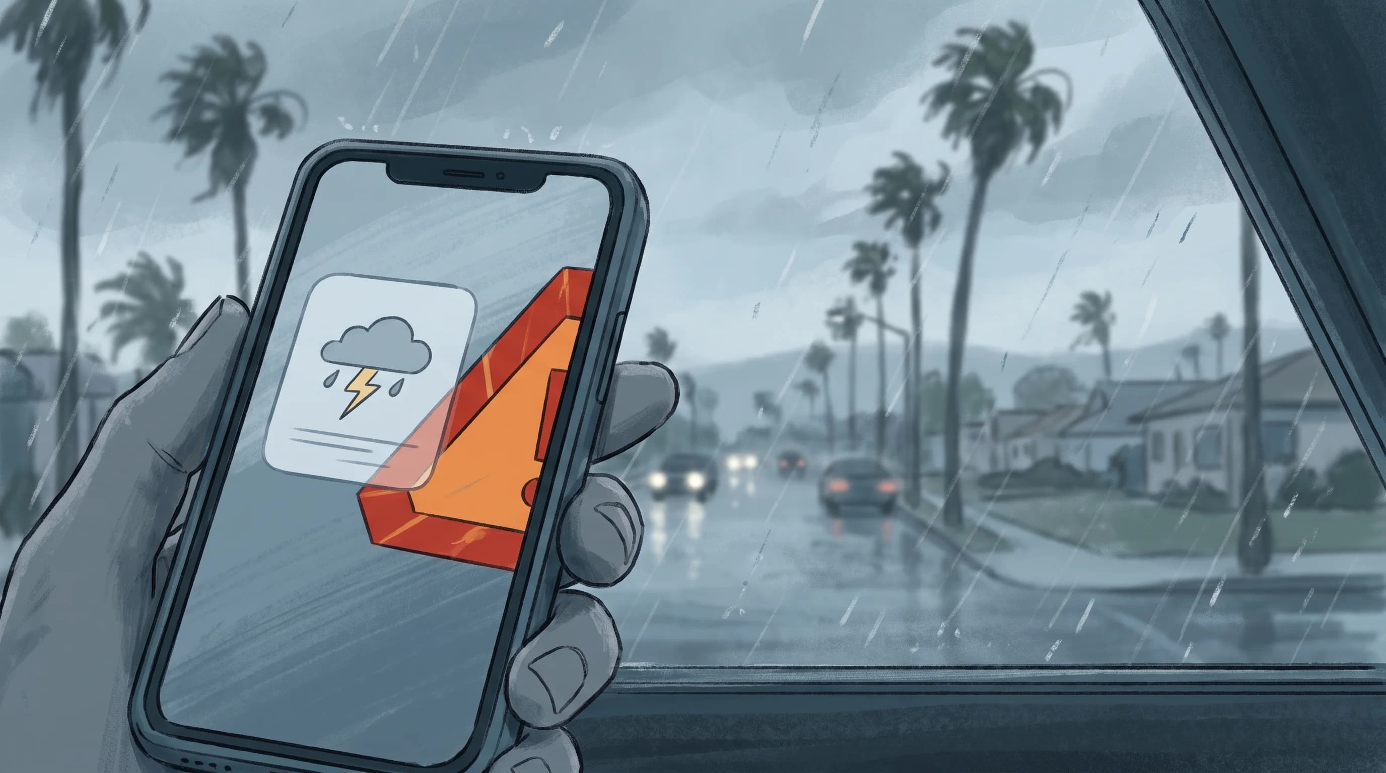
A weather watch means a hazard is possible, so review your plans and get ready. A weather warning means the hazard is happening, imminent or very likely soon, so act now. Both come from the National Weather Service.
In Los Angeles County they cover everything from Santa Ana wind fire danger and flash flooding below burn scars to heat in Downtown Los Angeles and dangerous surf at the coast. Knowing which alert you have, and exactly where it applies, matters more than the push notification headline.
What Is the Difference Between a Watch and a Warning?
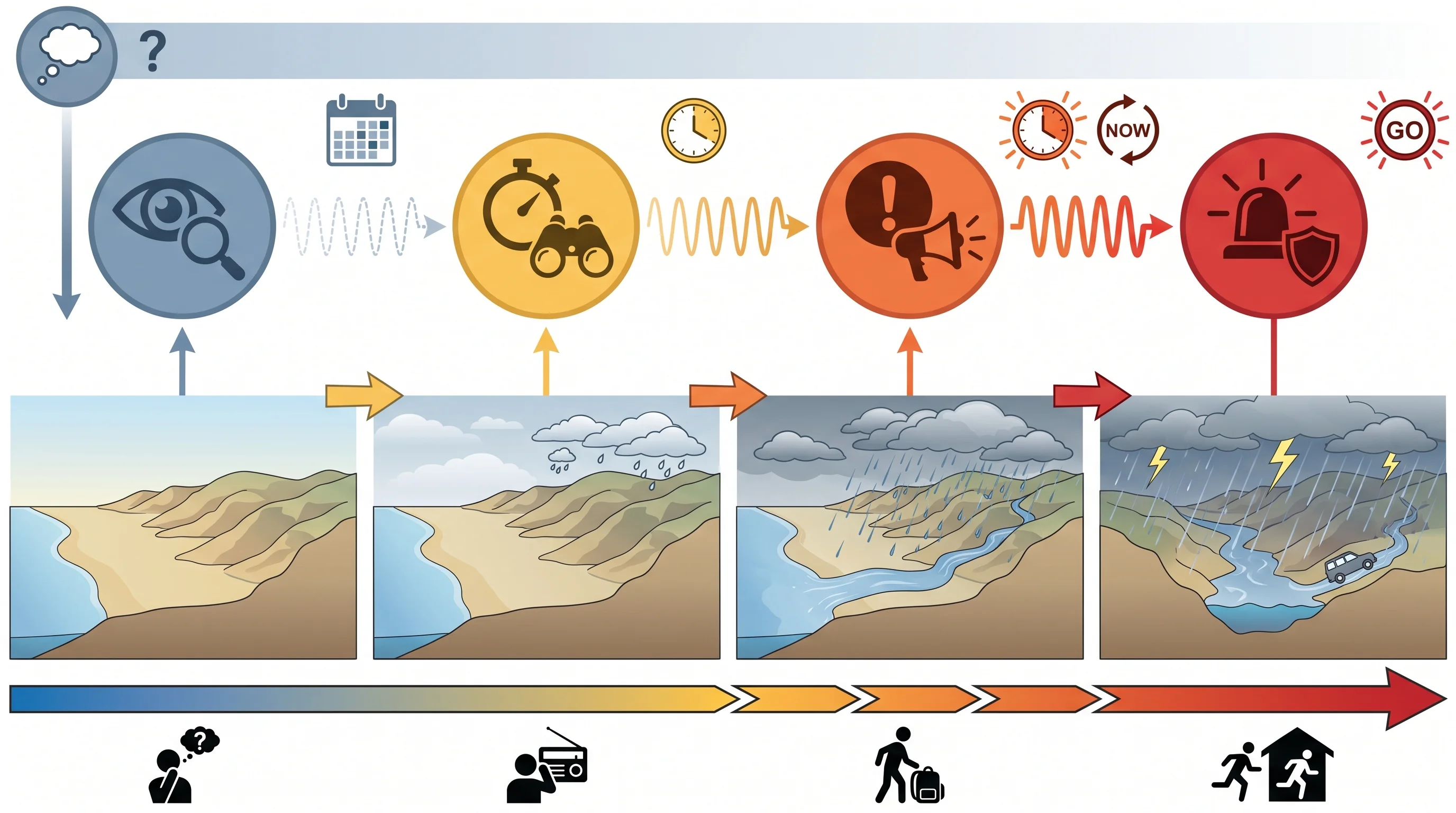
A watch means the ingredients for a hazard are coming together; a warning means the hazard is happening or about to. Meteorologists at NWS Los Angeles/Oxnard or NWS San Diego issue a watch when they are confident the ingredients are present, such as thunderstorm instability, a dry offshore wind event or a strong atmospheric river, but cannot yet pin down timing, strength or location. Watches can come hours to days ahead. A watch is the time to prepare: know your evacuation route near a burn scar, charge devices before a wind event or plan another route if flash flooding is possible.
A warning means the hazard is happening, has been confirmed by radar, satellite or observers or is expected within a short, defined window. Each warning includes the recommended action: take shelter, move to higher ground, stay out of the water or evacuate if a separate order has been issued. A watch means prepare. A warning means act now.
The different lead times are the reason for having both. A watch gives hours or days to plan calmly: pack a go-bag before a Red Flag Warning, move cars off a street that floods or reschedule a hike in the San Gabriel high country. A warning can shrink the decision window to minutes. A Flash Flood Warning below a burn scar can arrive only 15 to 30 minutes before dangerous runoff, once rain rates exceed the threshold.
A watch can expire with no warning following. The ingredients can come together as forecast and still fail to produce the hazard. That does not make the watch a false alarm; the final trigger never arrived.
| Hazard family | Watch means | Warning or advisory means |
|---|---|---|
| Fire weather | Fire Weather Watch: critical fire conditions, such as low humidity and strong wind over dry fuels, are possible in the next 12 to 72 hours | Red Flag Warning: critical fire weather conditions are occurring or imminent; any fire start could spread rapidly |
| Flash flooding | Flash Flood Watch: rainfall rates capable of flash flooding are possible, especially over recent burn scars | Flash Flood Warning: flash flooding is occurring or imminent in a specific, polygon-mapped area; move to higher ground immediately |
| High surf | No separate watch product is typically used; forecasters instead build lead time into the advisory or warning text | High Surf Advisory covers dangerous but more common surf and rip current risk; High Surf Warning covers surf large enough to threaten life and property along the immediate coast |
| Wind | High Wind Watch: damaging sustained wind or gusts are possible, often ahead of a Santa Ana or offshore wind event | High Wind Warning: sustained wind or gusts have reached warning-level strength and are occurring or imminent; a Wind Advisory covers a lower, still disruptive tier |
| Heat | Extreme Heat Watch: dangerously hot conditions are possible in the next 24 to 72 hours | Extreme Heat Warning: dangerously hot conditions are occurring or imminent; a Heat Advisory covers a lower but still hazardous heat tier |
| Winter weather (mountains) | Winter Storm Watch: significant snow, ice, or a mix is possible at higher elevations such as the San Gabriel and San Bernardino Mountains | Winter Storm Warning: significant winter weather is occurring or imminent; a Winter Weather Advisory covers lesser accumulations that can still make mountain roads hazardous |
Where Does an Advisory Fit?
An advisory covers weather the National Weather Service expects to cause significant inconvenience, and sometimes real danger, without reaching warning level. Wind Advisories, Heat Advisories, Winter Weather Advisories and High Surf Advisories are all issued in Los Angeles County in a typical year, each with criteria set by the local forecast office. An advisory is not safe to ignore. A Heat Advisory still means dangerous conditions for outdoor workers, older adults and anyone without reliable air conditioning.
A High Surf Advisory still means rip currents strong enough to require lifeguard rescues from Malibu to the South Bay. Treat an advisory as a real hazard one step below a warning.
Advisories vary by hazard. A Wind Advisory marks a lower tier below a High Wind Warning: gusts strong enough to snap branches and make driving difficult, but short of widespread structural damage. A High Surf Advisory at a beach with no lifeguard can carry real drowning risk without ever becoming a warning, because the High Surf Warning threshold is set high.
The advisory label alone does not show how dangerous it is for a specific activity. Read the hazard details in the product text, not just the category name, to decide whether it changes your plans.
Why Do Alert Names Change by Hazard?
Alert names change by hazard because each type of hazard has its own trigger, typical lead time and recommended action, and the National Weather Service runs a separate product line for each. Fire weather products, the Fire Weather Watch and Red Flag Warning, are based on wind speed, humidity and fuel dryness; see Red Flag Warning vs. Fire Weather Watch.
Flood products are based on rain rate, soil saturation and terrain, especially the fast runoff below recent burn scars in the foothills above Pasadena and other San Gabriel communities, as why LA floods so fast explains. Wind products track sustained speed and gusts, often from Santa Ana events, covered in Santa Ana winds and LA fire weather. Heat and winter weather have their own criteria, because dangerous heat in the basin and dangerous snow in the mountains are measured differently.
Evacuation orders come from outside the National Weather Service. The Los Angeles County Office of Emergency Management, the Los Angeles Fire Department or another local agency issues them, with their own alert levels and channels. A Red Flag Warning describes fire weather danger; it is not an order to leave home, though both often occur during a fast-moving fire.
Why Can Only Part of LA County Be Alerted?
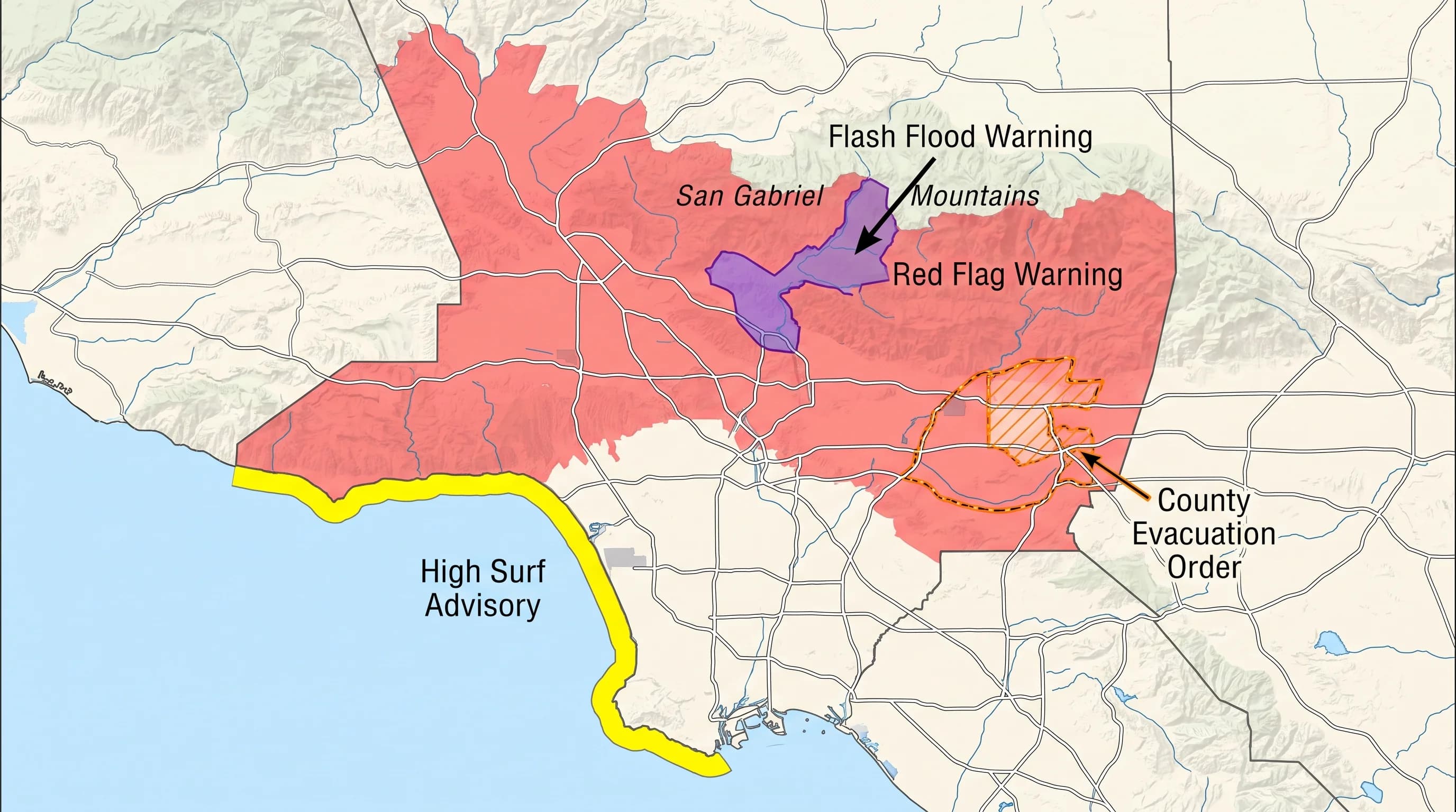
Only part of LA County gets alerted because the county spans coast, dense city basin, foothills, mountains above 8,000 feet and desert, and one hazard rarely affects all of it at once. The National Weather Service issues many alerts by forecast zone, which follows terrain and climate instead of city or county lines. A Red Flag Warning can cover the San Gabriel foothills while the San Fernando Valley around Woodland Hills and the beaches stay outside it.
Fast-moving hazards get even more precise alerts. Flash Flood Warnings and Severe Thunderstorm Warnings are usually drawn as polygons around the specific streets, canyons and drainages at risk. A countywide label in a news alert or push notification can make an alert sound broader than it is. Check the exact zone or polygon for your destination on weather.gov.
Elevation matters most in winter storms. The same storm can bring a Winter Storm Warning above about 5,000 feet in the San Gabriel Mountains near Wrightwood and Mount Baldy and only rain and wind in the basin. A resident near Pasadena who sees only a countywide winter storm mention could wrongly expect snow at home.
Coastal waters have separate marine zones for products like Small Craft Advisories and High Surf Warnings, which cover the shoreline and nearby waters, not inland neighborhoods. Treating a countywide alert summary as one uniform condition is a common way people misjudge their risk.
Does a Warning Guarantee an Impact?
A warning does not guarantee an impact at every location. A warning is the National Weather Service's highest-confidence product for a hazard, but it describes risk across an area and time window, not certainty for each address. Storms can weaken, shift a few miles or drop their heaviest rain just outside a polygon. Flash flooding depends on how much rain falls on which drainage in what period, so a small shift can spare one street and flood the next.
A miss at one location does not make the warning wrong. Hazards that develop in minutes to hours carry real forecast uncertainty. Treat a warning as the best available signal and act on it, instead of waiting to see whether your block gets hit.
Forecast uncertainty is built into local, fast-developing hazards. A Red Flag Warning describes a high risk that any fire will spread fast across a wide area, not a prediction that a fire will start. A High Surf Warning describes wave heights and rip currents along a stretch of coast, not identical waves at every beach.
Southern California terrain adds local variation. A canyon can funnel wind into much stronger gusts than the hillside nearby, and one intense rain cell can drop a burn scar's threshold rain on one drainage while the next stays dry. The warning is still valuable. Read it as the best estimate available when issued, not a street-by-street forecast.
What Should You Do When an Alert Arrives?
When an alert arrives, verify four things from the source: the hazard, the exact area, the start and end times and the recommended action. A Wireless Emergency Alert or push notification is often a shortened headline. The full product on weather.gov includes the polygon or zone map, the issuing office and specific guidance. In Los Angeles County, check NWS Los Angeles/Oxnard for most of the county or NWS San Diego for areas near the southern county line.
Wireless Emergency Alerts are reserved for the most urgent products, including Flash Flood Warnings and Tornado Warnings, so act on them immediately. County and city emergency notification systems are a separate, equally important channel, especially for wildfire evacuation orders, which do not come from the National Weather Service. Sign up for your local system before you need it, and check your address on the Los Angeles flood risk maps while skies are dry.
A watch means get ready, a warning means act now and an advisory is a real hazard below both. Before changing plans around a Red Flag Warning in the foothills, a Flash Flood Warning below a burn scar or a High Surf Warning on the coast, open the official product and confirm the hazard, zone or polygon and timing for your destination. Check current conditions and alerts for your Los Angeles destination on WeatherLA, then confirm the details on weather.gov.