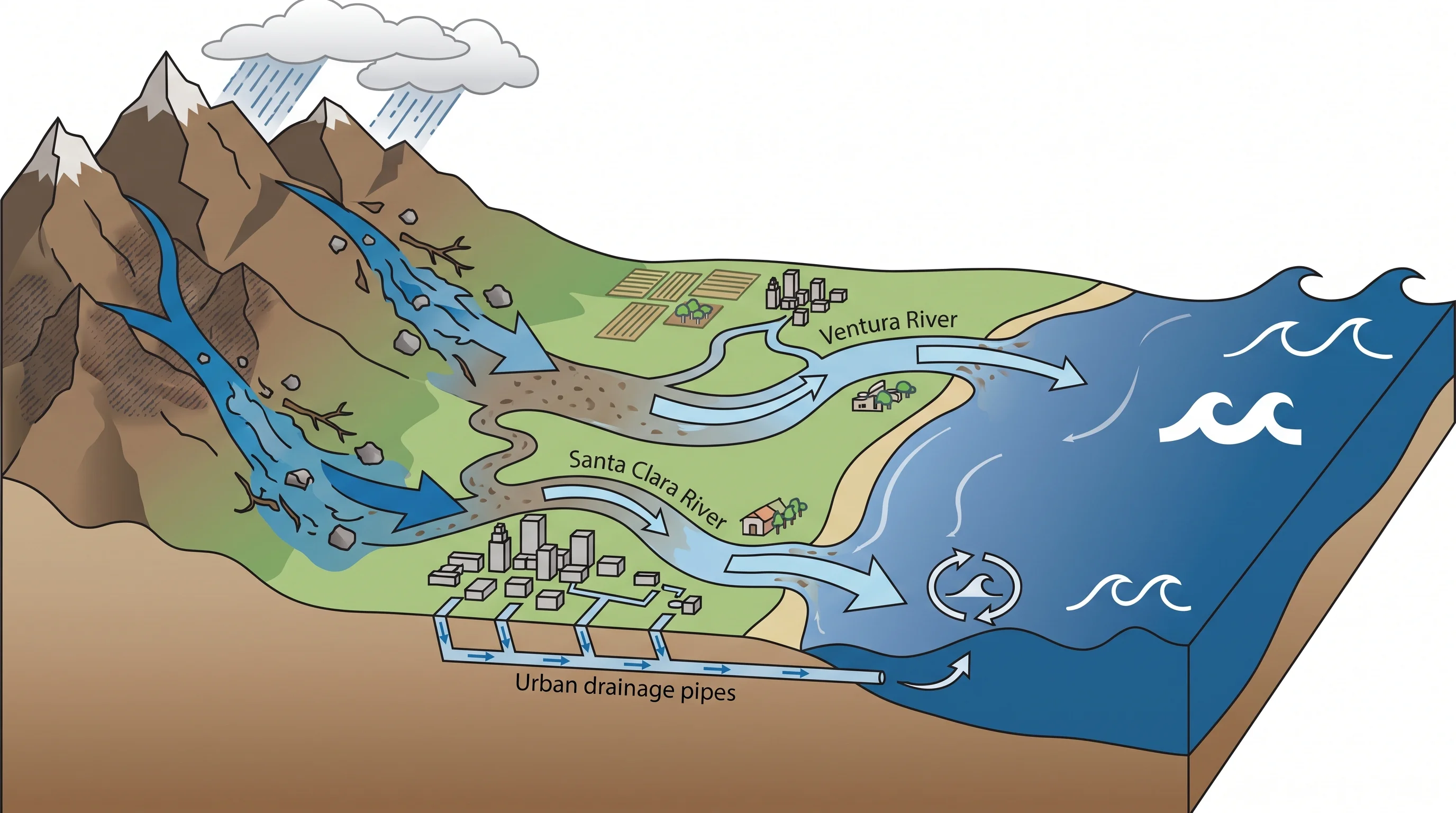
Ventura floods fast because two rivers, the Santa Clara River and the Ventura River, empty into the Pacific at the edge of the city. One storm can raise water from three directions at once: runoff from mountain and farm watersheds down each river, local flooding on city streets and Highway 101, and high surf or tide slowing drainage at the river mouths. That combination sets Ventura apart from a mountain-front city like Pasadena and a flat tidal city like Long Beach.
The Santa Clara River drains about 1,600 square miles, reaching back into the mountains above Santa Clarita. Major wildfires, including the 2017 Thomas Fire, have burned parts of that watershed. Burned slopes lose the plants that slow runoff in the next heavy storm.
Why Can Ventura County Flood From Mountains to Coast?
Ventura County floods along a chain that runs from the steep Transverse Ranges to the beach, and each link creates its own flood problem. Rain on the steep, lightly vegetated mountains above the Santa Clara and Ventura rivers runs off quickly and reaches the river channels fast. The rivers then cross farmland around Santa Paula and Fillmore, gain water from tributary creeks and reach the coast at Ventura and between Ventura and Oxnard, west of Camarillo.
One intense storm can cause a fast canyon flood in the foothills, a slower river rise downstream and street ponding in the city at the same time, each on its own schedule. The National Weather Service Los Angeles/Oxnard office, which covers Ventura County, tracks all three, because a warning for one does not tell you whether the others are happening.
How Do River Flooding and Flash Flooding Differ Here?
River flooding on the Santa Clara and Ventura rivers builds over many hours as rain from a large watershed collects in one channel. Flash flooding happens in a specific creek, canyon or city drainage and can rise and fall within an hour or two. The Santa Clara River watershed is large enough that rain near Santa Clarita or in the Los Padres National Forest can send a river peak toward the coast many hours later, while Ventura itself looks calm.
The Ventura River watershed is much smaller and steeper, so the Ventura River rises and falls faster than the Santa Clara River in a similar storm.
A resident watching only their own neighborhood can miss a river rise still moving downstream. Check river gauge data as well as local rainfall before using a route near either river.
| River | Approximate watershed size | Typical flood response |
|---|---|---|
| Santa Clara River | Roughly 1,600 square miles | Slower, multi-hour to multi-day rise; peak flow can arrive at the coast well after inland rain has ended |
| Ventura River | Roughly 226 square miles | Faster, steeper response; rises and falls more quickly than the Santa Clara River for a comparable storm |
| Local urban and canyon drainage | Individual neighborhood-scale | Fastest response of the three; street and underpass ponding can develop within minutes of an intense rain cell |
Why Are Recent Burn Scars a Special Concern?
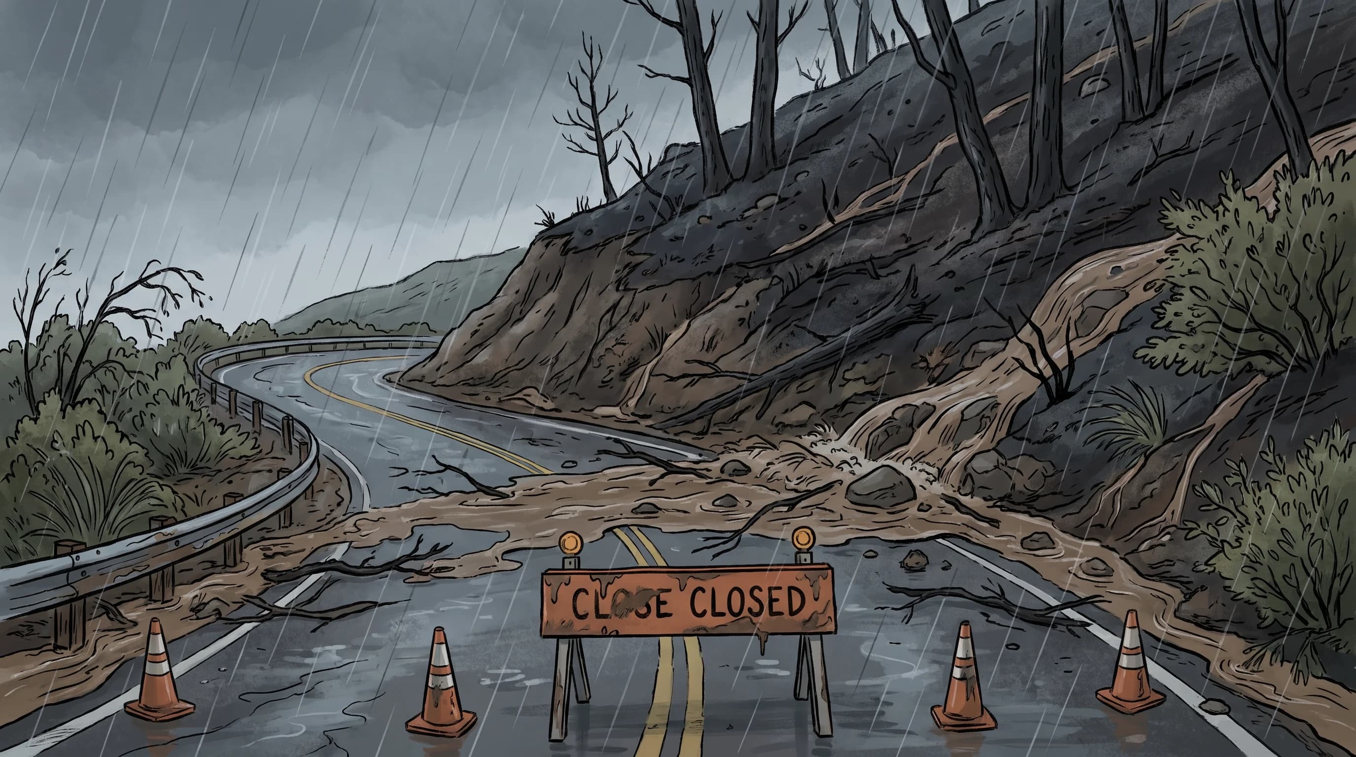
A recent wildfire burn scar above the Santa Clara or Ventura river watersheds turns an ordinary storm into a debris-flow hazard. Burned soil loses its plant cover and its ability to absorb water, so rain sheets off the slope immediately, carrying ash, soil and rock. The 2017 Thomas Fire burned a large part of the mountains above Ventura and Santa Barbara counties.
The U.S. Geological Survey and Ventura County emergency agencies watch burn scars most closely in the seasons after a fire, because far less rain triggers a debris flow on burned ground.
Risk from a burn scar fades as plants regrow. Check current USGS debris-flow guidance and Ventura County emergency notices for any specific slope. A Flash Flood Warning for a burned watershed above Ventura is more urgent than the same warning over unburned ground at a similar rain rate.
How Can Storm Direction Change Which Watershed Gets Hit?
Storm direction decides which Ventura County watershed gets the heaviest rain, because the Transverse Ranges run east to west and lift moist air differently depending on the wind. A storm with strong southerly or southeasterly flow brings heavier rain to slopes above the Santa Clara River valley near Santa Paula and Fillmore. A storm arriving with more westerly flow off the Pacific hits the Ventura River watershed and the coastal foothills first.
Heavier rain bands inside a larger storm make it less predictable. A narrow band of intense rain can sit over one canyon for an hour while a neighborhood a few miles away gets light rain. NWS Los Angeles/Oxnard meteorologists track both watersheds with radar and rain gauges during storms, because a countywide rainfall total can hide a dangerous rate over one drainage.
When Do Coastal Water Levels Add to the Problem?
Coastal water levels add to Ventura flooding when high surf or high tide arrives with heavy rain draining through the Santa Clara or Ventura river mouths. Both rivers drain efficiently only when the river outlet sits higher than the ocean. When surf and tide push ocean water up at the river mouth, water moving downstream backs up and spreads near the coast, even after the rain eases.
High water at the river mouth adds no new water; it slows the exit for water already there. The effect matters most in low areas near the river mouths and along Highway 101 and Pacific Coast Highway, where the roads run close to the river outlets and the open coast. Ventura County emergency planners and NWS coastal hazard products watch for one compound scenario: a soaked inland watershed, a rising river and high surf or tide at the coast. Any one of those is usually manageable, but all three together are dangerous.
What Should Ventura Travelers and Residents Monitor?
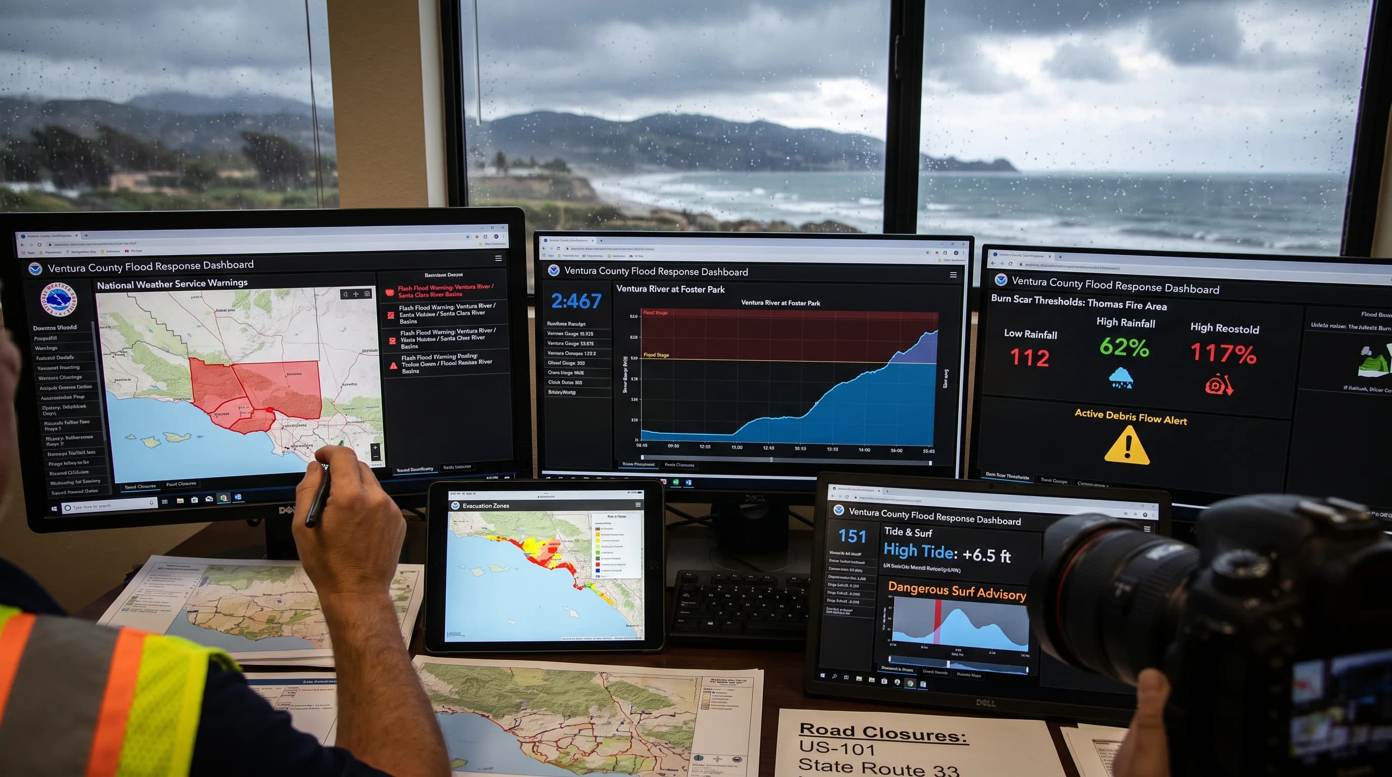
During heavy rain in Ventura County, check several sources, because no single product covers mountain, river, city and coastal risk. Start with Flash Flood Warnings and Flood Watches from the NWS Los Angeles/Oxnard office, which covers Ventura County, and check river stage forecasts for the Santa Clara and Ventura rivers. If your route passes below a recent burn scar, check Ventura County evacuation notices and USGS landslide and debris-flow hazard guidance before using a canyon road.
Near the coast, check the tide chart and surf forecast, since a river mouth can back up after the rain stops. Check Ventura County and Caltrans road closures before driving any low route near the river mouths, Highway 101 or Pacific Coast Highway. Standing water on a familiar road hides its depth and any damage underneath. The NWS flood safety guidance applies here as everywhere: never drive or walk into moving water.
Ventura's flood risk is one chain with three links: steep, sometimes burned mountain watersheds feeding the Santa Clara and Ventura rivers, the farmland and city the rivers cross, and river mouths the ocean can slow. Knowing which link is active in a storm, a fast canyon surge, a slower river rise or a coastal backup, separates an ordinary rainy day from a real hazard. Before heading toward Camarillo, Santa Paula or the Ventura coast in heavy rain, check NWS warnings, river gauges, burn-scar notices and the tide forecast together.