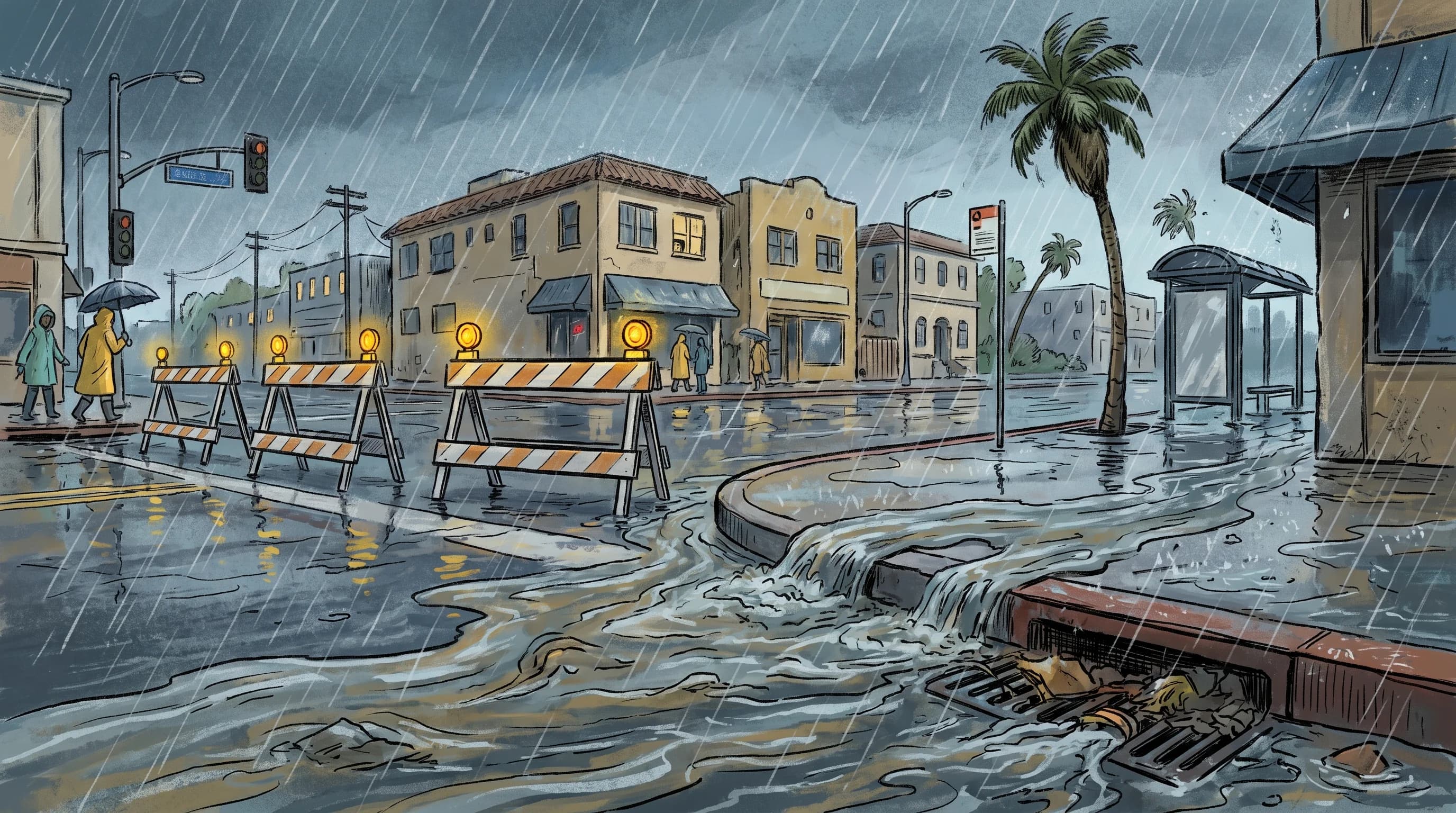
Santa Monica floods fast because its dense street grid is short, flat and almost entirely paved, so intense rain has nowhere to go but the storm drains and the ocean. Most Santa Monica street flooding comes from rain falling on the same block, not water from miles upstream, and it pools at low intersections within minutes. The coast adds two complications. Runoff from Pacific Palisades and Santa Monica Canyon funnels through the city toward the beach, and a high tide at the storm drain outlets slows drainage when it needs to be fastest.
Why Can Santa Monica Streets Flood During a Brief Storm?
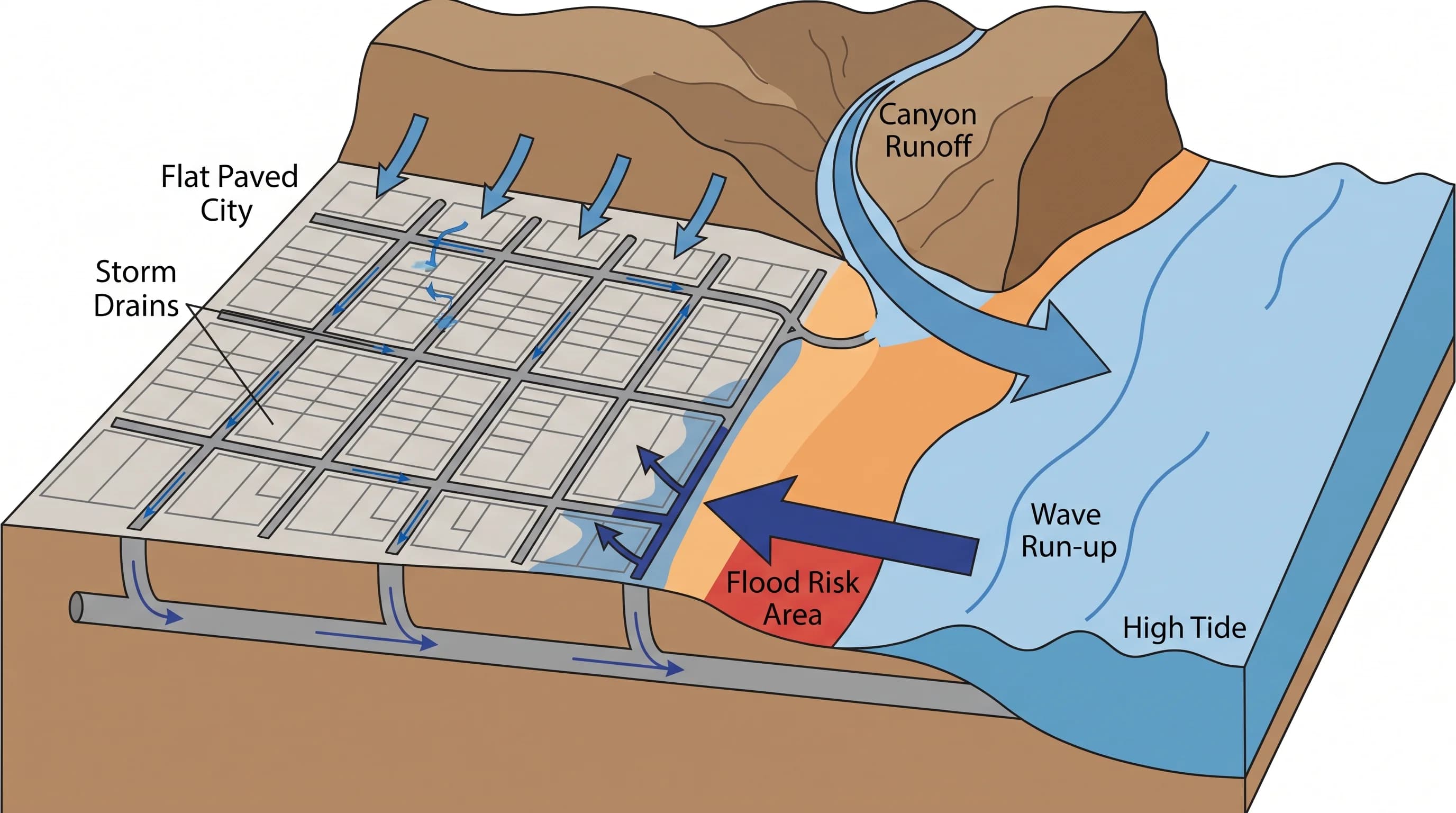
Santa Monica streets flood during brief storms because nearly all of the city's short, gently sloping grid is paved. Street, sidewalk, parking lot and rooftop absorb almost no rain, so a heavy downpour becomes runoff immediately. That runoff can reach the ocean only through the city's underground storm drains.
The drains are built for a set rain rate. When rain falls faster than the pipes and curb inlets can carry it, water backs up onto the street.
Low spots matter as much as pipe capacity. Underpasses, dips in the street grid and intersections a few feet below nearby blocks collect surface water first.
Santa Monica's flooding is mainly a drainage-capacity problem. It differs from the steep, canyon-driven flooding in why Los Angeles floods so fast and from the flat, tide-limited flooding in why Long Beach floods. Santa Monica also gets canyon runoff, which neither of those cities has.
How Do Canyon Mouths Differ From Downtown Drainage?
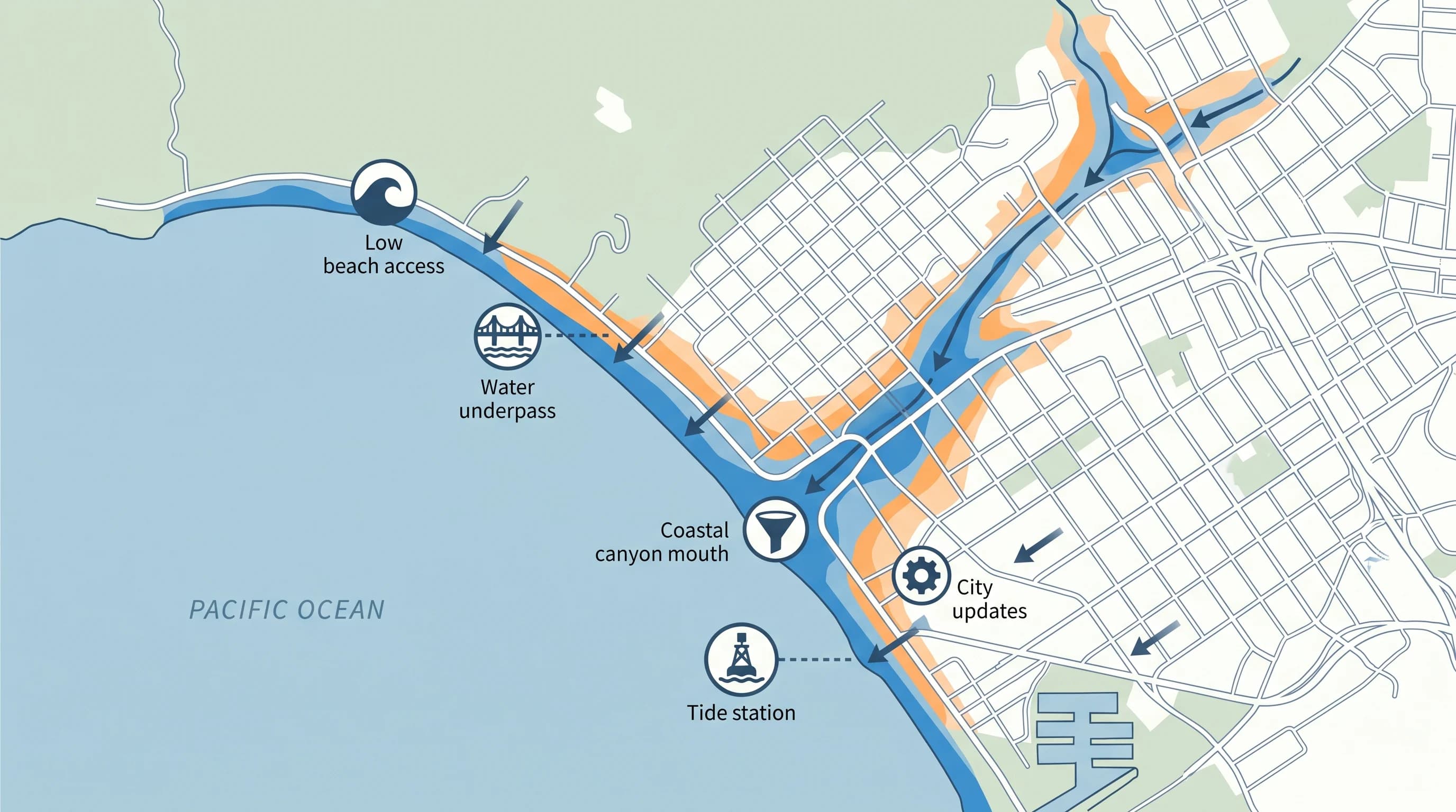
Water on a flat downtown Santa Monica block is local: it fell on that block or nearby, and the storm drains limit how fast it clears. Water at a canyon mouth comes from much farther away. Santa Monica Canyon and the watersheds on the bluffs above Pacific Palisades collect rain across a larger, steeper area of the Santa Monica Mountains foothills. That water funnels into a narrow channel that reaches the city near the coast.
A Santa Monica street can look dry while a sudden surge of muddy, fast water arrives from a canyon mouth. The rain behind that surge fell upslope minutes earlier. Canyon-mouth flooding also carries more sediment, branches and debris than street ponding, because it has scoured a longer natural channel. Treating canyon-mouth flooding and street ponding as the same hazard is a common mistake.
Canyon-mouth flooding and downtown street ponding share a city, not a cause. A City of Santa Monica or Los Angeles County Public Works closure at a canyon crossing reflects a different risk than a barricade at a flooded downtown intersection.
Can Tide and Surf Slow Rainwater Drainage?
Tide and surf slow rainwater drainage in Santa Monica, though they do not cause a rain flood on their own. Storm drains empty by gravity, so each outlet must sit higher than the water it drains into. A high tide shrinks that margin, and in extreme cases partly covers the outlet. The pipe then empties more slowly.
A storm arriving with a high tide, or with high surf pushing water up the beach and around drain outlets, leaves standing water in low coastal blocks longer than the same rain at low tide. This backwater effect adds no new water. It matters most in the blocks nearest the beach and the mouth of Santa Monica Canyon, where drains empty closest to sea level.
Storm drain discharge also carries runoff, bacteria and debris into the surf zone near drain outlets. That is why Los Angeles County often posts beach water-quality advisories or closures after a storm, even after the rain stops and the streets drain.
| Condition | What it affects | Where to check it |
|---|---|---|
| Rainfall rate over the city grid | Street and underpass ponding, storm drain overload | NWS Los Angeles/Oxnard flash flood products |
| Rainfall over Santa Monica Canyon and Palisades bluffs | Canyon-mouth surges reaching the coast with a delay | NWS point forecast for the upstream watershed |
| Tide stage at storm drain outfalls | How fast standing water drains after rain stops | NOAA tide predictions for the Santa Monica area |
| Surf height and wave run-up | Beach access safety, wave overtopping near outfalls | NWS coastal hazards and surf forecast for LA County beaches |
| Storm drain discharge and runoff bacteria | Beach water-quality advisories after rain | LA County Department of Public Health beach status |
Why Are Underpasses and Beach Access Routes Vulnerable?
Underpasses near the Santa Monica coast sit below the surrounding ground by design, so they flood first and drain last in heavy storms. Standing water in an underpass hides its depth. It can also hide displaced grates, shifted manhole covers and debris from a canyon mouth or nearby streets, which a driver cannot see.
Beach access routes and parking areas along Pacific Coast Highway and near the Santa Monica Pier face water from three directions: street drainage, canyon runoff and the surf. A route that looks clear early in a storm can be hit by street flow, a canyon surge and high tide or surf at once. Conditions can change from passable to closed with little warning.
Coastal closures therefore change more often during storms than inland street closures. A route that was open an hour ago is not necessarily safe now.
Which Warning Should a Santa Monica Visitor Follow?
Two kinds of National Weather Service products can apply to Santa Monica in the same storm. A Flood Advisory or Flash Flood Warning from NWS Los Angeles/Oxnard covers rain-driven flooding: minor street ponding under an advisory, or rapid, dangerous flooding under a warning. Each is drawn as a polygon around the affected watersheds and streets. A coastal flood or high surf product covers ocean hazards such as high water from tide and swell, waves over low seawalls or beach erosion, and it can be active with no rain at all.
During a winter storm, both kinds of product can be active for Santa Monica at once, one for the canyon and street network and one for the shoreline. Each has its own valid time and is reissued separately. Before relying on either, check the exact polygon and valid time on the current NWS Los Angeles/Oxnard page. A countywide warning does not automatically cover a specific Santa Monica block or beach.
What Should Drivers, Cyclists, and Pedestrians Do?
Drivers should never enter a flooded street or underpass, because standing water hides its depth and what lies beneath. Treat every City of Santa Monica closure barricade as final. About six inches of moving water can stall a passenger car, and about two feet can float most vehicles, including SUVs, according to NWS flood safety guidance. No depth is safe to test by driving slowly.
Cyclists and pedestrians face a related risk. Moving water at a flooded curb cut, canyon crossing or beach ramp can knock a person off balance before it looks dangerous, and storm drain openings disappear once water covers the street. If you plan to walk or bike near Santa Monica beaches or the pier during a storm, check the county beach status for water-quality closures, which can last after the rain and street flooding end. For Santa Monica's usual weather, see Santa Monica weather by month.
During any active flood product, follow the National Weather Service's national advice: take another route or wait, and never assume a familiar street is safe.
Santa Monica flooding has two overlapping causes. Most of it is ordinary urban drainage: pavement and short pipes cannot keep up with intense rain. The rest is coastal, with canyon runoff arriving from above and tide or surf slowing drainage at the bottom. Neither needs a major storm, so a short, intense downpour can close a beach parking lot or flood a familiar underpass with little warning.
Before using a low coastal route or visiting the beach in heavy rain, check the current NWS Los Angeles/Oxnard flood products, the tide and surf forecast and the City of Santa Monica hazard and flood resources. No single source covers every way the city floods. For comparison, see flash flooding in Ventura, where two larger rivers meet the coast.