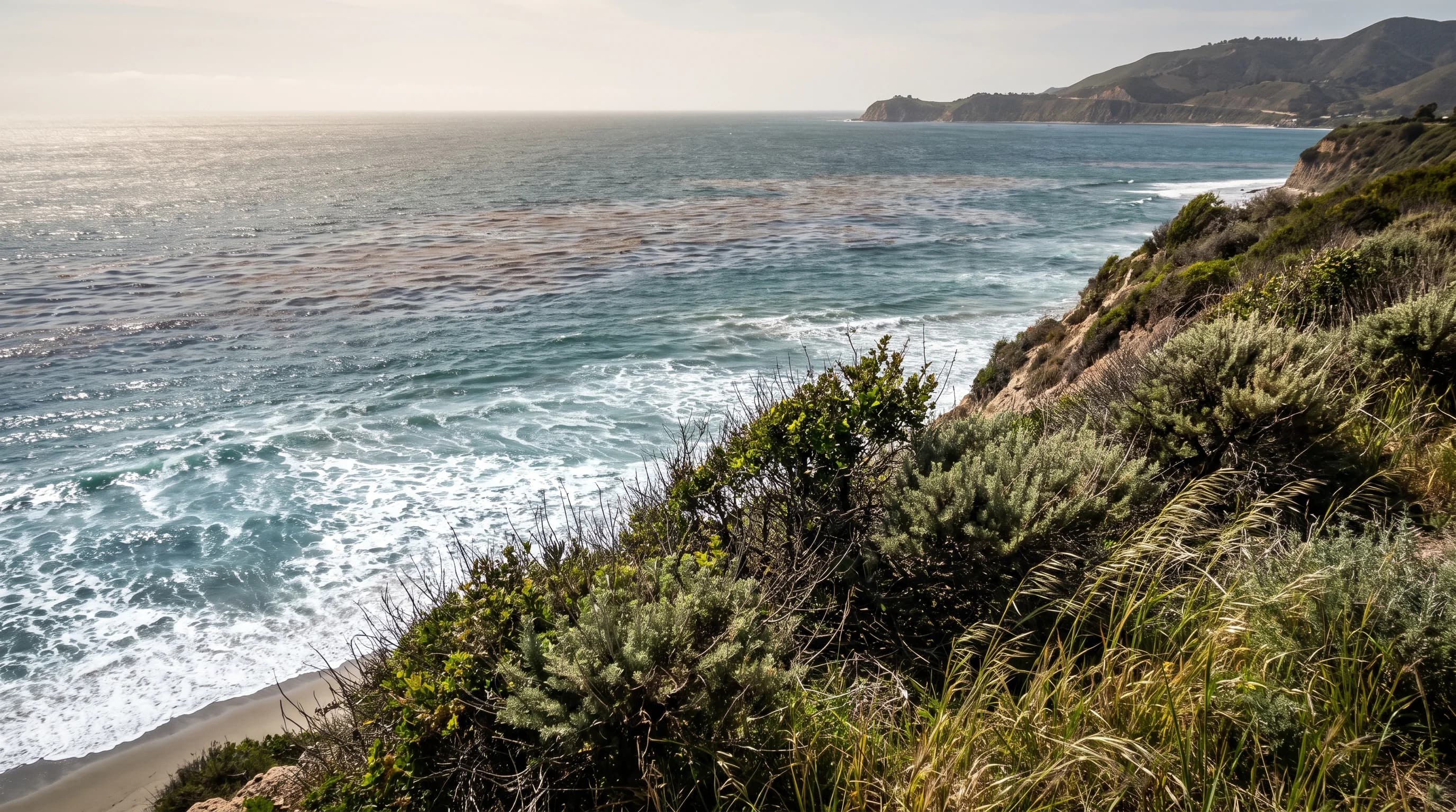
Upwelling is why the Pacific stays so cold in Southern California: wind along the coast, combined with Earth's rotation, pushes surface water offshore and pulls colder water up from several hundred feet down to replace it. A 90°F afternoon in Downtown Los Angeles can pair with 58°F ocean water at Santa Monica the same day. Upwelled water makes Southern California beaches feel closer to the North Pacific than to the postcard image of a warm ocean, especially in late spring and early summer.
What Is Coastal Upwelling?
Coastal upwelling is the replacement of wind-pushed surface water with colder, nutrient-rich water rising from below. Along the California coast, steady northwest wind blowing roughly parallel to the shore starts the process. As surface water moves away from the coast, deeper water rises to replace it, instead of warmer water flowing in from the side.
Upwelled water is cold before it reaches the surface, often having last touched the atmosphere years or decades earlier at a much higher latitude. It also carries more nutrients than sun-warmed surface water, because nutrients that sink out of the sunlit layer collect at depth until upwelling brings them back.
The result is a band of colder, often slightly murky, nutrient-rich water just offshore, under air that can be 20°F to 30°F warmer. NOAA's Ocean Service maintains the standard description of the process. The nutrients feed krill, which is why blue whales gather off Los Angeles in summer; see whale-watching weather in Southern California.
How Do Wind and Earth's Rotation Cause Upwelling?
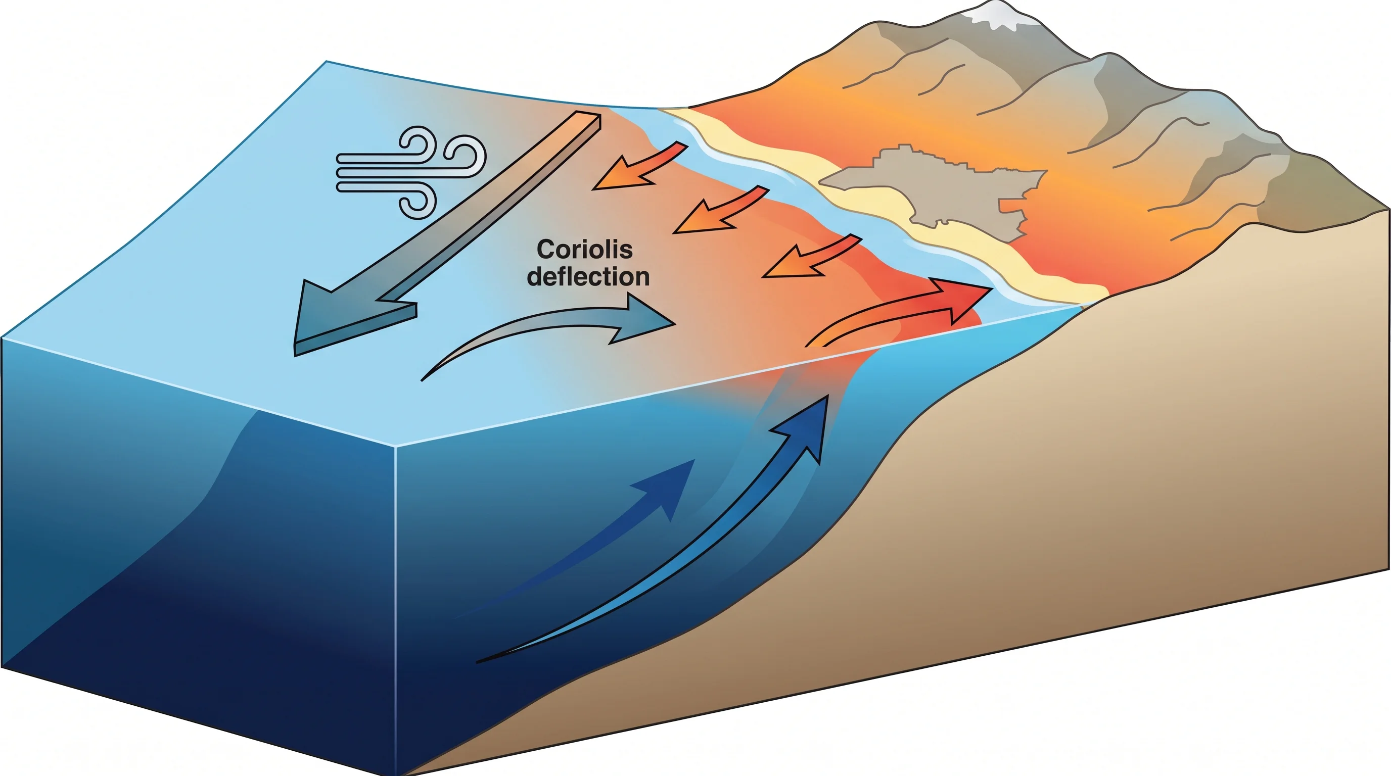
Wind and Earth's rotation cause upwelling together. The Coriolis effect, the apparent deflection of moving objects by Earth's rotation, turns wind-driven surface water to the right of the wind in the Northern Hemisphere. Wind plus that deflection is called Ekman transport. When northwest wind blows down the California coast, Ekman transport moves the surface water away from shore, not just downwind.
As the surface layer moves offshore, water rises from depth to replace it, usually from 50 to 200 meters (about 165 to 650 feet) down along the California coast. That water is cold enough to feel within a few steps of wading in.
Coastline direction matters as much as wind speed. A shore running parallel to a steady northwest wind sets up strong offshore Ekman transport. A coastline that curves away from the wind, like much of Southern California's, gets a weaker or interrupted version.
When and Where Is Upwelling Strongest Locally?
Upwelling along the California coast is strongest in spring and early summer, when the North Pacific High strengthens and drives steadier northwest wind. That is the same season as May Gray and June Gloom, and the two are linked: cold upwelled water helps sustain the coastal marine layer then. May Gray and June Gloom: LA's marine layer season covers that connection.
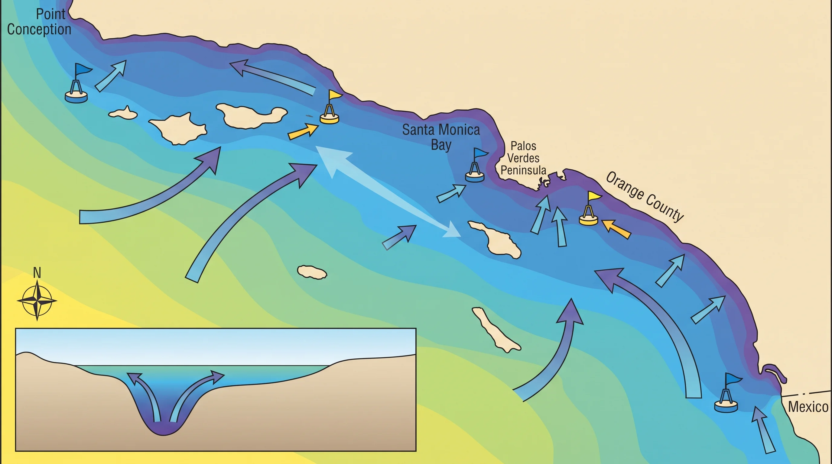
Southern California sits inside the Southern California Bight, the broad curve in the coastline from Point Conception to the U.S.-Mexico border. Point Conception, north of Santa Barbara, marks where the coast bends and upwelling wind blows more directly onto the open coast.
South and east of it, the Bight's curve shelters much of the shore. Upwelling in Southern California is therefore patchier and weaker than on the exposed Central California coast, though it does not disappear. Exposed headlands such as Point Dume and the Palos Verdes peninsula get stronger upwelling than beaches in bays.
Why Do Nearby Beaches Have Different Water Temperatures?
Nearby beaches have different water temperatures because upwelling strength depends on each beach's exposure, not just the regional wind. Several factors, listed below, combine at each beach on each day.
| Factor | Why it matters |
|---|---|
| Recent wind history | Upwelling responds to wind over the prior one to several days, not the current instant; a beach can stay cold for days after wind has already relaxed. |
| Coastline orientation and sheltering | Points and headlands exposed to northwesterly wind upwell more directly than beaches tucked into south-facing bays or behind a peninsula. |
| Nearshore currents | The California Current generally moves cold water southward offshore, while smaller countercurrents and eddies inside the Bight can push warmer or colder water into specific stretches of coast. |
| Depth just offshore | A steeply sloping seafloor puts deep, cold water closer to the beach than a gradually sloping, shallow shelf, where sunlight can warm a thin surface layer before it reaches shore. |
| Tide stage and time of day | Tidal mixing and the daily heating cycle both shift measured temperature by a few degrees over a single day, independent of upwelling. |
| Where the reading is taken | A buoy sitting in deeper offshore water and a lifeguard tower's knee-deep surf reading at the same beach can disagree by several degrees at the same hour. |
No single "Southern California ocean temperature" fits a specific trip. Sheltered coves near Malibu can run warmer than exposed stretches of Manhattan Beach or Redondo Beach the same week, a short drive apart, because each faces upwelling wind and currents differently. Monthly averages from the Santa Monica Pier gauge are in LA ocean water temperature by month.
How Does Upwelling Affect Fog and Marine Life?
Upwelling affects fog because cold upwelled water cools and stabilizes the air above it, which supports the coastal marine layer and fog, especially in late spring and early summer when upwelling peaks. Upwelling is one cause among several.
The temperature contrast between the ocean and hot inland valleys and the strength of the inversion above the coast also matter. For how the coastal cloud deck forms and breaks up, see the Los Angeles marine layer explainer. For the afternoon wind, see what is a sea breeze.
Upwelling also feeds marine life. The deep water that cools the surface carries nitrogen, phosphorus and other nutrients, fertilizer for the base of the ocean food web.
When that water reaches sunlight, phytoplankton bloom quickly and feed zooplankton, fish, seabirds and marine mammals. That is part of why the California Current, which upwelling helps drive, supports one of the most productive fisheries on the U.S. West Coast.
Upwelling does not directly cause harmful algal blooms. Its nutrients can be one of several ingredients, along with light and temperature, that set up bloom conditions.
How Should Swimmers Check Current Conditions?
Swimmers should check a same-day water temperature reading for their beach, not a seasonal average or another beach's forecast. NOAA's Tides and Currents network posts timestamped water temperatures at coastal stations. County lifeguards post current water temperature and surf conditions for individual beaches, usually the most accurate local source. For coastal forecasts, NWS Los Angeles/Oxnard covers Los Angeles and Ventura counties, and NWS San Diego covers Orange and San Diego counties.
Cold water is mainly a comfort and preparation issue, but pair it with ocean safety guidance. Rip currents are the most serious everyday ocean hazard, and the NWS rip current safety guidance applies in any water temperature.
Some low-lying parts of the coast also sit in mapped tsunami hazard zones, a separate risk covered in can a tsunami hit Southern California. Before swimming, check the nearest buoy or lifeguard water temperature, recent wind, swell and posted warnings. A beach you can see from where you stand may not share your conditions.
Warm August air over Venice Beach or Santa Monica says nothing reliable about that day's water temperature. Wind, coastline shape and currents, not air temperature, decide how much cold Pacific water rises to the surface. Check a same-day reading for your beach before planning a swim.