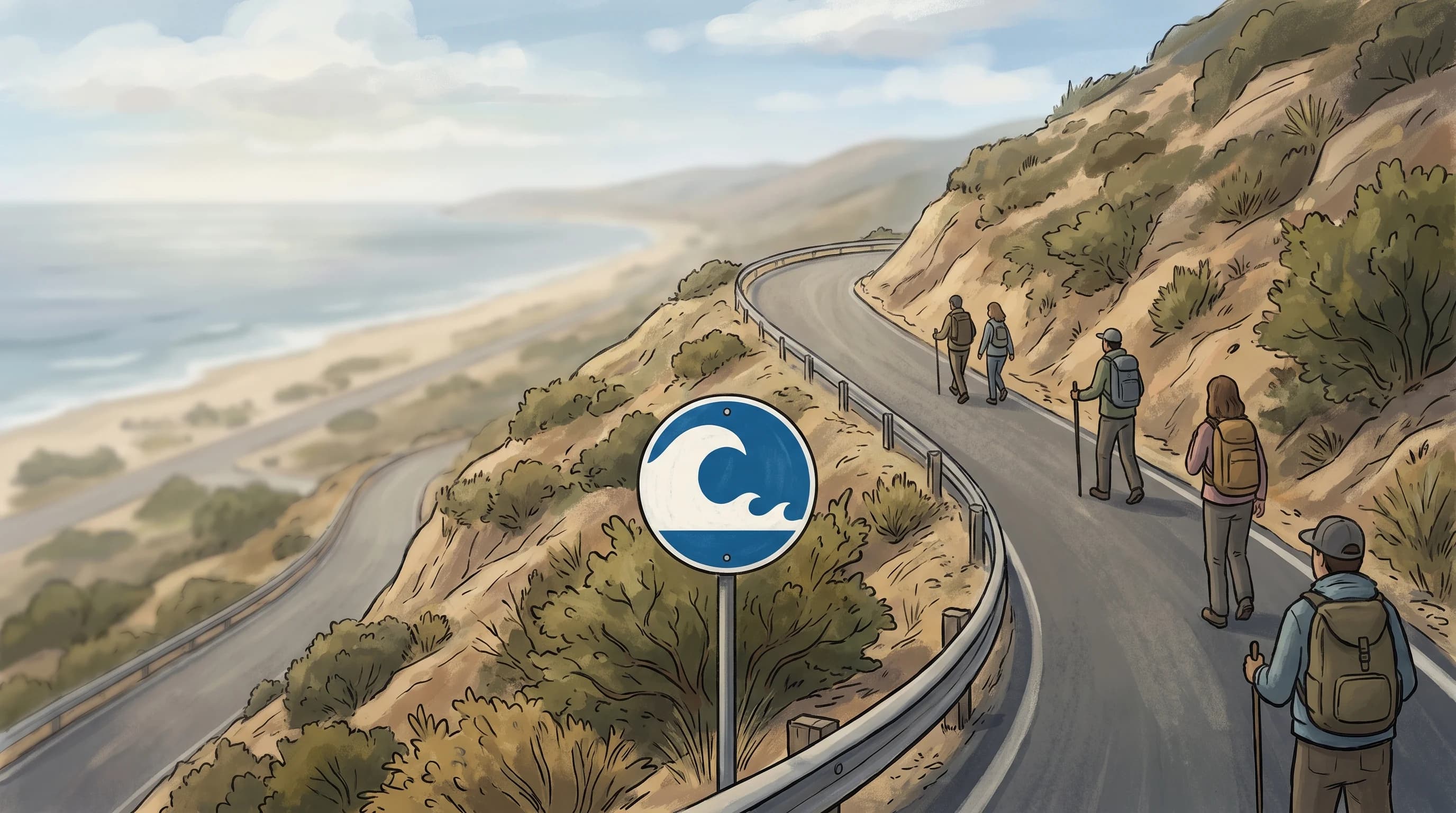
A tsunami can hit Southern California, and tsunamis have reached the coast before. NOAA tide gauges recorded tsunami waves in California after the 1964 Alaska earthquake and the 2011 Tohoku earthquake off Japan.
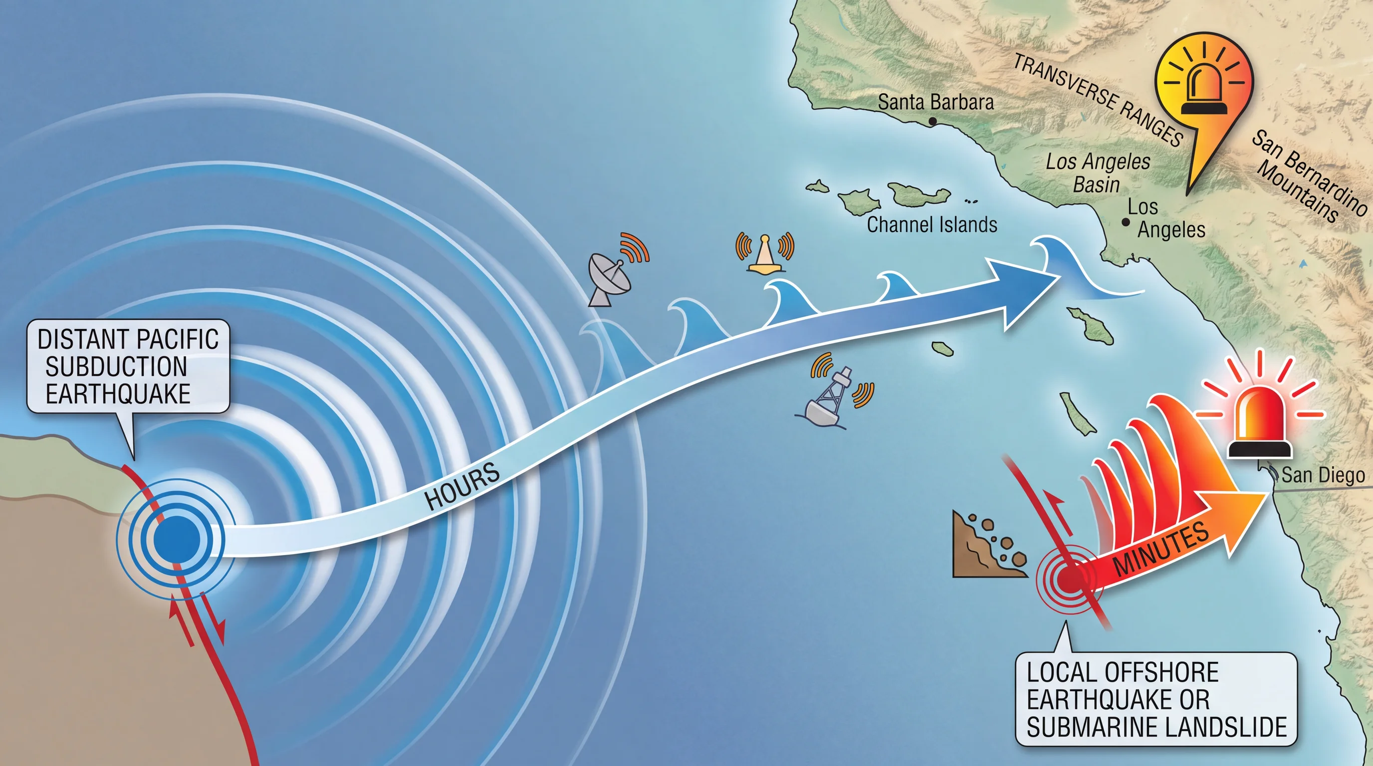
Damaging tsunamis are uncommon here, and the risk depends on where the wave starts. A distant Pacific earthquake gives Santa Monica, Malibu and other coastal communities hours of official warning. A local offshore fault or submarine landslide gives only minutes.
Can a Tsunami Hit Southern California?
Tsunamis have hit Southern California several times, even though the region does not sit above a subduction zone like Alaska, the Pacific Northwest or Japan. The magnitude 9.2 Great Alaska Earthquake in March 1964 sent a Pacific-wide tsunami that damaged harbors in Crescent City and along the Central California coast, with measured surges as far south as San Diego, according to NOAA records. The magnitude 9.1 Tohoku earthquake in March 2011 damaged boats and docks in Santa Cruz and Ventura harbors. Tide gauges along the Southern California coast recorded clear tsunami signals after the 2011 waves crossed the Pacific.
Neither the 1964 nor the 2011 tsunami produced a towering wave in Southern California. Both caused real, measurable damage around harbors and marinas. That is the accurate picture of tsunami risk here: uncommon, destructive to boats, docks and low-lying property, and dangerous in the water even when the wave is only a few feet high. Treat a tsunami as a real but infrequent coastal hazard, neither a doomsday event nor a curiosity.
Southern California's coast responds unevenly to the same tsunami. Open west-facing beaches, sheltered bays and working harbors each react differently.
An open beach can see a small rise in water while an enclosed harbor a few miles away sees strong currents that slam boats against docks for hours. NOAA documented that pattern in small-craft harbors after the 2011 Tohoku tsunami. Judge tsunami risk for the specific beach, bay or harbor, not the whole region.
What Can Generate a Tsunami That Reaches the SoCal Coast?
Two kinds of sources can send a tsunami to the Southern California coast: distant earthquakes and local sources. Distant sources are large subduction-zone earthquakes across the Pacific, along the Alaska-Aleutian arc, the Kuril-Kamchatka arc near Japan and Russia, South America or the Cascadia Subduction Zone off the Pacific Northwest. A tsunami from a distant earthquake takes several hours to reach California. That gives the National Weather Service Los Angeles/Oxnard office and the NWS San Diego office time to issue watches, advisories and warnings before the first wave arrives.
Local sources include offshore faults, submarine landslides on the continental shelf and, rarely, volcanic activity. A local tsunami reaches shore in minutes, not hours, so an official warning may not arrive before the first wave. That is why natural warning signs matter as much as phone alerts. NOAA Ocean Service research confirms that distance to the source, not just earthquake magnitude, controls how much reaction time a coastal community gets.
Submarine landslides are an easily overlooked tsunami source. A landslide on the seafloor, with or without an earthquake, displaces the water above it and can produce a tsunami from a small area close to shore. Landslide tsunamis are highly localized, according to NOAA hazard research. A slide off one part of the shelf can hit a nearby harbor hard and barely affect a beach a few miles away.
Officials cannot promise a fixed number of minutes of warning for every tsunami. Warning time depends on where the source is relative to where you are standing.
Earthquake magnitude alone does not predict a tsunami. A very large earthquake that moves the seafloor mostly sideways can produce little or no tsunami. Earthquakes, the main cause of tsunamis, have no connection to weather; see is earthquake weather real.
A smaller, shallow earthquake that lifts the seafloor near the coast can produce a significant local wave. NOAA's National Tsunami Warning Center therefore checks each earthquake's depth, location and fault motion before issuing a message. As a result, a dramatic-sounding earthquake sometimes brings only an Advisory, while a less publicized one still calls for caution.
Which Coastal Places Are Most Exposed?
Low-lying beaches, harbors, bays and river mouths are the most exposed places on the Southern California coast. Offshore wave height, measured by a NOAA buoy or deep-ocean sensor, is different from run-up, the elevation a tsunami reaches on land. A wave only a few feet high in open water grows as it funnels into a narrow, shallow inlet, so harbors and marinas often take more damage than nearby open coast. The Marina del Rey harbor, the San Pedro and Port of Los Angeles waterfront, and low beach frontage in Santa Monica and Long Beach all fall inside California's official tsunami hazard maps from Cal OES and the California Geological Survey.
No official ranking lists which Southern California beach or harbor is most at risk. Run-up depends on the source, the wave's direction, the seafloor shape and the tide when the wave arrives, and those change with each event. Every coastal city instead publishes an official tsunami hazard zone map showing which streets, parking lots and neighborhoods are inside the zone. Check that map before assuming any location is safe or unsafe.
River mouths and estuaries extend tsunami hazard inland. Where a river or flood-control channel meets the ocean, as near Long Beach, a tsunami can push seawater upstream well past normal tide levels. Cal OES tsunami maps extend hazard zones up rivers, channels and harbor entrances for this reason. If you live or stay near a coastal waterway, confirm whether your address is inside a mapped zone, even if you are not on the beach.
Elevation helps, but no single elevation rule replaces the map. A few dozen feet of elevation can separate a hazard zone from safe ground, and the exact threshold changes by location, source and shoreline shape. Cal OES and the California Geological Survey model the zones using detailed seafloor and terrain data for each stretch of coast. No general rule of feet or blocks matches that precision.
What Natural Warning Signs Demand Immediate Action?
Three natural signs mean move immediately, according to NOAA and National Weather Service guidance. The first is strong or long ground shaking near the coast. The second is a sudden, unusual drop or rise in ocean water.
The third is a loud roar from the ocean unlike normal surf. Any one sign is enough. A sudden retreat of water that exposes the seafloor, sandbars or distant tide pools often comes minutes before tsunami waves, so never walk out to look.
If you notice any of these signs at the coast, move inland or to high ground immediately, on foot if driving is not practical. Do not wait for a siren, phone alert or official confirmation. A local tsunami from an offshore fault or submarine landslide can reach the beach before any warning message does.
Strong ground shaking is the clearest sign of a local tsunami. If shaking near the coast makes it hard to stand, or lasts 20 seconds or longer, NOAA and Cal OES guidance says to leave the coast right away, without waiting to learn whether a tsunami formed. Not every strong coastal earthquake causes a tsunami, but moving inland unnecessarily costs far less than waiting.
Visitors often do not know this rule, including tourists at beaches and harbors from Venice Beach to Redondo Beach. Posted evacuation route signs at many Southern California beach parking lots and pier entrances exist for that reason.
A calm ocean does not mean no tsunami is coming. For a distant tsunami, the first warning is usually an official alert, and the ocean may look normal until the wave is close. Natural signs appear mostly when the source is near shore. For distant tsunamis hours away, the NOAA and NWS alert system described below is the main warning.
What Do Tsunami Information, Advisory, Watch, and Warning Mean?
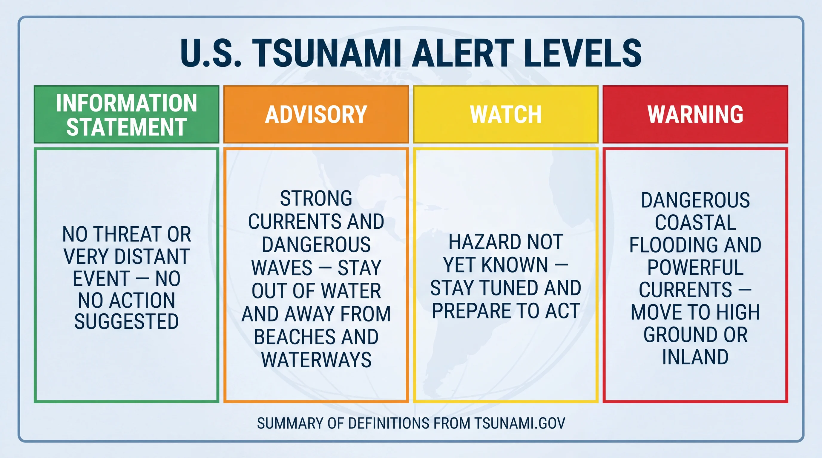
NOAA and the National Weather Service issue four levels of tsunami message, and each level calls for a different action. An Advisory and a Warning describe different threats, not two points on the same scale.
| Alert level | What it means | What to do |
|---|---|---|
| Tsunami Information Statement | An earthquake occurred and was evaluated, but no significant tsunami threat exists for this coast, or the threat is confined to an area far from Southern California | No action needed; informational only |
| Tsunami Advisory | A tsunami with strong currents or waves dangerous to people in or very near the water is expected or occurring; widespread inundation is not expected | Stay out of the water and away from beaches, harbors, and marinas until officials cancel the advisory |
| Tsunami Watch | A tsunami is possible based on a distant or regional earthquake, and officials are still evaluating the threat level to this coast | Stay alert, monitor official updates, and be ready to act if the watch is upgraded |
| Tsunami Warning | A dangerous tsunami with the potential for widespread inundation is expected or occurring | Evacuate the coastal hazard zone immediately to high ground or inland; do not wait for a second confirmation |
A Tsunami Advisory means stay out of the water; a Tsunami Warning means leave the hazard zone. An Advisory covers strong currents at beaches and harbors that can sweep a swimmer away or pull a boat off a dock, much like a strong rip current. A Warning covers flooding that can put water on streets, parking lots and ground floors well back from the shoreline. Treating all alert levels the same leads to two mistakes: ignoring a real Warning because a past Advisory was minor, or overreacting to an Information Statement that carries no local threat.
Where Should You Go During a Tsunami Threat?
During a tsunami threat, follow your city's official tsunami evacuation map. Every coastal jurisdiction in the Los Angeles area, working with Cal OES and county emergency management, publishes maps showing which streets are in the hazard zone and which route to take. The route out of a Santa Monica beach parking lot differs from the route out of a boat slip in Marina del Rey or off the San Pedro waterfront.
Before visiting a low-lying beach, harbor or bay in Southern California, look up that location's evacuation map. A general number of blocks or feet may not fit the terrain where you are standing.
If no map is available, move inland and uphill, away from beaches, harbors and river mouths, until you are clearly above and away from hazard areas. That is the general guidance from NOAA and California emergency officials. Stay away from the coast until local authorities and the National Weather Service give an all-clear. A tsunami is a series of waves, and later waves can be larger than the first.
Dangerous currents and surges continued for many hours after the first wave in past Pacific-wide tsunamis. Returning to the beach after one wave passes is a common and preventable mistake.
Southern California's tsunami risk is real, uncommon and specific to the source and location. A distant earthquake gives hours of warning, and a local one may give minutes. Know the natural signs that mean move now, and know what each NOAA alert level asks you to do.
Before visiting a low-lying beach or harbor such as Malibu, Long Beach or another coastal stop on WeatherLA, open that city's tsunami evacuation map and find the nearest inland or uphill route. For hazards that look similar but need different responses, see our guides to high surf in Los Angeles and sneaker waves.