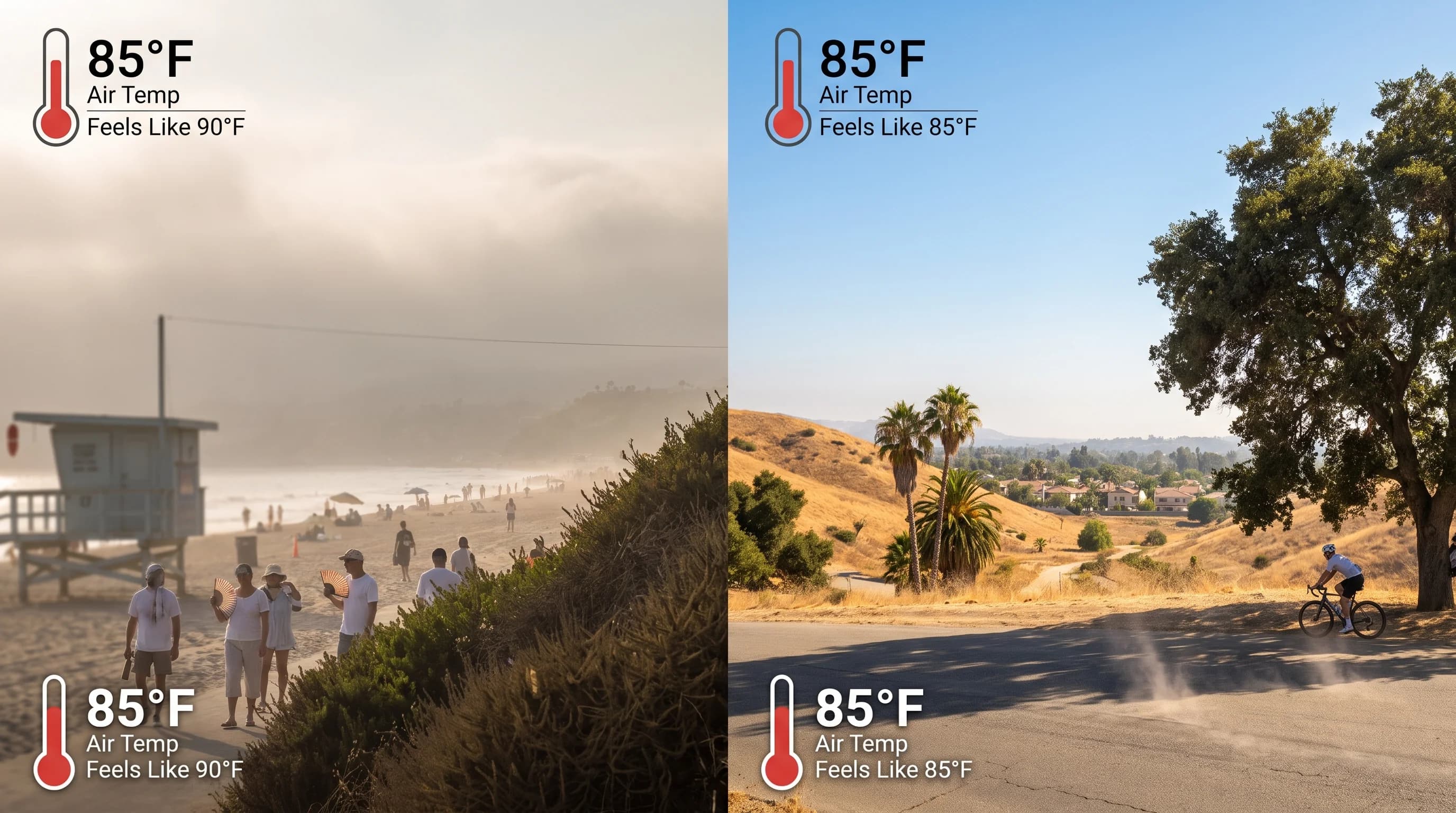
The heat index is the National Weather Service's estimate of how hot the air feels to your body once humidity is included, not just what the thermometer reads. It combines air temperature and relative humidity, because sweat evaporates less efficiently in humid air and your body loses one of its main ways to cool. In Los Angeles, a humid 85°F afternoon in Downtown Los Angeles can feel nearly as hot as a dry 95°F day in the San Fernando Valley, though the valley thermometer reads ten degrees higher.
What Is the Heat Index?
The heat index, also called the "feels like" temperature, is one number that estimates how hot it feels by combining air temperature and relative humidity, assuming shade and a light wind of about 5 mph. The National Weather Service calculates it with an equation based on physicist Robert Steadman's work, refined into the formula NWS offices use today. The heat index is not a body temperature forecast or a reading from any instrument. It is a calculated estimate from two numbers on any Los Angeles forecast: air temperature and relative humidity.
Because it assumes shade and light wind, the heat index describes a common outdoor situation, not the hottest possible one. Direct sun, still air or standing on hot asphalt in Woodland Hills can make it feel well hotter than the published number.
| Air temperature | 40% humidity | 60% humidity | 80% humidity | NWS risk category |
|---|---|---|---|---|
| 80°F | 80°F | 82°F | 84°F | Caution |
| 85°F | 85°F | 91°F | 100°F | Caution to Extreme Caution |
| 90°F | 91°F | 100°F | 113°F | Extreme Caution to Danger |
| 95°F | 97°F | 109°F | 124°F | Extreme Caution to Danger |
| 100°F | 109°F | 129°F | 146°F | Danger to Extreme Danger |
Source: NWS Heat Index chart. NWS defines Caution as 80 to 90°F heat index, Extreme Caution as 90 to 103°F, Danger as 103 to 124°F, and Extreme Danger as 125°F and above.
Why Does Humidity Make Heat Feel Worse?
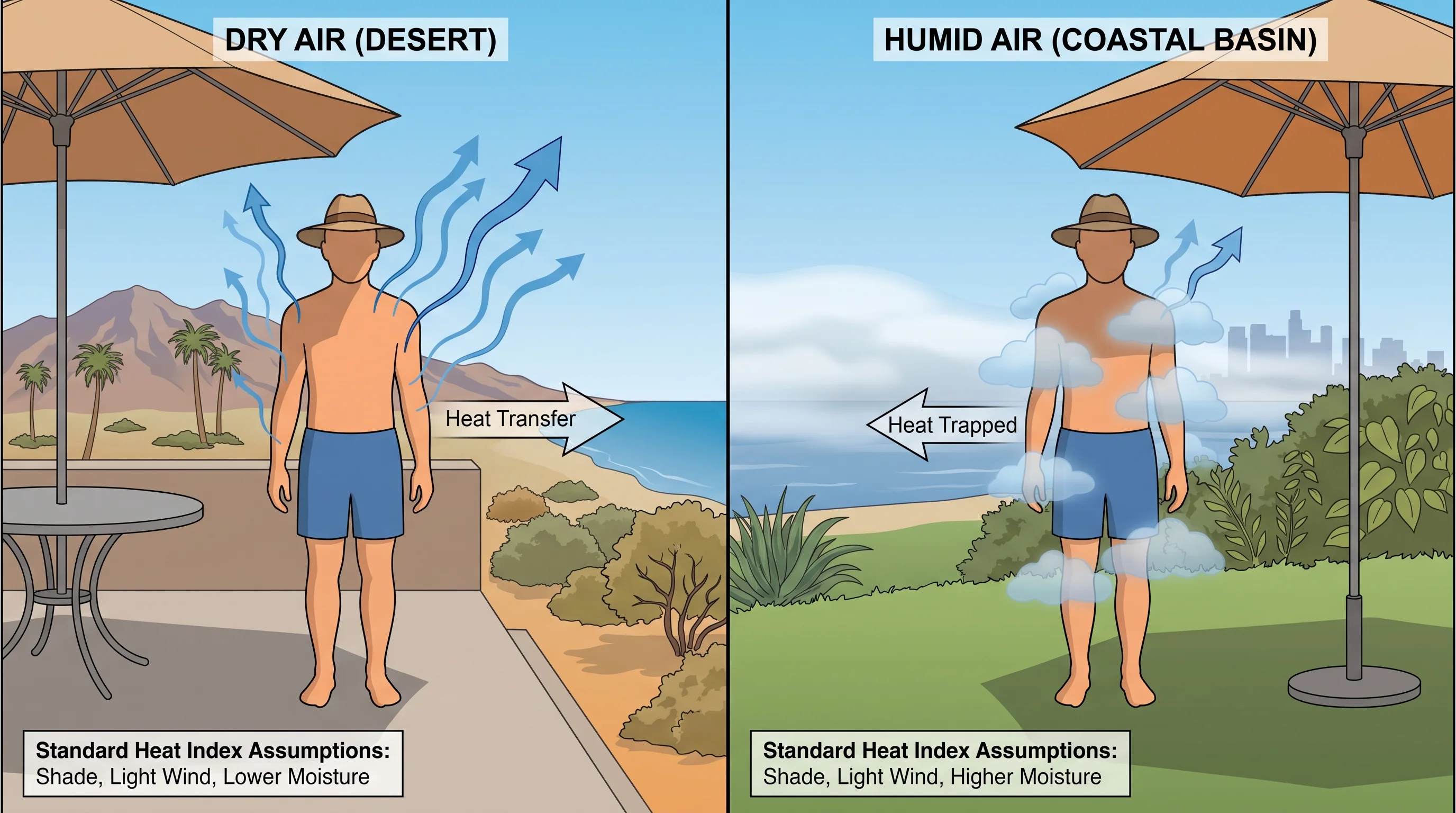
Humidity makes heat feel worse because it slows the sweat evaporation your body uses to cool itself. Sweat removes heat only when it evaporates off the skin; that change from liquid to vapor carries the heat away. When the air already holds a lot of water vapor, sweat evaporates more slowly, so the same amount of sweating removes less heat.
Slower evaporation is why the heat index rises faster than temperature alone. In the chart above, raising humidity from 40% to 80% at 90°F pushes the heat index from 93°F to 113°F, a 20-degree jump with no change on the thermometer. Read the heat index as an estimate of how hard your body works to stay cool, not as an air temperature. It does not measure core body temperature; it is a stand-in built from two weather measurements and the physics of human heat loss.
Why Can the Same Temperature Feel Different Across LA?
The same temperature feels different across Los Angeles because the coast, basin and inland areas rarely share the same humidity, sun or overnight cooling. Coastal and near-coastal areas like Downtown Los Angeles draw in moisture from the Pacific, so a moderate 85°F day can carry enough humidity to push the heat index several degrees above the thermometer. Inland valleys around Woodland Hills and foothill cities like Pasadena are drier. A hotter 95°F afternoon there sits closer to its air temperature on the heat index, yet it is the more dangerous heat once sun and exertion are added.
Wind, shade and sun change the feel further. A breezy coastal afternoon can feel cooler than its heat index, because the chart assumes only light wind. Direct sun adds a penalty the chart leaves out: full sunshine can raise the heat index by up to 15°F, according to the NWS. A "Caution" heat index on paper can therefore feel much more serious on an unshaded trail or parking lot.
Acclimatization also matters. A resident of an inland valley used to dry 95°F afternoons often handles that heat better than a coastal visitor facing it for the first time that season, even at the same heat index.
When Is Heat Index Less Useful?
The heat index is less useful whenever real conditions differ from its shade and light-wind assumptions, which is common in Southern California's sunniest, driest areas. In direct sun, heat stress can run well above the published number, because the formula has no sunshine term. In very dry air, common inland and in the deserts beyond, the heat index can sit near the air temperature on a dangerous day, because it measures only the humidity penalty.
Strong, gusty wind can cut both ways. It cools on a warm day, but during a Santa Ana event it blows hot, dry air and can make conditions feel harsher than a modest heat index suggests.
The National Weather Service therefore relies on HeatRisk, a color-coded forecast tool that adds how unusual the heat is for the season, how long it lasts and how warm the nights stay. For dry, sunny or strenuous situations, such as hiking from Pasadena's foothill trailheads on a hot day, HeatRisk and NWS heat guidance plan better than the heat index alone.
How Is the Heat Index Different From Wet Bulb and WBGT?
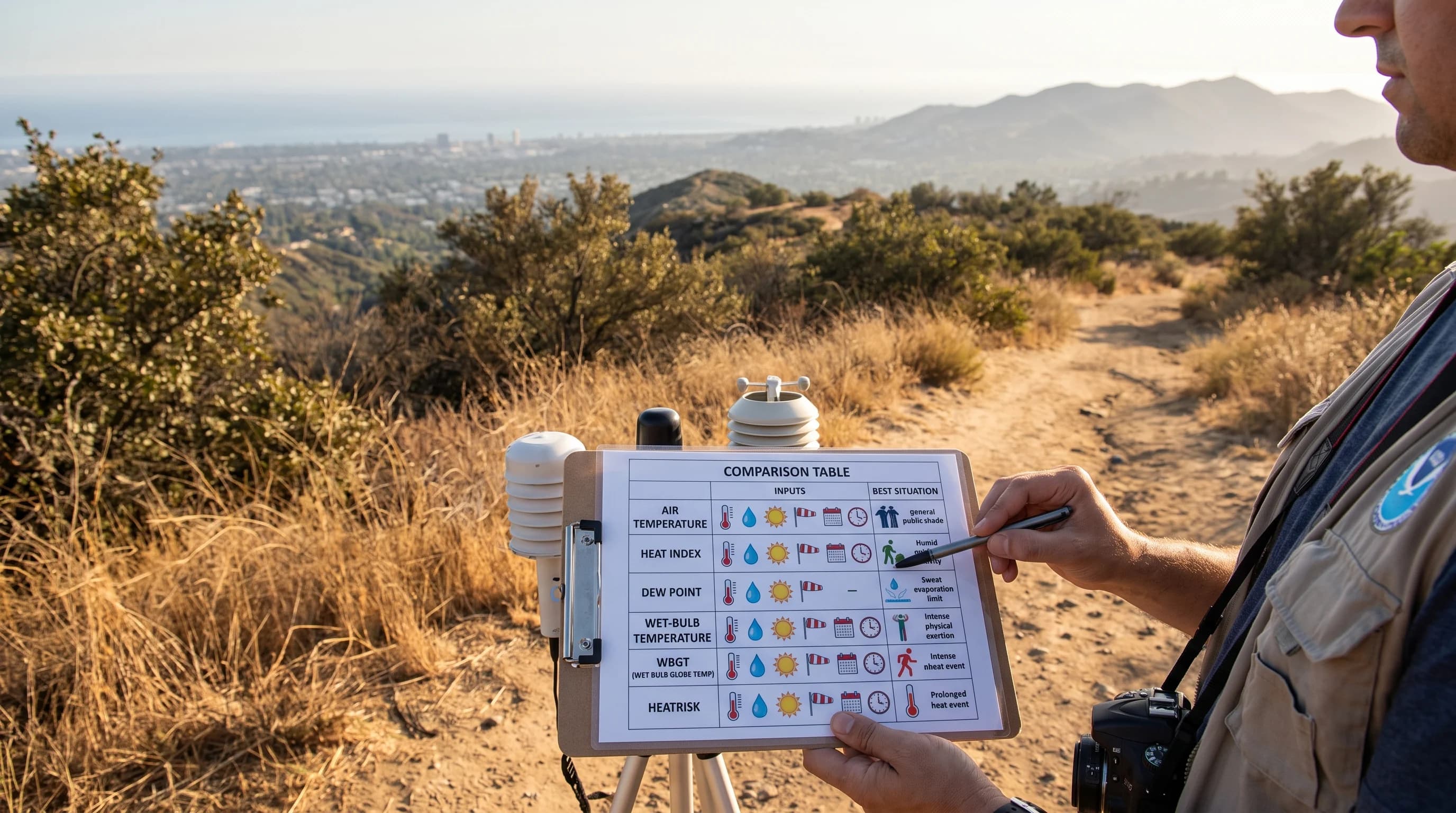
The heat index, wet-bulb temperature and WBGT (wet-bulb globe temperature) all describe heat stress, using different inputs for different purposes. The heat index uses only air temperature and relative humidity, assuming shade and light wind, which makes it a quick public planning number. Wet-bulb temperature measures how much cooling evaporation can still provide in the air. It marks a hard physical limit for the body that matters most in extreme humid heat, as what is wet-bulb temperature explains.
WBGT adds direct sunshine and actual wind speed to temperature and humidity. That is why the U.S. military and many athletic organizations use WBGT to set outdoor activity limits.
For most Los Angeles residents checking a forecast, the heat index is the right everyday tool. For the outer limits of humid heat, or strenuous activity in full sun, wet-bulb temperature and WBGT are more precise. Each answers a different question, and none replaces the others.
How Should You Act on Heat Forecasts?
To act on a Los Angeles heat forecast, check more than one feels-like number: the local temperature and humidity, the overnight low, the sun you will be in and any NWS heat alert. The NWS Los Angeles/Oxnard office and the NWS San Diego office issue Heat Advisories and Extreme Heat Warnings, formerly called Excessive Heat Warnings, when heat thresholds are met for a zone. Those alerts account for local climate, so a coastal and an inland Heat Advisory can reflect very different temperatures for the same risk.
Watch the overnight low. A heat index that drops after sunset does not mean the danger has passed if the night stays unusually warm, because the body needs a real nighttime cool-down to recover, as what causes a heat wave explains. Before spending long hours outdoors on a hot day, at the beach, on a trail or walking in Downtown Los Angeles, check the temperature, humidity, sun and any NWS heat alert for your exact destination.
Direct sun is a separate hazard; see the Los Angeles UV index for how fast sun becomes dangerous even when the heat index is moderate.
The heat index is a useful starting point for a Los Angeles forecast, but it is one input. Before a hot day outdoors, compare temperature, humidity, heat index, overnight low and sun exposure for your destination on WeatherLA's Los Angeles forecast pages, and treat any NWS heat alert as the final word.