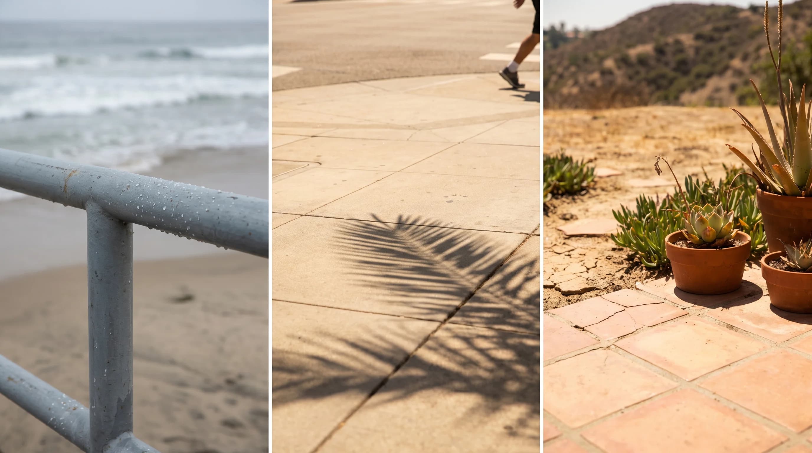
The hottest months in Los Angeles are July, August and September, depending on location. The coast and Downtown Los Angeles run warmest in August and September.
Inland valley communities such as Woodland Hills peak in July and August, with much higher extremes. Any part of the region can post its single hottest day outside those months during an offshore heat event. The Pacific Ocean shifts the calendar: water warms slowly, so the ocean-cooled coast peaks weeks after the inland heat that follows the sun.
What Are the Hottest Months in Los Angeles?
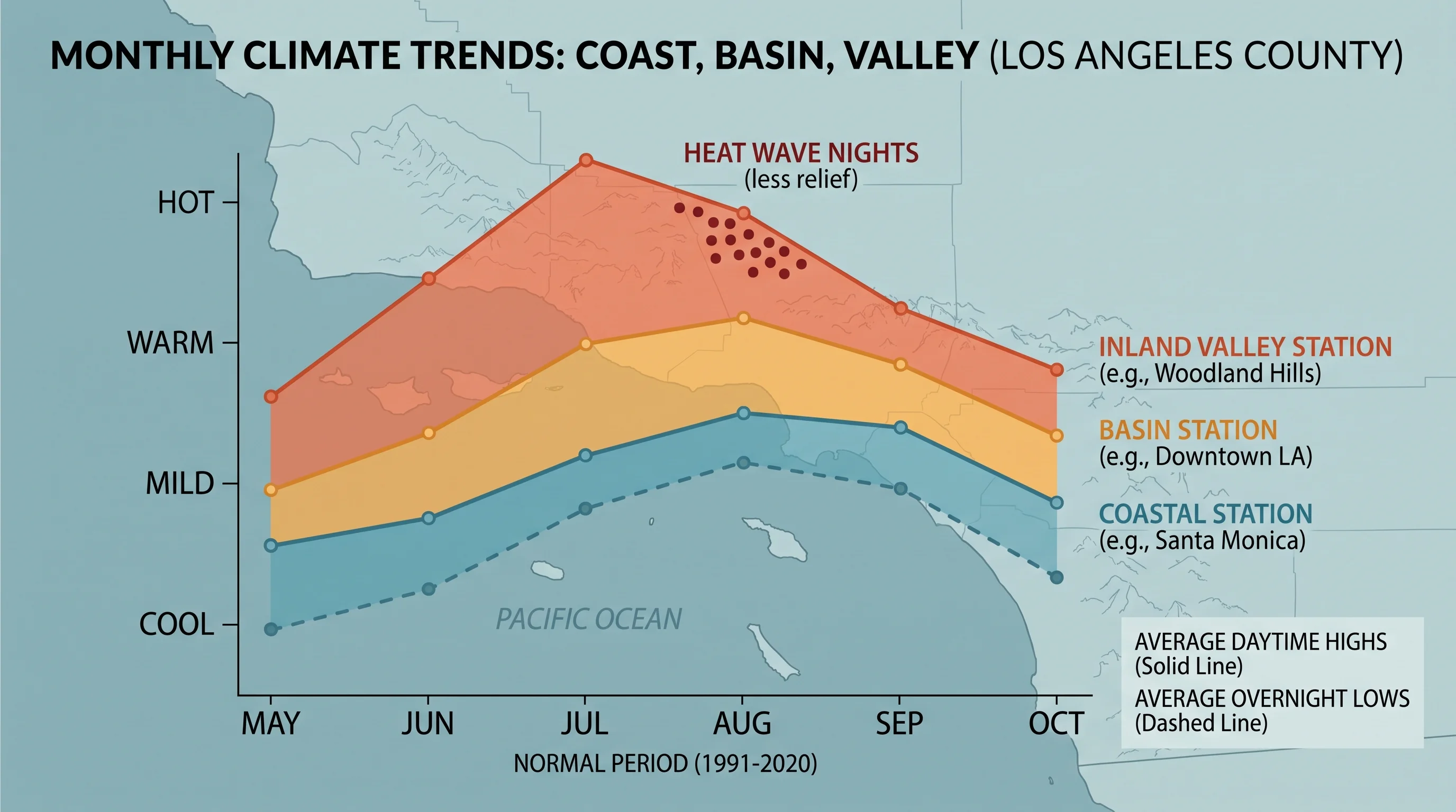
The hottest months in Los Angeles differ between the coast, basin and valleys. Under NOAA's 1991-2020 Climate Normals, coastal and near-coastal stations usually record their warmest averages in late August or September, after the summer sun has started to lower. Inland valley stations usually peak in July or August, closer to the solstice, with a much wider gap between mild mornings and scorching afternoons.
Downtown Los Angeles sits in the basin, partly shielded from the coast but still reached by onshore wind, so it runs hot without matching the deep valleys' extremes. Pasadena, at the base of the San Gabriel Mountains, gets less marine influence, so its summer highs run above the basin average even though it is a short drive from Downtown. Hot, still days have nothing to do with earthquakes, despite the old Southern California belief explained in is earthquake weather real. For the desert extreme, see how hot Death Valley gets.
Woodland Hills, in the San Fernando Valley, often records the highest readings in Los Angeles County on hot summer days. It sits far from the ocean's cooling and is surrounded by valley terrain that holds heat. No single station average describes all three places. A "Los Angeles temperature" with no location attached is close to meaningless for planning.
| Zone | Typical peak-heat window | Marine layer influence | Day-to-night swing |
|---|---|---|---|
| Coastal Los Angeles | Late August into September | Strong, most mornings | Narrow; ocean keeps nights mild |
| Basin (Downtown LA, Pasadena) | Late July through August | Moderate; burns off by midday | Moderate |
| Inland valley (Woodland Hills) | July through August, with early-fall offshore spikes | Weak to none most summer afternoons | Wide; heat retained overnight during heat waves |
Zone patterns reflect NOAA 1991-2020 Climate Normals station behavior for coastal, basin, and valley Los Angeles. Individual years vary; check a specific destination page for current conditions.
Why Does LA Heat Peak Late in Summer?
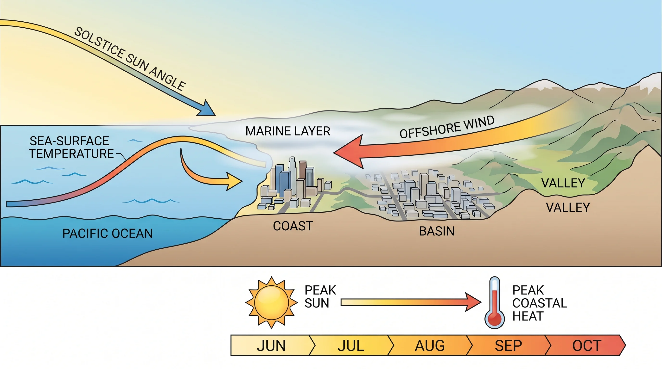
Coastal Los Angeles heat peaks weeks after the summer solstice because the Pacific Ocean warms slowly. Water holds far more heat than land or air, so ocean temperatures off Southern California keep rising through summer even as days shorten after June. This delay is called seasonal thermal lag. The ocean is warmest, and cools onshore air least, in late summer.
The marine layer also weakens as summer goes on. Early in summer, a persistent low cloud deck keeps coastal mornings gray and cool, the pattern called June Gloom. By August and September, the marine layer is usually shallower and clears earlier, letting more sun reach the coast while the ocean is at its warmest. Inland valleys heat mainly from direct sun on dry ground, which follows the sun angle and peaks closer to the solstice in July.
The hottest month on average is not always when the year's hottest day occurs. Record highs across Southern California often come during offshore wind events, when dry desert air flowing toward the coast wipes out the marine layer. Those events can push temperatures far above average anytime from late summer through autumn.
Downtown has reached 90°F in 31 of the last 35 Octobers, as LA weather in October shows. For how offshore heat events work, including Santa Ana winds, see what causes a heat wave in Los Angeles.
How Different Are the Coast and Valleys?
The coast and valleys can differ by 20 degrees or more on a summer afternoon, one of the largest short-distance temperature contrasts in the United States. A day in the mid-70s at the beach can reach the 90s or higher in the San Fernando Valley. Distance from the ocean and the marine layer drive the difference, not elevation or latitude. The gap is largest on summer afternoons and smallest overnight and in winter.
Humidity follows a related pattern. Coastal air holds more ocean moisture, so relative humidity stays higher while temperatures stay moderate. Valley air is usually drier, so Woodland Hills can feel less muggy, though not less hot, than a humid coastal evening.
The two areas also cool differently. The coast relies on the marine layer and sea breeze to reset temperatures daily. The valleys rely on nighttime radiational cooling, which works on clear, calm nights but fails during long heat waves.
The basin sits in between, and each neighborhood's temperature depends on how close it is to the gaps that let marine air in. Downtown Los Angeles gets a weakened sea breeze most summer afternoons, enough to stay below valley extremes but not enough to match the beach. Pasadena, at the foot of the San Gabriel Mountains, can trap warm air against the slopes in late afternoon and evening. Pasadena often runs a few degrees warmer than Downtown.
A single "Los Angeles" temperature in national weather coverage usually comes from one station and does not represent the basin, the valleys or the coast.
When Are Warm Nights Most Likely?
Warm nights are most likely during multi-day heat waves, in dense urban neighborhoods and in valleys where a stalled weather pattern blocks the usual overnight cooling. Overnight lows matter for health, because the body needs cooler hours to recover from daytime heat. A string of nights that never cool enough removes that recovery time.
City surfaces make warm nights worse. Pavement, concrete and buildings absorb sunlight by day and release it slowly after sunset, so dense neighborhoods stay warmer overnight than nearby open or green land, as why some Los Angeles neighborhoods stay hot after dark explains. During a long heat wave, that urban effect adds to the regional pattern already blocking overnight cooling. National Weather Service heat risk guidance and the NOAA Climate Prediction Center weigh consecutive warm nights, not just daytime highs, when assessing danger.
Can June Gloom Coexist With Inland Heat?
June Gloom and inland heat often happen on the same day. A shallow marine layer can keep the coast overcast and in the 60s while the San Fernando and San Gabriel valleys climb into the 90s, because the marine cloud deck is thin and low and rarely reaches far enough inland to cool the valleys. The coast and valleys sit under two different air masses separated by a few miles of terrain.
The split is most common early in summer, when the marine layer is deepest and most persistent. That is why the name June Gloom exists: the coastal cloud deck is thickest and slowest to clear in May and June, before the ocean warms and before late-summer high pressure weakens the marine layer. A gray coast and hot valley also happen later in summer.
Gray-coast, hot-valley days happen throughout summer, depending on onshore wind strength and the position of the offshore high pressure system. A visitor who checks only one citywide forecast can pack for the wrong city: a jacket for a 90-degree valley afternoon or shorts for a cloudy 63-degree beach.
The marine layer's daily depth and clearing time decide whether a coastal morning stays gray through lunch or clears by 9 a.m. That daily variation matters more for comfort than the difference between two weeks in peak summer. The same cloud deck almost never reaches over the mountains into the valleys, as why Los Angeles has so many distinct microclimates explains.
Which Forecast Should a Visitor Use?
Visitors should use the forecast for the exact neighborhood and time of day of each plan, not one citywide number. A beach morning, a Downtown lunch and a Valley evening can each need a different forecast on the same day. Check each destination's current conditions and forecast on WeatherLA, then check any active heat guidance before finalizing plans.
Before spending long hours outdoors in hot weather, check the National Weather Service HeatRisk product and any heat alerts from NWS Los Angeles/Oxnard or, for southern parts of the region, NWS San Diego. Check the UV index too. The same offshore wind that clears the marine layer and spikes valley heat also brings cloudless skies and strong UV across the region, including the coast.
Los Angeles has no single hottest month, only a hottest month for each location, as the twelve-month comparison in Los Angeles weather by month shows. Compare highs and overnight lows for your coast, basin or valley destination on WeatherLA, and check HeatRisk and heat alerts before committing to outdoor plans in late summer.